Los Angeles
| Los Angeles | |||||||||
|---|---|---|---|---|---|---|---|---|---|
| Metropolitan City | |||||||||
| City of Los Angeles | |||||||||
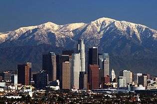
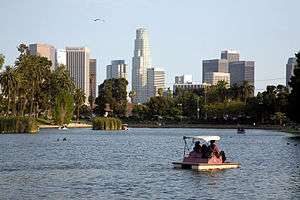
Clockwise from top: Downtown Los Angeles skyline, Echo Park, Theme Building at Los Angeles International Airport, Venice Beach, Vincent Thomas Bridge, Los Angeles City Hall, Hollywood Sign | |||||||||
| |||||||||
| Nickname(s): "L.A.", "City of Angels",[1] "Angeltown",[2] "The Entertainment Capital of the World", "The Big Orange"[1] "La-la-land", "Tinseltown"[1] | |||||||||
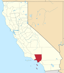
 Location in Los Angeles County in the state of California | |||||||||
 Los Angeles  Los Angeles Location in the United States | |||||||||
| Coordinates: 34°03′N 118°15′W / 34.050°N 118.250°WCoordinates: 34°03′N 118°15′W / 34.050°N 118.250°W | |||||||||
| Country |
| ||||||||
| State |
| ||||||||
| County |
| ||||||||
| CSA | Los Angeles-Long Beach | ||||||||
| MSA | Los Angeles-Long Beach-Anaheim | ||||||||
| Pueblo | September 4, 1781[3] | ||||||||
| Incorporated | April 4, 1850[4] | ||||||||
| Named for | Our Lady, Queen of the Angels | ||||||||
| Government | |||||||||
| • Type | Mayor-Council-Commission[5] | ||||||||
| • Body | Los Angeles City Council | ||||||||
| • Mayor | Eric Garcetti[6] | ||||||||
| • City Attorney | Mike Feuer[6] | ||||||||
| • City Controller | Ron Galperin[6] | ||||||||
| Area[7] | |||||||||
| • Metropolitan City | 503 sq mi (1,302 km2) | ||||||||
| • Land | 469 sq mi (1,214 km2) | ||||||||
| • Water | 34 sq mi (88 km2) 6.7% | ||||||||
| Elevation[8] | 305 ft (93 m) | ||||||||
| Highest elevation[9] | 5,074 ft (1,547 m) | ||||||||
| Lowest elevation[9] | 0 ft (0 m) | ||||||||
| Population (January 1, 2016)[10] | |||||||||
| • Metropolitan City | 4,030,904 | ||||||||
| • Rank |
1st, California 2nd, U.S. | ||||||||
| • Density | 8,282/sq mi (3,198/km2) | ||||||||
| • Urban[11] | 12,150,996 | ||||||||
| • Metro[12] | 13,131,431 | ||||||||
| • CSA[13] | 18,679,763 (US: 2nd) | ||||||||
| Demonym(s) | Angeleno | ||||||||
| Time zone | Pacific (UTC−8) | ||||||||
| • Summer (DST) | PDT (UTC−7) | ||||||||
| ZIP codes | 90001–90068, 90070–90084, 90086–90089, 90091, 90093–90097, 90099, 90101–90103, 90174, 90185, 90189, 90291–90293, 91040–91043, 91303–91308, 91342–91349, 91352–91353, 91356–91357, 91364–91367, 91401–91499, 91601–91609 | ||||||||
| Area codes | 213, 310/424, 562, 323, 661, 747/818 | ||||||||
| FIPS code | 06-44000 | ||||||||
| GNIS feature IDs | 1662328, 2410877 | ||||||||
| Website | Official website | ||||||||


Los Angeles (![]() i/lɒs ˈændʒəlᵻs/, Spanish for "The Angels"),[14] officially the City of Los Angeles and often known by its initials L.A., is the second-most populous city in the United States after New York City, the most populous city in California, and the county seat of Los Angeles County. Situated in Southern California, Los Angeles is known for its mediterranean climate, ethnic diversity, sprawling metropolis, and as a major center of the American entertainment industry. Los Angeles lies in a large coastal basin surrounded on three sides by mountains reaching up to and over 10,000 feet (3,000 m).
i/lɒs ˈændʒəlᵻs/, Spanish for "The Angels"),[14] officially the City of Los Angeles and often known by its initials L.A., is the second-most populous city in the United States after New York City, the most populous city in California, and the county seat of Los Angeles County. Situated in Southern California, Los Angeles is known for its mediterranean climate, ethnic diversity, sprawling metropolis, and as a major center of the American entertainment industry. Los Angeles lies in a large coastal basin surrounded on three sides by mountains reaching up to and over 10,000 feet (3,000 m).
Historically home to the Chumash and Tongva, Los Angeles was claimed by Juan Rodríguez Cabrillo for Spain in 1542 along with the rest of what would become Alta California. The city was officially founded on September 4, 1781, by Spanish governor Felipe de Neve. It became a part of Mexico in 1821 following the Mexican War of Independence. In 1848, at the end of the Mexican–American War, Los Angeles and the rest of California were purchased as part of the Treaty of Guadalupe Hidalgo, thereby becoming part of the United States. Los Angeles was incorporated as a municipality on April 4, 1850, five months before California achieved statehood. The city experienced rapid growth with the discovery of oil.[15]
The city is the focal point of the larger Los Angeles metropolitan area and the Greater Los Angeles Area region, which contain 13 million[16] and over 18 million people, respectively, as of 2010, making it one of the most populous metropolitan areas in the world as well as the second-largest in the United States. Los Angeles is the seat of Los Angeles County, the most populated county in the United States. The city's inhabitants are referred to as Angelenos.
Nicknamed the "City of Angels", Los Angeles is a global city with a diverse economy in entertainment, culture, media, fashion, science, sports, technology, education, medicine and research. It has been ranked 6th in the Global Cities Index and 9th in the Global Economic Power Index. The city is home to renowned institutions covering a broad range of professional and cultural fields, and is one of the most substantial economic engines within the United States. The Los Angeles combined statistical area (CSA) has a gross metropolitan product (GMP) of $831 billion (as of 2008), making it the third-largest in the world, after the Greater Tokyo and New York metropolitan areas.
Los Angeles includes Hollywood and leads the world in the creation of television productions and recorded music; it is also one of the leaders in motion picture production.
L.A. hosted the Summer Olympic Games in 1932 and 1984 and is currently bidding to host the 2024 Summer Olympics.
History
![]() Spanish Empire 1519–1821
Spanish Empire 1519–1821![]() First Mexican Empire 1821–1823
First Mexican Empire 1821–1823![]() United Mexican States 1823–1848
United Mexican States 1823–1848![]() California Republic 1846
California Republic 1846![]() United States 1848–present
United States 1848–present
Pre-colonial period
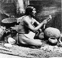
The Los Angeles coastal area was first settled by the Tongva (Gabrieleños) and Chumash Native American tribes thousands of years ago. A Gabrielino settlement in the area was called iyáangẚ (written Yang-na by the Spanish), meaning "poison oak place".[17][18]
Juan Rodríguez Cabrillo, a Portuguese-born explorer, claimed the area of southern California for the Spanish Empire of the Kingdom of Spain in 1542, while on an official military exploring expedition moving north along the Pacific coast from earlier colonizing bases of New Spain in Central and South America.[19] Gaspar de Portolà and Franciscan missionary Juan Crespí, reached the present site of Los Angeles on August 2, 1769.[20]
Spanish period
In 1771, Franciscan friar Junípero Serra directed the building of the Mission San Gabriel Arcángel, the first mission in the area.[21] On September 4, 1781, a group of forty-four settlers known as "Los Pobladores" founded the pueblo called "El Pueblo de Nuestra Señora la Reina de los Ángeles de Porciúncula"; in English it is "The Town of Our Lady the Queen of the Angels of Porciúncula". The Queen of the Angels is an honorific of the Virgin Mary.[22] Two-thirds of the settlers were mestizo or mulatto with a mixture of African, indigenous and European ancestry.[23] The settlement remained a small ranch town for decades, but by 1820, the population had increased to about 650 residents.[24] Today, the pueblo is commemorated in the historic district of Los Angeles Pueblo Plaza and Olvera Street, the oldest part of Los Angeles.[25]
Mexican period
New Spain achieved its independence from the Spanish Empire in 1821, and the pueblo continued as a part of Mexico. During Mexican rule, Governor Pío Pico made Los Angeles Alta California's regional capital.
American period
| Old Los Angeles | |
|---|---|
 Los Ángeles Plaza in 1869, looking north towards Upper Town. | |
 Legend
|
Mexican rule ended during the Mexican–American War: Americans took control from the Californios after a series of battles, culminating with the signing of the Treaty of Cahuenga on January 13, 1847.[26]
Railroads arrived with the completion of the Southern Pacific line to Los Angeles in 1876.[27] Oil was discovered in the city and surrounding area in 1892, and by 1923, the discoveries had helped California become the country's largest oil producer, accounting for about one-quarter of the world's petroleum output.[28]
By 1900, the population had grown to more than 102,000,[29] putting pressure on the city's water supply.[30] The completion of the Los Angeles Aqueduct in 1913, under the supervision of William Mulholland, assured the continued growth of the city.[31]
In 1910, Hollywood merged into Los Angeles, with 10 movie companies already operating in the city at the time. By 1921, more than 80 percent of the world's film industry was concentrated in L.A.[32] The money generated by the industry kept the city insulated from much of the economic loss suffered by the rest of the country during the Great Depression.[33] By 1930, the population surpassed one million.[34] In 1932, the city hosted the Summer Olympics.
During World War II, Los Angeles was a major center of wartime manufacturing, such as shipbuilding and aircraft. Calship built hundreds of Liberty Ships and Victory Ships on Terminal Island, and the Los Angeles area was the headquarters of six of the country's major aircraft manufacturers (Douglas Aircraft Company, Hughes Aircraft, Lockheed, North American Aviation, Northrop Corporation, and Vultee). During the war, more aircraft were produced in one year than in all the pre-war years since the Wright brothers flew the first airplane in 1903, combined. Manufacturing in Los Angeles skyrocketed, and as William S. Knudsen, of the National Defense Advisory Commission put it, "We won because we smothered the enemy in an avalanche of production, the like of which he had never seen, nor dreamed possible.[35]

Following the end of World War II, Los Angeles grew more rapidly than ever, sprawling into the San Fernando Valley.[36] The expansion of the Interstate Highway System during the 1950s and 1960s helped propel suburban growth and signaled the demise of the city's electrified rail system, once the world's largest.
The 1960s saw race relations boil over into the Watts Riots of 1965 which resulted in 34 deaths and over 1,000 injuries. It was the most severe riot in the city's history until the Los Angeles riots of 1992. In 1969, Los Angeles became the birthplace of the Internet, as the first ARPANET transmission was sent from the University of California, Los Angeles (UCLA) to SRI in Menlo Park.[37]
In 1984, the city hosted the Summer Olympic Games for the second time. Despite being boycotted by 14 Communist countries, the 1984 Olympics became more financially successful than any previous,[38] and the second Olympics to turn a profit until then – the other, according to an analysis of contemporary newspaper reports, being the 1932 Summer Olympics, also held in Los Angeles.[39]
Racial tensions erupted on April 29, 1992, with the acquittal by a Simi Valley jury of the police officers captured on videotape beating Rodney King, culminating in large-scale riots.[40] They were the largest riots in US history causing approximately $1.3 billion in damage as well as 53 deaths and over 2,000 injuries.[41][42]
In 1994, the 6.7 Northridge earthquake shook the city, causing $12.5 billion in damage and 72 deaths.[43] The century ended with the Rampart scandal, one of the most extensive documented cases of police misconduct in American history.[44]
In 2002, voters defeated efforts by the San Fernando Valley and Hollywood to secede from the city.[45]
Geography
Cityscape

Left to right: San Gabriel Mountains, downtown, Hollywood (foreground), and Wilshire Boulevard
The city is divided into over 80 districts and neighborhoods,[46] many of which were incorporated places or communities that merged into the city.[47] These neighborhoods were developed piecemeal, and are well-defined enough that the city has signage marking nearly all of them.[48]
More broadly, the city is divided into the following areas: Downtown Los Angeles, East Los Angeles and Northeast Los Angeles, South Los Angeles, the Harbor Area, Greater Hollywood, Wilshire, the Westside, and the San Fernando and Crescenta Valleys.
Overview
The city's street pattern generally follows a grid plan, with uniform block lengths and occasional roads that cut across blocks. However, this is complicated by rugged terrain, which has necessitated having different grids for each of the valleys that Los Angeles covers. Major streets are designed to move large volumes of traffic through many parts of the city; many of them are extremely long: Sepulveda Boulevard is 43 miles (69 km) long, while Foothill Boulevard is over 60 miles (97 km) long, reaching as far east as San Bernardino. Drivers in Los Angeles suffer from one of the worst rush hour periods in the world, according to an annual traffic index by navigation system maker, TomTom. L.A. drivers spend an additional 92 hours in traffic each year. During the peak rush hour there is 80% congestion, according to the index.[49]
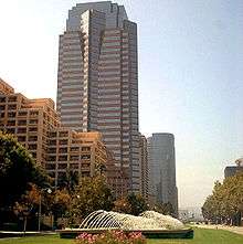
Los Angeles is strongly characterized by the presence of low-rise buildings. Outside of a few centers such as Downtown, Warner Center, Century City, Koreatown, Miracle Mile, Hollywood and Westwood, skyscrapers and high-rise buildings are not common. The few skyscrapers that are built outside of those areas often stand out above the rest of the surrounding landscape. Most construction is done in separate units, rather than wall-to-wall. That being said, downtown Los Angeles itself has many buildings over 30 stories, with fourteen over 50 stories, and two over 70 stories (the tallest buildings west of Chicago-see List of tallest buildings in Los Angeles). Also, Los Angeles is increasingly becoming a city of apartments rather than single family dwellings, especially in the dense inner city and Westside neighborhoods.
Landmarks
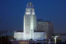
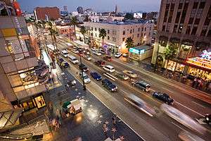
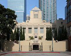
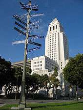
Important landmarks in Los Angeles include the Hollywood Sign, Walt Disney Concert Hall, Capitol Records Building, the Cathedral of Our Lady of the Angels, Angels Flight, TCL Chinese Theatre, Dolby Theatre, Griffith Observatory, Getty Center, Getty Villa, the Los Angeles Memorial Coliseum, the Los Angeles County Museum of Art, the Venice Canal Historic District and boardwalk, Theme Building, Bradbury Building, U.S. Bank Tower, Wilshire Grand Tower, Hollywood Boulevard, Los Angeles City Hall, Hollywood Bowl, Battleship USS Iowa, Watts Towers, Staples Center, Dodger Stadium, and Olvera Street.
-
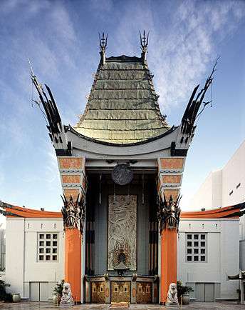
TCL Chinese Theatre
-
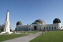
Griffith Observatory
-

Capitol Records Building
-

Angels Flight
-

Downtown Los Angeles at sunset
Topography

The city of Los Angeles covers a total area of 502.7 square miles (1,302 km2), comprising 468.7 square miles (1,214 km2) of land and 34.0 square miles (88 km2) of water.[7] The city extends for 44 miles (71 km) longitudinally and for 29 miles (47 km) latitudinally. The perimeter of the city is 342 miles (550 km).
Los Angeles is both flat and hilly. The highest point in the city proper is 5,074 ft (1,547 m) Mount Lukens,[50][51] located at the northeastern end of the San Fernando Valley. The eastern end of the Santa Monica Mountains stretches from Downtown to the Pacific Ocean and separates the Los Angeles Basin from the San Fernando Valley. Other hilly parts of Los Angeles include the Mt. Washington area north of Downtown, eastern parts such as Boyle Heights, the Crenshaw district around the Baldwin Hills, and the San Pedro district.
Surrounding the city are much higher mountains. Immediately to the north lie the San Gabriel Mountains, which is a popular recreation area for Angelenos. Its high point is Mount San Antonio, locally known as Mount Baldy, which reaches 10,064 feet (3,068 m). Further afield, the highest point in the greater Los Angeles area is San Gorgonio Mountain, with a height of 11,503 feet (3,506 m).
The Los Angeles River, which is largely seasonal, is the primary drainage channel. It was straightened and lined in 51 miles (82 km) of concrete by the Army Corps of Engineers to act as a flood control channel.[52] The river begins in the Canoga Park district of the city, flows east from the San Fernando Valley along the north edge of the Santa Monica Mountains, and turns south through the city center, flowing to its mouth in the Port of Long Beach at the Pacific Ocean. The smaller Ballona Creek flows into the Santa Monica Bay at Playa del Rey.
Vegetation
Los Angeles is rich in native plant species partly because of its diversity of habitats, including beaches, wetlands, and mountains. The most prevalent plant communities are coastal sage scrub, chaparral shrubland, and riparian woodland.[53] Native plants include: California poppy, matilija poppy, toyon, Ceanothus, Chamise, Coast Live Oak, sycamore, willow and Giant Wildrye. Many of these native species, such as the Los Angeles sunflower, have become so rare as to be considered endangered. Though it is not native to the area, the official tree of Los Angeles is the Coral Tree (Erythrina caffra)[54] and the official flower of Los Angeles is the Bird of Paradise (Strelitzia reginae).[55] Mexican Fan Palms, Canary Island Palms, Queen Palms, Date Palms, and California Fan Palms are common in the Los Angeles area, although only the last is native.
Geology
Los Angeles is subject to earthquakes because of its location on the Pacific Ring of Fire. The geologic instability has produced numerous faults, which cause approximately 10,000 earthquakes annually in Southern California, though most of them are too small to be felt.[56] The strike-slip San Andreas Fault system is located at the boundary between the Pacific Plate and the North American Plate, and is vulnerable to the "big one", a potentially large and damaging event.[57] The Los Angeles basin and metropolitan area are also at risk from blind thrust earthquakes.[58] Major earthquakes that have hit the Los Angeles area include the 1933 Long Beach, 1971 San Fernando, 1987 Whittier Narrows, and the 1994 Northridge events. Nevertheless, all but a few are of low intensity and are not felt. The USGS has released the UCERF California earthquake forecast which models earthquake occurrence in California. Parts of the city are also vulnerable to tsunamis; harbor areas were damaged by waves from the Valdivia earthquake in 1960.[59]
Climate

Los Angeles has a Mediterranean climate (Köppen climate classification Csb on the coast, Csa inland), and receives just enough annual precipitation to avoid either Köppen's BSh or BSk (semi-arid climate) classification. Los Angeles has plenty of sunshine throughout the year, with an average of only 35 days with measurable precipitation annually.[60] The coastal region around Los Angeles has a climate that is comparable to coastal areas of southeastern Spain such as Alicante or Elche, in temperature range and variation, in sunshine hours and as well as annual precipitation levels.
Temperatures in the coastal basin exceed 90 °F (32 °C) on a dozen or so days in the year, from one day a month in April, May, June and November to three days a month in July, August, October and to five days in September.[60] Temperatures in the San Fernando and San Gabriel Valleys are considerably warmer. Temperatures are subject to substantial daily swings; in inland areas the difference between the average daily low and the average daily high is over 30 °F (17 °C).[61] The average annual temperature of the sea is 63 °F (17 °C), from 58 °F (14 °C) in January to 68 °F (20 °C) in August.[62] Hours of sunshine total more than 3,000 per year, from an average of 7 hours of sunshine per day in December to an average of 12 in July.[63]
The Los Angeles area is also subject to phenomena typical of a microclimate, causing extreme variations in temperature in close physical proximity to each other. For instance, the average July maximum temperature at the Santa Monica Pier is 75 °F (24 °C) whereas it is 95 °F (35 °C) in Canoga Park.[64] The city, like much of the southern California coast, is subject to a late spring/early summer weather phenomenon called "June Gloom". This involves overcast or foggy skies in the morning which yield to sun by early afternoon.[65]
Downtown Los Angeles averages 14.93 in (379 mm) of precipitation annually, which mainly occurs during November through March,[66] generally in the form of moderate rain showers, but sometimes as heavy rainfall during winter storms. Summer days are usually rainless. Rarely, an incursion of moist air from the south or east can bring brief thunderstorms in late summer, especially to the mountains. The coast gets slightly less rainfall, while the inland and mountain areas get considerably more. Years of average rainfall are rare. The usual pattern is year to year variability, with a short string of dry years of 5–10 in (130–250 mm) rainfall, followed by one or two wet years with more than 20 in (510 mm).[66] Wet years are usually associated with warm water El Niño conditions in the Pacific, dry years with cooler water La Niña episodes. A series of rainy days can bring floods to the lowlands and mudslides to the hills, especially after wildfires have denuded the slopes.
Both freezing temperatures and snowfall are extremely rare in the city basin and along the coast, with the last occurrence of a 32 °F (0 °C) reading at the downtown station being January 29, 1979;[66] freezing temperatures occur nearly every year in valley locations while the mountains within city limits typically receive snowfall every winter. The greatest snowfall recorded in downtown Los Angeles was 2.0 inches (5 cm) on January 15, 1932.[66][67] At the official downtown station, the highest recorded temperature is 113 °F (45 °C) on September 27, 2010,[66][68] while the lowest is 28 °F (−2 °C),[66] on January 4, 1949.[66] During autumn and winter, Santa Ana winds sometimes bring much warmer and drier conditions to Los Angeles, and raise the wildfire risk.
| Climate data for Los Angeles (USC, Downtown), 1981–2010 normals, extremes 1877–present | |||||||||||||
|---|---|---|---|---|---|---|---|---|---|---|---|---|---|
| Month | Jan | Feb | Mar | Apr | May | Jun | Jul | Aug | Sep | Oct | Nov | Dec | Year |
| Record high °F (°C) | 95 (35) |
95 (35) |
99 (37) |
106 (41) |
103 (39) |
112 (44) |
109 (43) |
106 (41) |
113 (45) |
108 (42) |
100 (38) |
92 (33) |
113 (45) |
| Mean maximum °F (°C) | 83.3 (28.5) |
84.3 (29.1) |
85.8 (29.9) |
91.2 (32.9) |
89.7 (32.1) |
90.2 (32.3) |
94.1 (34.5) |
95.3 (35.2) |
98.9 (37.2) |
95.5 (35.3) |
88.0 (31.1) |
81.4 (27.4) |
102.7 (39.3) |
| Average high °F (°C) | 68.2 (20.1) |
68.6 (20.3) |
70.2 (21.2) |
72.7 (22.6) |
74.5 (23.6) |
78.1 (25.6) |
83.1 (28.4) |
84.4 (29.1) |
83.1 (28.4) |
78.5 (25.8) |
72.8 (22.7) |
67.7 (19.8) |
75.2 (24) |
| Average low °F (°C) | 47.8 (8.8) |
49.3 (9.6) |
51.0 (10.6) |
53.5 (11.9) |
57.1 (13.9) |
60.3 (15.7) |
63.6 (17.6) |
64.1 (17.8) |
63.1 (17.3) |
58.7 (14.8) |
52.0 (11.1) |
47.5 (8.6) |
55.7 (13.2) |
| Mean minimum °F (°C) | 41.3 (5.2) |
42.9 (6.1) |
44.9 (7.2) |
48.4 (9.1) |
53.6 (12) |
57.2 (14) |
61.2 (16.2) |
61.8 (16.6) |
59.2 (15.1) |
54.1 (12.3) |
45.0 (7.2) |
40.8 (4.9) |
39.1 (3.9) |
| Record low °F (°C) | 28 (−2) |
28 (−2) |
31 (−1) |
36 (2) |
40 (4) |
46 (8) |
49 (9) |
49 (9) |
44 (7) |
40 (4) |
34 (1) |
30 (−1) |
28 (−2) |
| Average rainfall inches (mm) | 3.12 (79.2) |
3.80 (96.5) |
2.43 (61.7) |
0.91 (23.1) |
0.26 (6.6) |
0.09 (2.3) |
0.01 (0.3) |
0.04 (1) |
0.24 (6.1) |
0.66 (16.8) |
1.04 (26.4) |
2.33 (59.2) |
14.93 (379.2) |
| Average rainy days (≥ 0.01 in) | 6.1 | 6.4 | 5.5 | 3.2 | 1.3 | 0.6 | 0.3 | 0.3 | 1.0 | 2.5 | 3.3 | 5.2 | 35.7 |
| Mean monthly sunshine hours | 225.3 | 222.5 | 267.0 | 303.5 | 276.2 | 275.8 | 364.1 | 349.5 | 278.5 | 255.1 | 217.3 | 219.4 | 3,254.2 |
| Percent possible sunshine | 71 | 72 | 72 | 78 | 64 | 64 | 83 | 84 | 75 | 73 | 70 | 71 | 73 |
| Source: NOAA (sun 1961–1977)[69][70][71] | |||||||||||||
| Climate data for Los Angeles (LAX), 1981–2010 normals, extremes 1944–present | |||||||||||||
|---|---|---|---|---|---|---|---|---|---|---|---|---|---|
| Month | Jan | Feb | Mar | Apr | May | Jun | Jul | Aug | Sep | Oct | Nov | Dec | Year |
| Record high °F (°C) | 91 (33) |
92 (33) |
95 (35) |
95 (35) |
91 (33) |
103 (39) |
93 (34) |
98 (37) |
106 (41) |
101 (38) |
101 (38) |
94 (34) |
106 (41) |
| Mean maximum °F (°C) | 81.2 (27.3) |
81.0 (27.2) |
79.6 (26.4) |
83.4 (28.6) |
79.9 (26.6) |
80.0 (26.7) |
83.6 (28.7) |
85.7 (29.8) |
90.1 (32.3) |
89.9 (32.2) |
85.5 (29.7) |
78.9 (26.1) |
94.7 (34.8) |
| Average high °F (°C) | 64.6 (18.1) |
64.3 (17.9) |
64.4 (18) |
66.4 (19.1) |
68.1 (20.1) |
70.6 (21.4) |
73.8 (23.2) |
74.9 (23.8) |
74.6 (23.7) |
72.5 (22.5) |
68.9 (20.5) |
64.6 (18.1) |
69.0 (20.6) |
| Average low °F (°C) | 48.8 (9.3) |
50.0 (10) |
51.7 (10.9) |
53.8 (12.1) |
57.3 (14.1) |
60.5 (15.8) |
63.7 (17.6) |
64.3 (17.9) |
63.2 (17.3) |
59.3 (15.2) |
53.2 (11.8) |
48.7 (9.3) |
56.2 (13.4) |
| Mean minimum °F (°C) | 41.1 (5.1) |
42.5 (5.8) |
44.6 (7) |
47.5 (8.6) |
52.5 (11.4) |
56.2 (13.4) |
59.8 (15.4) |
60.6 (15.9) |
58.4 (14.7) |
52.7 (11.5) |
45.3 (7.4) |
40.9 (4.9) |
38.8 (3.8) |
| Record low °F (°C) | 27 (−3) |
34 (1) |
35 (2) |
42 (6) |
45 (7) |
48 (9) |
52 (11) |
51 (11) |
47 (8) |
43 (6) |
38 (3) |
32 (0) |
27 (−3) |
| Average rainfall inches (mm) | 2.71 (68.8) |
3.25 (82.6) |
1.85 (47) |
0.70 (17.8) |
0.22 (5.6) |
0.08 (2) |
0.03 (0.8) |
0.05 (1.3) |
0.21 (5.3) |
0.56 (14.2) |
1.11 (28.2) |
2.05 (52.1) |
12.82 (325.6) |
| Average rainy days (≥ 0.01 in) | 6.0 | 6.6 | 5.8 | 2.8 | 1.2 | 0.6 | 0.5 | 0.3 | 1.0 | 2.3 | 3.4 | 5.2 | 35.7 |
| Average relative humidity (%) | 63.4 | 67.9 | 70.5 | 71.0 | 74.0 | 75.9 | 76.6 | 76.6 | 74.2 | 70.5 | 65.5 | 62.9 | 70.8 |
| Source: NOAA (relative humidity 1961–1990)[69][72][73] | |||||||||||||
| Climate data for Los Angeles (Canoga Park, in the San Fernando Valley) | |||||||||||||
|---|---|---|---|---|---|---|---|---|---|---|---|---|---|
| Month | Jan | Feb | Mar | Apr | May | Jun | Jul | Aug | Sep | Oct | Nov | Dec | Year |
| Record high °F (°C) | 93 (34) |
94 (34) |
101 (38) |
105 (41) |
113 (45) |
113 (45) |
115 (46) |
116 (47) |
115 (46) |
110 (43) |
99 (37) |
96 (36) |
116 (47) |
| Average high °F (°C) | 67.9 (19.9) |
69.9 (21.1) |
72.0 (22.2) |
77.7 (25.4) |
81.3 (27.4) |
88.8 (31.6) |
95.0 (35) |
96.0 (35.6) |
91.7 (33.2) |
84.4 (29.1) |
74.7 (23.7) |
68.8 (20.4) |
80.7 (27.1) |
| Daily mean °F (°C) | 53.7 (12.1) |
55.4 (13) |
57.2 (14) |
61.3 (16.3) |
65.2 (18.4) |
71.0 (21.7) |
76.0 (24.4) |
76.8 (24.9) |
73.5 (23.1) |
66.8 (19.3) |
58.2 (14.6) |
53.6 (12) |
64.1 (17.8) |
| Average low °F (°C) | 39.5 (4.2) |
40.9 (4.9) |
42.3 (5.7) |
44.8 (7.1) |
49.1 (9.5) |
53.2 (11.8) |
56.9 (13.8) |
57.6 (14.2) |
55.2 (12.9) |
49.2 (9.6) |
41.7 (5.4) |
38.3 (3.5) |
47.4 (8.6) |
| Record low °F (°C) | 19 (−7) |
18 (−8) |
26 (−3) |
30 (−1) |
33 (1) |
36 (2) |
42 (6) |
42 (6) |
38 (3) |
27 (−3) |
23 (−5) |
20 (−7) |
18 (−8) |
| Average rainfall inches (mm) | 3.83 (97.3) |
4.40 (111.8) |
3.60 (91.4) |
0.88 (22.4) |
0.32 (8.1) |
0.07 (1.8) |
0.01 (0.3) |
0.15 (3.8) |
0.24 (6.1) |
0.62 (15.7) |
1.29 (32.8) |
2.38 (60.5) |
17.79 (452) |
| Average rainy days | 6.2 | 5.9 | 6.1 | 3.0 | 1.3 | 0.4 | 0.1 | 0.7 | 1.3 | 2.0 | 3.2 | 4.4 | 34.6 |
| Source: NOAA[61] | |||||||||||||
Environmental issues

A Gabrielino settlement in the area was called iyáangẚ (written Yang-na by the Spanish), which has been translated as "poison oak place".[17][18] Yang-na has also been translated as "the valley of smoke".[74][75] Owing to geography, heavy reliance on automobiles, and the Los Angeles/Long Beach port complex, Los Angeles suffers from air pollution in the form of smog. The Los Angeles Basin and the San Fernando Valley are susceptible to atmospheric inversion, which holds in the exhausts from road vehicles, airplanes, locomotives, shipping, manufacturing, and other sources.[76]
The smog season lasts from approximately May to October.[77] While other large cities rely on rain to clear smog, Los Angeles gets only 15 inches (380 mm) of rain each year: pollution accumulates over many consecutive days. Issues of air quality in Los Angeles and other major cities led to the passage of early national environmental legislation, including the Clean Air Act. More recently, the state of California has led the nation in working to limit pollution by mandating low-emission vehicles. Smog is expected to continue to drop in the coming years because of aggressive steps to reduce it, which include electric and hybrid cars, improvements in mass transit, and other measures.
The number of Stage 1 smog alerts in Los Angeles has declined from over 100 per year in the 1970s to almost zero in the new millennium.[78] Despite improvement, the 2006 and 2007 annual reports of the American Lung Association ranked the city as the most polluted in the country with short-term particle pollution and year-round particle pollution.[79] In 2008, the city was ranked the second most polluted and again had the highest year-round particulate pollution.[80] The city met its goal of providing 20 percent of the city's power from renewable sources in 2010.[81] The American Lung Association's 2013 survey ranks the metro area as having the nation's worst smog, and fourth in both short-term and year-round pollution amounts.[82]
Climate change has already affected Los Angeles with a 4 degree average temperature rise from 1878 to 2005 with a UCLA study predicting that coastal areas will rise 3 to 4 degrees in temperature and urban areas 4 to 4.5 degrees.[83] In 2014, the fire season never finished in Southern California and studies have predicted that climate change will cause more frequent and larger fires by the end of the century.[83] Climate change is also expected to affect sea levels which are expected to rise 5 to 24 inches from 2000 to 2050 leading to higher storm surge and waves, which could result in more extensive flooding that could threaten critical coastal infrastructure.[83]
Los Angeles is also home to the nation's largest urban oil field. There are more than 700 active oil wells located within 1,500 feet of homes, churches, schools and hospitals in the city, a situation about which the EPA has voiced serious concerns.[84]
Demographics
| Historical population | |||
|---|---|---|---|
| Census | Pop. | %± | |
| 1850 | 1,610 | — | |
| 1860 | 4,385 | 172.4% | |
| 1870 | 5,728 | 30.6% | |
| 1880 | 11,183 | 95.2% | |
| 1890 | 50,395 | 350.6% | |
| 1900 | 102,479 | 103.4% | |
| 1910 | 319,198 | 211.5% | |
| 1920 | 576,673 | 80.7% | |
| 1930 | 1,238,048 | 114.7% | |
| 1940 | 1,504,277 | 21.5% | |
| 1950 | 1,970,358 | 31.0% | |
| 1960 | 2,479,015 | 25.8% | |
| 1970 | 2,811,801 | 13.4% | |
| 1980 | 2,968,528 | 5.6% | |
| 1990 | 3,485,398 | 17.4% | |
| 2000 | 3,694,820 | 6.0% | |
| 2010 | 3,792,621 | 2.6% | |
| Est. 2015 | 3,971,883 | [85] | 4.7% |
The 2010 United States Census[87] reported that Los Angeles had a population of 3,792,621.[88] The population density was 8,092.3 people per square mile (2,913.0/km²). The age distribution was 874,525 people (23.1%) under 18, 434,478 people (11.5%) from 18 to 24, 1,209,367 people (31.9%) from 25 to 44, 877,555 people (23.1%) from 45 to 64, and 396,696 people (10.5%) who were 65 or older.[88] The median age was 34.1 years. For every 100 females there were 99.2 males. For every 100 females age 18 and over, there were 97.6 males.[88]
There were 1,413,995 housing units—up from 1,298,350 during 2005–2009[88]—at an average density of 2,812.8 households per square mile (1,086.0/km²), of which 503,863 (38.2%) were owner-occupied, and 814,305 (61.8%) were occupied by renters. The homeowner vacancy rate was 2.1%; the rental vacancy rate was 6.1%. 1,535,444 people (40.5% of the population) lived in owner-occupied housing units and 2,172,576 people (57.3%) lived in rental housing units.[88]
According to the 2010 United States Census, Los Angeles had a median household income of $49,497, with 22.0% of the population living below the federal poverty line.[88]
Race and ethnicity
| Racial composition | 2010[88] | 1990[89] | 1970[89] | 1940[89] |
|---|---|---|---|---|
| Non-Hispanic White | 28.7% | 37.3% | 61.1%[90] | 86.3% |
| Black or African American | 9.6% | 14.0% | 17.9% | 4.2% |
| Hispanic or Latino | 48.5% | 39.9% | 17.1%[90] | 7.1%[91] |
| Asian | 11.3% | 9.8% | 3.6% | 2.2% |
Los Angeles is home to people from more than 140 countries speaking 224 different identified languages.[92] Ethnic enclaves like Chinatown, Historic Filipinotown, Koreatown, Little Armenia, Little Ethiopia, Tehrangeles, Little Tokyo, Little Bangladesh and Thai Town provide examples of the polyglot character of Los Angeles.
According to the 2010 Census, the racial makeup of Los Angeles included: 1,888,158 Whites (49.8%), 365,118 African Americans (9.6%), 28,215 Native Americans (0.7%), 426,959 Asians (11.3%), 5,577 Pacific Islanders (0.1%), 902,959 from other races (23.8%), and 175,635 (4.6%) from two or more races.[88] Hispanics or Latinos of any race were 1,838,822 persons (48.5%).
Non-Hispanic whites were 28.7% of the population in 2010,[88] compared to 86.3% in 1940.[89] People of Mexican ancestry make up the largest ethnic group of Latinos at 31.9% of Los Angeles' population, followed by those of Salvadoran (6.0%) and Guatemalan (3.6%) heritage. The Latino population is spread throughout the city of Los Angeles and its metropolitan area but it is most heavily concentrated in the East Los Angeles, Northeast Los Angeles and Northwest Los Angeles regions, which has a long established Mexican-American and Central American community.
The largest Asian ethnic groups are Filipinos (3.2%) and Koreans (2.9%), which have their own established ethnic enclaves−Koreatown in the Wilshire Center and Historic Filipinotown. Chinese people, which make up 1.8% of Los Angeles' population, reside mostly outside of Los Angeles city limits and rather in the San Gabriel Valley of eastern Los Angeles County, but make a sizable presence in the city, notably in Chinatown. Chinatown and Thaitown are also home to many Thais and Cambodians, which make up 0.3% and 0.1% of Los Angeles' population, respectively. Japanese comprise 0.9% of L.A.'s population, and have an established Little Tokyo in the city's downtown, and another significant community of Japanese Americans is located in the Sawtelle district of West Los Angeles. Vietnamese make up 0.5% of Los Angeles' population. Indians make up 0.9% of the city's population.
The Los Angeles metropolitan area is home to a large Middle Eastern population, including Armenians and Iranians, many of whom live in enclaves like Little Armenia and Tehrangeles.
African Americans have been the predominant ethnic group in South Los Angeles, which has emerged as the largest African American community in the western United States since the 1960s. The neighborhoods of South LA with highest concentration of African Americans include Crenshaw, Baldwin Hills, Leimert Park, Hyde Park, Gramercy Park, Manchester Square and Watts.[93] Apart from South Los Angeles, neighborhoods in the Central region of Los Angeles, such as Mid-City, Mid-Wilshire and Arlington Heights has a moderate-to-high concentration of African Americans as well. In 1970, the Census Bureau reported the city's population as 17.9% black, 61.1% non-Hispanic white and 17.1% Hispanic.[89]
Religion
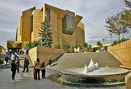

According to a 2014 study by the Pew Research Center, Christianity is the most prevalently practiced religion in Los Angeles (65%).[94][95] The Roman Catholic Archbishop of Los Angeles leads the largest archdiocese in the country.[96] Cardinal Roger Mahony oversaw construction of the Cathedral of Our Lady of the Angels, which opened in September 2002 in downtown Los Angeles.[97] Construction of the cathedral marked a coming of age of the city's Catholic, heavily Latino community. There are numerous Catholic churches and parishes throughout Los Angeles.
In 2011 the once common but ultimately lapsed custom of conducting a procession and Mass in honour of Nuestra Señora de los Ángeles in commemoration of the founding of the City of Los Angeles in 1781 was revived by the Queen of Angels Foundation and its founder Mark Albert, with the support and approbation of the Archdiocese of Los Angeles as well as several civic leaders.[98] The recently revived custom is a continuation of the original processions and Masses which commenced on the first anniversary of the founding of Los Angeles in 1782 and continued for nearly a century thereafter.
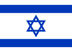
With 621,000 Jews in the metropolitan area (490,000 in city proper), the region has the second largest population of Jews in the United States.[99] Many of Los Angeles' Jews now live on the Westside and in the San Fernando Valley, though Boyle Heights and Northwest Los Angeles once had large Jewish populations. Many varieties of Judaism are represented in the area, including Reform, Conservative, Orthodox, and Reconstructionist. The Breed Street Shul in East Los Angeles, built in 1923, was the largest synagogue west of Chicago in its early decades.[100] (It is no longer a sacred space and is being converted to a museum and community center.)[101] The Kabbalah Centre also has a presence in the city.[102]
The International Church of the Foursquare Gospel was founded in Los Angeles by Aimee Semple McPherson in 1927 and remains headquartered there to this day. For many years, the church convened at Angelus Temple, which, when built, was one of the largest churches in the country.
The Los Angeles California Temple, the second largest temple operated by The Church of Jesus Christ of Latter-day Saints, is on Santa Monica Boulevard in the Westwood district of Los Angeles. Dedicated in 1956, it was the first LDS temple built in California and it was the largest in the world when completed.[103]
The Hollywood region of Los Angeles also has several significant headquarters, churches, and the Celebrity Center of Scientology.
Because of Los Angeles' large multi-ethnic population, a wide variety of faiths are practiced, including Islam, Buddhism, Hinduism, Zoroastrianism, Sikhism, Bahá'í, various Eastern Orthodox Churches, Sufism and others. Immigrants from Asia for example, have formed a number of significant Buddhist congregations making the city home to the greatest variety of Buddhists in the world. Atheism and other secular beliefs are also common, as the city is the largest in the Western U.S. Unchurched Belt.
Economy

The economy of Los Angeles is driven by international trade, entertainment (television, motion pictures, video games, music recording, and production), aerospace, technology, petroleum, fashion, apparel, and tourism. Other significant industries include finance, telecommunications, law, healthcare, and transportation.
Three of the six major film studios—Paramount Pictures, 20th Century Fox, and Universal Pictures—are located within the city limits.
Los Angeles is the largest manufacturing center in the western United States.[104] The contiguous ports of Los Angeles and Long Beach together comprise the fifth-busiest port in the world and the most significant port in the Western Hemisphere and is vital to trade within the Pacific Rim.[104]
The Los Angeles–Long Beach metropolitan area has a gross metropolitan product of $866 billion (as of 2015),[105] making it the third-largest economic metropolitan area in the world, after Tokyo and New York.[106] Los Angeles has been classified an "Alpha world city" according to a 2012 study by a group at Loughborough University.[107]
The largest employers in the city as of 2009 were, in descending order, the City of Los Angeles, the County of Los Angeles, and University of California, Los Angeles.[108] The University of Southern California (USC) is the city's fourth largest employer and the largest private sector employer.[109]
Fortune 500
The city was home to six companies in the 2014 Fortune 500.[110]
| Top publicly traded companies in Los Angeles for 2014 (ranked by revenues) with City and U.S. ranks | |||||
| LA | corporation | US | |||
| 1 | Occidental Petroleum Corporation | 116 | |||
| 2 | Health Net, Inc. | 254 | |||
| 3 | Reliance Steel & Aluminum Co. | 299 | |||
| 4 | AECOM Technology Corporation | 332 | |||
| 5 | Oaktree Capital Group, LLC | 354 | |||
| 6 | CBRE Group, Inc. | 363 | |||
| Source: Fortune 500[111] | |||||
Culture
.jpg)
Los Angeles is often billed as the "Creative Capital of the World", because one in every six of its residents works in a creative industry[112] and there are more artists, writers, filmmakers, actors, dancers and musicians living and working in Los Angeles than any other city at any time in history.[113]
Movies and the performing arts
The city's Hollywood neighborhood has become recognized as the center of the motion picture industry. Los Angeles plays host to the annual Academy Awards and is the site of the USC School of Cinematic Arts, the oldest film school in the United States.[114]
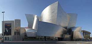
The performing arts play a major role in Los Angeles' cultural identity. According to the USC Stevens Institute for Innovation, "there are more than 1,100 annual theatrical productions and 21 openings every week."[113] The Los Angeles Music Center is "one of the three largest performing arts centers in the nation", with more than 1.3 million visitors per year.[115] The Walt Disney Concert Hall, centerpiece of the Music Center, is home to the prestigious Los Angeles Philharmonic. Notable organizations such as Center Theatre Group, the Los Angeles Master Chorale, and the Los Angeles Opera are also resident companies of the Music Center. Talent is locally cultivated at premier institutions such as the Colburn School and the USC Thornton School of Music.
Museums and galleries
There are 841 museums and art galleries in Los Angeles County.[116] In fact, Los Angeles has more museums per capita than any other city in the world.[116] Some of the notable museums are the Los Angeles County Museum of Art (the largest art museum in the Western United States[117]), the Getty Center (part of the larger J. Paul Getty Trust, the world's wealthiest art institution[118]), the Battleship Iowa, and the Museum of Contemporary Art. A significant number of art galleries are located on Gallery Row, and tens of thousands attend the monthly Downtown Art Walk there.[119]
Sports

The city of Los Angeles and its metropolitan area is the home of nine major league professional sports teams. These teams include the Los Angeles Dodgers and Los Angeles Angels of Anaheim of Major League Baseball (MLB), the Los Angeles Rams of the National Football League (NFL), the Los Angeles Lakers and Los Angeles Clippers of the National Basketball Association (NBA), the Los Angeles Kings and Anaheim Ducks of the National Hockey League (NHL), the Los Angeles Galaxy of Major League Soccer (MLS), and the Los Angeles Sparks of the Women's National Basketball Association (WNBA).
Other notable sports teams include the UCLA Bruins and the USC Trojans in the National Collegiate Athletic Association (NCAA), both of which are Division I teams in the Pac-12 Conference.
Los Angeles is the second-largest city in the United States but hosted no NFL team between 1995 and 2015. At one time, the Los Angeles area hosted two NFL teams: the Rams and the Raiders. Both left the city in 1995, with the Rams moving to St. Louis, and the Raiders moving back to their original home of Oakland. After 21 seasons in St. Louis, on January 12, 2016, the NFL announced that the Rams would be moving back to Los Angeles for the 2016 NFL season. A new stadium will be built in Inglewood, California for the team by the 2019 season.[120][121][122] Prior to 1995, the Rams played their home games in the Los Angeles Memorial Coliseum from 1946–1979 and the Raiders played their home games at the Los Angeles Memorial Coliseum from 1982–1994.
Los Angeles has twice hosted the Summer Olympic Games: in 1932 and in 1984, Los Angeles is bidding for 2024 Summer Olympics. Memorial Coliseum as the host stadium. When the tenth Olympic Games were hosted in 1932, the former 10th Street was renamed Olympic Blvd. Super Bowls I and VII were also held in the city, as well as multiple FIFA World Cup games at the Rose Bowl in 1994, including the final. Los Angeles also hosted the Deaflympics in 1985[123] and Special Olympics World Summer Games in 2015.[124]
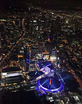
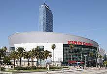
Los Angeles boasts a number of sports venues, including Dodger Stadium, the Los Angeles Memorial Coliseum, The Forum, the StubHub Center, the Staples Center, and the Rose Bowl in nearby Pasadena.
Government
Los Angeles is a charter city as opposed to a general law city. The current charter was adopted on June 8, 1999 and has been amended many times since then.[125] The elected government consists of the Los Angeles City Council and the Mayor of Los Angeles which operate under a mayor-council government, as well as the city attorney (not to be confused with the district attorney, a county office) and controller. The current mayor is Eric Garcetti. There are 15 city council districts.
The city has many departments and appointed officers, including the Los Angeles Police Department (LAPD), the Los Angeles Board of Police Commissioners, the Los Angeles Fire Department (LAFD), the Housing Authority of the City of Los Angeles (HACLA), the Los Angeles Department of Transportation (LADOT), and the Los Angeles Public Library (LAPL).
The Charter of the City of Los Angeles ratified by voters in 1999 created a system of advisory neighborhood councils that would represent the diversity of stakeholders, defined as those who live, work or own property in the neighborhood. The neighborhood councils are relatively autonomous and spontaneous in that they identify their own boundaries, establish their own bylaws, and elect their own officers. There are currently about 90 neighborhood councils.
Residents of Los Angeles elect supervisors for the 1st, 2nd, 3rd and 4th supervisorial districts.
Federal and state representation
In the California State Assembly, Los Angeles is split between fourteen districts.[126] In the California State Senate, the city is split between eight districts.[127] In the United States House of Representatives, it is split between ten congressional districts.[128]
Crime
Los Angeles experienced a significant decline in crime in the 1990s and late 2000s and reached a 50-year low in 2009 with 314 homicides.[129][130] This is a rate of 7.85 per 100,000 population—a major decrease from 1980 when a homicide rate of 34.2 per 100,000 was reported.[131][132] This included 15 officer-involved shootings. One shooting led to the death of a SWAT team member, Randal Simmons, the first in LAPD's history.[133] Los Angeles in the year of 2013 totaled 251 murders, a decrease of 16 percent from the previous year. Police speculate that the drop resulted from a number of factors, including young people spending more time online.[134] The murder rate increased slightly from 6.5 per 100,000 people in 2013 to 6.7 per 100,000 in 2014 to 7 per 100,000 in 2015.[135][136]
The Dragna crime family and the Cohen crime family dominated organized crime in the city during the Prohibition era[137] and reached its peak during the 1940s and 1950s with the battle of Sunset Strip as part of the American Mafia, but has gradually declined since then with the rise of various black and Hispanic gangs in the late 1960s and early 1970s.[137]
According to the Los Angeles Police Department, the city is home to 45,000 gang members, organized into 450 gangs.[138] Among them are the Crips and Bloods, which are both African American street gangs that originated in the South Los Angeles region. Latino street gangs such as the Sureños, a Mexican American street gang, and Mara Salvatrucha, which has mainly members of Salvadoran descent, all originated in Los Angeles. This has led to the city being referred to as the "Gang Capital of America".[139]
Education
Colleges and universities
There are three public universities located within the city limits: California State University, Los Angeles (CSULA), California State University, Northridge (CSUN) and University of California, Los Angeles (UCLA).
Private colleges in the city include the American Film Institute Conservatory, Alliant International University, Syracuse University (Los Angeles Campus), American Academy of Dramatic Arts (Los Angeles Campus), American Jewish University, The American Musical and Dramatic Academy – Los Angeles campus, Antioch University's Los Angeles campus, Charles R. Drew University of Medicine and Science, Emperor's College, Fashion Institute of Design & Merchandising's Los Angeles campus (FIDM), Los Angeles Film School, Loyola Marymount University (LMU is also the parent university of Loyola Law School located in Los Angeles), Marymount College, Mount St. Mary's College, National University of California, Occidental College ("Oxy"), Otis College of Art and Design (Otis), Southern California Institute of Architecture (SCI-Arc), Southwestern Law School, University of Southern California (USC), and Woodbury University.
The community college system consists of nine campuses governed by the trustees of the Los Angeles Community College District: East Los Angeles College (ELAC), Los Angeles City College (LACC), Los Angeles Harbor College, Los Angeles Mission College, Los Angeles Pierce College, Los Angeles Valley College (LAVC), Los Angeles Southwest College, Los Angeles Trade-Technical College and West Los Angeles College.
There are numerous additional colleges and universities outside the city limits in the Greater Los Angeles area.
Schools and libraries
Los Angeles Unified School District serves almost all of the city of Los Angeles, as well as several surrounding communities, with a student population around 800,000.[140] After Proposition 13 was approved in 1978, urban school districts had considerable trouble with funding. LAUSD has become known for its underfunded, overcrowded and poorly maintained campuses, although its 162 Magnet schools help compete with local private schools. Several small sections of Los Angeles are in the Las Virgenes Unified School District. The Los Angeles County Office of Education operates the Los Angeles County High School for the Arts. The Los Angeles Public Library system operates 72 public libraries in the city.[141] Enclaves of unincorporated areas are served by branches of the County of Los Angeles Public Library, many of which are within walking distance to residents.
Media
The major daily English-language newspaper in the area is the Los Angeles Times. La Opinión is the city's major daily Spanish-language paper. The Korea Times is the city's major daily Korean language paper while The World Journal is the city and county's major Chinese newspaper. The Los Angeles Sentinel is the city's major African-American weekly paper, boasting the largest African-American readership in the Western United States. Investor's Business Daily is distributed from its L.A. corporate offices, which are headquartered in Playa del Rey.
There are also a number of smaller regional newspapers, alternative weeklies and magazines, including the Los Angeles Register, Los Angeles Daily News (which focuses coverage on the San Fernando Valley), LA Weekly, L.A. Record (which focuses coverage on the music scene in the Greater Los Angeles Area), Los Angeles Magazine, the Los Angeles Business Journal, the Los Angeles Daily Journal (legal industry paper), The Hollywood Reporter, Variety (both entertainment industry papers), and Los Angeles Downtown News. In addition to the major papers, numerous local periodicals serve immigrant communities in their native languages, including Armenian, English, Korean, Persian, Russian, Chinese, Japanese, Hebrew, and Arabic. Many cities adjacent to Los Angeles also have their own daily newspapers whose coverage and availability overlaps into certain Los Angeles neighborhoods. Examples include The Daily Breeze (serving the South Bay), and The Long Beach Press-Telegram.
Los Angeles arts, culture and nightlife news is also covered by a number of local and national online guides like Time Out Los Angeles, Thrillist, Kristin's List, DailyCandy, LAist, and Flavorpill.[142]
The Los Angeles metro area is the second-largest broadcast designated market area in the U.S. with 5,431,140 homes (4.956% of the U.S.) which is served by a wide variety of local AM & FM radio and television stations.
Los Angeles and New York City are the only two media markets to have seven VHF allocations assigned to them.[143]
The city has major broadcast channels as well as three PBS stations. World TV operates on two channels and the area has several Spanish-language television networks. KTBN 40 is the flagship station of the religious Trinity Broadcasting Network, based out of Santa Ana. A variety of independent television stations also operate in the area.
The city also has local broadcasting such as:
CBS affiliate KCBS on channel 2. NBC affiliate KNBC on channel 4. The CW affiliate KTLA on channel 5. ABC affiliate KABC on channel 7. CBS Sister station KCAL on channel 9. FOX affiliate KTTV on channel 11.
Transportation
Freeways

The city and the rest of the Los Angeles metropolitan area are served by an extensive network of freeways and highways. The Texas Transportation Institute, which publishes an annual Urban Mobility Report, ranked Los Angeles road traffic as the most congested in the United States in 2005 as measured by annual delay per traveler.[144] The average traveler in Los Angeles experienced 72 hours of traffic delay per year according to the study. Los Angeles was followed by San Francisco/Oakland, Washington, D.C. and Atlanta, (each with 60 hours of delay).[145] Despite the congestion in the city, the mean travel time for commuters in Los Angeles is shorter than other major cities, including New York City, Philadelphia and Chicago. Los Angeles' mean travel time for work commutes in 2006 was 29.2 minutes, similar to those of San Francisco and Washington, D.C.[146]
Among the major highways that connect LA to the rest of the nation include Interstate 5, which runs south through San Diego to Tijuana in Mexico and north through Sacramento, Portland, and Seattle to the Canada–US border; Interstate 10, the southernmost east–west, coast-to-coast Interstate Highway in the United States, going to Jacksonville, Florida; and U.S. Route 101, which heads to the California Central Coast, San Francisco, the Redwood Empire, and the Oregon and Washington coasts.
Transit systems
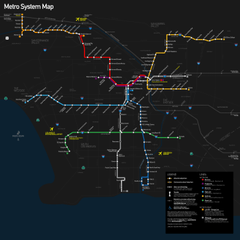
The LA County Metropolitan Transportation Authority and other agencies operate an extensive system of bus lines, as well as subway and light rail lines across Los Angeles County, with a combined monthly ridership (measured in individual boardings) of 38.8 million as of September 2011. The majority of this (30.5 million) is taken up by the city's bus system,[147] the second busiest in the country. The subway and light rail combined average the remaining roughly 8.2 million boardings per month.[147] In 2005, 10.2% of Los Angeles commuters rode some form of public transportation.[148]
The city's subway system is the ninth busiest in the United States and its light rail system is the country's second busiest.[149] The rail system includes the Red and Purple subway lines, as well as the Gold, Blue, Expo, and Green light rail lines. In 2016 the Expo Line was extended to the Pacific at Santa Monica. The Metro Orange and Silver lines are bus rapid transit lines with stops and frequency similar to those of light rail. The city is also central to the commuter rail system Metrolink, which links Los Angeles to all neighboring counties as well as many suburbs.
Besides the rail service provided by Metrolink and the Los Angeles County Metropolitan Transportation Authority, Los Angeles is served by inter-city passenger trains from Amtrak. The main rail station in the city is Union Station just north of Downtown.
In addition, the city directly contracts for local and commuter bus service through the Los Angeles Department of Transportation, or LADOT.
Airports
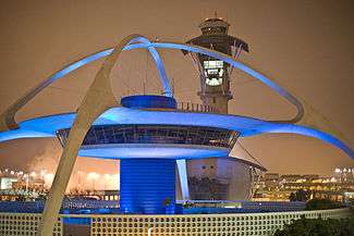
The main international and domestic airport serving Los Angeles is Los Angeles International Airport (IATA: LAX, ICAO: KLAX), commonly referred to by its airport code, LAX. The sixth busiest commercial airport in the world and the third busiest in the United States, LAX handled over 66 million passengers and close to 2 million tons of cargo in 2013.
Other major nearby commercial airports include:
- (IATA: ONT, ICAO: KONT) LA/Ontario International Airport, owned by the city of Los Angeles; serves the Inland Empire.
- (IATA: BUR, ICAO: KBUR) Bob Hope Airport, formerly known as Burbank Airport; serves the San Fernando and San Gabriel Valleys
- (IATA: LGB, ICAO: KLGB) Long Beach Airport, serves the Long Beach/Harbor area
- (IATA: SNA, ICAO: KSNA) John Wayne Airport of Orange County
One of the world's busiest general-aviation airports is also located in Los Angeles, Van Nuys Airport (IATA: VNY, ICAO: KVNY).[150]
Seaports
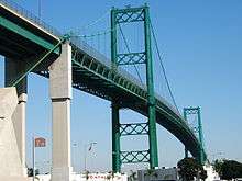
The Port of Los Angeles is located in San Pedro Bay in the San Pedro neighborhood, approximately 20 miles (32 km) south of Downtown. Also called Los Angeles Harbor and WORLDPORT LA, the port complex occupies 7,500 acres (30 km2) of land and water along 43 miles (69 km) of waterfront. It adjoins the separate Port of Long Beach.
The sea ports of the Port of Los Angeles and Port of Long Beach together make up the Los Angeles/Long Beach Harbor.[151][152] Together, both ports are the fifth busiest container port in the world, with a trade volume of over 14.2 million TEU's in 2008.[153] Singly, the Port of Los Angeles is the busiest container port in the United States and the largest cruise ship center on the West Coast of the United States – The Port of Los Angeles' World Cruise Center served about 590,000 passengers in 2014.[154]
There are also smaller, non-industrial harbors along Los Angeles' coastline. The port includes four bridges: the Vincent Thomas Bridge, Henry Ford Bridge, Gerald Desmond Bridge, and Commodore Schuyler F. Heim Bridge. Passenger ferry service from San Pedro to the city of Avalon on Santa Catalina Island is provided by Catalina Express.
Notable people
As home to Hollywood and its entertainment industry, numerous singers, actors and other entertainers live in various districts of Los Angeles.
Twin towns and sister cities
Los Angeles has 25 sister cities,[155] listed chronologically by year joined:
-
 Eilat, Israel (1959)
 -
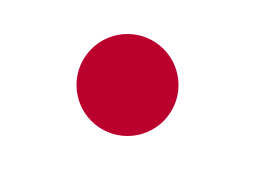 Nagoya, Japan (1959)
 -
 Salvador, Bahia, Brazil (1962)
 -
 Bordeaux, France (1964)[156][157]
 -
 Berlin, Germany (1967)[158]
 -
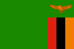 Lusaka, Zambia (1968)
 -
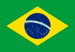
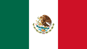 Mexico City, Mexico (1969)
 -
 Auckland, New Zealand (1971)
 -
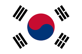 Busan, South Korea (1971)
 -
 Mumbai, India (1972)
 -
 Tehran, Iran (1972)
 -
 Taipei, Taiwan, Republic of China (1979)
 -
 Guangzhou, People's Republic of China (1981)[159]
 -
 Athens, Greece (1984)
 -
 Saint Petersburg, Russia (1984)
 -
 Vancouver, British Columbia, Canada (1986)[160]
 -
 Giza, Egypt (1989)
 -
 Jakarta, Indonesia (1990)
 -
 Kaunas, Lithuania (1991)
 -
 Makati, Philippines (1992)
 -
 Split, Croatia (1993)[161]
 -
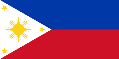
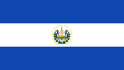 San Salvador, El Salvador (2005)
 -
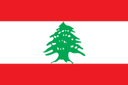 Beirut, Lebanon (2006)
 -
 Ischia, Campania, Italy (2006)
 -
 Yerevan, Armenia (2007)[162]
In addition, Los Angeles has the following "friendship cities":[163]
-
 London, England, United Kingdom
 -
 Łódź, Poland
 - Manchester, England, United Kingdom
- Los Angeles also has an exchange partnership with Tel Aviv, Israel.[164]
See also
- Eastside Los Angeles
- Largest cities in Southern California
- Largest cities in the Americas
- List of cities and towns in California
- List of hotels in Los Angeles
- List of largest California cities by population
- List of museums in Los Angeles
- List of museums in Los Angeles County, California
- List of music venues in Los Angeles
- List of people from Los Angeles
- List of tallest buildings in Los Angeles
- Los Angeles in popular culture
- National Register of Historic Places listings in Los Angeles, California
References
- 1 2 3 Gollust, Shelley (April 18, 2013). "Nicknames for Los Angeles". Voice of America. Retrieved June 26, 2014.
- ↑ Smith, Jack (October 12, 1989). "A Teflon Metropolis Where No Nicknames Stick". Los Angeles Times. p. 1. Retrieved October 1, 2011.
- ↑ Barrows, H.D. (1899). "Felepe de Neve". Historical Society of Southern California Quarterly. 4. p. 151ff. Retrieved September 28, 2011.
- ↑ "California Cities by Incorporation Date" (Word Document). California Association of Local Agency Formation Commissions. Retrieved August 25, 2014.
- ↑ "About the City Government". City of Los Angeles. Retrieved February 8, 2015.
- 1 2 3 "City Directory". City of Los Angeles. Archived from the original on November 13, 2014. Retrieved September 28, 2014.
- 1 2 "2010 Census U.S. Gazetteer Files – Places – California". United States Census Bureau.
- ↑ "Los Angeles City Hall". Geographic Names Information System. United States Geological Survey. Retrieved October 16, 2014.
- 1 2 "Elevations and Distances". US Geological Survey. April 29, 2005. Retrieved February 10, 2015.
- ↑ "New State Population Report: California grew by 348,000 residents in 2015" (PDF). dof.ca.gov. 2016. Archived from the original (PDF) on June 4, 2016.
- ↑ "Urban Areas". United States Census Bureau. Retrieved August 29, 2014.http://www.census.gov/geo/reference/ua/urban-rural-2010.html
- ↑ "Annual Estimates of the Resident Population: April 1, 2010 to July 1, 2013 – United States -- Metropolitan Statistical Area; and for Puerto Rico". United States Census Bureau. Retrieved August 29, 2014.
- ↑ "Annual Estimates of the Resident Population: April 1, 2010 to July 1, 2013 – United States -- Combined Statistical Area; and for Puerto Rico". Census Bureau. Census Bureau. Retrieved August 29, 2014.
- ↑ Also
 i/lɒs ˈændʒəliːz/, or /lɒs ˈæŋɡəlᵻs/. [los ˈaŋxeles], meaning The Angels.
 - ↑ "Subterranean L.A.: The Urban Oil Fields | The Getty Iris". blogs.getty.edu. Retrieved December 31, 2015.
- ↑ "Annual Estimates of the Population of Metropolitan and Micropolitan Statistical Areas". United States Census Bureau. July 1, 2012. Retrieved January 7, 2015.
- 1 2 Bright, William (1998). Fifteen Hundred California Place Names. University of California Press. p. 86. ISBN 978-0-520-21271-8. LCCN 97043147.
Founded on the site of a Gabrielino Indian village called Yang-na, or more accurately iyáangẚ, 'poison-oak place.'
- 1 2 Sullivan, Ron (December 7, 2002). "Roots of native names". San Francisco Chronicle. Retrieved January 7, 2015.
Los Angeles itself was built over a Gabrielino village called Yangna or iyaanga', 'poison oak place.'
- ↑ Willard, Charles Dwight (1901). The Herald's History of Los Angeles. Los Angeles: Kingsley-Barnes & Neuner. pp. 21–24. Retrieved September 29, 2011.
- ↑ "Portola Expedition 1769 Diaries". Pacifica Historical Society. Retrieved January 7, 2015.
- ↑ Leffingwell, Randy; Worden, Alastair (November 4, 2005). California missions and presidios. Voyageur Press. pp. 43–44. ISBN 978-0-89658-492-1. Retrieved September 30, 2011.
- ↑ Sullivan, Noelle (December 8, 2009). It Happened in Southern California: Remarkable Events That Shaped History (2nd ed.). Globe Pequot. pp. 7–9. ISBN 978-0-7627-5423-6. Retrieved September 29, 2011.
- ↑ Mulroy, Kevin; Taylor, Quintard; Autry Museum of Western Heritage (March 2001). "The Early African Heritage in California (Forbes, Jack D.)". Seeking El Dorado: African Americans in California. University of Washington Press. p. 79. ISBN 978-0-295-98082-9. Retrieved September 30, 2011.
- ↑ Guinn, James Miller (1902). Historical and biographical record of southern California: containing a history of southern California from its earliest settlement to the opening year of the twentieth century. Chapman pub. co. p. 63. Retrieved September 30, 2011.
- ↑ Estrada, William D. (2006). Los Angeles's Olvera Street. Arcadia Publishing. ISBN 978-0-7385-3105-2. Retrieved September 30, 2011.
- ↑ Guinn, James Miller (1902). Historical and biographical record of southern California: containing a history of southern California from its earliest settlement to the opening year of the twentieth century. Chapman pub. co. p. 50. Retrieved September 30, 2011.
- ↑ Mulholland, Catherine (2002). William Mulholland and the Rise of Los Angeles. University of California Press. p. 15. ISBN 978-0-520-23466-6. Retrieved September 30, 2011.
- ↑ Kipen, David (2011). Los Angeles in the 1930s: The WPA Guide to the City of Angels. University of California Press. pp. 45–46. ISBN 978-0-520-26883-8. Retrieved September 30, 2011.
- ↑ "Population of the 100 Largest Urban Places: 1900". United States Census Bureau. June 15, 1998. Retrieved January 8, 2015.
- ↑ "The Los Angeles Aqueduct and the Owens and Mono Lakes (MONO Case)". American University. Retrieved January 8, 2015.
- ↑ Reisner, Marc (1993). Cadillac desert: the American West and its disappearing water. Penguin. p. 86. ISBN 978-0-14-017824-1. Retrieved September 30, 2011.
- ↑ Buntin, John (April 6, 2010). L.A. Noir: The Struggle for the Soul of America's Most Seductive City. Random House Digital, Inc. p. 18. ISBN 978-0-307-35208-8. Retrieved September 30, 2011.
- ↑ Young, William H.; Young, Nancy K. (March 2007). The Great Depression in America: a cultural encyclopedia. Greenwood Publishing Group. p. 21. ISBN 978-0-313-33521-1. Retrieved September 30, 2011.
- ↑ "Population of the 100 Largest Urban Places: 1930". United States Census Bureau. June 15, 1998. Retrieved January 8, 2015.
- ↑ Parker, Dana T. Building Victory: Aircraft Manufacturing in the Los Angeles Area in World War II, pp.5-8, 14, 26, 36, 50, 60, 78, 94, 108, 122, Cypress, CA, 2013. ISBN 978-0-9897906-0-4.
- ↑ Bruegmann, Robert (November 1, 2006). Sprawl: A Compact History. University of Chicago Press. p. 133. ISBN 978-0-226-07691-1. Retrieved October 1, 2011.
- ↑ Hafner, Katie; Lyon, Matthew (August 1, 1999). Where Wizards Stay Up Late: The Origins Of The Internet. Simon and Schuster. p. 153. ISBN 978-0-684-87216-2. Retrieved October 1, 2011.
- ↑ Woo, Elaine (June 30, 2004). "Rodney W. Rood, 88; Played Key Role in 1984 Olympics, Built Support for Metro Rail". Los Angeles Times. Retrieved October 1, 2011.
- ↑ Zarnowski, C. Frank (Summer 1992). "A Look at Olympic Costs" (PDF). Citius, Altius, Fortius. 1 (1): 16–32. Retrieved October 1, 2011.
- ↑ Rucker, Walter C.; Upton, James N.; Hughey, Matthew W. (2007). "Los Angeles (California) Riots of 1992". Encyclopedia of American race riots. Greenwood Publishing Group. pp. 376–85. ISBN 978-0-313-33301-9. Retrieved October 1, 2011.
- ↑ "The 10 Biggest Ever American Riots". TheRichest. February 24, 2014. Retrieved January 23, 2015.
- ↑ Wilson, Stan (April 25, 2012). "Riot anniversary tour surveys progress and economic challenges in Los Angeles". CNN. Retrieved January 23, 2015.
- ↑ Reich, Kenneth (December 20, 1995). "Study Raises Northridge Quake Death Toll to 72". Los Angeles Times. p. B1. Retrieved October 1, 2011.
- ↑ "Rampart Scandal Timeline". PBS Frontline. Retrieved October 1, 2011.
- ↑ Orlov, Rick (November 3, 2012). "Secession drive changed San Fernando Valley, Los Angeles". Los Angeles Daily News. Retrieved January 12, 2015.
- ↑ Pool, Bob (February 19, 2009). "L.A. neighborhoods, you're on the map". Los Angeles Times. Retrieved October 2, 2011.
- ↑ Abu-Lughod, Janet L. (1999). New York, Chicago, Los Angeles: America's global cities. U of Minnesota Press. p. 66. ISBN 978-0-8166-3336-4. Retrieved October 2, 2011.
- ↑ LADOT Archived September 7, 2015, at the Wayback Machine.
- ↑ "Los Angeles tops worst cities for traffic in USA". USA TODAY. Retrieved December 31, 2015.
- ↑ "Elevations of the 50 Largest Cities (by population, 1980 Census)". United States Geological Survey. Archived from the original on October 2, 2011. Retrieved October 3, 2011.
- ↑ "Mount Lukens Guide". Sierra Club Angeles Chapter. Retrieved October 3, 2011.
- ↑ Gumprecht, Blake (March 2001). The Los Angeles River: Its Life, Death, and Possible Rebirth. JHU Press. p. 173. ISBN 978-0-8018-6642-5. Retrieved October 3, 2011.
- ↑ Miller, George Oxford (January 15, 2008). Landscaping with Native Plants of Southern California. Voyageur Press. p. 15. ISBN 978-0-7603-2967-2. Retrieved October 6, 2011.
- ↑ National Research Council (U.S.). Advisory Committee on Technology Innovation (1979). Tropical legumes: resources for the future : report of an ad hoc panel of the Advisory Committee on Technology Innovation, Board on Science and Technology for International Development, Commission on International Relations, National Research Council. National Academies. p. 258. NAP:14318. Retrieved October 6, 2011.
- ↑ "Flower". Los Angeles Magazine. Emmis Communications. April 2003. p. 62. ISSN 1522-9149. Retrieved October 6, 2011.
- ↑ "Earthquake Facts". United States Geological Survey. Retrieved October 3, 2011.
- ↑ "San Andreas Fault Set for the Big One". Physorg.com. June 21, 2006. Retrieved October 3, 2011.
- ↑ Shaw, John H.; Shearer, Peter M. (March 5, 1999). "An Elusive Blind-Thrust Fault Beneath Metropolitan Los Angeles". Science. 283 (5407): 1516–1518. doi:10.1126/science.283.5407.1516. PMID 10066170. Retrieved October 3, 2011.
- ↑ "World's Largest Recorded Earthquake". Geology.com. Retrieved January 12, 2015.
- 1 2 "Historical Weather for Los Angeles, California, United States of America". Weatherbase.com. Retrieved December 15, 2011.
- 1 2 "Climatography of the United States No. 20 (1971–2000)" (PDF). National Oceanic and Atmospheric Administration. 2004. Archived from the original (PDF) on September 2, 2013. Retrieved October 5, 2011.http://www.ncdc.noaa.gov/nespls/olstore.prodspecific?prodnum=5058
- ↑ "Pacific Ocean Temperatures on California Coast". beachcalifornia.com. Retrieved October 5, 2011.
- ↑ "Los Angeles Climate Guide". weather2travel.com. Retrieved October 5, 2011.
- ↑ "Climate of California". Western Regional Climate Center. Retrieved October 6, 2011.
- ↑ Poole, Matthew R. (September 22, 2010). Frommer's Los Angeles 2011. John Wiley & Sons. p. 22. ISBN 978-0-470-62619-1. Retrieved October 5, 2011.
- 1 2 3 4 5 6 7
- ↑ Burt, Christopher C.; Stroud, Mark (June 26, 2007). Extreme weather: a guide & record book. W. W. Norton & Company. p. 100. ISBN 978-0-393-33015-1. Retrieved October 5, 2011.
- ↑ Pool, Bob; Lin II, Rong-Gong (September 27, 2010). "L.A.'s hottest day ever". Los Angeles Times. Retrieved October 5, 2011.
- 1 2 "NowData – NOAA Online Weather Data". National Oceanic and Atmospheric Administration. Retrieved June 7, 2013.
- ↑ "Station Name: CA LOS ANGELES DWTN USC CAMPUS". National Oceanic and Atmospheric Administration. Retrieved 2014-05-09.
- ↑ "LOS ANGELES/WBO CA Climate Normals". National Oceanic and Atmospheric Administration. Retrieved October 20, 2013.
- ↑ "Station Name: CA LOS ANGELES INTL AP". National Oceanic and Atmospheric Administration. Retrieved 2014-05-09.
- ↑ "WMO Climate Normals for LOS ANGELES/INTL, CA 1961–1990". National Oceanic and Atmospheric Administration. Retrieved 2014-04-17.
- ↑ Bowman, Chris (July 8, 2008). "Smoke is Normal – for 1800". The Sacramento Bee. Archived from the original on July 9, 2008. Retrieved October 6, 2011.
- ↑ Gordon J. MacDonald. "Environment: Evolution of a Concept" (PDF). p. 2.
The Native American name for Los Angeles was Yang na, which translates into "the valley of smoke."
- ↑ Stimson, Thomas E. (July 1955). What can we do about smog?. Popular Mechanics. p. 65. ISSN 0032-4558. Retrieved October 6, 2011.
- ↑ Smog Hangs Over Olympic Athletes. New Scientist. August 11, 1983. p. 393. ISSN 0262-4079. Retrieved October 6, 2011.
- ↑ Marziali, Carl (March 4, 2015). "L.A.'s Environmental Success Story: Cleaner Air, Healthier Kids". USC News. Retrieved March 16, 2015.
- ↑ "Most Polluted Cities". American Lung Association. Retrieved January 12, 2015.
- ↑ "Pittsburgh and Los Angeles the most polluted US cities". citymayors.com. May 4, 2008. Retrieved October 7, 2011.
- ↑ "Los Angeles meets 20 percent renewable energy goal". Bloomberg News. January 14, 2011. Archived from the original on February 1, 2011. Retrieved October 7, 2011.
- ↑ "American Lung Association State of the Air 2013 – Los Angeles-Long Beach-Riverside, CA". American Lung Association State of the Air 2013. Retrieved September 1, 2015.
- 1 2 3 Baehr, Leslie (June 17, 2014). "Climate Change Is Ruining Some Of The Best Things About Los Angeles". Business Insider. Retrieved January 23, 2015.
- ↑ "EPA officers sickened by fumes at South L.A. oil field". latimes.com. Retrieved March 24, 2016.
- ↑ "Annual Estimates of the Resident Population for Incorporated Places: April 1, 2010 to July 1, 2015". Retrieved July 2, 2016.
- ↑ "Census of Population and Housing". Census.gov. Archived from the original on May 11, 2015. Retrieved June 4, 2015.
- ↑ "2010 Census Interactive Population Search: CA — Los Angeles". United States Census Bureau. Retrieved July 12, 2014.
- 1 2 3 4 5 6 7 8 9 "Los Angeles (city), California". United States Census Bureau. Retrieved October 3, 2016.
- 1 2 3 4 5 "Race and Hispanic Origin for Selected Cities and Other Places: Earliest Census to 1990". United States Census Bureau. Retrieved November 6, 2015.
- 1 2 From 15% sample
- ↑ Hispanic origin based on the White population of Spanish mother tongue.
- ↑ "City Basics". City of Los Angeles. April 12, 2005. Archived from the original on November 27, 2010. Retrieved April 13, 2010.https://performance.lacity.org/
- ↑ Ray, MaryEllen Bell (1985). The City of Watts, California: 1907 to 1926. ISBN 0-917047-01-X. Retrieved November 6, 2015.
- ↑ Major U.S. metropolitan areas differ in their religious profiles, Pew Research Center
- ↑ "America's Changing Religious Landscape". Pew Research Center: Religion & Public Life. May 12, 2015.
- ↑ Pomfret, John (April 2, 2006). "Cardinal Puts Church in Fight for Immigration Rights". Washington Post. Retrieved October 22, 2011.
- ↑ Stammer, Larry B.; Becerra, Hector (September 4, 2002). "Pomp Past, Masses Flock to Cathedral". Los Angeles Times. Retrieved October 22, 2011.
- ↑ Dellinger, Robert (September 6, 2011). "2011 'Grand Procession' revives founding of L.A. Marian devotion" (PDF). The Tidings Online. Retrieved January 14, 2015.
- ↑ "World Jewish Population". SimpleToRemember.com. Retrieved October 23, 2011.
- ↑ "Washington Symposium and Exhibition Highlight Restoration and Adaptive Reuse of American Synagogues". Jewish Heritage Report (1). March 1997. Retrieved October 23, 2011.
- ↑ "Los Angeles's Breed Street Shul Saved by Politicians". Jewish Heritage Report. II (1–2). Spring–Summer 1998. Retrieved October 23, 2011.
- ↑ Luscombe, Belinda (August 6, 2006). "Madonna Finds A Cause". Time Magazine. Retrieved October 23, 2011.
- ↑ "LDS Los Angeles California Temple". The Church of Jesus Christ of Latter-day Saints. Retrieved October 23, 2011.
- 1 2 "Los Angeles: Economy". City-Data. Retrieved October 7, 2011.
- ↑ "Gross Metropolitan Product".
- ↑ "CIA World Factbook, 2009: GDP (official exchange rate)". Central Intelligence Agency. October 2008. Archived from the original on October 4, 2008. Retrieved October 9, 2011.
- ↑ "The World According to GaWC 2012". Globalization and World Cities Research Network. Loughborough University. Retrieved January 25, 2014.
- ↑ "City of Los Angeles CAFR (2010)" (PDF). City of Los Angeles. p. 332 (367). Retrieved October 14, 2011.
- ↑ George, Evan (December 11, 2006). "Trojan Dollars: Study Finds USC Worth $4 Billion Annually to L.A. County". Los Angeles Downtown News. Archived from the original on April 30, 2009.
- ↑ "Fortune 500". Fortune. Time Inc. Retrieved April 13, 2015.
- ↑ "Fortune 500". Fortune. Time Inc. Retrieved May 6, 2015.
- ↑ "Is Los Angeles really the creative capital of the world? Report says yes". SmartPlanet. November 19, 2009. Retrieved October 14, 2011.
- 1 2 "Only In LA: Tapping L.A. Innovation". University of Southern California. Archived from the original on October 2, 2011. Retrieved October 14, 2011.
- ↑ Waxman, Sharon (January 31, 2006). "At U.S.C., a Practical Emphasis in Film". The New York Times. Retrieved October 14, 2011.
- ↑ "Explore the Center". Music Center of Los Angeles County. Archived from the original on October 5, 2011. Retrieved October 14, 2011.
- 1 2 "The Los Angeles Region". Loyola Marymount University. May 5, 2008. Archived from the original on October 18, 2011. Retrieved October 20, 2011.https://www.lmu.edu/about/The_Los_Angeles_Region.htm
- ↑ "Overview". Los Angeles County Museum of Art. Retrieved October 20, 2011.
- ↑ Boehm, Mike (March 16, 2009). "Getty slashes operating budget after severe investment losses". Los Angeles Times. Retrieved October 20, 2011.
- ↑ Mather, Kate (August 5, 2011). "Downtown L.A. Art Walk safety changes planned". Los Angeles Times. Retrieved October 20, 2011.
- ↑ Hanzus, Dan (January 12, 2016). "Rams to relocate to L.A.; Chargers first option to join". NFL.com. National Football League. Retrieved January 13, 2016.
- ↑ "Rams to Return to Los Angeles". St. Louis Rams. January 12, 2016. Retrieved January 13, 2016.
- ↑ Maske, Mark (January 12, 2016). "NFL returns to Los Angeles: Owners approve move by Rams; Chargers with option to join". The Washington Post. Retrieved January 12, 2016.
- ↑ "Games - Deaflympics". deaflympics.com.
- ↑ "Los Angeles To Host 2015 Special Olympics World Summer Games". Special Olympics. September 14, 2011. Retrieved February 9, 2012.
- ↑ "Los Angeles, California Code Resources". American Legal Publishing. Retrieved January 23, 2015.
- ↑ "Communities of Interest — City". California Citizens Redistricting Commission. Retrieved September 28, 2014.
- ↑ "Communities of Interest — City". California Citizens Redistricting Commission. Retrieved September 28, 2014.
- ↑ "Communities of Interest — City". California Citizens Redistricting Commission. Retrieved September 27, 2014.
- ↑ Powell, Amy (January 6, 2010). "Los Angeles crime rates hit 50-year lows". KABC-TV. Archived from the original on July 21, 2015. Retrieved January 14, 2015.
- ↑ "LAPD year-end crime statistics". Los Angeles Police Department. Retrieved April 13, 2010.
- ↑ "Uniform Crime Reports of Los Angelesand Index from 1985 to2005". Retrieved April 20, 2016.
- ↑ "LAPD Online Crime Rates" (PDF). Los Angeles Police Department. Retrieved April 13, 2010.
- ↑ "Simmons, Randal". Los Angeles Police Department. Retrieved July 9, 2008.
- ↑ "LAPD City Murder Rate Drops 16 Percent". KCBS-TV. January 6, 2014. Retrieved February 4, 2014.
- ↑ "America's 2014 Murder Capital". The Daily Beast. Retrieved September 1, 2015.
- ↑ FOX. "Crime rates in Los Angeles rise 12.6 percent". foxla.com.
- 1 2 DeVico, Peter (2007). The Mafia Made Easy: The Anatomy and Culture of La Cosa Nostra. Tate Publishing. p. 154. ISBN 1-60247-254-8. Retrieved September 6, 2012.
- ↑ "Gangs". Los Angeles Police Department. Retrieved April 13, 2010.
- ↑ Serjeant, Jill (February 8, 2007). "Police target 11 worst Los Angeles street gangs". Reuters. Retrieved January 14, 2015.
- ↑ "US Census, District information". United States Census Bureau. Retrieved October 24, 2011.
- ↑ "Los Angeles Public Library Branches". Los Angeles Public Library. Retrieved October 24, 2011.
- ↑ "Flavorpill". flavorpill. Retrieved September 1, 2015.
- ↑ "Allocation". Museum of Broadcast Communications. Retrieved October 20, 2011.
- ↑ Woolsey, Matt (April 25, 2008). "Best And Worst Cities For Commuters". Forbes. Retrieved October 24, 2011.
- ↑ Woolsey, Matt. "In Depth: 10 Worst Cities For Commuters". Forbes. Retrieved October 24, 2011.
- ↑ "American Community Survey 2006, Table S0802". United States Census Bureau. Archived from the original on September 16, 2008.http://www.census.gov/programs-surveys/acs/
- 1 2 "Ridership Statistics". Los Angeles County Metropolitan Transportation Authority. Retrieved October 24, 2011.
- ↑ Christie, Les (June 29, 2007). "New Yorkers are Top Transit Users". CNN. Retrieved October 24, 2011.
- ↑ "Public Transit Ridership Report" (PDF). American Public Transportation Association. 2011. Retrieved October 24, 2011.
- ↑ "Van Nuys Airport General Description". Los Angeles World Airports. Retrieved October 25, 2011.
- ↑ "Los Angeles/Long Beach Harbor Safety Committee" (PDF). Retrieved March 16, 2011.
- ↑ "Los Angeles/Long Beach Harbor Employers Association". Harboremployers.com. Retrieved March 16, 2011.
- ↑ "AAPA World Port Rankings 2008" (PDF). Retrieved March 16, 2011.
- ↑ "Cruise Passenger and Ferry Terminals". Port of Los Angeles. Retrieved January 14, 2015.
- ↑ "Sister Cities of Los Angeles". Sister Cities Los Angeles. Retrieved September 29, 2011.
- ↑ "Bordeaux– Rayonnement européen et mondial". Mairie de Bordeaux (in French). Archived from the original on February 7, 2013. Retrieved July 29, 2013.
- ↑ "Bordeaux-Atlas français de la coopération décentralisée et des autres actions extérieures". Délégation pour l'Action Extérieure des Collectivités Territoriales (Ministère des Affaires étrangères) (in French). Archived from the original on February 7, 2013. Retrieved July 29, 2013.
- ↑ "Berlin City Partnerships". Der Regierende Bürgermeister Berlin. Archived from the original on May 21, 2013. Retrieved September 17, 2013.
- ↑ "Guangzhou Sister Cities". Guangzhou Foreign Affairs Office. Archived from the original on October 24, 2012. Retrieved July 21, 2013.
- ↑ "Vancouver Twinning Relationships" (PDF). City of Vancouver. Retrieved December 5, 2009.
- ↑ "Gradovi prijatelji Splita" [Split Twin Towns]. Grad Split [Split Official City Website] (in Croatian). Archived from the original on March 24, 2012. Retrieved December 19, 2013.
- ↑ "Yerevan Twin Towns & Sister Cities". Yerevan Municipality Official Website. Retrieved November 4, 2013.
- ↑ "Twinning link with LA". Manchester Evening News. July 27, 2009. Retrieved July 28, 2009.
- ↑ "Tel Aviv/Los Angeles Partnership". The Jewish Federation of Greater Los Angeles. 2007. Archived from the original on June 23, 2008. Retrieved August 7, 2008.
Further reading
- General
- Carey McWilliams (2009). Southern California: An Island on the Land (9th ed.). Peregrine Smith. ISBN 978-0-87905-007-8.
- Richard White (1991). It's Your Misfortune and None of My Own: A New History of the American West. University of Oklahoma Press. ISBN 978-0-8061-2567-1.
- David Rieff (1992). Los Angeles: Capital of the Third World. Touchstone. ISBN 978-0-671-79210-7.
- Peter Theroux (1994). Translating LA: A Tour of the Rainbow City. Norton. ISBN 978-0-393-31394-9.
- Paul Glover (1995). Los Angeles: A History of the Future. Greenplanners. ISBN 978-0-9622911-0-4.
- Leonard Pitt & Dale Pitt (2000). Los Angeles A to Z: An Encyclopedia of the City and County. Berkeley: University of California Press. ISBN 978-0-520-20530-7.
- Kevin Starr and David Ulin (2009). Jim Heimann, ed. Los Angeles: Portrait of a City. Taschen America. ISBN 978-3-8365-0291-7.
- Architecture and urban theory
- Reyner Banham (2009). Los Angeles: The Architecture of Four Ecologies (2nd ed.). Berkeley: University of California Press. ISBN 978-0-520-26015-3.
- Mike Davis (2006). City of Quartz: Excavating the Future in Los Angeles. Verso. ISBN 978-1-84467-568-5.
- Robert M. Fogelson (1993). The Fragmented Metropolis: Los Angeles 1850–1930. Berkeley: University of California Press. ISBN 978-0-520-08230-4.
- Norman M. Klein (1997). The History of Forgetting: Los Angeles and the Erasure of Memory. Verso. ISBN 978-1-84467-242-4.
- Sam Hall Kaplan (2000). L.A. Lost & Found: An Architectural History of Los Angeles. Hennessey and Ingalls. ISBN 978-0-940512-23-8.
- Wim de Wit and Christopher James Alexander (2013). Overdrive: L.A. Constructs the Future, 1940–1990. Getty Publications. ISBN 978-1-60606-128-2.
- Race relations
- Acuña, Rodolfo (1996). Anything but Mexican: Chicanos in contemporary Los Angeles. Verso. ISBN 978-1-85984-031-3. Retrieved September 30, 2011.
- George, Lynell (1992). No Crystal Stair: African Americans in the City of Angels. Verso. ISBN 978-0-86091-389-4.
- Sides, Josh (2006). L.A. City Limits: African American Los Angeles from the Great Depression to the Present. Berkeley: University of California Press. ISBN 978-0-520-24830-4.
- Eduardo Obregón Pagán (2006). Murder at the Sleepy Lagoon: Zoot Suits, Race, and Riot in Wartime L.A. The University of North Carolina Press. ISBN 978-0-8078-5494-5.
- R. J. Smith (2007). The Great Black Way: L.A. in the 1940s and the Last African American Renaissance. PublicAffairs. ISBN 978-1-58648-521-4.
- LGBT
- Lillian Faderman and Stuart Timmons (2006). Gay L. A.: A History of Sexual Outlaws, Power Politics, And Lipstick Lesbians. Basic Books. ISBN 0-465-02288-X.
- Hurewitz, Daniel (2007). Bohemian Los Angeles: and the Making of Modern Politics. Berkeley: University of California Press. ISBN 0-520-24925-9.
- Environment
- Marc Reisner (1986). Cadillac Desert: The American West and its Disappearing Water. Penguin Books. ISBN 978-0-14-017824-1.
- Chip Jacobs and William Kelly (2008). Smogtown: The Lung-Burning History of Pollution in Los Angeles. Outlook Hardcover. ISBN 1-58567-860-0.
- Art and literature
- David L. Ulin, ed. (2002). Writing Los Angeles: A Literary Anthology. Library of America. ISBN 978-1-931082-27-3.
- Whiting, Cécile (2008). Pop L.A.: Art and the City in the 1960s. Berkeley: University of California Press. ISBN 978-0-520-25634-7.
External links
| Topics |  | |
|---|---|---|
| Government | ||