Avocado Heights, California
| Bassett | |
|---|---|
| Census-designated place | |
 Location of Avocado Heights in Los Angeles County, California. | |
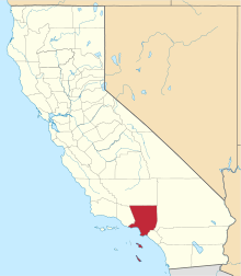
 Bassett Location in the United States | |
| Coordinates: 34°2′19″N 118°0′16″W / 34.03861°N 118.00444°WCoordinates: 34°2′19″N 118°0′16″W / 34.03861°N 118.00444°W | |
| Country |
|
| State |
|
| County | Los Angeles |
| Area[1] | |
| • Total | 2.842 sq mi (7.359 km2) |
| • Land | 2.706 sq mi (7.008 km2) |
| • Water | 0.136 sq mi (0.351 km2) 4.77% |
| Elevation[2] | 338 ft (103 m) |
| Population (2010) | |
| • Total | 15,411 |
| • Density | 5,400/sq mi (2,100/km2) |
| Time zone | PST (UTC-8) |
| • Summer (DST) | PDT (UTC-7) |
| ZIP code | 91746 |
| Area code(s) | 626 |
| FIPS code | 06-03344 |
| GNIS feature ID | 1724314 |
Avocado Heights is an unincorporated census-designated place in Los Angeles County, California, United States. It lies in the San Gabriel Valley, near Puente Hills. On the northern border lies the unincorporated community of West Puente Valley; on the eastern border the City of Industry. A thin strip of the City of Industry runs to the south, and the Pomona Freeway and the Puente Hills are farther south. To the west is the San Gabriel River and the San Gabriel River Freeway, as well as the California Country Club. Avocado Heights is approximately 15 miles (24 km) from the downtown Los Angeles Civic Center. The population was 15,411 at the 2010 census, up from 15,148 at the 2000 census.
A significant portion of Avocado Heights remains equestrian and semi-rural, with many homes on lots of 0.5 acres 21,780 square feet (2,023 m2) or more. The proximity of polluting industries in what became the City of Industry, as well as the Puente Hills Landfill, suppressed property values throughout the post-World War II era--discouraging the development that transformed most of the San Gabriel Valley into a relatively densely developed suburban area.
Geography
Avocado Heights is located at 34°2′19″N 118°0′16″W / 34.03861°N 118.00444°W (34.038610, −118.004575),[3] or about three miles (5 km) southeast of El Monte.[4] According to the United States Census Bureau, the CDP has a total area of 2.8 square miles (7.3 km2). 2.7 square miles (7.0 km2) of it is land, and 0.1 square miles (0.26 km2) of it (4.77%) is water.
The primary thoroughfare is Don Julian Road, named for the nickname given to early Anglo settler William Workman by local Californios; his homestead lies on Don Julian Road just to the east in Industry. The community is served by Don Julian Elementary School, which is part of the Bassett Unified School District.
Climate
Avocado Heights is classified as Hot Summer Mediterranean climate. It is characterized by warm winters and very hot summers and receives a shielding effect from nearby hills to the south which keeps it warmer than other cities nearby.
| Climate data for Avocado Heights, California (1981–2010 normals) | |||||||||||||
|---|---|---|---|---|---|---|---|---|---|---|---|---|---|
| Month | Jan | Feb | Mar | Apr | May | Jun | Jul | Aug | Sep | Oct | Nov | Dec | Year |
| Average high °F (°C) | 72 (22) |
73 (23) |
76 (24) |
80 (27) |
84 (29) |
90 (32) |
95 (35) |
96 (36) |
95 (35) |
85 (29) |
79 (26) |
72 (22) |
83.1 (28.3) |
| Average low °F (°C) | 49 (9) |
50 (10) |
52 (11) |
54 (12) |
59 (15) |
63 (17) |
65 (18) |
67 (19) |
65 (18) |
60 (16) |
53 (12) |
49 (9) |
57.2 (13.8) |
| Average precipitation inches (mm) | 3.78 (96) |
3.53 (89.7) |
2.66 (67.6) |
.93 (23.6) |
.33 (8.4) |
.06 (1.5) |
.01 (0.3) |
.03 (0.8) |
.18 (4.6) |
.30 (7.6) |
1.21 (30.7) |
2.43 (61.7) |
16.43 (417.3) |
| Source: [5] | |||||||||||||
Demographics
| Historical population | |||
|---|---|---|---|
| Census | Pop. | %± | |
| 1970 | 9,810 | — | |
| 1980 | 11,721 | 19.5% | |
| 1990 | 14,232 | 21.4% | |
| 2000 | 15,148 | 6.4% | |
| 2010 | 15,411 | 1.7% | |
2010
The 2010 United States Census[6] reported that Avocado Heights had a population of 15,411. The population density was 5,423.8 people per square mile (2,094.1/km²). The racial makeup of Avocado Heights was 8,564 (55.6%) White (7.8% Non-Hispanic White),[7] 136 (0.9%) African American, 107 (0.7%) Native American, 1,359 (8.8%) Asian, 13 (0.1%) Pacific Islander, 4,726 (30.7%) from other races, and 506 (3.3%) from two or more races. Hispanic or Latino of any race were 12,648 persons (82.1%).
The Census reported that 15,332 people (99.5% of the population) lived in households, 79 (0.5%) lived in non-institutionalized group quarters, and 0 (0%) were institutionalized.
There were 3,813 households, out of which 1,900 (49.8%) had children under the age of 18 living in them, 2,351 (61.7%) were opposite-sex married couples living together, 622 (16.3%) had a female householder with no husband present, 331 (8.7%) had a male householder with no wife present. There were 205 (5.4%) unmarried opposite-sex partnerships, and 23 (0.6%) same-sex married couples or partnerships. 368 households (9.7%) were made up of individuals and 181 (4.7%) had someone living alone who was 65 years of age or older. The average household size was 4.02. There were 3,304 families (86.7% of all households); the average family size was 4.16.
The population was spread out with 4,210 people (27.3%) under the age of 18, 1,676 people (10.9%) aged 18 to 24, 4,277 people (27.8%) aged 25 to 44, 3,575 people (23.2%) aged 45 to 64, and 1,673 people (10.9%) who were 65 years of age or older. The median age was 33.7 years. For every 100 females there were 98.5 males. For every 100 females age 18 and over, there were 96.4 males.
There were 3,922 housing units at an average density of 1,380.3 per square mile (532.9/km²), of which 2,934 (76.9%) were owner-occupied, and 879 (23.1%) were occupied by renters. The homeowner vacancy rate was 0.7%; the rental vacancy rate was 3.1%. 11,422 people (74.1% of the population) lived in owner-occupied housing units and 3,910 people (25.4%) lived in rental housing units.
According to the 2010 United States Census, Avocado Heights had a median household income of $72,240, with 14.1% of the population living below the federal poverty line.[7]
2000
As of the 2000 census,[8] the population was 15,148, with 3,758 households, and 3,280 families residing in the CDP. The population density was 5,675.7 inhabitants per square mile (2,190.5/km²). There were 3,839 housing units at an average density of 1,438.4 per square mile (555.1/km²). The racial makeup of the CDP was 51.43% White, 1.47% Black or African American, 1.16% Native American, 9.12% Asian, 0.11% Pacific Islander, 33.06% from other races, and 3.66% from two or more races. 77.74% of the population were Hispanic or Latino of any race.
Of the 3,758 households, 45.6% had children under the age of 18 living with them, 66.0% were married couples living together, 14.2% had a female householder with no husband present, and 12.7% were non-families. 9.7% of all households were made up of individuals and 3.8% had someone living alone who was 65 years of age or older. The average household size was 4.00 and the average family size was 4.16.
The age range was 30.9% under the age of 18, 10.9% from 18 to 24, 29.5% from 25 to 44, 20.0% from 45 to 64, and 8.7% who were 65 years of age or older. The median age was 30 years. For every 100 females there were 99.3 males. For every 100 females age 18 and over, there were 97.5 males.
The median income for a household in the CDP was $48,712, and the median income for a family was $48,939. Males had a median income of $30,837 versus $26,481 for females. The per capita income for the CDP was $14,570. About 13.2% of families and 16.3% of the population were below the poverty line, including 22.0% of those under age 18 and 9.8% of those age 65 or over.
Government
In the California State Legislature, Avocado Heights is in the 22nd Senate District, represented by Democrat Ed Hernandez, and in the 57th Assembly District, represented by Democrat Ian Calderon.[9]
In the United States House of Representatives, Avocado Heights is in California's 32nd congressional district, represented by Democrat Grace Napolitano.[10]
References
- ↑ "2010 Census U.S. Gazetteer Files – Places – California". United States Census Bureau.
- ↑ "Avocado Heights". Geographic Names Information System. United States Geological Survey. Retrieved November 4, 2014.
- ↑ "US Gazetteer files: 2010, 2000, and 1990". United States Census Bureau. 2011-02-12. Retrieved 2011-04-23.
- ↑ http://www.city-data.com/city/Avocado-Heights-California.html city-data.com
- ↑ "Average Weather for - Temperature and Precipitation". weather.com. Retrieved 2014-05-03.
- ↑ "2010 Census Interactive Population Search: CA - Avocado Heights CDP". U.S. Census Bureau. Retrieved July 12, 2014.
- 1 2 http://quickfacts.census.gov/qfd/states/06/0603344.html. Missing or empty
|title=(help) - ↑ "American FactFinder". United States Census Bureau. Archived from the original on September 11, 2013. Retrieved 2008-01-31.
- ↑ "Statewide Database". UC Regents. Retrieved November 20, 2014.
- ↑ "California's 32nd Congressional District - Representatives & District Map". Civic Impulse, LLC.
 |
South El Monte | El Monte | La Puente | |
| Unincorporated Los Angeles County | |
La Puente | ||
| ||||
| | ||||
| Unincorporated Los Angeles County | Unincorporated Los Angeles County | Hacienda Heights |