Oroville, California
| Oroville, California | ||
|---|---|---|
| City | ||
| City of Oroville | ||
| ||
| Nickname(s): "City of Gold" | ||
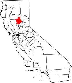
 Location of Oroville in California | ||
 Oroville, California Location in the contiguous United States | ||
| Coordinates: 39°31′N 121°33′W / 39.517°N 121.550°WCoordinates: 39°31′N 121°33′W / 39.517°N 121.550°W | ||
| Country | United States of America | |
| State | California | |
| County | Butte | |
| Incorporated | January 3, 1906[1] | |
| Government | ||
| • City Council |
Mayor Linda Dahlmeier Vice Mayor Thil Wilcox Art Hatley Jack Berry Marlene Del Rosario Dave Pittman Jr Simpson | |
| • State Senator | Jim Nielsen (R)[2] | |
| • State Assembly | James Gallagher (R)[3] | |
| • U.S. Congress | Doug LaMalfa (R)[4] | |
| Area[5] | ||
| • City | 13.011 sq mi (33.701 km2) | |
| • Land | 12.993 sq mi (33.653 km2) | |
| • Water | 0.018 sq mi (0.048 km2) 0.14% | |
| Elevation | 167 ft (51 m) | |
| Population (2010) | ||
| • City | 16,061 | |
| • Estimate (2015) | 16,260 | |
| • Density | 1,200/sq mi (480/km2) | |
| • Metro | 48,000 (estimated) | |
| Time zone | PST (UTC-8) | |
| • Summer (DST) | PDT (UTC-7) | |
| ZIP codes | 95940, 95965, 95966 | |
| Area code(s) | 530 | |
| FIPS code | 06-54386 | |
| GNIS feature IDs | 277570, 2411337 | |
| Website |
www | |
Oroville (formerly, Ophir City) is the county seat of Butte County, California. The population was 15,506 (2010 census), up from 13,004 (2000 census). Oroville is located off of Highway 70, and is in close proximity to Highway 99, which connects Butte County with Interstate 5. Chico, California is located about 25 minutes north of the city, and Sacramento lies about an hour south. Oroville is considered the gateway to Lake Oroville and Feather River recreational areas.The Berry Creek Rancheria of Maidu Indians of California is headquartered here. The City of Oroville has recently annexed two location in South Oroville, areas A and B, which have a combined population of 2,725 people. The U.S. Census Bureau estimated the population of the city to be 17,996 as of Jan. 1, 2016, up 1,908 people or 11.9 percent during 2015.
History
Oroville is situated at the base of the foothills on the banks of the Feather River where it flows out of the Sierra Nevada onto the flat floor of the Sacramento Valley. It was established as the head of navigation on the Feather River to supply gold miners during the California Gold Rush.
The town was originally called Ophir City, but the name was changed to Oroville when the first post office opened in 1854 ("oro" is "gold" in Spanish).[6] The City Of Oroville was incorporated on January 3, 1906.
Gold was found at Bidwell Bar, one of the first gold mining sites in California, bringing thousands of prospectors to the Oroville area seeking riches. Now inundated by the waters of enormous Lake Oroville, which was filled in 1968, Bidwell Bar is memorialized by the Bidwell Bar Bridge, an original remnant from the area and the first suspension bridge in California (California Historical Landmark #314). In the early 20th century the Western Pacific Railroad completed construction of the all-weather Feather River Canyon route through the Sierra Nevadas giving it the nickname of "The Feather River Route". Oroville would serve as an important stop for the famous California Zephyr during its 20-year run. In 1983, this became a part of the Union Pacific Railroad as their Feather River Canyon Subdivision. A major highway, State Route 70, roughly parallels the railroad line winding through the canyon.

The Chinese Temple (CHL #770 and listed on the National Register of Historic Places) is another monument to Oroville's storied past. Chinese laborers from the pioneer era established the Temple as a place of worship for followers of Chinese Popular Religion and the three major Chinese religions: Taoism, Buddhism, and Confucianism. The Chinese Temple and Garden, as it is now called, has an extensive collection of artifacts and a serene garden to enjoy.
The olive-canning industry was founded in Oroville by Freda Ehmann, the "mother of ripe olives." She built a large cannery in Oroville, and by 1900 was the president of the world's largest canned olive factory. Ehmann was a believer in women's suffrage and a friend of Susan B. Anthony[7]

Ishi, Oroville's most famous resident, was the last of the Yahi Indians and is considered the last "Stone Age" Indian to come out of the wilderness and into western civilization. When he appeared out of the hills in East Oroville in 1911, he was immediately thrust into the national spotlight. The Visitor's Center at Lake Oroville has a thorough exhibit and documentary film on Ishi and his life in society.
Archaeological finds place the northwestern border for the prehistoric Martis people in the Oroville area.[8]
The Lynching of Tom Noacks
On August 7, 1881, beloved elderly pioneer, Jack Crum was stomped to death by local bully Tom Noacks in Chico, California. The young Noacks was feared by the locals of Butte County, not only because of his size and strength, but because he was mentally unbalanced and enjoyed punching oxen in the head. Noacks was arrested and jailed in Chico’s jail, but once word got out that the old pioneer had been murdered, the authorities moved him to the Butte County jail in Oroville for his safety. Crum’s friends knew that Noacks was in the county jail, and they made their way to Oroville with rope in hand. Knocking on the jail door, the men told the jailer that they had a prisoner from the town of Biggs, California. Once in the jail, they overpowered the jailer and dragged Noacks from his cell. They took the cowering man to Crum’s former farm and hanged him from an old cottonwood tree. Nobody was ever prosecuted for the lynching.[9]
Geography
Oroville is situated at the head of navigation on the Feather River. The Yuba River flows into the Feather River near Marysville, California and these flow together to the Sacramento River. Geologically, Oroville is situated at the meeting place of three provinces: the Central Valley alluvial plain to the west, the crystalline Sierra Nevada to the SE and the volcanic Cascade Mountains to the north. It has a Mediterranean climate.
Oroville sits on the eastern rim of the Great Valley, defined today by the floodplains of the Sacramento River and its tributaries. Around Oroville these sediments are dominated by thick fans of Feather River sediments, but just east of this there is a thin, N-S band of late Cretaceous sediments. These sit on top of the Sierran basement, which beneath eastern Oroville comprise greenschist-facies metavolcanic rocks of Jurassic age, giving way to granites of the Sierra batholith to the east. These are manifestations of a vigorous island arc sequence, built out over an east-dipping subduction zone of mid-to-late Mesozoic age. The gold veins lace this ancient arc, remobilized by Mesozoic shearing and intrusions of igneous rock. The crystalline foothills are locally overlain by a Cenozoic sequence of Eocene clean beach sands overlain by Neogene volcanics, including the Diamond Head-like profile of Table Mountain.
Climate
According to the Köppen Climate Classification system, Oroville has a warm-summer Mediterranean climate, abbreviated "Csa" on climate maps.[10]
| Climate data for Oroville | |||||||||||||
|---|---|---|---|---|---|---|---|---|---|---|---|---|---|
| Month | Jan | Feb | Mar | Apr | May | Jun | Jul | Aug | Sep | Oct | Nov | Dec | Year |
| Record high °F (°C) | 82 (28) |
82 (28) |
88 (31) |
96 (36) |
104 (40) |
115 (46) |
115 (46) |
113 (45) |
108 (42) |
102 (39) |
90 (32) |
76 (24) |
115 (46) |
| Average high °F (°C) | 55.1 (12.8) |
60.8 (16) |
65.3 (18.5) |
71.7 (22.1) |
80.8 (27.1) |
89.8 (32.1) |
96.4 (35.8) |
94.7 (34.8) |
89 (32) |
78.6 (25.9) |
64.7 (18.2) |
55.3 (12.9) |
75.2 (24) |
| Average low °F (°C) | 37.2 (2.9) |
40.4 (4.7) |
43.4 (6.3) |
46.3 (7.9) |
52.2 (11.2) |
58.3 (14.6) |
62 (17) |
59.9 (15.5) |
55.6 (13.1) |
49 (9) |
42 (6) |
37.3 (2.9) |
48.6 (9.2) |
| Record low °F (°C) | 22 (−6) |
22 (−6) |
26 (−3) |
29 (−2) |
30 (−1) |
35 (2) |
45 (7) |
42 (6) |
40 (4) |
27 (−3) |
23 (−5) |
12 (−11) |
12 (−11) |
| Average precipitation inches (mm) | 5.55 (141) |
4.84 (122.9) |
4.05 (102.9) |
2.21 (56.1) |
1 (30) |
0.44 (11.2) |
0.04 (1) |
0.14 (3.6) |
0.4 (10) |
1.65 (41.9) |
3.57 (90.7) |
4.8 (122) |
28.69 (728.7) |
| Average snowfall inches (cm) | 0 (0) |
0 (0) |
0 (0) |
0 (0) |
0 (0) |
0 (0) |
0 (0) |
0 (0) |
0 (0) |
0 (0) |
0 (0) |
0 (0) |
0 (0) |
| Average precipitation days | 11 | 10 | 9 | 7 | 4 | 2 | 0 | 0 | 1 | 4 | 8 | 10 | 66 |
| Source: WRCC[11] | |||||||||||||
Local government
Fire department
|
| |
| The Hornets Nest | |
| Operational area | |
|---|---|
| Country |
|
| State |
|
| City | Oroville |
| Agency overview | |
| Established | 1856 |
| Annual calls | 3,301 |
| Employees | 21 full time & 12 paid call |
| Fire chief | Charles Hurley |
| IAFF | 2404[12] |
| Facilities and equipment | |
| Stations | 1 |
| Engines | 4 |
| Website | |
| Oroville Fire Department | |
The Oroville Fire Department is the fire department for the City of Oroville. They are responsible for calls within the city jurisdiction of approximately 13 square miles (34 km2) with a population of 16,260 (as of 2015).[13]
History
According to the Department's website, the fire company was formed in 1856. At the time, the only other department in California, was the Sacramento City Fire Department.[14] The department serviced a community burgeoning with the gold mining activity of the time. The equipment consisted of a hay wagon, which was subsequently lost to fire.[14]
In 1921, the Department functioned under the guidance of Chief F. W. Krueger. The department took responsibility for fires outside of the city limits. This included a lumber yard conflagration set off by a careless smoker. The department used at least 700 ft (210 m) of hose measuring 2.5 in (64 mm) to put out the fire. Damages from the fire in the lumber yard were estimated around $250,000 (not adjusted for inflation).[15] In that era, the department was primarily staffed by volunteers.[15] They had one paid "full time driver and chemical man" according to a 1926 survey published by the Oroville District Chamber of Commerce.[16]
Modern era
The Oroville Fire Department responded to primarily calls for medical aid in 2013. Over 3000 calls for assistance were responded to that year, of which over 70% were for medical assistance.[17]
Demographics
| Historical population | |||
|---|---|---|---|
| Census | Pop. | %± | |
| 1860 | 2,429 | — | |
| 1870 | 1,425 | −41.3% | |
| 1880 | 1,743 | 22.3% | |
| 1890 | 1,787 | 2.5% | |
| 1910 | 3,859 | — | |
| 1920 | 3,340 | −13.4% | |
| 1930 | 3,698 | 10.7% | |
| 1940 | 4,421 | 19.6% | |
| 1950 | 5,387 | 21.9% | |
| 1960 | 6,115 | 13.5% | |
| 1970 | 7,536 | 23.2% | |
| 1980 | 8,683 | 15.2% | |
| 1990 | 11,960 | 37.7% | |
| 2000 | 13,004 | 8.7% | |
| 2010 | 15,546 | 19.5% | |
| Est. 2015 | 16,260 | [18] | 4.6% |
2010
The 2010 United States Census[20] reported that Oroville had a population of 15,546. The population density was 1,194.8 people per square mile (461.3/km²). The racial makeup of Oroville was 11,686 (75.2%) White, 453 (2.9%) African American, 573 (3.7%) Native American, 1,238 (8.0%) Asian, 56 (0.4%) Pacific Islander, 554 (3.6%) from other races, and 986 (6.3%) from two or more races. Hispanic or Latino of any race were 1,945 persons (12.5%).
The Census reported that 14,662 people (94.3% of the population) lived in households, 72 (0.5%) lived in non-institutionalized group quarters, and 812 (5.2%) were institutionalized.
There were 5,646 households, out of which 2,126 (37.7%) had children under the age of 18 living in them, 1,893 (33.5%) were opposite-sex married couples living together, 1,174 (20.8%) had a female householder with no husband present, 430 (7.6%) had a male householder with no wife present. There were 615 (10.9%) unmarried opposite-sex partnerships, and 33 (0.6%) same-sex married couples or partnerships. 1,699 households (30.1%) were made up of individuals and 718 (12.7%) had someone living alone who was 65 years of age or older. The average household size was 2.60. There were 3,497 families (61.9% of all households); the average family size was 3.22.
The population was spread out with 4,267 people (27.4%) under the age of 18, 1,969 people (12.7%) aged 18 to 24, 3,940 people (25.3%) aged 25 to 44, 3,417 people (22.0%) aged 45 to 64, and 1,953 people (12.6%) who were 65 years of age or older. The median age was 31.5 years. For every 100 females there were 93.7 males. For every 100 females age 18 and over, there were 91.8 males.
There were 6,194 housing units at an average density of 476.0 per square mile (183.8/km²), of which 2,423 (42.9%) were owner-occupied, and 3,223 (57.1%) were occupied by renters. The homeowner vacancy rate was 3.6%; the rental vacancy rate was 8.4%. 6,293 people (40.5% of the population) lived in owner-occupied housing units and 8,369 people (53.8%) lived in rental housing units.
2000
According to the United States Census Bureau, the city has a total area of 12.3 square miles (31.8 km²), of which, 12.2 square miles (31.7 km²) of it is land and 0.04 square miles (0.1 km²) of it (0.16%) is water.
As of the census[21] of 2000, there were 13,004 people, 4,881 households, and 2,948 families residing in the city. The population density was 1,061.4 people per square mile (409.9/km²). There were 5,419 housing units at an average density of 442.3 per square mile (170.8/km²). The racial makeup of the city was 77.2% White, 4.0% Black or African American, 3.9% Native American, 6.3% Asian, 0.3% Pacific Islander, 2.8% from other races, and 5.4% from two or more races. 8.3% of the population were Hispanic or Latino of any race.
There were 4,881 households out of which 33.9% had children under the age of 18 living with them, 36.4% were married couples living together, 18.9% had a female householder with no husband present, and 39.6% were non-families. 33.2% of all households were made up of individuals and 14.5% had someone living alone who was 65 years of age or older. The average household size was 2.50 and the average family size was 3.19.
In the city the population was spread out with 30.1% under the age of 18, 10.3% from 18 to 24, 25.8% from 25 to 44, 19.2% from 45 to 64, and 14.7% who were 65 years of age or older. The median age was 33 years. For every 100 females there were 95.8 males. For every 100 females age 18 and over, there were 90.7 males.
The median income for a household in the city was $21,911, and the median income for a family was $27,666. Males had a median income of $28,587 versus $21,916 for females. The per capita income for the city was $12,345. About 16.2% of families and 23.1% of the population were below the poverty line, including 39.3% of those under age 18 and 8.9% of those age 65 or over.
Points of interest

- The Oroville Dam, perhaps Oroville's most famous site, is one of the 20 largest dams in the world, the largest earth filled dam in the US, as well as the tallest dam in the US. This dam is 770 feet (235 m) tall and 6920 feet (2109 m) long, and it impounds Lake Oroville, which has a capacity of 3,500,000 acre feet (4.3 km3) of water, making it the second largest reservoir in California. This is one of the most important parts of the California State Water Project (see also the Central Valley Project, a Federal undertaking). Both systems move water from water-rich Northern California to water-poor Southern California. This facility is operated by the California Department of Water Resources which is undergoing contract renewal with the City of Oroville and Butte County. The state has not paid any taxes on this facility nor developed the lake for recreation as originally promised which have been a bone of contention with the local government and residents.
- The Mother Orange Tree, located in Oroville, California, is the oldest of all Northern California orange trees.
- The Feather River Fish Hatchery located on Table Mtn Blvd just at the river. They raise Chinook salmon and steelhead along the Feather River. The annual Oroville Salmon Festival is held on the fourth Saturday of September at both the Hatchery and downtown Oroville. Tours for schools and individuals available.
- Located on Montgomery Street off of Highway 70, Riverbend Park is a 210-acre park on the Feather River was established in 2006. There is boat access to the river as well as fishing, disc golf, running and walking trails, river-beach, and water fountains to play in on hot days.
- Bedrock Park - swimming and fishing in the Feather River. Picnic areas. Located on the Feather River at the North end of Feather River Blvd.
- Brad Freeman Bike Trail - 41-mile (66 km) bike trail running along the Feather River up to the Dam back down through the city then out to the forebay and afterbay.
- Chinese Temple - built in 1863 by members of the Chinese Popular Religion.
- The Oroville Municipal Airport is located south of State Route 162 west of State Route 70 at 39°29′19″N 121°29′19″W / 39.48861°N 121.48861°W.
- The Berry Creek Rancheria (Tyme Maidu Tribe) has tribal government offices listed on Tyme Way off State Route 162 with an approximate latitude/longitude of 39°30′08″N 121°30′16″W / 39.50222°N 121.50444°W.
- The State of California, Office of Statewide Health Planning and Development defines Oroville Hospital as a General Acute Care Hospital in Oroville with a Level III Trauma Center and Basic emergency care as of 08/22/2006. The facility is located near (NAD83) latitude/longitude of 39.5048594605 degrees N, -121.542808921 degrees W.
Nearby attractions
- North and South Table Mountain - two volcanic plateaus located 3 miles (4.8 km) outside of Oroville. Home to vernal pools, mine shafts, spring wildflowers, ancient basalt flows, and seasonal waterfalls.
- Feather Falls - 6th highest waterfall in the U.S. Home to the ladybug migration. It plunges 410 ft into the Feather River
- Bald Rock - granite batholith located in the Plumas National Forest.
- Lake Oroville State Recreation Area - a large area of lakeshore, forest, streams, hiking, biking, and horse trails located along the shoreline of Lake Oroville.
- Thermalito Afterbay - manmade reservoir located just west of Oroville. Good for boating, hunting, and fishing.
- The Mother Orange Tree - the first orange tree planted in California.
- Thermalito Forebay - located off of Highway 70, it is a 300-acre man-made reservoir with day use area and a small campground for self-contained vehicles designed for one night stays. North Forebay is reserved exclusively for sailboats, canoes, and other non power boats. There is a 200-yard sandy swimming beach. Good for swimming, boating, and wildlife viewing.
- Oroville State Wildlife Area - a small area of protected wetland on the Feather River near Thermalito Diversion Pool. Area is well known for hunting and birdwatching.
Commerce and lifestyle
The 2008 cost of living index in Oroville was 79.0 (low, U.S. average is 100).
Recently, as Chico has grown as a regional commercial giant, more people have been drawn to Oroville for close shopping, and lower property prices. It has been speculated that Oroville has undergone more construction of homes in the last four years than it has in the last 30 before it. A possible reason for this could be that the skyrocketing of property values in the San Francisco Bay Area has caused migration of new families.
Oroville is also home to a considerable number of ethnic Hmong. The Hmong migrated from Southeast Asia, especially from the country Laos, after the Vietnam War. The Hmong were allies of the American forces during the Vietnam War, many were recruited to help fight the Communist forces in Laos and Vietnam. Thus the Hmongs were given political asylum after the fall of Saigon to the Communist in 1975. Every year there is an annual festival during autumn which was originally a harvest festival but now called the New Year celebration. Ethnic Hmong make up 4.8% of Oroville's population, one of the larger communities in the north state. In the 1950s, a community of Romanians migrated from Europe, with 560 still there today.
Nearby Indian reservations led to a surge in the Native American population, measured at 6.7% of the population in the 2000 census, but may be as high as 12%. The largest tribal group is the local Maidu. The world's largest museum of Maidu culture is located in Oroville East, at the Lookout Museum.
Top employers
According to the City's 2008 Comprehensive Annual Financial Report, the top employers in the city are:[22]
| # | Employer | # of Employees |
|---|---|---|
| 1 | County of Butte | 2,384 |
| 2 | Oroville Hospital | 1,233 |
| 3 | Pacific Coast Producers | 725 |
| 4 | Gold Country Casino | 520 |
| 5 | RCBS | 169 |
| 6 | Roplast Industries | 150 |
| 7 | Sierra Pacific Industries | 135 |
| 8 | Currier Square | 127 |
| 9 | City of Oroville | 119 |
| 10 | The Home Depot | 105 |
Popular culture
In the early 1970s the Movie "The Klansman", starring Richard Burton, Lee Marvin and O.J. Simpson, was filmed in Oroville. The story took place in rural Alabama and at the time Oroville looked a bit like the old South. Simpson was a great favorite with local citizens, handing out awards at the high school sports award banquet and making friends everywhere he went. Marvin and Burton, whose wife Elizabeth Taylor was sometimes in residence at a rented mansion, held down the bar at the Prospectors Village Motel. While Marvin stuck to drinking, Burton presented a "pre-engagement engagement ring" to the local Miss Pepsi Cola. Toward the end of the shoot a high school janitor heard that Burton was dallying with his wife, whereupon the janitor chased the movie star out of town.[23]
This Is Oroville, a novelty song recorded and released as a 45 rpm single in 1987 by local teacher Steve Herman, is generally considered to be among the more popular California 'city songs.'
Notable events
- Train Tunnel Disaster October 7, 1965.[24]
- 5.7 magnitude earthquake: August 1, 1975.[25]
- "The Outlaw of Josey Wales" (1976) with actor, Clint Eastwood, was partially filmed in Oroville [26]
- U-2 Spy Plane Crash North of Oroville on January 31, 1980.[27]
- U-2 Spy Plane Crash in front of Oroville Mercury-Register on August 7, 1996.[28]
- June 1, 2011, a tornado rated at EF-2, struck northwest of Oroville, causing significant damage to a ranch and a garage.[29]
- 5.7 magnitude earthquake, May 23, 2013.[30]
Education
The Oroville Union High School District includes all of the greater Oroville area, including many neighborhoods that are not within the city limits of Oroville. The District includes two traditional high schools, Las Plumas High School and Oroville High School, and Prospect High School, which functions as a continuation/remedial high school. The city also has an Adult School, Oroville Adult School, which includes an array of traditional, technical, vocational and career programs such as EMT, Medical Assisting, CNA, etc.
The Oroville Elementary School District includes five primary schools and two middle schools, Central Middle School and Ishi Hills Middle School.
There are also several small rural school districts in the surrounding areas.
Higher educational opportunities are found at Butte Community College, just north of town, and at nearby California State University, Chico (CSUC).
Oroville Elementary School District
Elementary Schools
- Bird Street Elementary
- Oakdale Heights Elementary
- Ophir Elementary
- Stanford Avenue Elementary
- Wyandotte Avenue Elementary
- Sierra Avenue Elementary
- Plumas Ave Elementary
Middle Schools
- Central Middle School
- Ishi Hills Middle School
- Nelson Avenue Middle School
Oroville Union High School District
High Schools
- Oroville High School
- Las Plumas High School
- Prospect High School
Higher education
- Oroville Adult School
- California State University, Chico (in Chico, 24 miles (39 km) northwest of Oroville)
- Butte Community College
- Northwest Lineman College
Notable people
- Isaac Austin, professional basketball player
- Kevin Brown, professional baseball player for the Milwaukee Brewers in the early 1990s
- Bobby Chacon, two time world boxing champion
- Erle Stanley Gardner, author of the Perry Mason novels
- Ishi, last surviving member of the Yahi Native American Tribe, who exited the wilderness in August 1911 in East Oroville
- Doug LaMalfa, U.S. Representative of California's 1st congressional district
- The Marcy Brothers, an American country music trio
- Marilyn Nash, actress and casting director[31]
- Gary Nolan, professional baseball player
- John Spence, first American combat frogman[32]
- Adolphus Frederic St. Sure, Federal Judge
- Frank Tuttle (artist), contemporary Native American artist
- Chuck Yeager, the first man to break the sound barrier
- Robert H. Young, Korean War Medal of Honor recipient
Media
Oroville is home to KOYO-LP, a low power community radio station owned and operated by the Bird Street Arbor Day Media Project. The station was built by numerous volunteers from Oroville and around the region in April 2002 at the second Prometheus Radio Project barnraising. KOYO-LP broadcasts music, news, and public affairs to listeners at 107.1FM.
Superfund sites
Oroville has three designated superfund cleanup sites, two of which have been cleaned up and delisted: a Koppers Co. wood treatment plant, a Louisiana Pacific sawmill, and the Western Pacific railyard.
The Koppers Co. plant was listed on September 21, 1984 for pentachlorophenol (PCP), dioxin, furan, polycyclic aromatic hydrocarbon (PAH), and heavy metals (copper, chromium, and arsenic) contamination due to chemicals spilled on unpaved areas.[33][34]
The Louisiana-Pacific sawmill was listed on June 10, 1986 for pentachlorophenol PCP, dioxin, furan, heavy metals (arsenic, boron, and copper), and polycyclic aromatic hydrocarbon (PAH) contamination. Following remediation, the site was delisted on November 21, 1996. The sawmill was shut down in 2001.[35][36]
The Western Pacific Railroad yard was listed on August 30, 1990 for volatile organic compound (VOC) and heavy metals (arsenic, lead, and chromium) contamination. Following remediation, the site was delisted on August 29, 2001.[37][38]
Sister cities
 - Salem, Massachusetts (United States) 2007[39]
References
- ↑ "California Cities by Incorporation Date" (Word). California Association of Local Agency Formation Commissions. Retrieved March 27, 2013.
- ↑ "Senators". State of California. Retrieved March 20, 2013.
- ↑ "Members Assembly". State of California. Retrieved March 20, 2013.
- ↑ "California's 1st Congressional District - Representatives & District Map". Civic Impulse, LLC. Retrieved March 2, 2013.
- ↑ U.S. Census Archived 2012-07-14 at WebCite
- ↑ Durham, David L. (1998). California's Geographic Names: A Gazetteer of Historic and Modern Names of the State. Clovis, Calif.: Word Dancer Press. p. 288. ISBN 1-884995-14-4.
- ↑ Vicki L. Ruiz. Cannery Women, Cannery Lives. University of New Mexico Press, 1987, pp. 23-24.
- ↑ Brauman, Sharon K. (2004-10-06). "NORTH FORK PETROGLYPHS". ucnrs.org. Retrieved 2008-08-15.
- ↑ Kulczyk,David. (2008). California Justice: Shootouts, Lynching and Assassinations in the Golden State. Word Dancer Press. P41 ISBN 1-884995-54-3
- ↑ Climate Summary for Oroville, California
- ↑ "ORLEANS, CA (046521)". Western Regional Climate Center. Retrieved December 3, 2015.
- ↑ "IAFF Local Websites". Retrieved 11 January 2015.
- ↑ "City Quick Facts". City of Oroville. Retrieved 11 January 2015.
- 1 2 "City of Oroville, CA : Fire Department".
- 1 2 Fire and Water Engineering. 1921. p. 594.
- ↑ Commerce, Oroville and Allied Communities Chamber of (1926). A survey of facts ...: The Oroville District, Oroville and allied communities, Oroville, California. Oroville and Allied Communities Chamber of Commerce.
- ↑ "Oroville City Council to consider cost recovery for emergency medical aid calls".
- ↑ "Annual Estimates of the Resident Population for Incorporated Places: April 1, 2010 to July 1, 2015". Retrieved July 2, 2016.
- ↑ "Census of Population and Housing". Census.gov. Archived from the original on May 11, 2015. Retrieved June 4, 2015.
- ↑ "2010 Census Interactive Population Search: CA - Oroville city". U.S. Census Bureau. Retrieved July 12, 2014.
- ↑ "American FactFinder". United States Census Bureau. Archived from the original on 2013-09-11. Retrieved 2008-01-31.
- ↑ City of Montebello CAFR
- ↑ The Klansman at the Internet Movie Database
- ↑ https://web.archive.org/web/20160303183031/https://www.facebook.com/ext/share.php?sid=55145174707&h=aflu7&u=7hblw. Archived from the original on March 3, 2016. Retrieved December 26, 2015. Missing or empty
|title=(help) - ↑ https://web.archive.org/web/20090226202207/http://www.johnmartin.com/earthquakes/eqpapers/00000052.htm. Archived from the original on February 26, 2009. Retrieved March 12, 2009. Missing or empty
|title=(help) - ↑ http://www.imdb.com/title/tt0075029/locations?ref_=tt_dt_dt
- ↑ "Location of U-2s".
- ↑ "Dedication planned for U-2 crash victims memorial". Oroville Mercury Register. Oroville, CA. November 15, 2013.
- ↑ "Damaged Assessed From Tornadoes". Sacramento Bee. Sacramento, CA. Archived from the original on December 3, 2011.
- ↑ Byrd, Deborah (May 24, 2013). "5.7-magnitude earthquake in northern California last night". EarthSky.org.
- ↑ "Actress Marilyn Nash dies, Starred with Chaplin in 'Monsieur Verdoux'". Variety Magazine. 2011-10-14. Retrieved 2011-10-16.
- ↑ Perry, Tony (2013-11-03). "John Spence dies at 95; Navy diver and pioneering WWII 'frogman'". Los Angeles Times. Retrieved 2013-11-27.
- ↑ "NPL Site Narrative for Koppers Co., Inc. (Oroville Plant)". National Priorities List. United States Environmental Protection Agency. February 24, 2006. Retrieved 2007-08-10.
- ↑ "Koppers Industries Inc. (Oroville Plant)". Region 9: Superfund. United States Environmental Protection Agency. Retrieved 2007-08-10.
- ↑ "NPL Site Narrative for Louisiana-Pacific Corp.". National Priorities List. United States Environmental Protection Agency. February 24, 2006. Retrieved 2007-08-10.
- ↑ "Louisiana-Pacific Corp.". Region 9: Superfund. United States Environmental Protection Agency. Retrieved 2007-08-10.
- ↑ "NPL Site Narrative for Western Pacific Railroad Co.". National Priorities List. United States Environmental Protection Agency. February 24, 2006. Retrieved 2007-08-10.
- ↑ "Western Pacific Railroad Co.". Region 9: Superfund. United States Environmental Protection Agency. Retrieved 2007-08-10.
- ↑ Chico considers establishing permanent sister city guidelines - Chico Enterprise Record Archived September 27, 2011, at the Wayback Machine.
External links
| Wikimedia Commons has media related to Oroville, California. |
| Wikivoyage has a travel guide for Oroville. |
- Official website
- 101 Things To Do In Oroville
- Downtown Oroville
- Oroville Area Chamber of Commerce
- Oroville Dam
- Lake Oroville
- The Oroville Mercury-Register (Newspaper of Oroville)
- KOYO-LP Low Power Community Radio
- U.S. Geological Survey Geographic Names Information System: Oroville, California