East Pasadena, California
| East Pasadena | |
|---|---|
| census-designated place | |
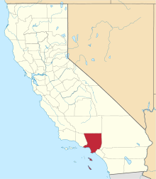
 Location of East Pasadena in Los Angeles County, California. | |
 East Pasadena Location in the United States | |
| Coordinates: 34°8′24″N 118°4′40″W / 34.14000°N 118.07778°WCoordinates: 34°8′24″N 118°4′40″W / 34.14000°N 118.07778°W | |
| Country |
|
| State |
|
| County | Los Angeles |
| Area[1] | |
| • Total | 1.323 sq mi (3.426 km2) |
| • Land | 1.318 sq mi (3.412 km2) |
| • Water | 0.005 sq mi (0.013 km2) 0.39% |
| Elevation | 725 ft (221 m) |
| Population (2010) | |
| • Total | 6,144 |
| • Density | 4,600/sq mi (1,800/km2) |
| Time zone | PST (UTC-8) |
| • Summer (DST) | PDT (UTC-7) |
| ZIP code | 91107 |
| Area code(s) | 626 |
| FIPS code | 06-20984 |
| GNIS feature ID | 1660585 |
East Pasadena is a census-designated place (CDP) in Los Angeles County, California, United States. The population was 6,144 at the 2010 census, up from 6,045 at the 2000 census.
Geography
East Pasadena is located at 34°8′24″N 118°4′40″W / 34.14000°N 118.07778°W (34.140057, -118.077650).[2]
According to the United States Census Bureau, the CDP has a total area of 1.3 square miles (3.4 km2), all land.
The land area of East Pasadena is separated into two non-contiguous segments:
- The main portion, bordered by Pasadena city limits on the North, California Boulevard on the south, Michillinda Avenue (Arcadia city limits) on the east, and San Gabriel Boulevard on the west.
- A smaller district to the west, bordered by Del Mar Boulevard to the north, San Marino city limits to the south, Berkeley Avenue to the west and San Gabriel Boulevard to the east.
The community has become considerably smaller as the city of Pasadena has expanded its boundaries to include more of the unincorporated area of East Pasadena.[3]
Demographics
| Historical population | |||
|---|---|---|---|
| Census | Pop. | %± | |
| 1990 | 5,910 | — | |
| 2000 | 6,045 | 2.3% | |
| 2010 | 6,144 | 1.6% | |
| source:[4] | |||
2010
The 2010 United States Census[5] reported that East Pasadena had a population of 6,144. The population density was 4,645.1 people per square mile (1,793.5/km²). The racial makeup of East Pasadena was 3,183 (51.8%) White (33.9% Non-Hispanic White),[6] 183 (3.0%) African American, 47 (0.8%) Native American, 1,589 (25.9%) Asian, 7 (0.1%) Pacific Islander, 857 (13.9%) from other races, and 278 (4.5%) from two or more races. Hispanic or Latino of any race were 2,139 persons (34.8%).
The Census reported that 6,119 people (99.6% of the population) lived in households, 7 (0.1%) lived in non-institutionalized group quarters, and 18 (0.3%) were institutionalized.
There were 2,096 households, out of which 704 (33.6%) had children under the age of 18 living in them, 1,158 (55.2%) were opposite-sex married couples living together, 241 (11.5%) had a female householder with no husband present, 115 (5.5%) had a male householder with no wife present. There were 98 (4.7%) unmarried opposite-sex partnerships, and 14 (0.7%) same-sex married couples or partnerships. 441 households (21.0%) were made up of individuals and 178 (8.5%) had someone living alone who was 65 years of age or older. The average household size was 2.92. There were 1,514 families (72.2% of all households); the average family size was 3.37.
The population was spread out with 1,303 people (21.2%) under the age of 18, 510 people (8.3%) aged 18 to 24, 1,645 people (26.8%) aged 25 to 44, 1,729 people (28.1%) aged 45 to 64, and 957 people (15.6%) who were 65 years of age or older. The median age was 40.5 years. For every 100 females there were 97.3 males. For every 100 females age 18 and over, there were 96.0 males.
There were 2,184 housing units at an average density of 1,651.2 per square mile (637.5/km²), of which 1,435 (68.5%) were owner-occupied, and 661 (31.5%) were occupied by renters. The homeowner vacancy rate was 1.3%; the rental vacancy rate was 2.4%. 4,286 people (69.8% of the population) lived in owner-occupied housing units and 1,833 people (29.8%) lived in rental housing units.
According to the 2010 United States Census, East Pasadena had a median household income of $71,151, with 16.0% of the population living below the federal poverty line.[6]
2000
As of the census[7] of 2000, there were 6,045 people, 2,038 households, and 1,502 families residing in the CDP. The population density was 4,586.6 inhabitants per square mile (1,768.2/km²). There were 2,124 housing units at an average density of 1,611.6 per square mile (621.3/km²). The racial makeup of the CDP was 55.70% White, 2.55% Black or African American, 0.79% Native American, 20.03% Asian, 0.05% Pacific Islander, 14.43% from other races, and 6.45% from two or more races. 35.24% of the population were Hispanic or Latino of any race.
There were 2,038 households out of which 34.6% had children under the age of 18 living with them, 58.0% were married couples living together, 10.7% had a female householder with no husband present, and 26.3% were non-families. 21.3% of all households were made up of individuals and 7.6% had someone living alone who was 65 years of age or older. The average household size was 2.95 and the average family size was 3.43.
In the CDP the population was spread out with 24.6% under the age of 18, 8.4% from 18 to 24, 29.6% from 25 to 44, 23.8% from 45 to 64, and 13.6% who were 65 years of age or older. The median age was 37 years. For every 100 females there were 94.6 males. For every 100 females age 18 and over, there were 91.2 males.
The median income for a household in the CDP was $53,378, and the median income for a family was $61,531. Males had a median income of $50,208 versus $35,104 for females. The per capita income for the CDP was $34,548. About 6.1% of families and 9.4% of the population were below the poverty line, including 12.6% of those under age 18 and 4.0% of those age 65 or over.
Politics
In the state legislature East Pasadena is located in the 25th Senate District, represented by Democrat Carol Liu and in the 41st Assembly District, represented by Democrat Chris Holden. Federally, East Pasadena is located in California's California's 27th congressional district and is represented by Democrat Judy Chu.
The Los Angeles County Sheriff's Department (LASD) operates the Temple Station in Temple City, serving East Pasadena.[8]
References
- ↑ U.S. Census
- ↑ "US Gazetteer files: 2010, 2000, and 1990". United States Census Bureau. 2011-02-12. Retrieved 2011-04-23.
- ↑ "City of Pasadena, California". cityofpasadena.net. 2014. Retrieved July 29, 2014.
- ↑ "CENSUS OF POPULATION AND HOUSING (1790-2000)". U.S. Census Bureau. Retrieved 2010-07-17.
- ↑ "2010 Census Interactive Population Search: CA - East Pasadena CDP". U.S. Census Bureau. Retrieved July 12, 2014.
- 1 2 "East Pasadena CDP QuickFacts". US Census Bureau. 2014. Retrieved July 29, 2014.
- ↑ "American FactFinder". United States Census Bureau. Retrieved 2008-01-31.
- ↑ "Temple Station." Los Angeles County Sheriff's Department. Retrieved on January 21, 2010.