Yankee Hill, Butte County, California
| Yankee Hill | |
|---|---|
| census-designated place | |
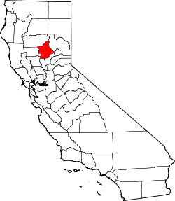
 Yankee Hill Location in California | |
| Coordinates: 39°42′13″N 121°31′20″W / 39.70361°N 121.52222°WCoordinates: 39°42′13″N 121°31′20″W / 39.70361°N 121.52222°W | |
| Country |
|
| State |
|
| County | Butte County |
| Area[1] | |
| • Total | 6.063 sq mi (15.703 km2) |
| • Land | 6.061 sq mi (15.698 km2) |
| • Water | 0.002 sq mi (0.005 km2) 0.03% |
| Elevation[2] | 1,982 ft (604 m) |
| Population (2010) | |
| • Total | 333 |
| • Density | 55/sq mi (21/km2) |
| Time zone | Pacific (PST) (UTC-8) |
| • Summer (DST) | PDT (UTC-7) |
| GNIS feature IDs | 1656414; 2612489 |
| U.S. Geological Survey Geographic Names Information System: Yankee Hill, Butte County, California; U.S. Geological Survey Geographic Names Information System: Yankee Hill, Butte County, California | |
Yankee Hill (formerly, Rich Gulch and Spanishtown)[3] is a census-designated place[4] in Butte County, California. It is located 6.5 miles (10.5 km) east-southeast of Paradise,[3] at an elevation of 1982 feet (604 m). The population was 333 at the 2010 census.
History
Rich Gulch was settled in 1850. When Chilean and Spanish miners arrived in the 1850s, the place was renamed to Spanishtown. New Englanders settled later, applying the current name. A post office operated at Yankee Hill from 1858 to 1951. A modern-day post office is still in operation at the Pines Hardware Store, 11300A Miller Flat Rd. in Yankee Hill.[3]
Demographics
The 2010 United States Census[5] reported that Yankee Hill had a population of 333. The population density was 54.9 people per square mile (21.2/km²). The racial makeup of Yankee Hill was 305 (91.6%) White, 2 (0.6%) African American, 7 (2.1%) Native American, 4 (1.2%) Asian, 0 (0.0%) Pacific Islander, 5 (1.5%) from other races, and 10 (3.0%) from two or more races. Hispanic or Latino of any race were 22 persons (6.6%).
The Census reported that 333 people (100% of the population) lived in households, 0 (0%) lived in non-institutionalized group quarters, and 0 (0%) were institutionalized.
There were 155 households, out of which 21 (13.5%) had children under the age of 18 living in them, 71 (45.8%) were opposite-sex married couples living together, 14 (9.0%) had a female householder with no husband present, 11 (7.1%) had a male householder with no wife present. There were 16 (10.3%) unmarried opposite-sex partnerships, and 1 (0.6%) same-sex married couples or partnerships. 45 households (29.0%) were made up of individuals and 20 (12.9%) had someone living alone who was 65 years of age or older. The average household size was 2.15. There were 96 families (61.9% of all households); the average family size was 2.53.
The population was spread out with 33 people (9.9%) under the age of 18, 18 people (5.4%) aged 18 to 24, 59 people (17.7%) aged 25 to 44, 140 people (42.0%) aged 45 to 64, and 83 people (24.9%) who were 65 years of age or older. The median age was 53.6 years. For every 100 females there were 99.4 males. For every 100 females age 18 and over, there were 96.1 males.
There were 182 housing units at an average density of 30.0 per square mile (11.6/km²), of which 125 (80.6%) were owner-occupied, and 30 (19.4%) were occupied by renters. The homeowner vacancy rate was 1.6%; the rental vacancy rate was 8.8%. 268 people (80.5% of the population) lived in owner-occupied housing units and 65 people (19.5%) lived in rental housing units.
References
- ↑ "2010 Census U.S. Gazetteer Files – Places – California". United States Census Bureau.
- ↑ U.S. Geological Survey Geographic Names Information System: Yankee Hill, Butte County, California
- 1 2 3 Durham, David L. (1998). California's Geographic Names: A Gazetteer of Historic and Modern Names of the State. Clovis, Calif.: Word Dancer Press. p. 338. ISBN 1-884995-14-4.
- ↑ U.S. Geological Survey Geographic Names Information System: Yankee Hill, Butte County, California
- ↑ "2010 Census Interactive Population Search: CA - Yankee Hill CDP". U.S. Census Bureau. Retrieved July 12, 2014.