Nord, California
| Nord | |
|---|---|
| census-designated place | |
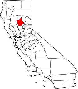
 Nord Location in California | |
| Coordinates: 39°46′47″N 121°57′26″W / 39.77972°N 121.95722°WCoordinates: 39°46′47″N 121°57′26″W / 39.77972°N 121.95722°W | |
| Country |
|
| State |
|
| County | Butte County |
| Area[1] | |
| • Total | 2.105 sq mi (5.453 km2) |
| • Land | 2.105 sq mi (5.453 km2) |
| • Water | 0 sq mi (0 km2) 0% |
| Elevation[2] | 151 ft (46 m) |
| Population (2010) | |
| • Total | 320 |
| • Density | 150/sq mi (59/km2) |
| Time zone | Pacific (PST) (UTC-8) |
| • Summer (DST) | PDT (UTC-7) |
| ZIP Code | 95973 |
| Area code(s) | 530 |
| GNIS feature ID | 1659766; 2612484 |
| U.S. Geological Survey Geographic Names Information System: Nord, California; U.S. Geological Survey Geographic Names Information System: Nord, California | |
Nord is a census-designated place[3] in Butte County, California. Its zip code is 95973 and its area code is 530. It lies at an elevation of 151 feet (46 m). Nord's population was 320 at the 2010 census.
History
A post office operated at Nord from 1871 to 1933, with an interruption from 1919 to 1920.[4]
Demographics
The 2010 United States Census[5] reported that Nord had a population of 320. The population density was 152.0 people per square mile (58.7/km²). The racial makeup of Nord was 233 (72.8%) White, 1 (0.3%) African American, 6 (1.9%) Native American, 16 (5.0%) Asian, 0 (0.0%) Pacific Islander, 48 (15.0%) from other races, and 16 (5.0%) from two or more races. Hispanic or Latino of any race were 122 persons (38.1%).
The Census reported that 320 people (100% of the population) lived in households, 0 (0%) lived in non-institutionalized group quarters, and 0 (0%) were institutionalized.
There were 104 households, out of which 42 (40.4%) had children under the age of 18 living in them, 65 (62.5%) were opposite-sex married couples living together, 5 (4.8%) had a female householder with no husband present, 6 (5.8%) had a male householder with no wife present. There were 7 (6.7%) unmarried opposite-sex partnerships, and 1 (1.0%) same-sex married couples or partnerships. 19 households (18.3%) were made up of individuals and 7 (6.7%) had someone living alone who was 65 years of age or older. The average household size was 3.08. There were 76 families (73.1% of all households); the average family size was 3.61.
The population was spread out with 83 people (25.9%) under the age of 18, 33 people (10.3%) aged 18 to 24, 79 people (24.7%) aged 25 to 44, 99 people (30.9%) aged 45 to 64, and 26 people (8.1%) who were 65 years of age or older. The median age was 36.5 years. For every 100 females there were 117.7 males. For every 100 females age 18 and over, there were 115.5 males.
There were 108 housing units at an average density of 51.3 per square mile (19.8/km²), of which 81 (77.9%) were owner-occupied, and 23 (22.1%) were occupied by renters. The homeowner vacancy rate was 0%; the rental vacancy rate was 4.2%. 247 people (77.2% of the population) lived in owner-occupied housing units and 73 people (22.8%) lived in rental housing units.
Government
State
The citizens of Nord, as constituents of California's 3rd Assembly District, are represented by Republican James Gallagher in the California State Assembly,[6] and as members of California's 4th Senate District, are represented by Republican Jim Nielsen in the California State Senate.[7]
Federal
Nord is in California's 1st congressional district, represented by Republican Doug LaMalfa.[8]
References
- ↑ "2010 Census U.S. Gazetteer Files – Places – California". United States Census Bureau.
- ↑ U.S. Geological Survey Geographic Names Information System: Nord, California
- ↑ U.S. Geological Survey Geographic Names Information System: Nord, California
- ↑ Durham, David L. (1998). California's Geographic Names: A Gazetteer of Historic and Modern Names of the State. Clovis, Calif.: Word Dancer Press. p. 285. ISBN 1-884995-14-4.
- ↑ "2010 Census Interactive Population Search: CA - Nord CDP". U.S. Census Bureau. Retrieved July 12, 2014.
- ↑ "Members Assembly". State of California. Retrieved March 20, 2013.
- ↑ "Senators". State of California. Retrieved March 20, 2013.
- ↑ "California's 1st Congressional District - Representatives & District Map". Civic Impulse, LLC. Retrieved March 1, 2013.