Lava Beds, California
Coordinates: 39°28′27″N 121°34′13″W / 39.47417°N 121.57028°W
| Lava Beds | |
|---|---|
| Former settlement | |
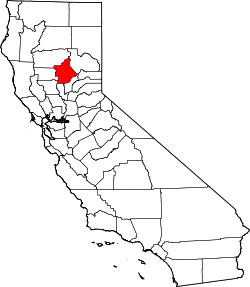
 Lava Beds Location in California | |
| Coordinates: 39°28′27″N 121°34′13″W / 39.47417°N 121.57028°W | |
| Country | United States |
| State | California |
| County | Butte County |
| Elevation[1] | 151 ft (46 m) |
Lava Beds is a former settlement in Butte County, California. It lay at an elevation of 151 feet (46 m). It remained on maps as late as 1895. It was a community of Chinese miners, located near Pacific Heights, 2.5 miles (4.0 km) north-northwest of Palermo.[2]
References
- ↑ U.S. Geological Survey Geographic Names Information System: Lava Beds, California
- ↑ Durham, David L. (1998). California's Geographic Names: A Gazetteer of Historic and Modern Names of the State. Clovis, Calif.: Word Dancer Press. p. 289. ISBN 1-884995-14-4.
External links
This article is issued from Wikipedia - version of the 7/14/2016. The text is available under the Creative Commons Attribution/Share Alike but additional terms may apply for the media files.
