Stirling City, California
| Stirling City | |
|---|---|
| census-designated place | |
|
USGS satellite photo of Stirling City | |
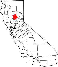
 Stirling City Location in California | |
| Coordinates: 39°54′28″N 121°31′41″W / 39.90778°N 121.52806°WCoordinates: 39°54′28″N 121°31′41″W / 39.90778°N 121.52806°W | |
| Country |
|
| State |
|
| County | Butte County |
| Area[1] | |
| • Total | 1.178 sq mi (3.051 km2) |
| • Land | 1.177 sq mi (3.049 km2) |
| • Water | 0.001 sq mi (0.002 km2) 0.07% |
| Elevation[2] | 3,570 ft (1,088 m) |
| Population (2010) | |
| • Total | 295 |
| • Density | 250/sq mi (97/km2) |
| Time zone | Pacific (PST) (UTC-8) |
| • Summer (DST) | PDT (UTC-7) |
| ZIP Code | 95978 |
| Area code(s) | 530 |
| GNIS feature ID | 235493; 2612488 |
| U.S. Geological Survey Geographic Names Information System: Stirling City, California; U.S. Geological Survey Geographic Names Information System: Stirling City, California | |

Stirling City is a census-designated place[3] in Butte County, California, located on Paradise Ridge in the western foothills of the Sierra Nevada. Contrary to its name, Stirling City is not a city. Its ZIP Code is 95978 and area code 530. It lies at an elevation of 3570 feet (1088 m). Stirling City had a population of 295 at the 2010 census.
Stirling City is located at 39°54′28″N 121°31′41″W / 39.90778°N 121.52806°W, around 45 miles (32 km) northeast of Chico, California. It is built around a loop (which terminates a winding spur line) of the Southern Pacific Railroad, built to collect lumber from the Lassen National Forest.
It was founded in 1903 by the Diamond Match Company[4] of Barberton, Ohio, as a center for processing cut lumber from the surrounding forests. Diamond Match official Fred Clough named the city, taking the name from the boiler used at Diamond's Baberton plant, made by the Stirling Boiler Company.
The sawmill closed in the early 1970s. The land surrounding Stirling City is still harvested for timber, and the cleared area is farmed for cattle, fruit, and nuts.
A post office opened in 1903.[4]
Demographics
The 2010 United States Census[5] reported that Stirling City had a population of 295. The population density was 250.4 people per square mile (96.7/km²). The racial makeup of Stirling City was 264 (89.5%) White, 1 (0.3%) African American, 11 (3.7%) Native American, 0 (0.0%) Asian, 0 (0.0%) Pacific Islander, 1 (0.3%) from other races, and 18 (6.1%) from two or more races. Hispanic or Latino of any race were 17 persons (5.8%).
The Census reported that 295 people (100% of the population) lived in households, 0 (0%) lived in non-institutionalized group quarters, and 0 (0%) were institutionalized.
There were 117 households, out of which 34 (29.1%) had children under the age of 18 living in them, 49 (41.9%) were opposite-sex married couples living together, 14 (12.0%) had a female householder with no husband present, 12 (10.3%) had a male householder with no wife present. There were 11 (9.4%) unmarried opposite-sex partnerships, and 0 (0%) same-sex married couples or partnerships. 34 households (29.1%) were made up of individuals and 8 (6.8%) had someone living alone who was 65 years of age or older. The average household size was 2.52. There were 75 families (64.1% of all households); the average family size was 3.07.
The population was spread out with 76 people (25.8%) under the age of 18, 19 people (6.4%) aged 18 to 24, 62 people (21.0%) aged 25 to 44, 94 people (31.9%) aged 45 to 64, and 44 people (14.9%) who were 65 years of age or older. The median age was 41.1 years. For every 100 females there were 107.7 males. For every 100 females age 18 and over, there were 104.7 males.
There were 151 housing units at an average density of 128.2 per square mile (49.5/km²), of which 71 (60.7%) were owner-occupied, and 46 (39.3%) were occupied by renters. The homeowner vacancy rate was 2.7%; the rental vacancy rate was 6.1%. 164 people (55.6% of the population) lived in owner-occupied housing units and 131 people (44.4%) lived in rental housing units.
Climate
| Climate data for Stirling City | |||||||||||||
|---|---|---|---|---|---|---|---|---|---|---|---|---|---|
| Month | Jan | Feb | Mar | Apr | May | Jun | Jul | Aug | Sep | Oct | Nov | Dec | Year |
| Average high °C (°F) | 11 (51) |
12 (54) |
15 (59) |
18 (65) |
23 (73) |
28 (82) |
32 (90) |
32 (89) |
28 (83) |
22 (72) |
15 (59) |
11 (52) |
21 (69) |
| Average low °C (°F) | 0 (32) |
1 (33) |
2 (35) |
3 (38) |
7 (44) |
10 (50) |
13 (55) |
12 (54) |
10 (50) |
7 (44) |
2 (36) |
0 (32) |
6 (42) |
| Average precipitation mm (inches) | 56 (2.2) |
284 (11.2) |
218 (8.6) |
122 (4.8) |
64 (2.5) |
30 (1) |
3 (0.1) |
5 (0.2) |
23 (0.9) |
89 (3.5) |
193 (7.6) |
297 (11.7) |
1,628 (64.1) |
| Source: Weatherbase [6] | |||||||||||||
References
- ↑ "2010 Census U.S. Gazetteer Files – Places – California". United States Census Bureau.
- ↑ U.S. Geological Survey Geographic Names Information System: Stirling City, California
- ↑ U.S. Geological Survey Geographic Names Information System: Stirling City, California
- 1 2 Durham, David L. (1998). California's Geographic Names: A Gazetteer of Historic and Modern Names of the State. Clovis, Calif.: Word Dancer Press. p. 319. ISBN 1-884995-14-4.
- ↑ "2010 Census Interactive Population Search: CA - Stirling City CDP". U.S. Census Bureau. Retrieved July 12, 2014.
- ↑ "Weatherbase.com". Weatherbase. 2013. Retrieved on June 30, 2013.