Berry Creek, California
- For the place formerly called Berry Creek, see Virginia Mills, California.
| Berry Creek | |
|---|---|
| Census-designated place | |
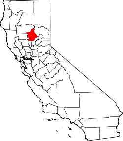
 Berry Creek Location in California | |
| Coordinates: 39°38′43″N 121°24′12″W / 39.64528°N 121.40333°WCoordinates: 39°38′43″N 121°24′12″W / 39.64528°N 121.40333°W | |
| Country |
|
| State |
|
| County | Butte County |
| Area[1] | |
| • Total | 57.180 sq mi (148.094 km2) |
| • Land | 57.120 sq mi (147.940 km2) |
| • Water | 0.060 sq mi (0.154 km2) 0.10% |
| Elevation[2] | 1,995 ft (608 m) |
| Population (2010) | |
| • Total | 1,424 |
| • Density | 25/sq mi (9.6/km2) |
| Time zone | Pacific (UTC-8) |
| • Summer (DST) | PDT (UTC-7) |
| ZIP code | 95916 |
| Area code | 530 |
| GNIS feature IDs | 1658040, 2612472 |
| [2] | |
Berry Creek (formerly, Berry Valley)[3] is a census-designated place[4] about 12 miles (19 km) northeast of Oroville, California in hilly terrain at 1,995 feet (608 m) above mean sea level. The community is located along Oroville-Quincy Highway on the shore of Madrone Lake. The US Geological Survey shows coordinates of 39°38′43″N 121°24′12″W / 39.64528°N 121.40333°W for the town. The community is home to Berry Creek Elementary School (K-8). Berry Creek is inside Area code 530 and wired phone numbers follow the format (530) 589-xxxx. The community's ZIP code is 95916, and is shared with the community of Brush Creek (which is about four miles or six kilometers east on Oroville-Quincy Highway). The population was 1,424 at the 2010 census.
There is a California Department of Forestry and Fire Protection fire station at an area called Harts Mill just south of the community. This is a historic name for a community once located at 39°37′25″N 121°26′08″W / 39.62361°N 121.43556°W. Harts Mill was probably a mining community named for a stamp mill. The USGS lists a variant name of Virginia Mill for the area.
History
Berry Creek's first post office was established in 1875 being transferred from Oak Arbor; it changed locations several times before being closed in 1912. It was re-established in 1913, closed again in 1926, and re-opened in 1927.[3]
Demographics
The 2010 United States Census[5] reported that Berry Creek had a population of 1,424. The population density was 24.9 people per square mile (9.6/km²). The racial makeup of Berry Creek was 1,249 (87.7%) White, 8 (0.6%) African American, 48 (3.4%) Native American, 13 (0.9%) Asian, 3 (0.2%) Pacific Islander, 13 (0.9%) from other races, and 90 (6.3%) from two or more races. Hispanic or Latino of any race were 98 persons (6.9%).
The Census reported that 1,424 people (100% of the population) lived in households, 0 (0%) lived in non-institutionalized group quarters, and 0 (0%) were institutionalized.
There were 652 households, out of which 99 (15.2%) had children under the age of 18 living in them, 313 (48.0%) were opposite-sex married couples living together, 54 (8.3%) had a female householder with no husband present, 32 (4.9%) had a male householder with no wife present. There were 53 (8.1%) unmarried opposite-sex partnerships, and 5 (0.8%) same-sex married couples or partnerships. 207 households (31.7%) were made up of individuals and 81 (12.4%) had someone living alone who was 65 years of age or older. The average household size was 2.18. There were 399 families (61.2% of all households); the average family size was 2.65.
The population was spread out with 183 people (12.9%) under the age of 18, 92 people (6.5%) aged 18 to 24, 203 people (14.3%) aged 25 to 44, 601 people (42.2%) aged 45 to 64, and 345 people (24.2%) who were 65 years of age or older. The median age was 54.3 years. For every 100 females there were 111.6 males. For every 100 females age 18 and over, there were 110.0 males.
There were 983 housing units at an average density of 17.2 per square mile (6.6/km²), of which 525 (80.5%) were owner-occupied, and 127 (19.5%) were occupied by renters. The homeowner vacancy rate was 4.5%; the rental vacancy rate was 7.1%. 1,080 people (75.8% of the population) lived in owner-occupied housing units and 344 people (24.2%) lived in rental housing units.
Berry Creek Rancheria
The Tyme Maidu community of the Maidu nation has a similar-sounding community called Berry Creek Rancheria of Maidu Indians of California about 4.25 straight-line miles southeast on a bearing of 109 degrees off true North. The community is located along Bean Creek Road. The latitude and longitude for the Rancheria are 39°37′33″N 121°19′37″W / 39.62583°N 121.32694°W on the Forbestown, California, 1994, 7.5-minute quadrangle. The tribal government gets mail at an Oroville location.
References
- ↑ "2010 Census U.S. Gazetteer Files – Places – California". United States Census Bureau.
- 1 2 "Berry Creek". Geographic Names Information System. United States Geological Survey.
- 1 2 Durham, David L. (1998). California's Geographic Names: A Gazetteer of Historic and Modern Names of the State. Clovis, Calif.: Word Dancer Press. p. 193. ISBN 1-884995-14-4.
- ↑ U.S. Geological Survey Geographic Names Information System: Berry Creek, California
- ↑ "2010 Census Interactive Population Search: CA - Berry Creek CDP". U.S. Census Bureau. Retrieved July 12, 2014.
- US Department of Education, National Center for Educational Statistics.
- US Geological Survey, National Geographic Names Database.
- US Department of Commerce, miscellaneous records derived from public data sets used to determine geographic attributes like area code and ZIP code.
- Map: Berry Creek, California, 7.5 minute quadrangle, 1994, US Geological Survey.
- US Census Bureau, 2000 census statistical area records, (mostly used for data matching against other sources).
- web site of US Senator Barbara Boxer