Chapmantown, California
Coordinates: 39°43′14″N 121°49′00″W / 39.72056°N 121.81667°W
| Chapmantown | |
|---|---|
| incorporated community | |
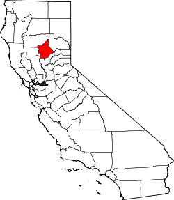
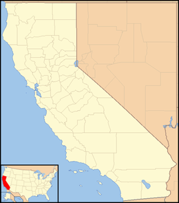 Chapmantown  Chapmantown Location in California | |
| Coordinates: 39°43′14″N 121°49′00″W / 39.72056°N 121.81667°W | |
| Country | United States |
| State | California |
| County | Butte County |
| Elevation[1] | 207 ft (63 m) |
Chapmantown (originally called Chapman's Addition, Kenyan Oaks, and also Chapmanville) is an unincorporated community in Butte County, California. It lies at an elevation of 207 feet (63 m). It is a working class residential neighborhood. The neighborhood is named after Augustus Chapman[2] an 1860 emigrant from Michigan to Chico. Mr. Chapman was owner of a hotel, general store and a large lumber mill with a retail store in Chico. Chapman designed a subdivision which developed rapidly and which is known to this day as Chapmantown (NPS 1982).
Chapmantown is entirely surrounded by the city of Chico but is not part of the city. Chapmantown has no representation on the Chico City Council. Rather, it is under the jurisdiction of the County of Butte. All government representation for residents is through the Butte County Board of Supervisors.
Chapmantown is currently known as the area bounded by Humboldt Avenue, Boucher Street, Guill Street and East Sixteenth Street. The neighborhood south of East Twentieth Street to the east of Fair Street is also referred to as Chapmantown. Historically, Chapmantown referred to everything east of Mulberry Street, but that is no longer the case.
Although it is true at one time that Chapman residents had no access to city services due being outside the city limits, that has slowly been changing over the last twenty years. Most residents are now on city water, and though many older homes still use septic systems, all newer homes are on the city sewer. Although there are no sidewalks, there are also none of the regulations associated with the municipality either (prohibition on chicken coops, burn permits, etc.)
The neighborhood is home to the A.H. Chapman House, the Dorothy F. Johnson Neighborhood Center, a facility of the Chico Area Recreation District; Chapman Elementary School; and several churches. The neighborhood is also just a few blocks from Chico's major shopping area.
References
- ↑ U.S. Geological Survey Geographic Names Information System: Chapmantown, California
- ↑ "A.H. Chapman House". National Park Service. Retrieved September 22, 2015.