Bougoula, Koulikoro
| Bougoula | |
|---|---|
| Commune and village | |
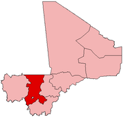
 Bougoula Location in Mali | |
| Coordinates: 12°18′29″N 7°47′32″W / 12.30806°N 7.79222°WCoordinates: 12°18′29″N 7°47′32″W / 12.30806°N 7.79222°W | |
| Country |
|
| Region | Koulikoro Region |
| Cercle | Kati Cercle |
| Elevation | 348 m (1,142 ft) |
| Population (2009)[1] | |
| • Total | 10,780 |
| Time zone | GMT (UTC+0) |
Bougoula is a village and rural commune in the Cercle of Kati in the Koulikoro Region of south-western Mali. The commune contains 11 villages[2] and at the time of the 2009 census had a population of 10,780.[1] The village of Bougoula is 50 km south of the Malian capital, Bamako.
References
- 1 2 Resultats Provisoires RGPH 2009 (Région de Koulikoro) (PDF) (in French), République de Mali: Institut National de la Statistique.
- ↑ Communes de la Région de Koulikoro (PDF) (in French), Ministère de l’administration territoriale et des collectivités locales, République du Mali, archived from the original (PDF) on 2012-03-09.
External links
- Plan de Sécurité Alimentaire Commune Rurale de Bougoula 2008-2012 (PDF) (in French), Commissariat à la Sécurité Alimentaire, République du Mali, USAID-Mali, 2008.
This article is issued from Wikipedia - version of the 11/6/2016. The text is available under the Creative Commons Attribution/Share Alike but additional terms may apply for the media files.