Ouélessébougou
| Ouélessébougou | |
|---|---|
| Commune and town | |
|
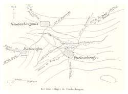
The three villages of Ouélessébougou, 1892 | |
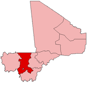
 Ouélessébougou Location in Mali | |
| Coordinates: 12°0′0″N 7°54′40″W / 12.00000°N 7.91111°WCoordinates: 12°0′0″N 7°54′40″W / 12.00000°N 7.91111°W | |
| Country |
|
| Region | Koulikoro Region |
| Cercle | Kati Cercle |
| Government | |
| • Mayor | Niankoro Yeah Samake |
| Area[1] | |
| • Total | 1,118 km2 (432 sq mi) |
| Population (2009 census)[2] | |
| • Total | 50,056 |
| • Density | 45/km2 (120/sq mi) |
| Time zone | GMT (UTC+0) |
Ouélessébougou is a town and rural commune in the Cercle of Kati in the Koulikoro Region of south-western Mali. The commune covers an area of approximately 1,118 square kilometers and includes the town of Ouélessébougou and 44 villages.[3] In the 2009 census the commune had a population of 50,056.[2] The town lies 80 km south of Bamako on the Route Nationale 7.
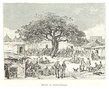
Ouélessébougou market in 1892
See also
References
| Wikimedia Commons has media related to Ouélessébougou. |
- ↑ "Common and Fundamental Operational Datasets Registry: Mali", United Nations Office for the Coordination of Humanitarian Affairs http://cod.humanitarianresponse.info/country-region/mali Missing or empty
|title=(help). commune_mali.zip (Originally from the Direction Nationale des Collectivités Territoriales, République du Mali) - 1 2 Resultats Recensement Général de la Population et de l’Habitat 2009 (Région de Koulikoro) (PDF) (in French), République de Mali: Institut National de la Statistique.
- ↑ Communes de la Région de Koulikoro (PDF) (in French), Ministère de l’administration territoriale et des collectivités locales, République du Mali.
External links
- Official website of Ouélessébougou
- Plan de Sécurité Alimentaire Commune Rurale de Ouélessébougou 2008-2012 (PDF) (in French), Commissariat à la Sécurité Alimentaire, République du Mali, USAID-Mali, 2008.
This article is issued from Wikipedia - version of the 3/31/2016. The text is available under the Creative Commons Attribution/Share Alike but additional terms may apply for the media files.