Doumba
| Doumba | |
|---|---|
| Commune and town | |
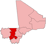
 Doumba Location in Mali | |
| Coordinates: 12°1′34″N 8°7′12″W / 12.02611°N 8.12000°WCoordinates: 12°1′34″N 8°7′12″W / 12.02611°N 8.12000°W | |
| Country |
|
| Region | Koulikoro Region |
| Cercle | Koulikoro Cercle |
| Population (1998) | |
| • Total | 2,647 |
| Time zone | GMT (UTC+0) |
Doumba is a small town and commune in the Cercle of Koulikoro in the Koulikoro Region of south-western Mali. It covers a surface of 250 km2 and comprises 7 villages: Doumba, Fani, Babougou, Dombana, Kossaba, Dibaro, and Sinzani. As of 2008 the commune had a population of 7557 inhabitants [1]
References
- ↑ "Plan de securite alimentaire commune rurale de Doumba 2008-2012" (PDF). Commissariat a la Sécurité Alimentaire. Retrieved August 10, 2011.
This article is issued from Wikipedia - version of the 2/7/2016. The text is available under the Creative Commons Attribution/Share Alike but additional terms may apply for the media files.