Diago
| Diago | |
|---|---|
| Commune and village | |
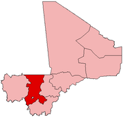
 Diago Location in Mali | |
| Coordinates: 12°46′39″N 8°9′23″W / 12.77750°N 8.15639°WCoordinates: 12°46′39″N 8°9′23″W / 12.77750°N 8.15639°W | |
| Country |
|
| Region | Koulikoro Region |
| Cercle | Kati Cercle |
| Population (2009 census)[1] | |
| • Total | 3,269 |
| Time zone | GMT (UTC+0) |
Diago is a village and rural commune in the Cercle of Kati in the Koulikoro Region of south-western Mali. The commune contains 7 villages[2] and in the 2009 census had a population of 3,269.[1] The village of Diago is 10 km northwest the town of Kati, the chef-lieu of the cercle.
References
- 1 2 Resultats Provisoires RGPH 2009 (Région de Koulikoro) (PDF) (in French), République de Mali: Institut National de la Statistique.
- ↑ Communes de la Région de Koulikoro (PDF) (in French), Ministère de l’administration territoriale et des collectivités locales, République du Mali.
External links
Plan de Sécurite Alimentaire Commune Rurale de Diago 2008-2012 (PDF) (in French), Commissariat à la Sécurité Alimentaire, République du Mali, USAID-Mali, 2008.
This article is issued from Wikipedia - version of the 3/1/2013. The text is available under the Creative Commons Attribution/Share Alike but additional terms may apply for the media files.