Sobra, Mali
For the place in Croatia, see Sobra.
| Sobra | |
|---|---|
| Commune | |
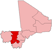
 Sobra Location within Mali | |
| Coordinates: 12°26′7″N 8°44′25″W / 12.43528°N 8.74028°WCoordinates: 12°26′7″N 8°44′25″W / 12.43528°N 8.74028°W[1] | |
| Country |
|
| Region | Koulikoro |
| Cercle | Kati Cercle |
| Area[2] | |
| • Total | 938 km2 (362 sq mi) |
| Population (2009 census)[3] | |
| • Total | 9,900 |
| • Density | 11/km2 (27/sq mi) |
| Time zone | GMT (UTC+0) |
Sobra is a rural commune in the Kati Cercle of the Koulikoro Region of Mali. The commune covers an area of approximately 938 square kilometers and contains 10 villages. In the 2009 census it had a population of 9,900. The administrative centre (chef-lieu) is the village of Sandama.
References
- ↑ "Common and Fundamental Operational Datasets Registry: Mali", United Nations Office for the Coordination of Humanitarian Affairs http://cod.humanitarianresponse.info/country-region/mali Missing or empty
|title=(help). cheflieu_mali.zip - ↑ "Common and Fundamental Operational Datasets Registry: Mali", United Nations Office for the Coordination of Humanitarian Affairs http://cod.humanitarianresponse.info/country-region/mali Missing or empty
|title=(help). commune_mali.zip (Originally from the Direction Nationale des Collectivités Territoriales, République du Mali) - ↑ Resultats Provisoires RGPH 2009 (Région de Koulikoro) (PDF) (in French), République de Mali: Institut National de la Statistique.
External links
- Plan de Sécurité Alimentaire Commune Rurale de Sobra 2008-2012 (PDF) (in French), Commissariat à la Sécurité Alimentaire, République du Mali, USAID-Mali, 2008.
This article is issued from Wikipedia - version of the 11/30/2015. The text is available under the Creative Commons Attribution/Share Alike but additional terms may apply for the media files.