Koronga
| Koronga | |
|---|---|
| Commune and village | |
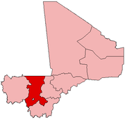
 Koronga Location in Mali | |
| Coordinates: 15°20′0″N 7°36′30″W / 15.33333°N 7.60833°WCoordinates: 15°20′0″N 7°36′30″W / 15.33333°N 7.60833°W | |
| Country |
|
| Region | Koulikoro Region |
| Cercle | Nara Cercle |
| Population (2009 census)[1] | |
| • Total | 7,931 |
| Time zone | GMT (UTC+0) |
Koronga is a village and commune in the Cercle of Nara in the Koulikoro Region of south-western Mali. The village is 40 km northwest of Nara, the administrative centre of the cercle, and 20 km south of the Mauritanian border. The commune contains 17 villages[2] and in the 2009 census had a population of 7,931.[1]
The commune has a Sahelian climate with an annual rainfall of around 400 mm.[3]
References
- 1 2 Resultats Provisoires RGPH 2009 (Région de Koulikoro) (PDF) (in French), République de Mali: Institut National de la Statistique.
- ↑ Communes de la Région de Koulikoro (PDF) (in French), Ministère de l’administration territoriale et des collectivités locales, République du Mali.
- ↑ L'Hôte, Yann; Mahé, Gil (1995), West and Central Africa Mean Annual Rainfall (1951-1989), ORSTOM, Département Continentales.
External links
- Plan de Sécurité Alimentaire Commune Rurale de Koronga 2007-2011 (PDF) (in French), Commissariat à la Sécurité Alimentaire, République du Mali, USAID-Mali, 2007.
This article is issued from Wikipedia - version of the 10/8/2013. The text is available under the Creative Commons Attribution/Share Alike but additional terms may apply for the media files.