Woodland Township, New Jersey
| Woodland Township, New Jersey | |
|---|---|
| Township | |
| Township of Woodland | |
|
Savoy Boulevard through the Pine Barrens in Woodland Township | |
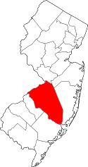
 Woodland Township highlighted in Burlington County. Inset map: Burlington County highlighted in the State of New Jersey. | |
 Census Bureau map of Woodland Township, New Jersey | |
| Coordinates: 39°50′29″N 74°31′04″W / 39.841289°N 74.51774°WCoordinates: 39°50′29″N 74°31′04″W / 39.841289°N 74.51774°W[1][2] | |
| Country |
|
| State |
|
| County | Burlington |
| Incorporated | March 7, 1866 |
| Government[3] | |
| • Type | Township |
| • Body | Township Committee |
| • Mayor | Matthew A. Henrich (R, term ends December 31, 2016)[4][5] |
| • Administrator / Clerk | Maryalice Brown[6] |
| Area[1] | |
| • Total | 96.385 sq mi (249.638 km2) |
| • Land | 94.558 sq mi (244.905 km2) |
| • Water | 1.827 sq mi (4.733 km2) 1.90% |
| Area rank |
6th of 566 in state 2nd of 40 in county[1] |
| Elevation[7] | 118 ft (36 m) |
| Population (2010 Census)[8][9][10] | |
| • Total | 1,788 |
| • Estimate (2015)[11] | 1,793 |
| • Rank |
499th of 566 in state 35th of 40 in county[12] |
| • Density | 18.9/sq mi (7.3/km2) |
| • Density rank |
563rd of 566 in state 39th of 40 in county[12] |
| Time zone | Eastern (EST) (UTC-5) |
| • Summer (DST) | Eastern (EDT) (UTC-4) |
| ZIP code | 08019 - Chatsworth[13] |
| Area code(s) | 609[14] |
| FIPS code | 3400582420[1][15][16] |
| GNIS feature ID | 0882080[1][17] |
| Website |
www |

Woodland Township is a township in Burlington County, New Jersey, United States. As of the 2010 United States Census, the township's population was 1,788[8][9][10] reflecting an increase of 618 (+52.8%) from the 1,170 counted in the 2000 Census, which had in turn declined by 893 (-43.3%) from the 2,063 counted in the 1990 Census.[18]
Woodland was incorporated as a township by an act of the New Jersey Legislature on March 7, 1866, from portions of Pemberton Township, Shamong Township, Southampton Township and Washington Township. Portions of the township were taken to form Tabernacle Township on March 22, 1901.[19]
Geography
According to the United States Census Bureau, the township had a total area of 96.385 square miles (249.638 km2), including 94.558 square miles (244.905 km2) of land and 1.827 square miles (4.733 km2) of water (1.90%).[1][2]
The township borders Bass River Township, Pemberton Township, Southampton Township, Tabernacle Township, Washington Township in Burlington County; and Barnegat Township, Lacey Township, Little Egg Harbor Township and Manchester Township in Ocean County.[20]
Unincorporated communities, localities and place names located partially or completely within the township include Bullock, Butlers Place, Chatsworth (the postal address for most of the residents of the township), DeCou Pond, Dukes Bridge, Four Mile Goose Pond, Hedger House, Johnson Place, Jones Mill, Lebanon, Long Causeway, Old Halfway, South Park and Woodmansie.[21]
The township is one of 56 South Jersey municipalities that are included within the New Jersey Pinelands National Reserve, a protected natural area of unique ecology covering 1,100,000 acres (450,000 ha), that has been classified as a United States Biosphere Reserve and established by Congress in 1978 as the nation's first National Reserve.[22] All of the township is included in the state-designated Pinelands Area, which includes portions of Burlington County, along with areas in Atlantic, Camden, Cape May, Cumberland, Gloucester and Ocean counties.[23]
Demographics
| Historical population | |||
|---|---|---|---|
| Census | Pop. | %± | |
| 1870 | 389 | — | |
| 1880 | 325 | −16.5% | |
| 1890 | 327 | 0.6% | |
| 1900 | 475 | 45.3% | |
| 1910 | 548 | * | 15.4% |
| 1920 | 970 | 77.0% | |
| 1930 | 970 | 0.0% | |
| 1940 | 1,374 | 41.6% | |
| 1950 | 1,524 | 10.9% | |
| 1960 | 1,904 | 24.9% | |
| 1970 | 2,032 | 6.7% | |
| 1980 | 2,285 | 12.5% | |
| 1990 | 2,063 | −9.7% | |
| 2000 | 1,170 | −43.3% | |
| 2010 | 1,788 | 52.8% | |
| Est. 2015 | 1,793 | [11][24] | 0.3% |
| Population sources:1870-2000[25] 1870-1920[26] 1870[27][28] 1880-1890[29] 1890-1910[30] 1910-1930[31] 1930-1990[32] 2000[33][34] 2010[8][9][10] * = Lost territory in previous decade.[19] | |||
Census 2010
The 2010 United States Census counted 1,788 people, 476 households, and 358.9 families residing in the township. The population density was 18.9 per square mile (7.3/km2). The township contained 494 housing units at an average density of 5.2 per square mile (2.0/km2). The racial makeup of the township was 89.60% (1,602) White, 8.11% (145) Black or African American, 0.06% (1) Native American, 0.84% (15) Asian, 0.00% (0) Pacific Islander, 0.45% (8) from other races, and 0.95% (17) from two or more races. Hispanics or Latinos of any race were 4.81% (86) of the population.[8]
Out of a total of 476 households, 30.5% had children under the age of 18 living with them, 60.7% were married couples living together, 8.2% had a female householder with no husband present, and 24.6% were non-families. 17.9% of all households were made up of individuals, and 5.5% had someone living alone who was 65 years of age or older. The average household size was 2.76 and the average family size was 3.14.[8]
In the township, 20.2% of the population were under the age of 18, 6.3% from 18 to 24, 25.6% from 25 to 44, 37.4% from 45 to 64, and 10.5% who were 65 years of age or older. The median age was 43.3 years. For every 100 females the census counted 152.9 males, but for 100 females at least 18 years old, it was 166.0 males.[8]
The Census Bureau's 2006-2010 American Community Survey showed that (in 2010 inflation-adjusted dollars) median household income was $65,568 (with a margin of error of +/- $16,290) and the median family income was $96,875 (+/- $31,126). Males had a median income of $61,250 (+/- $11,359) versus $33,393 (+/- $4,757) for females. The per capita income for the borough was $33,552 (+/- $5,866). About 4.9% of families and 4.6% of the population were below the poverty line, including 8.6% of those under age 18 and 9.7% of those age 65 or over.[35]
Census 2000
As of the 2000 United States Census[15] there were 1,170 people, 425 households, and 323 families residing in the township. The population density was 12.2 people per square mile (4.7/km²). There were 448 housing units at an average density of 4.7 per square mile (1.8/km²). The racial makeup of the township was 98.03% White, 0.60% African American, 0.09% Native American, 0.34% Asian, 0.17% from other races, and 0.77% from two or more races. Hispanic or Latino of any race were 1.20% of the population.[33][34]
There were 425 households out of which 35.1% had children under the age of 18 living with them, 60.5% were married couples living together, 8.9% had a female householder with no husband present, and 24.0% were non-families. 19.1% of all households were made up of individuals and 5.2% had someone living alone who was 65 years of age or older. The average household size was 2.75 and the average family size was 3.15.[33][34]
In the township the population was spread out with 25.8% under the age of 18, 7.3% from 18 to 24, 31.3% from 25 to 44, 27.9% from 45 to 64, and 7.7% who were 65 years of age or older. The median age was 38 years. For every 100 females there were 99.0 males. For every 100 females age 18 and over, there were 101.9 males.[33][34]
The median income for a household in the township was $59,271, and the median income for a family was $65,972. Males had a median income of $43,654 versus $31,765 for females. The per capita income for the township was $26,126. About 2.0% of families and 2.9% of the population were below the poverty line, including 2.9% of those under age 18 and 4.0% of those age 65 or over.[33][34]
Government
Local government
Woodland Township is governed under the Township form of government. The governing body is a three-member Township Committee, whose members are elected directly by the voters at-large in partisan elections to serve three-year terms of office on a staggered basis, with one seat coming up for election each year as part of the November general election in a three-year cycle.[3][36] At an annual reorganization meeting, the Township Committee selects one of its members to serve as Mayor.
As of 2016, the members of the Woodland Township Committee are Mayor Matthew Henrich (R, term on committee and as mayor ends December 31, 2016), Mark J. Herndon (R, term on committee ends 2018; term as deputy mayor ends 2016) and William DeGroff (R, 2017).[4][37][38][39][40][41]
Federal, state and county representation
Woodland Township is located in the 3rd Congressional District[42] and is part of New Jersey's 8th state legislative district.[9][43][44]
New Jersey's 3rd Congressional District is represented by Tom MacArthur (R, Toms River).[45] New Jersey is represented in the United States Senate by Cory Booker (D, Newark, term ends 2021)[46] and Bob Menendez (D, Paramus, 2019).[47][48]
For the 2016–2017 session (Senate, General Assembly), the 8th Legislative District of the New Jersey Legislature is represented in the State Senate by Dawn Marie Addiego (R, Evesham Township) and in the General Assembly by Maria Rodriguez-Gregg (R, Evesham Township) and Joe Howarth (R, Evesham Township).[49] The Governor of New Jersey is Chris Christie (R, Mendham Township).[50] The Lieutenant Governor of New Jersey is Kim Guadagno (R, Monmouth Beach).[51]
Burlington County is governed by a Board of chosen freeholders, whose five members are elected at-large in partisan elections to three-year terms of office on a staggered basis, with either one or two seats coming up for election each year.[52] The board chooses a director and deputy director from among its members at an annual reorganization meeting held in January.[52] As of 2015, Burlington County's Freeholders are Director Mary Ann O'Brien (R, Medford Township, 2017; Director of Administration and Human Services),[53] Deputy Director Bruce Garganio (R, Florence Township, 2017; Director of Public Works and Health),[54] Aimee Belgard (D, Edgewater Park Township, 2015; Director of Hospital, Medical Services and Education)[55] Joseph Donnelly (R, Cinnaminson Township, 2016; Director of Public Safety, Natural Resources, and Education)[56] and Joanne Schwartz (D, Southampton Township, 2015; Director of Health and Corrections).[57][52] Constitutional officers are County Clerk Tim Tyler,[58] Sheriff Jean E. Stanfield[59] and Surrogate George T. Kotch.[60]
Politics
As of March 23, 2011, there were a total of 947 registered voters in Woodland Township, of which 153 (16.2% vs. 33.3% countywide) were registered as Democrats, 394 (41.6% vs. 23.9%) were registered as Republicans and 400 (42.2% vs. 42.8%) were registered as Unaffiliated. There were no voters registered to other parties.[61] Among the township's 2010 Census population, 53.0% (vs. 61.7% in Burlington County) were registered to vote, including 66.4% of those ages 18 and over (vs. 80.3% countywide).[61][62]
In the 2012 presidential election, Republican Mitt Romney received 379 votes here (57.0% vs. 40.2% countywide), ahead of Democrat Barack Obama with 275 votes (41.4% vs. 58.1%) and other candidates with 6 votes (0.9% vs. 1.0%), among the 665 ballots cast by the township's 962 registered voters, for a turnout of 69.1% (vs. 74.5% in Burlington County).[63][64] In the 2008 presidential election, Republican John McCain received 396 votes here (55.4% vs. 39.9% countywide), ahead of Democrat Barack Obama with 300 votes (42.0% vs. 58.4%) and other candidates with 12 votes (1.7% vs. 1.0%), among the 715 ballots cast by the township's 953 registered voters, for a turnout of 75.0% (vs. 80.0% in Burlington County).[65] In the 2004 presidential election, Republican George W. Bush received 351 votes here (57.0% vs. 46.0% countywide), ahead of Democrat John Kerry with 254 votes (41.2% vs. 52.9%) and other candidates with 8 votes (1.3% vs. 0.8%), among the 616 ballots cast by the township's 874 registered voters, for a turnout of 70.5% (vs. 78.8% in the whole county).[66]
In the 2013 gubernatorial election, Republican Chris Christie received 310 votes here (70.6% vs. 61.4% countywide), ahead of Democrat Barbara Buono with 107 votes (24.4% vs. 35.8%) and other candidates with 8 votes (1.8% vs. 1.2%), among the 439 ballots cast by the township's 977 registered voters, yielding a 44.9% turnout (vs. 44.5% in the county).[67][68] In the 2009 gubernatorial election, Republican Chris Christie received 307 votes here (60.9% vs. 47.7% countywide), ahead of Democrat Jon Corzine with 160 votes (31.7% vs. 44.5%), Independent Chris Daggett with 28 votes (5.6% vs. 4.8%) and other candidates with 5 votes (1.0% vs. 1.2%), among the 504 ballots cast by the township's 950 registered voters, yielding a 53.1% turnout (vs. 44.9% in the county).[69]
Education
The Woodland Township School District serves students in Kindergarten through eighth grade at Chatsworth Elementary School. As of the 2011-12 school year, the district's one school had an enrollment of 151 students and 13.8 classroom teachers (on an FTE basis), for a student–teacher ratio of 10.94:1.[70]
Public school students from Woodland Township in ninth through twelfth grades attend Seneca High School, located in Tabernacle Township, which also serves students from Shamong Township, Southampton Township and Tabernacle Townships.[71] The school is part of the Lenape Regional High School District, which also serves students from Evesham Township, Medford Lakes, Medford Township and Mount Laurel Township at Shawnee High School.[72][73] As of the 2013-14 school year, the high school had an enrollment of 1,249 students and 119.8 classroom teachers (on an FTE basis), for a student–teacher ratio of 10.4:1.[74]
Students from Woodland Township, and from all of Burlington County, are eligible to attend the Burlington County Institute of Technology, a countywide public school district that serves the vocational and technical education needs of students at the high school and post-secondary level at its campuses in Medford and Westampton Township.[75]
Transportation
As of May 2010, the township had a total of 73.73 miles (118.66 km) of roadways, of which 44.75 miles (72.02 km) were maintained by the municipality, 15.47 miles (24.90 km) by Burlington County and 13.51 miles (21.74 km) by the New Jersey Department of Transportation.[76]
Only two major state and county routes pass through Woodland. Route 70 runs along the northwestern border while Route 72 travels from the northwest to the southeast. CR 532 and CR 563 also pass through and intersect with each other in Chatsworth. Four Mile Circle is a traffic circle located at the junction of Route 70, Route 72, Buddtown Road (County Route 644), and New Lisbon Road (County Route 646).[77]
The Garden State Parkway is accessible outside the township in neighboring Lacey, Barnegat, Stafford, Little Egg Harbor, and Bass River Townships.
References
- 1 2 3 4 5 6 2010 Census Gazetteer Files: New Jersey County Subdivisions, United States Census Bureau. Accessed May 21, 2015.
- 1 2 US Gazetteer files: 2010, 2000, and 1990, United States Census Bureau. Accessed September 4, 2014.
- 1 2 2012 New Jersey Legislative District Data Book, Rutgers University Edward J. Bloustein School of Planning and Public Policy, March 2013, p. 103.
- 1 2 Township Committee, Woodland Township. Accessed June 23, 2016.
- ↑ 2016 New Jersey Mayors Directory, New Jersey Department of Community Affairs. Accessed June 14, 2016.
- ↑ Office of the Municipal Clerk, Woodland Township. Accessed June 23, 2016.
- ↑ U.S. Geological Survey Geographic Names Information System: Township of Woodland, Geographic Names Information System. Accessed March 14, 2013.
- 1 2 3 4 5 6 DP-1 - Profile of General Population and Housing Characteristics: 2010 for Woodland township, Burlington County, New Jersey, United States Census Bureau. Accessed September 2, 2012.
- 1 2 3 4 Municipalities Grouped by 2011-2020 Legislative Districts, New Jersey Department of State, p. 5. Accessed January 6, 2013.
- 1 2 3 Profile of General Demographic Characteristics: 2010 for Woodland township, New Jersey Department of Labor and Workforce Development. Accessed September 2, 2012.
- 1 2 PEPANNRES - Annual Estimates of the Resident Population: April 1, 2010 to July 1, 2015 - 2015 Population Estimates for New Jersey municipalities, United States Census Bureau. Accessed May 22, 2016.
- 1 2 GCT-PH1 Population, Housing Units, Area, and Density: 2010 - State -- County Subdivision from the 2010 Census Summary File 1 for New Jersey, United States Census Bureau. Accessed August 12, 2013.
- ↑ Look Up a ZIP Code for Chatsworth, NJ, United States Postal Service. Accessed September 2, 2012.
- ↑ Area Code Lookup - NPA NXX for Chatsworth, NJ, Area-Codes.com. Accessed November 18, 2014.
- 1 2 American FactFinder, United States Census Bureau. Accessed September 4, 2014.
- ↑ A Cure for the Common Codes: New Jersey, Missouri Census Data Center. Accessed September 2, 2012.
- ↑ US Board on Geographic Names, United States Geological Survey. Accessed September 4, 2014.
- ↑ Table 7. Population for the Counties and Municipalities in New Jersey: 1990, 2000 and 2010, New Jersey Department of Labor and Workforce Development, February 2011. Accessed September 2, 2012.
- 1 2 Snyder, John P. The Story of New Jersey's Civil Boundaries: 1606-1968, Bureau of Geology and Topography; Trenton, New Jersey; 1969. p. 100. Accessed September 2, 2012.
- ↑ Areas touching Woodland Township, MapIt. Accessed December 29, 2014.
- ↑ Locality Search, State of New Jersey. Accessed May 21, 2015.
- ↑ The Pinelands National Reserve, New Jersey Pinelands Commission. Accessed December 2, 2013.
- ↑ Pinelands Municipalities, New Jersey Pinelands Commission, April 2003. Accessed December 2, 2013.
- ↑ Census Estimates for New Jersey April 1, 2010 to July 1, 2015, United States Census Bureau. Accessed May 22, 2016.
- ↑ Barnett, Bob. Population Data for Burlington County Municipalities, 1800 - 2000, WestJersey.org, January 6, 2011. Accessed September 2, 2012.
- ↑ Compendium of censuses 1726-1905: together with the tabulated returns of 1905, New Jersey Department of State, 1906. Accessed July 24, 2013.
- ↑ Raum, John O. The History of New Jersey: From Its Earliest Settlement to the Present Time, Volume 1, p. 266, J. E. Potter and company, 1877. Accessed July 24, 2013. "Woodland township was formed from Pemberton, Shamong, Southampton and Washington in 1866, and although the largest in the county as to territory, it is the smallest in population, containing in 1870, 389 inhabitants. Shamong, Woodmansie, Mount Misery and Speedwell are villages of the township."
- ↑ Staff. A compendium of the ninth census, 1870, p. 259. United States Census Bureau, 1872. Accessed July 24, 2013.
- ↑ Porter, Robert Percival. Preliminary Results as Contained in the Eleventh Census Bulletins: Volume III - 51 to 75, p. 97. United States Census Bureau, 1890. Accessed July 24, 2013.
- ↑ Thirteenth Census of the United States, 1910: Population by Counties and Minor Civil Divisions, 1910, 1900, 1890, United States Census Bureau, p. 335. Accessed September 2, 2012.
- ↑ Fifteenth Census of the United States : 1930 - Population Volume I, United States Census Bureau, p. 715. Accessed September 2, 2012.
- ↑ Table 6. New Jersey Resident Population by Municipality: 1930 - 1990, New Jersey Department of Labor and Workforce Development. Accessed June 28, 2015.
- 1 2 3 4 5 Census 2000 Profiles of Demographic / Social / Economic / Housing Characteristics for Woodland township, Burlington County, New Jersey, United States Census Bureau. Accessed September 2, 2012.
- 1 2 3 4 5 DP-1: Profile of General Demographic Characteristics: 2000 - Census 2000 Summary File 1 (SF 1) 100-Percent Data for Woodland township, Burlington County, New Jersey, United States Census Bureau. Accessed September 2, 2012.
- ↑ DP03: Selected Economic Characteristics from the 2006-2010 American Community Survey 5-Year Estimates for Woodland township, Burlington County, New Jersey, United States Census Bureau. Accessed September 3, 2012.
- ↑ "Forms of Municipal Government in New Jersey", p. 7. Rutgers University Center for Government Studies. Accessed June 3, 2015.
- ↑ 2016 Municipal Data Sheet, Tabernacle Township. Accessed June 23, 2016.
- ↑ A Guide to Burlington County - 2015, Burlington County, New Jersey. Accessed June 20, 2016.
- ↑ November 3, 2015 Summary Report Burlington County Official Results / Recounts Appended, Burlington County, New Jersey, November 25, 2015. Accessed June 20, 2016.
- ↑ November 4, 2014 Summary Report Burlington County Official Recounted Results, Burlington County, New Jersey, December 22, 2014. Accessed June 13, 2015.
- ↑ November 5, 2013 Summary Report Burlington County Official Results, Burlington County, New Jersey. Accessed November 18, 2014.
- ↑ Plan Components Report, New Jersey Redistricting Commission, December 23, 2011. Accessed January 6, 2013.
- ↑ 2016 New Jersey Citizen's Guide to Government, p. 66, New Jersey League of Women Voters. Accessed July 20, 2016.
- ↑ Districts by Number for 2011-2020, New Jersey Legislature. Accessed January 6, 2013.
- ↑ Tom MacArthur Biography, United States House of Representatives. Accessed January 7, 2015.
- ↑ About Cory Booker, United States Senate. Accessed January 26, 2015. "He now owns a home and lives in Newark's Central Ward community."
- ↑ Biography of Bob Menendez, United States Senate, January 26, 2015. "He currently lives in Paramus and has two children, Alicia and Robert."
- ↑ Senators of the 114th Congress from New Jersey. United States Senate. Accessed January 26, 2015. "Booker, Cory A. - (D - NJ) Class II; Menendez, Robert - (D - NJ) Class I"
- ↑ Legislative Roster 2016-2017 Session, New Jersey Legislature. Accessed January 17, 2016.
- ↑ "About the Governor". State of New Jersey. Retrieved 2010-01-21.
- ↑ "About the Lieutenant Governor". State of New Jersey. Retrieved 2010-01-21.
- 1 2 3 Staff. Board of Chosen Freeholders, Burlington County, New Jersey. Accessed May 12, 2015.
- ↑ Mary Ann O'Brien, Burlington County, New Jersey. Accessed May 12, 2015.
- ↑ Bruce Garganio, Burlington County, New Jersey. Accessed May 12, 2015.
- ↑ Aimee Belgard, Burlington County, New Jersey. Accessed August 4, 2014.
- ↑ Joseph B. Donnelly, Burlington County, New Jersey. Accessed May 12, 2015.
- ↑ Joanne Schwartz, Burlington County, New Jersey. Accessed May 12, 2015.
- ↑ County Clerk, Burlington County. Accessed May 12, 2015.
- ↑ Sheriff's Department, Burlington County. Accessed May 12, 2015.
- ↑ Surrogate, Burlington County. Accessed May 12, 2015.
- 1 2 Voter Registration Summary - Burlington, New Jersey Department of State Division of Elections, March 23, 2011. Accessed December 29, 2014.
- ↑ GCT-P7: Selected Age Groups: 2010 - State -- County Subdivision; 2010 Census Summary File 1 for New Jersey, United States Census Bureau. Accessed December 29, 2014.
- ↑ Presidential November 6, 2012 General Election Results - Burlington County, New Jersey Department of State Division of Elections, March 15, 2013. Accessed December 29, 2014.
- ↑ Number of Registered Voters and Ballots Cast November 6, 2012 General Election Results - Burlington County, New Jersey Department of State Division of Elections, March 15, 2013. Accessed December 29, 2014.
- ↑ 2008 Presidential General Election Results: Burlington County, New Jersey Department of State Division of Elections, December 23, 2008. Accessed December 29, 2014.
- ↑ 2004 Presidential Election: Burlington County, New Jersey Department of State Division of Elections, December 13, 2004. Accessed December 29, 2014.
- ↑ 2013 Governor: Burlington County, New Jersey Department of State Division of Elections, January 29, 2014. Accessed December 29, 2014.
- ↑ Number of Registered Voters and Ballots Cast November 5, 2013 General Election Results : Burlington County, New Jersey Department of State Division of Elections, January 29, 2014. Accessed December 29, 2014.
- ↑ 2009 Governor: Burlington County, New Jersey Department of State Division of Elections, December 31, 2009. Accessed December 29, 2014.
- ↑ District information for Woodland Township School District, National Center for Education Statistics. Accessed November 18, 2014.
- ↑ Seneca High School 2015 Report Card Narrative, New Jersey Department of Education. Accessed June 2, 2016. "ATTENDANCE AREA: Shamong, Southampton, Tabernacle and Woodland Townships"
- ↑ Lenape Regional High School District 2015 Report Card Narrative, New Jersey Department of Education. Accessed May 28, 2016. "The Lenape Regional High School District (LRHSD) serves the eight municipalities of Evesham, Medford, Mount Laurel, Shamong, Southampton, Tabernacle and Woodland Townships and Medford Lakes Borough."
- ↑ Staff. "Regional School Districts", Burlington County Times, April 26, 2015. Accessed May 28, 2016. "LENAPE REGIONAL Serves: Evesham, Medford, Medford Lakes, Mount Laurel, Shamong, Southampton, Tabernacle, Woodland"
- ↑ School Data for Seneca High School, National Center for Education Statistics. Accessed June 2, 2016.
- ↑ Why Choose BCIT?, Burlington County Institute of Technology. Accessed December 2, 2013.
- ↑ Burlington County Mileage by Municipality and Jurisdiction, New Jersey Department of Transportation, May 2010. Accessed December 2, 2013.
- ↑ Four Mile Circle, Geographic Names Information System. Accessed November 5, 2015.
External links
- Municipal website
- Woodland Township School District's 2014–15 School Report Card from the New Jersey Department of Education
- School Data for the Woodland Township School District, National Center for Education Statistics
- Lenape Regional High School District
 |
Pemberton Township | Manchester Township | | |
| Tabernacle Township | |
Lacey Township | ||
| ||||
| | ||||
| Washington Township | Stafford Township Barnegat Township Bass River Township Little Egg Harbor Township |