Timbuctoo, New Jersey
| Timbuctoo, New Jersey | |
|---|---|
| Unincorporated community | |
 Timbuctoo, New Jersey | |
| Coordinates: 40°00′11″N 74°48′51″W / 40.00306°N 74.81417°WCoordinates: 40°00′11″N 74°48′51″W / 40.00306°N 74.81417°W | |
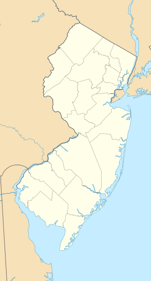
| Country |
|
| State |
|
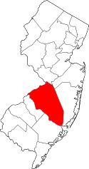
| County | Burlington |
| Township | Westampton |
| Elevation[1] | 10 m (33 ft) |
| Time zone | Eastern (EST) (UTC-5) |
| • Summer (DST) | EDT (UTC-4) |
| GNIS feature ID | 881192[1] |
Timbuctoo is an unincorporated community in Westampton Township, Burlington County, New Jersey, United States.[1][2]
Timbuctoo is a small settlement located along Rancocas Creek, founded by free blacks and former slaves around 1820.[3][4] At its peak in the mid-nineteenth century, Timbuctoo had more than 125 residents, a school, an African Methodist Episcopal Zion Church, and a cemetery.[5]
History
Timbuctoo was founded by free blacks and former slaves around 1820, in a township surrounded by Quaker communities.[6][7] Timbuctoo appeared on Burlington County maps as early 1849,[8] and continues to appear on maps today.[9]
In 1860 the "Battle of Pine Swamp" took place in Timbuctoo, and it was reported in the New Jersey Mirror, a local newspaper. It involved armed residents of Timbuctoo preventing the capture of Perry Simmons, a fugitive slave living in Timbuctoo, by a southern slave catcher.[5]
The US Census identified the "Village of Timbuctoo" as a separate entity within Westampton Township for the first time in 1880, enumerating 108 residents and 29 households.[10]
Today, the key remaining evidence of Timbuctoo's historical significance is a cemetery, which contains graves of black Civil War Veterans. Some current residents and landowners date back to the early 20th century. At least two families are descendants of early 19th century settlers.[11]
See also
References
- 1 2 3 U.S. Geological Survey Geographic Names Information System: Timbuctoo
- ↑ Locality Search, State of New Jersey. Accessed June 9, 2016.
- ↑ "African American Historical Site Excavated in NJ". Essence (magazine). July 4, 2010. Retrieved 2010-07-28.
- ↑ "Timbuctoo". National Public Radio. July 25, 2010. Retrieved 2010-07-28.
The site was once a village called Timbuctoo. In the 1820s, freed and escaped blacks formed a self-sustaining town well before the Civil War and emancipation. Timbuctoo survived through the end of slavery in New Jersey, the Fugitive Slave Act and the Jim Crow era. The last families didn't leave until the 1950s. At its peak, Timbuctoo was home to more than 150 people.
- 1 2 "African American Historical Sites". Burlington County, New Jersey. Retrieved 2010-08-02.
Located along the Rancocas Creek about one mile from Mount Holly, "Buckto" or "Bucktown," as it is commonly called, was a community of freed slaves and a haven for fugitive slaves. In connection with the latter, there occurred in 1860 an incident called the "Battle of Pine Swamp" that was reported in the New Jersey Mirror, a local newspaper. This incident involved armed residents of Timbuctoo preventing the capture of Perry Simmons, a fugitive slave living in Timbuctoo, by a southern slave catcher aided by sympathetic local whites.
- ↑ Rizzo, Dennis. (2008). Parallel Communities: The Underground Railroad in South Jersey. New York: History Press.
- ↑ Lyght, Ernest. (1978). Path of Freedom: The Black Presence in New Jersey's Burlington, County 1659-1900. Cherry Hill: E and E Publishing House.
- ↑ Burlington County Historical Society. 1849 Map of Timbuctoo and Mount Holly.
- ↑ Official Map of Burlington County. Accessed August 1, 2010.
- ↑ US Census Bureau. 1880 Census of Population and Housing. Accessed July 27, 2010 on http://www.Ancestry.com.
- ↑ Weston, Guy. (2005). "At Home in Timbuctoo". Courier Post. December 18, 2005.