Tormey, California
| Tormey | |
|---|---|
| Unincorporated community | |
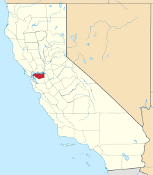
 Tormey Location in California | |
| Coordinates: 38°03′02″N 122°14′57″W / 38.05056°N 122.24917°WCoordinates: 38°03′02″N 122°14′57″W / 38.05056°N 122.24917°W[1] | |
| Country | United States |
| State | California |
| County | Contra Costa County |
| Elevation[1] | 20 ft (6 m) |
| GNIS ID[1][2] | 1660016 |
| FIPS code[1][2] | 06-79058 |
Tormey, formerly known as El Cierbo (Spanish for: "The Deer"), is an unincorporated community in Contra Costa County, California, United States.[1] It is located between Rodeo and Crockett on the edge of the ConocoPhillips oil refinery in Rodeo. It is 6.5 miles (10 km) west-northwest of Martinez,[3] at an elevation of 20 feet (6 m).[1] The community is home to several dozen homes and the former[4] offices of the John Swett Unified School District.[5] Originally a company town for management and refinery workers at the Selby Smelter, American Smelting and Refining Company. Tormey is located astride old U.S. Route 40, now San Pablo Avenue. Old County Road offshoots from it and at the end there is a water reservoir. The former Southern Pacific Railroad and now its new owner since 1996, the Union Pacific Railroad, skirts the bayshore side of Tormey. In the 1940s and 50's the Tormey Store served many of the grocery needs of the residents. The Hogg family managed the store with its single gasoline pump for many years. Although the area is unincorporated, many times it is referred to as being in the Crockett hills, or simply "the village" (by its residents), or the "refinery village". The ZIP Code is 94547. The community is inside area code 510. The town is named for Patrick Tormey, who purchased the property from the Ygnacio Martinez Rancho El Pinole estate.
A post office operated at Tormey from 1891 to 1892.[3]
References
- 1 2 3 4 5 6 "Tormey (Contra Costa County, California)". Geographic Names Information System. United States Geological Survey. Retrieved May 11, 2014.
- 1 2 "FIPS55 Data: California". FIPS55 Data. United States Geological Survey. February 23, 2006. Archived from the original on June 18, 2006. Retrieved May 11, 2014. External link in
|work=(help) - 1 2 Durham, David L. (1998). California's Geographic Names: A Gazetteer of Historic and Modern Names of the State. Clovis, Calif.: Word Dancer Press. p. 715. ISBN 1-884995-14-4.
- ↑ JSUSD website. Accessed on 2007-09-24.
- ↑ JSUSD website. Via archive.org. 2000-04-19. Accessed on 2007-09-24.
| Bodies of water |
|  |
|---|---|---|
| Counties | ||
| Major cities | ||
| Cities and towns 100k–250k | ||
| Cities and towns 50k–99k | ||
| Cities and towns 25k-50k | ||
| Cities and towns 10k–25k |
| |
| Sub-regions | ||
