Tara Hills, California
| Tara Hills | |
|---|---|
| Census-designated place | |
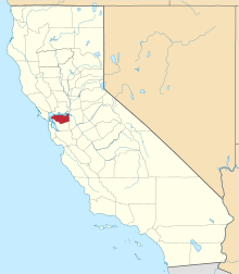
 Location in Contra Costa County and the state of California | |
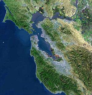
 Tara Hills Location in the United States | |
| Coordinates: 37°59′37″N 122°18′59″W / 37.99361°N 122.31639°W | |
| Country |
|
| State |
|
| County | Contra Costa |
| Government | |
| • County Supervisor | John Gioia |
| • State Senate | Nancy Skinner (D)[1] |
| • State Assembly | Tony Thurmond (D)[2] |
| • U. S. Congress | Mike Thompson (D)[3] |
| Area[4] | |
| • Total | 0.639 sq mi (1.654 km2) |
| • Land | 0.639 sq mi (1.654 km2) |
| • Water | 0 sq mi (0 km2) 0% |
| Elevation[5] | 92 ft (28 m) |
| Population (2010) | |
| • Total | 5,126 |
| • Density | 8,000/sq mi (3,100/km2) |
| Time zone | PST (UTC-8) |
| • Summer (DST) | PDT (UTC-7) |
| ZIP code | 94806 |
| Area code(s) | 510 |
| FIPS code | 06-77924 |
| GNIS feature IDs | 1701652, 2410059 |
| [5] | |
Tara Hills is a census-designated place (CDP) in Contra Costa County, California, United States. The population was 5,126 at the 2010 census.
Geography
According to the United States Census Bureau, the CDP has a total area of 0.6 square miles (1.6 km2), all of it land. Tara Hills is located in the San Francisco Bay Area region of Northern California.
Although this is a census area, outside of the City of San Pablo, the mailing addresses are San Pablo, California.
Demographics
2010
The 2010 United States Census[6] reported that Tara Hills had a population of 5,126. The population density was 8,028.2 people per square mile (3,099.7/km²). The racial makeup of Tara Hills was 2,212 (43.2%) White, 682 (13.3%) African American, 31 (0.6%) Native American, 869 (17.0%) Asian, 18 (0.4%) Pacific Islander, 1,018 (19.9%) from other races, and 296 (5.8%) from two or more races. Hispanic or Latino of any race were 1,947 persons (38.0%).
The Census reported that 99.7% of the population lived in households and 0.3% lived in non-institutionalized group quarters.
There were 1,662 households, out of which 674 (40.6%) had children under the age of 18 living in them, 874 (52.6%) were opposite-sex married couples living together, 251 (15.1%) had a female householder with no husband present, 127 (7.6%) had a male householder with no wife present. There were 82 (4.9%) unmarried opposite-sex partnerships, and 13 (0.8%) same-sex married couples or partnerships. 326 households (19.6%) were made up of individuals and 147 (8.8%) had someone living alone who was 65 years of age or older. The average household size was 3.08. There were 1,252 families (75.3% of all households); the average family size was 3.55.
The population was spread out with 1,227 people (23.9%) under the age of 18, 540 people (10.5%) aged 18 to 24, 1,359 people (26.5%) aged 25 to 44, 1,344 people (26.2%) aged 45 to 64, and 656 people (12.8%) who were 65 years of age or older. The median age was 36.8 years. For every 100 females there were 95.2 males. For every 100 females age 18 and over, there were 92.5 males.
There were 1,729 housing units at an average density of 2,707.9 per square mile (1,045.5/km²), of which 1,159 (69.7%) were owner-occupied, and 503 (30.3%) were occupied by renters. The homeowner vacancy rate was 2.0%; the rental vacancy rate was 3.3%. 3,618 people (70.6% of the population) lived in owner-occupied housing units and 1,494 people (29.1%) lived in rental housing units.
2000
As of the census[7] of 2000, there were 5,332 people, 1,792 households, and 1,370 families residing in the CDP. The population density was 6,819.4 people per square mile (2,639.4/km²). There were 1,817 housing units at an average density of 2,323.9 per square mile (899.4/km²). The racial makeup of the CDP was 51.76% White, 14.44% Black or African American, 0.66% Native American, 14.14% Asian, 0.54% Pacific Islander, 12.55% from other races, and 5.91% from two or more races. 23.87% of the population were Hispanic or Latino of any race.
There were 1,792 households out of which 35.5% had children under the age of 18 living with them, 57.4% were married couples living together, 12.7% had a female householder with no husband present, and 23.5% were non-families. 17.9% of all households were made up of individuals and 5.0% had someone living alone who was 65 years of age or older. The average household size was 2.96 and the average family size was 3.34.
In the CDP the population was spread out with 26.1% under the age of 18, 8.6% from 18 to 24, 31.2% from 25 to 44, 23.2% from 45 to 64, and 11.0% who were 65 years of age or older. The median age was 36 years. For every 100 females there were 98.5 males. For every 100 females age 18 and over, there were 94.5 males.
The median income for a household in the CDP was $56,380, and the median income for a family was $60,774. Males had a median income of $41,090 versus $32,500 for females. The per capita income for the CDP was $22,946. About 2.7% of families and 5.2% of the population were below the poverty line, including 3.6% of those under age 18 and 7.8% of those age 65 or over.
Commerce
There is the Tara Hills shopping center, and also many stores along San Pablo Avenue. The area is served by WestCat buses.
References
- ↑ "Senators". State of California. Retrieved April 1, 2013.
- ↑ "Members Assembly". State of California. Retrieved April 1, 2013.
- ↑ "California's 5th Congressional District - Representatives & District Map". Civic Impulse, LLC. Retrieved March 9, 2013.
- ↑ "2010 Census U.S. Gazetteer Files – Places – California". United States Census Bureau.
- 1 2 "Tara Hills". Geographic Names Information System. United States Geological Survey.
- ↑ "2010 Census Interactive Population Search: CA - Tara Hills CDP". U.S. Census Bureau. Retrieved July 12, 2014.
- ↑ "American FactFinder". United States Census Bureau. Retrieved 2008-01-31.
| Bodies of water |
|  |
|---|---|---|
| Counties | ||
| Major cities | ||
| Cities and towns 100k–250k | ||
| Cities and towns 50k–99k | ||
| Cities and towns 25k-50k | ||
| Cities and towns 10k–25k |
| |
| Sub-regions | ||
 |
San Pablo Bay | | ||
| |
Pinole | |||
| ||||
| | ||||
| Richmond | El Sobrante |