Walnut Creek, California
| City of Walnut Creek | |
|---|---|
| City | |
|
Walnut Creek as seen from Acalanes Open Space | |
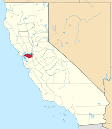
 Location of Walnut Creek within California | |
 City of Walnut Creek Location in the United States | |
| Coordinates: 37°54′23″N 122°03′54″W / 37.90639°N 122.06500°WCoordinates: 37°54′23″N 122°03′54″W / 37.90639°N 122.06500°W | |
| Country | United States |
| State | California |
| County | Contra Costa |
| First settled | 1849[1] |
| Incorporated | October 21, 1914[1] |
| Government | |
| • Type | General Law |
| • City Council | |
| • State Leg. |
|
| • U. S. Congress | Mark DeSaulnier (D)[5] |
| Area[6] | |
| • Total | 19.769 sq mi (51.201 km2) |
| • Land | 19.757 sq mi (51.169 km2) |
| • Water | 0.012 sq mi (0.031 km2) 0.06% |
| Elevation | 131 ft (40 m) |
| Population (2010) | |
| • Total | 64,173 |
| • Density | 3,200/sq mi (1,300/km2) |
| Time zone | PST (UTC-8) |
| • Summer (DST) | PDT (UTC-7) |
| ZIP codes | 94595–94598 |
| Area code(s) | 925 |
| FIPS code | 06-83346 |
| GNIS feature IDs | 1660120, 2412174 |
| Website | Official website |
.jpg)
Walnut Creek is a city in Contra Costa County, California, United States, located 16 miles (26 kilometres) east of the city of Oakland in the East Bay region of the San Francisco Bay Area. Although not the largest city within the county, Walnut Creek serves as a hub for its neighboring cities because of its location at the junction of (I-680) and San Francisco/Oakland (SR-24) and its accessibility by BART. Its active downtown neighborhood features hundred-year-old buildings and extensive high-end retail establishments, restaurants and entertainment venues. As of 2014, the city's total estimated population is 67,673.
History

There are three bands of Bay Miwok Indians associated with early Walnut Creek:[7][8] the Saclan, whose territory extended through the hills east of present-day Oakland, Rossmoor, Lafayette, Moraga, and Walnut Creek; the Volvon (also spelled Bolbon, Wolwon, and Zuicun) at Mt. Diablo; and the Tactan at Danville and Walnut Creek, on San Ramon Creek.
Today's Walnut Creek is located amidst the earlier site of four Mexican land grants. One of these land grants – measuring 18,000 acres (73 km2) – belonged to Juana Sanchez de Pacheco, who deeded it to her two grandsons. Ygnacio Sibrian, one of the grandsons, created the first roofed home in the valley in about 1850. The grant was called Rancho Arroyo de Las Nueces y Bolbones, named after the principal waterway, Arroyo de las Nueces (Walnut Creek) as well as for the local group of indigenous Americans (Bolbones). The Arroyo de las Nueces was named for the occurrence in the valley of the native species of walnut tree, the California Walnut.
With the coming of American settlers following the Mexican-American War, a small settlement called "The Corners" emerged, named because it was the place where roads from Pacheco and Lafayette met. The site of this first American settlement is found today at the intersection of Mt. Diablo Boulevard and North Main Street. The first town settler was William Slusher, who built a dwelling on the bank of Walnut Creek, which was called "Nuts Creek" by the Americans in 1849. In the year 1855, Milo Hough of Lafayette built the hotel named "Walnut Creek House" in the corners. A blacksmith shop and a store soon joined the hotel, and a year later, Hiram Penniman (who built Shadelands Ranch) laid out the town site and realigned the Main Street of today. Two decades later, the community changed its name from The Corners to Walnut Creek.
In December 1862 a United States Post Office was established, and the community was named "Walnut Creek".[9] The downtown street patterns laid out in 1871–1872 by pioneer Homer Shuey on a portion of one of his family's large cattle ranches are still present today.
Walnut Creek began to grow with the arrival of Southern Pacific Railroad service in 1891. On October 21, 1914, the town and the surrounding area of 500 acres (2.0 square kilometres)), were incorporated as the 8th city in Contra Costa County. A branch line of the Southern Pacific railroad ran through Walnut Creek until the late 1970s. The East Bay Regional Park District's Iron Horse Trail, used by walkers, runners and bikers, runs over what were portions of that branch line.[10] The mainline of the Sacramento Northern Railway passed through Walnut Creek. Both railroads had stations here. Today, the Pittsburg/Bay Point – SFO Line line of the Bay Area Rapid Transit (BART) serves Walnut Creek with a station adjacent to Highway 680.
With the 1951 opening of the downtown Broadway Shopping Center (now Broadway Plaza), Contra Costa County's first major retail center, the city took off in a new direction, and its population more than quadrupled – from 2,460 in 1950 to 9,903 in 1960.
Geography and climate
Walnut Creek is located at 37°54′23″N 122°03′54″W / 37.90639°N 122.06500°W.[11] Portions lie in both the San Ramon Valley and the Ygnacio Valley below the western slopes of Mount Diablo. According to the United States Census Bureau, the city has a total area of 19.8 sq mi (51.2 km2), 0.06 percent of which is water. Walnut Creek – the actual waterway that runs through town – has been routed underneath downtown through a series of tunnels starting at the southwest end of Macy's and ending just southwest of Maria Maria Restaurant.
Open space

Walnut Creek owns more open space per capita than any other community in the state of California. In 1974, Walnut Creek voters approved a $6.7 million bond measure that allowed the city to purchase 1,800 acres (730 ha) of undeveloped hillsides, ridge lines, and park sites. Walnut Creek owns parts of Lime Ridge Open Space, Shell Ridge Open Space, Acalanes Ridge Open Space, and Sugarloaf Open Space.
The East Bay Regional Park District operates Diablo Foothills Regional Park and Castle Rock Regional Recreation Area, both in Walnut Creek.
Climate
Walnut Creek's warm summer Mediterranean climate (Köppen climate classification Csb) is typical of California's interior valleys. In summer, high pressure is in control of the region, leading to almost unbroken sunshine and virtually no precipitation. Days start out cool but quickly warm up, with high temperatures normally in the 80s Fahrenheit (27 to 32 °C). Temperatures of 100 °F (38 °C) or hotter occur numerous times during heatwaves, however. In the winter, the jet stream moves far enough south so that Pacific storms can reach Walnut Creek, bringing much-needed rain – average annual rainfall approximates 20 inches (510 mm), with slight variations occurring in microclimates based on elevation and topography. During particularly cold storms, snow falls on the peak of nearby Mount Diablo, but snow in the valley floor is very rare. There are also plenty of clear, mild days in winter, often with morning frost. The climate allows for the successful cultivation of many plants and crops, being warm enough for citrus yet cold enough for apples. The Ruth Bancroft Garden is a renowned botanical garden that showcases the diversity of plants that can be successfully grown.
| Climate data for WALNUT CREEK 2 ESE, California (1893–1974) | |||||||||||||
|---|---|---|---|---|---|---|---|---|---|---|---|---|---|
| Month | Jan | Feb | Mar | Apr | May | Jun | Jul | Aug | Sep | Oct | Nov | Dec | Year |
| Record high °F (°C) | 80 (27) |
83 (28) |
97 (36) |
94 (34) |
103 (39) |
109 (43) |
115 (46) |
112 (44) |
114 (46) |
101 (38) |
89 (32) |
76 (24) |
115 (46) |
| Average high °F (°C) | 55 (13) |
61 (16) |
65 (18) |
71 (22) |
76 (24) |
83 (28) |
88 (31) |
87 (31) |
84 (29) |
77 (25) |
66 (19) |
56 (13) |
72.4 (22.4) |
| Average low °F (°C) | 36 (2) |
38 (3) |
40 (4) |
43 (6) |
47 (8) |
52 (11) |
54 (12) |
54 (12) |
52 (11) |
46 (8) |
41 (5) |
37 (3) |
45.0 (7.2) |
| Record low °F (°C) | 17 (−8) |
21 (−6) |
24 (−4) |
28 (−2) |
32 (0) |
34 (1) |
38 (3) |
41 (5) |
36 (2) |
27 (−3) |
23 (−5) |
18 (−8) |
17 (−8) |
| Average precipitation inches (mm) | 4.52 (114.8) |
3.62 (91.9) |
2.47 (62.7) |
1.38 (35.1) |
0.56 (14.2) |
0.14 (3.6) |
0.01 (0.3) |
0.04 (1) |
0.24 (6.1) |
1.05 (26.7) |
2.26 (57.4) |
3.83 (97.3) |
20.12 (511.1) |
| Average precipitation days (≥ 0.01 in) | 10 | 9 | 8 | 5 | 3 | 1 | 0 | 0 | 1 | 3 | 6 | 9 | 53 |
| Source: [12][13] | |||||||||||||
Public transit and bike trails

The city hosts two BART stations, Walnut Creek station and Pleasant Hill station (in the unincorporated area known as Contra Costa Centre Transit Village). BART provides direct service from Walnut Creek to San Francisco, heading west, and Pittsburg, heading east. Other cities such as Berkeley and Fremont can be accessed via transfers.
Central Contra Costa Transit Authority (County Connection/CCCTA) provides bus service throughout Walnut Creek and Contra Costa County at a modest cost. County Connection also operates three free weekday shuttles within city limits: the Downtown Trolley/Route 4 loops from Walnut Creek BART to Broadway Plaza; Route 5 runs from Walnut Creek BART to Creekside; and Route 7, which runs from Pleasant Hill BART to Shadelands Business Park.
Walnut Creek is transected by the Iron Horse Trail (running north/south) through its downtown, as well as the Contra Costa Canal Trail (running east/west) at the north end of the city. Both these trails, in addition to city bike lanes, make bicycle transportation feasible for both recreation and an alternative commute.
Demographics
| Historical population | |||
|---|---|---|---|
| Census | Pop. | %± | |
| 1880 | 94 | — | |
| 1920 | 538 | — | |
| 1930 | 1,014 | 88.5% | |
| 1940 | 1,578 | 55.6% | |
| 1950 | 2,420 | 53.4% | |
| 1960 | 9,903 | 309.2% | |
| 1970 | 39,844 | 302.3% | |
| 1980 | 54,033 | 35.6% | |
| 1990 | 60,569 | 12.1% | |
| 2000 | 64,296 | 6.2% | |
| 2010 | 64,173 | −0.2% | |
| Est. 2015 | 68,910 | [14] | 7.4% |
2010 census
The 2010 United States Census[16] reported that Walnut Creek had a population of 64,173. The population density was 3,246.2 people per square mile (1,253.4/km²). The racial makeup of Walnut Creek was 50,487 (78.7 percent) White, 1,035 (1.6 percent) African American, 155 (0.2 percent) Native American, 8,027 (12.5 percent) Asian, 125 (0.2 percent) Pacific Islander, 1,624 (2.5 percent) from other races, and 2,720 (4.2 percent) from two or more races. Hispanic or Latino of any race were 5,540 persons (8.6 percent).
The Census reported that 63,171 people (98.4 percent of the population) lived in households, 176 (0.3 percent) lived in non-institutionalized group quarters, and 826 (1.3 percent) were institutionalized.
There were 30,443 households, out of which 6,363 (20.9 percent) had children under the age of 18 living in them, 13,305 (43.7 percent) were opposite-sex married couples living together, 2,071 (6.8 percent) had a female householder with no husband present, 844 (2.8 percent) had a male householder with no wife present. There were 1,286 (4.2 percent) unmarried opposite-sex partnerships, and 298 (1.0 percent) same-sex married couples or partnerships. 11,884 households (39.0 percent) were made up of individuals and 6,424 (21.1 percent) had someone living alone who was 65 years of age or older. The average household size was 2.08. There were 16,220 families (53.3 percent of all households); the average family size was 2.79.
The population was spread out with 10,719 people (16.7 percent) under the age of 18, 3,599 people (5.6 percent) aged 18 to 24, 15,137 people (23.6 percent) aged 25 to 44, 17,653 people (27.5 percent) aged 45 to 64, and 17,065 people (26.6 percent) who were 65 years of age or older. The median age was 47.9 years. For every 100 females there were 86.4 males. For every 100 females age 18 and over, there were 83.0 males.
There were 32,681 housing units at an average density of 1,653.2 per square mile (638.3/km²), of which 20,262 (66.6 percent) were owner-occupied, and 10,181 (33.4 percent) were occupied by renters. The homeowner vacancy rate was 2.4 percent; the rental vacancy rate was 6.7 percent. 43,079 people (67.1 percent of the population) lived in owner-occupied housing units and 20,092 people (31.3 percent) lived in rental housing units.
|
2000 census
As of the census[18] of 2000, there were 64,296 people, 30,301 households, and 16,544 families residing in the city. The population density was 1,246.9/km² (3,229.6/mi²). There were 31,425 housing units at an average density of 609.4/km² (1,578.5/mi²). The racial makeup of the city was 83.89 percent White, 1.07 percent African American, 0.33 percent Native American, 9.36 percent Asian, 0.15 percent Pacific Islander, 1.96 percent from other races, and 3.25 percent from two or more races. Hispanic or Latino of any race were 5.99 percent of the population.
There were 30,301 households out of which 20.9 percent had children under the age of 18 living with them, 45.7 percent were married couples living together, 6.7 percent had a female householder with no husband present, and 45.4 percent were non-families. 38.0 percent of all households were made up of individuals and 19.7 percent had someone living alone who was 65 years of age or older. The average household size was 2.09 and the average family size was 2.78.
In the city the population was spread out with 17.6 percent under the age of 18, 5.2 percent from 18 to 24, 27.1 percent from 25 to 44, 24.8 percent from 45 to 64, and 25.3 percent who were 65 years of age or older. The median age was 45 years. For every 100 females there were 85.8 males. For every 100 females age 18 and over, there were 81.5 males.
Education
Public K-12
Walnut Creek residents attend schools in five public-school districts.[19] The Walnut Creek School District (K–8) has 5 elementary schools and one middle school in the city. Some residents are served by schools from the Mount Diablo Unified School District (K–12), the Acalanes Union High School District (9–12), the San Ramon Valley Unified School District (K–12), and the Lafayette School District (K–8). The following public schools are within the city limits of Walnut Creek:
Walnut Creek School District
- Buena Vista Elementary
- Indian Valley Elementary
- Murwood Elementary
- Parkmead Elementary
- Walnut Heights Elementary
- Walnut Creek Intermediate
- Tice Creek School
Acalanes Union High School District
- Las Lomas High School
- Acalanes Center for Independent Study
- Del Oro High (continuation school)
Mount Diablo Unified School District
- Eagle Peak Montessori (charter elementary)
- Bancroft Elementary
- Valle Verde Elementary
- Walnut Acres Elementary
- Foothill Middle
- Northgate High School
Private K-12
Walnut Creek is home to several private schools, including
- Berean Christian High School (Grades: 9–12)
- Contra Costa Christian Schools (Grades: PK–12)[20]
- Garden Gate Montessori School (Grades: PK–K)
- North Creek Academy & Preschool (Grades: PK–8)
- Palmer School (Grades: K–8)
- St. Mary of the Immaculate Conception School (Grades: PK–8)
- The Seven Hills School (Grades: PK–8)
- Springfield Montessori School (Grades: PK–K)
- Walnut Creek Christian Academy (Grades: K–8)[21]
Public libraries

The Walnut Creek Library and the Ygnacio Valley Library of the Contra Costa County Library are located in Walnut Creek.[22][23] The Ygnacio Valley Branch, which opened in 1975, is also known as the Thurman G. Casey Memorial Library.[23] Fundraising and other support is provided by the Walnut Creek Library Foundation.
On February 26, 2008, the city demolished the Walnut Creek Library, that was built in 1961 at the southern end of Civic Park. Mayor Gwen Regalia hosted a groundbreaking on the same site for the new library on May 19, 2008. The new library, designed by Group 4 Architecture, Research + Planning, Inc., has 42,000 square feet (3,900 m2) and an underground parking garage.[24] Construction was completed in 2010 and the library was officially opened on July 17, 2010.[25]
Economy
Companies based in Walnut Creek include Carollo Engineers, Central Garden & Pet (makers of AvoDerm, Amdro, Kaytee, among others),[26] American Reprographics Company, CSE Insurance Group, and the PMI Group.
Top employers
According to Walnut Creek's 2010 Comprehensive Annual Financial Report,[27] the top employers in the city are:
| # | Employer | # of Employees |
|---|---|---|
| 1 | John Muir Health | 4,604 |
| 2 | Kaiser Permanente | 2,300 |
| 3 | Safeway | 1,275 |
| 4 | Nordstrom | 570 |
| 5 | IHC | 500 |
| 6 | United States Postal Service | 409 |
| 7 | Aetna | 400 |
| 8 | Macy's | 400 |
| 9 | City of Walnut Creek | 364 |
| 10 | HCR Manor Care | 360 |
In 2012, the city was listed among the 10 best places to retire in the U.S. by CBS Money Watch and U.S. News.[28][29]
Culture
Arts companies and venues


Bedford Gallery
This 3,500-square-foot exhibition space hosts several exhibitions annually, featuring historic and modern art from contemporary artists. The gallery is a community-based facility that provides art workshops, lectures, and educational programs to the public throughout the year.
California Symphony
The California Symphony, notable for its commitment to the performance of music by American composers, has been based in Walnut Creek since its inception in 1986.
Center Repertory Company
The Center Repertory Company is the in-house theater company for the Lesher Center for the Arts. It stages six productions a year, including the annual production of A Christmas Carol.
Civic Arts Education
A community arts education program offering classes to children and adults since 1964. Classes include beginning, intermediate and expert levels in ceramics, sculpture, dance, fiber arts, digital media, photography, drama, drawing, painting, printmaking, glass, jewelry and music. The Clay Arts Guild (CAG) is a non-profit volunteer organization, established in 1964, supporting ceramics arts education under the Civic Arts Education program. An arts-based preschool and youth arts center are popular year-round programs, all part of the City of Walnut Creek's Arts Recreation & Community Services Department.
Company C Contemporary Ballet
Established in 2002, Company C commissions new work and performs historic modern ballet throughout the Bay Area. Past performances have featured the works of Twyla Tharp, Michael Smuin, Lynne Taylor-Corbett, Charles Anderson, and Antony Tudor,
Festival Opera
The Festival Opera Association was founded in Walnut Creek in 1991 to preserve and advance the operatic art form. The company produces a free Opera in the Park in Civic Park in addition to main stage performances at the Lesher Center for the Arts.[30]
Lesher Center for the Arts
Three performance spaces (The Knight Stage 3, The Hoffman, and The Margaret Lesher theatres) and the Bedford Gallery are included in this modern building. The Center is named for Dean Lesher, newspaper publisher and founder of the Contra Costa Times.
Points of interest

- Tony La Russa's Animal Rescue Foundation (ARF)
- Bedford Art Gallery
- Boundary Oak Golf Course
- Broadway Plaza Shopping Center
- Castle Rock Park
- Civic Park, including seasonal outdoor skating rink
- Heather Farm Park, including Gardens at Heather Farm and all-abilities playground
- Howe Homestead Park
- Lesher Center for the Arts
- Lindsay Wildlife Museum
- Mount Diablo State Park
- Open space hiking/biking trails, including Acalanes, Lime Ridge, Shell Ridge (featuring Fossil Hill trail)
- Old Borges Ranch
- Ruth Bancroft Garden
- St. Paul's Episcopal Church, featuring Carpenter Gothic chapel
- Shadelands Ranch Museum
- Walden Park Disc Golf Course
- Walnut Creek Model Railroad Society
Media
Walnut Creek is served by the daily newspaper, The East Bay Times (formerly The Contra Costa Times). The paper was originally run and owned by the Lesher family. Since the death of Dean Lesher in 1993, the paper has had several owners. The Times as it is known, has a section called "The Walnut Creek Journal."
Walnut Creek TV (WCTV) is the city's government-access television channel, covering local government and community events. WCTV is available in Walnut Creek on Comcast channel 28 (channel 26 in Rossmoor), Astound channel 29, AT&T U-verse channel 99 under the menu option "Walnut Creek Television," and on YouTube. Claycord.com is the widely read independent news and talk blog serving the greater Walnut Creek metropolitan area.
Notable people
- Matt Anger, professional tennis player
- Tom Candiotti, MLB pitcher
- Richard Carlson, psychotherapist, author of Don't Sweat the Small Stuff[31]
- Dr. Alette Coble-Temple, Ms. Wheelchair America 2016, disability advocate[32][33]
- Stephen Curry, NBA All-star[34]
- Kyle Gass, guitarist for Tenacious D, attended Las Lomas High School
- Lee Goldberg, writer and television producer, graduated from Northgate High School (1980)
- Dan Haren, MLB pitcher[35]
- Brandon Harkins, professional golfer
- Jack Henderson, artist, charity fundraiser
- Marya Hornbacher, author[36]
- Kristian Ipsen, U.S. diver, Olympic bronze medalist[37]
- Bessilyn Johnson, daughter of Hiram Penniman, Shadelands Ranch owner, resident of Scotty's Castle in Death Valley
- Randy Johnson, MLB pitcher
- Kira Kazantsev, Miss America 2015
- Joshua Kors, investigative reporter, graduated from Las Lomas High School
- Mark "Mad Dog" Madsen, NBA player
- James McCoubrey (1901–2013) world's oldest living man[38]
- John A. Nejedly (1914–2006), California State Senator
- Kyle Newacheck, co-creator, co-star of Comedy Central's Workaholics
- Jason Newsted, bassist for Metallica
- Aaron Poreda, MLB pitcher
- Markie Post, television actress
- Jeff Richards, writer and featured performer on NBC's Saturday Night Live, 2001–04
- Bill Rigney, MLB infielder, Angels' first manager
- Lester Rodney, journalist, civil rights activist[39]
- Katharine Ross, film actress, graduated from Las Lomas High School (1957)
- Leslie Carrara-Rudolph, Sesame Street puppeteer
- Justin Speier, MLB pitcher
- Joe Starkey, California Golden Bears and former San Francisco 49ers announcer
- Greg Sestero, Actor, star of cult classic The Room, author of The Disaster Artist, born in Walnut Creek.
- Christy Turlington, supermodel, health activist
- Lars Ulrich, drummer for Metallica
- Joseph R. Walker, 19th-century wilderness explorer and scout
- Johnny Weekly, MLB outfielder
- Wayne A. Wiegand, library historian, author, academic
Sister cities
Walnut Creek has an active Sister Cities International program with two sister cities. Schools in the city have a yearly student-exchange with these cities.[40]
See also
References
- 1 2 , walnut-creek.org, retrieved on October 8, 2007
- 1 2 3 4 5 "City Council". Walnut Creek. Retrieved March 27, 2013.http://www.walnut-creek.org/citygov/depts/cd/planning/west_downtown_specific_plan/city_council_and_commission_meetings.asp
- ↑ "Senators". State of California. Retrieved March 27, 2013.
- ↑ "Members Assembly". State of California. Retrieved March 27, 2013.
- ↑ "California's 11th Congressional District - Representatives & District Map". Civic Impulse, LLC. Retrieved March 11, 2013.
- ↑ U.S. Census Archived 2012-07-14 at WebCite http://www.census.gov/ http://www.census.gov/
- ↑ Forester, 2006.
- ↑ Milliken, 1995
- ↑ Durham, David L. (1998). California's Geographic Names: A Gazetteer of Historic and Modern Names of the State. Clovis, Calif.: Word Dancer Press. p. 719. ISBN 1-884995-14-4.
- ↑ About the Iron Horse Corridor. Retrieved May 28, 2010.
- ↑ U.S. Geological Survey Geographic Names Information System: Walnut Creek, California
- ↑ "WALNUT CREEK 2 ESE, CALIFORNIA Period of Record General Climate Summary – Temperature". Wrcc.dri.edu. October 31, 2012. Retrieved August 19, 2013.
- ↑ "WALNUT CREEK 2 ESE, CALIFORNIA Period of Record General Climate Summary – Precipitation". Wrcc.dri.edu. October 31, 2012. Retrieved August 19, 2013.
- ↑ "Annual Estimates of the Resident Population for Incorporated Places: April 1, 2010 to July 1, 2015". Retrieved July 2, 2016.
- ↑ "Census of Population and Housing". Census.gov. Archived from the original on May 11, 2015. Retrieved June 4, 2015.
- ↑ "2010 Census Interactive Population Search: CA – Walnut Creek city". U.S. Census Bureau. Retrieved July 12, 2014.
- ↑ "Demographic Profile Bay Area Census".
- ↑ "American FactFinder". United States Census Bureau. Archived from the original on September 11, 2013. Retrieved January 31, 2008.
- ↑ Walnut Creek City Council (April 4, 2006). "Walnut Creek General Plan 2025". pp. 2–15. Retrieved February 23, 2010.
- ↑ "Contra Costa Christian School website". Cccss.org. Retrieved August 19, 2013.
- ↑ "Walnut Creek Christian Academy website". Wccaeagles.org. Retrieved August 19, 2013.
- ↑ "Walnut Creek Library." Contra Costa County Library. Retrieved on April 1, 2010.
- 1 2 "Ygnacio Valley Library." Contra Costa County Library. Retrieved on April 1, 2010.
- ↑ City of Walnut Creek, Downtown Library Project, Construction on Track for New Library opening in 2010. Retrieved July 26, 2010.
- ↑ Walnut Creek Library Foundation, New Walnut Creek Library Grand Opening, July 10, 2010.
- ↑ "Central Garden & Pet » Corporate & Investor Relations". Central.com. Retrieved August 19, 2013.
- ↑ "City of Walnut Creek CAFR". Retrieved May 30, 2011.http://www.walnut-creek.org/government/city-budget/other-financial-reports
- ↑ Smith, Nancy F. (March 8, 2012). "The 10 Best Places to Retire". Finance.yahoo.com. Retrieved August 19, 2013.
- ↑ Brandon, Emily (October 17, 2011). "The 10 Best Places to Retire in 2012". Money.usnews.com. Retrieved August 19, 2013.
- ↑ Kosman, Joshua (July 11, 2012). "Loyal base asked to benefit opera". San Francisco Chronicle. Retrieved April 11, 2013.
- ↑ DelVecchio, Rick (December 16, 2006). "RICHARD CARLSON: 1961–2006; 'Don't Sweat Small Stuff' author dies at 45". San Francisco Chronicle. article appeared on page B – 1 of the San Francisco Chronicle. Retrieved January 5, 2010.
- ↑ "Dr. Alette Coble-Temple crowned MWA 2016!," Ms. Wheelchair America. Retrieved on May 21, 2016.
- ↑ Fancher, Lou (August 10, 2015) "Walnut Creek woman crowned Ms. Wheelchair America," The East Bay Times. Retrieved on May 21, 2016.
- ↑ Vongs, Pueng. (November 25, 2015) "Photos: Warriors star Stephen Curry buys mansion in Walnut Creek," The Mercury News. Retrieved on May 20, 2016.
- ↑ Suchon, Josh (July 21, 2006). "Haren's home is in the East Bay". Oakland Tribune. Retrieved March 8, 2007.
- ↑ Ronan, Alex (July 29, 2014) "'Like Seeing a Ghost’: Wasted, 15 Years Later," New York Magazine – The Cut. Retrieved on May 21, 2016.
- ↑ Lutz, Rachel (April 4, 2016). "Who is... Kristian Ipsen," NBCOlympics.com. Retrieved on May 21, 2016.
- ↑ Richards, Sam (July 10, 2013). "James McCoubrey, acknowledged as the oldest living man in California, dies in Walnut Creek at 111". mercurynews.com. Contra Costa Times. Retrieved July 10, 2013.
- ↑ Goldstein, Richard (December 23, 2009) "Lester Rodney, Early Voice in Fight Against Racism in Sports, Dies at 98," The New York Times. Retrieved on May 21, 2016.
- ↑ "Walnut Creek – Sister City Program". City of Walnut Creek. Retrieved January 18, 2011.http://www.walnut-creek.org/services/citizen/
Further reading
- Emanuels, George (1982). Ygnacio Valley, 1834–1970. OCLC 9221187.
- Emanuels, George (1991) [1984]. Walnut Creek: Arroyo de Las Nueces. Walnut Creek, Calif.: Diablo Books. ISBN 0-9607520-2-1. OCLC 11704494.
- Nilda Rego (1998). Days Gone By in Contra Costa County Vol II. Lafayette, Calif.: Great West Books. ISBN 1-889652-02-4. OCLC 71402468.
External links
| Wikimedia Commons has media related to Walnut Creek, California. |
| Wikivoyage has a travel guide for Walnut Creek. |
 |
Martinez | Pleasant Hill, Concord | Clayton | |
| Lafayette, Orinda | |
Mount Diablo State Park | ||
| ||||
| | ||||
| Moraga | Alamo, Danville | Diablo |
| Bodies of water |
|  |
|---|---|---|
| Counties | ||
| Major cities | ||
| Cities and towns 100k–250k | ||
| Cities and towns 50k–99k | ||
| Cities and towns 25k-50k | ||
| Cities and towns 10k–25k |
| |
| Sub-regions | ||