Interstate 680 (California)
| |||||||
|---|---|---|---|---|---|---|---|
 | |||||||
| Route information | |||||||
| Defined by Streets and Highways Code § 620 | |||||||
| Maintained by Caltrans | |||||||
| Length: | 70.536 mi[1] (113.517 km) | ||||||
| History: | State highway in 1933; Interstate in 1955 | ||||||
| Major junctions | |||||||
| South end: |
| ||||||
|
| |||||||
| North end: |
| ||||||
| Highway system | |||||||
| |||||||
.svg.png)
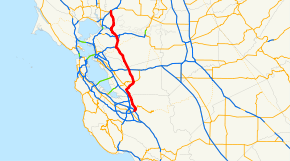
Interstate 680 (I-680) is a north–south Interstate Highway in Northern California. It curves around the eastern cities of the San Francisco Bay Area from San Jose to Interstate 80 at Fairfield, bypassing cities along the eastern shore of San Francisco Bay such as Oakland and Richmond while serving others more inland such as Pleasanton and Concord.
Built in the 1920s and designated in 1955, I-680 begins at a junction with I-280 and US 101 (Bayshore Freeway), and heads northeast and north-northwest through the northeast part of San Jose. After passing State Route 237 (SR 237) in Milpitas and SR 262 in Fremont, I-680 abruptly turns northeast (where a connection to a SR 238 freeway was planned) and enters the hills and valleys of the California Coast Ranges. The highway crosses over Mission Pass, also known as the Sunol Grade, and descends into the Sunol Valley, where it meets SR 84 near Sunol. From Sunol, I-680 again heads north-northwesterly through valleys, including the San Ramon Valley, along the Calaveras Fault. Junctions along this portion include I-580 in Dublin and SR 24 in Walnut Creek. Beyond the latter interchange, a three-way directional junction with the SR 24 freeway west to Oakland, I-680 heads north into Pleasant Hill, where SR 242 splits and I-680 again heads northwesterly. After the junction with SR 4 in Martinez, the highway crosses the Carquinez Strait on the Benicia-Martinez Bridge, immediately meeting the east end of I-780 on the Benicia end. The remainder of I-680, from Benicia to I-80 at Fairfield, lies between a hilly area to the west representing the southwestern tip of the Vaca Mountains, and a marshy area (along the Suisun Bay and Cordelia Slough) to the east.[2]
Route description

I-680 is part of the California Freeway and Expressway System.[3] This route is eligible for the State Scenic Highway System from the Santa Clara-Alameda county line to SR 24 in Walnut Creek.,[4] and is a scenic route from either SR 238 or SR 262 (CalTrans's designation is unclear; just defines it as Mission Blvd.) to the Contra Costa county line, and from the Alameda county line to SR 24.[5] It's routed legislatively as (a) Route 101 near San Jose to Route 780 at Benicia passing near Warm Springs, Mission San Jose, Scotts Corners, and Sunol, and via Walnut Creek, and (b) Route 780 at Benicia to Route 80 near Cordelia.[6]
The route begins at U.S. Route 101 at the Joe Colla Interchange, where it acts as a continuation of I-280 eastward.[7] From here, it begins its journey northward through San Jose, where it meets the Capitol Expressway, signed as CR G21, about a mile northeast of I-680's southern terminus.[1] The next exit northbound is SR 130, which is also known as Alum Rock Avenue, unsigned at the intersection.[8][9] As it continues through Santa Clara County, it meets numerous local roads before interchanging with the Montague Expressway. Here, it exits San Jose and enters the city of Milpitas, California, where it meets SR 237, often referred to as Calaveras Boulevard. After one more intersection, I-680 exits Santa Clara County and enters Alameda County.[1]
In Alameda County, the freeway begins in the city of Fremont, where it intersects SR 262, which was unsigned until 2000. Continuing through the city, it meets Mission Boulevard at SR 238 before exiting the city. Prior to 2002, two ghost ramps existed here, remains of an abandoned freeway project replacing Mission Blvd.[1] Amid Alameda County, it abruptly turns northeastward and enters a hilly area, where it crosses over Mission Pass, and descends into the Sunol Valley, where it runs concurrently with SR 84 for a short while. Afterwards, it enters Pleasanton and intersects with I-580, currently California's longest auxiliary interstate providing access to Oakland and the Central Valley. It enters Dublin for a short segment before exiting the county and entering Contra Costa County.[1][7]
Upon entering Contra Costa County, the route meets numerous local roads through the cities of San Ramon, Danville, and Alamo before entering Walnut Creek, where it meets SR 24.[1] I-680 then enters Pleasant Hill for a short time and Concord, where it meets SR 242. Upon exiting Concord, it meets SR 4. It then enters Martinez, where it follows the Benicia-Martinez Bridge over the Carquinez Strait, on which the route crosses the county line and enters Benicia in Solano County.[1][10][7] On the Benicia-Martinez bridge, I-680 northbound requires a toll, while I-680 southbound is free direction. In Benicia, I-680 interchanges with I-780. It then exits the city and after passing through rural areas routing parallel to the San Joaquin Delta, it enters Fairfield, where it meets I-80, which is the route's northern terminus.[7]
In the wake of the September 11 Attacks, a U.S. flag was painted on a large piece of concrete on a hill along the Sunol Grade. It stayed there for nine years before Caltrans painted it over, as the mural had been painted on without authorization.[11] Due to this action being taken shortly before July 4th, 2010, and also due to the mural's fame, this was met with controversy. The flag was replaced shortly later.
Of the above names, only the name Sinclair Freeway for its designated portion usually appears on maps, and the other portions on maps are always unnamed, referred to as simply I-680.[10]
High-occupancy lanes
A 14-mile (23 km) southbound high-occupancy toll (HOT) lane along I-680 between SR 84 in Alameda County and SR 237 in Santa Clara County opened on September 20, 2010.[12] Solo drivers are required to pay a toll via a FasTrak transponder. Studies regarding the implementation of northbound HOT lanes on I-680 are currently underway.[13]
HOV Lanes exist on this portion from slightly north of I-580 to Walnut Creek, and again from Concord to the Benicia-Martinez Bridge. The portion leading to the Benicia-Martinez Bridge requires a car with 3+ persons, unlike California's regular carpool lanes of 2+ persons.[14]
History
.jpg)
Historic routing
By the 1920s, a road ran south from Martinez through Walnut Creek, Dublin, Danville, and Sunol to Mission San Jose, where it met State Highway Route 5 (Mission Boulevard, signed over the years as US 48, US 101E, SR 9, and now SR 238). It was not yet paved south of Dublin, where it crossed Mission Pass between the Sunol Valley and the San Francisco Bay basin.[10] The majority of this roadway was added to the state highway system in 1933 as portions of several routes: Route 108 from Mission San Jose to Sunol, Route 107 from Sunol to Walnut Creek, and Route 75 from Walnut Creek to Pleasant Hill.[15][16]
At Martinez, the Martinez-Benicia Ferry took automobiles across the Carquinez Strait to Benicia, where Route 7, one of the original state highways from the 1910 bond issue, led north and northeast past Fairfield towards Sacramento and Oregon.[17] The portion north from Benicia to Fairfield became part of Route 74 in 1935, when Route 7 was realigned to the more direct American Canyon route that is now I-80.[18] None of the aforementioned roads were given state sign route numbers in 1934, when that system was laid out,[19] but by 1937 they had been numbered SR 21.[20] This route began at the intersection of Warm Springs Boulevard and Brown Road in Warm Springs, where Route 5 and Route 69 (SR 17) split, followed Route 5 along Mission Boulevard to Mission San Jose (this part later became an overlap with SR 9), and then continued to US 40 (Route 7) at Cordelia. The routing was very close to the present I-680, following such roads as Pleasanton Sunol Road, San Ramon Valley Boulevard, Danville Boulevard, Main Street in Walnut Creek, Contra Costa Boulevard, and Pacheco Boulevard.[21]
The portion of SR 21 between Pleasant Hill and Martinez was finally added to the state highway system in 1949, as a branch of Route 75.[22] The ferry approach in Benicia became a spur of Route 74 in 1947,[23] and in 1953 it was transferred to Route 75. The same law, effective immediately as an urgency measure, authorized the Department of Public Works to acquire the ferry system, then operated by the city of Martinez, which was planning to shut it down.[24] Ownership was transferred just after midnight on October 6, 1953.[25]
History as an Interstate

The Bureau of Public Roads approved urban routes of the Interstate Highway System on September 15, 1955, including a loop around the San Francisco Bay, soon numbered I-280 and I-680. The east half (I-680) began at the interchange of US 101 north of downtown San Jose and followed the Nimitz Freeway (SR 17/Route 69, now I-880) to the split at Warm Springs (the present location of SR 262), SR 21 to Benicia, and Route 74 (no sign route number) to I-80 in Vallejo.[26][27][28] The first piece of I-680 freeway built, other than the pre-existing Nimitz Freeway, was in the late 1950s, along the SR 24 overlap between North Main Street in Walnut Creek and Monument Boulevard in Pleasant Hill.[29][30] A southerly extension, bypassing downtown Walnut Creek to South Main Street, opened on March 22, 1960, connecting with the SR 24 freeway to Oakland.[31] In the next decade, the freeway was completed from Vallejo south to SR 238 at Mission San Jose, and the roadway north from Benicia to Fairfield, which became the only remaining piece of SR 21, was also upgraded to freeway standards.[32][33]
In the 1964 renumbering, the legislative designation was changed to Route 680. SR 17 was officially moved to former Route 5 between San Jose and Warm Springs, which had not had a signed designation since the Nimitz Freeway (then I-680) was constructed,[34] but this was instead marked as part of SR 238 (which replaced SR 9 north of Mission San Jose), and SR 17 remained signed along the Nimitz Freeway.[35] This was very short-lived, as the Bureau of Public Roads approved a shift in the south end of I-680 in October 1964.[27] The legislature changed the routes in 1965, swapping Routes 17 and 680 south of Warm Springs, and creating a new SR 262 on the short roadway at Warm Springs where they had overlapped to switch sides.[36][37] However, until I-680 was completed in the early-to-mid 1970s,[32] it remained signed along the Nimitz Freeway, and the old road between San Jose and Warm Springs continued to be marked as SR 238.[33] One more change was made to the routing of I-680: in July 1973, the remainder of SR 21, from Benicia to Fairfield, was added to the Interstate Highway System. This became the new alignment of I-680, and the old route to Vallejo became I-780. The corresponding changes were made by the state legislature in 1976.[38]
Joe Colla Interchange
The interchange at the beginning of I-680 at I-280 and U.S. Route 101 was constructed years before its completion. The two bridges, with no on ramps or off ramps stood as a 110 foot tall monument to inefficiency for years in the 1970s. It became the butt of many local jokes. The highlight prank occurred in January 1976, when a 1960 Chevrolet Impala was placed on the highest bridge overnight, where it obviously would be impossible to drive. The following day, San Jose City Councilman Joe Colla was photographed standing next to the car, a photo which was circulated across many newspapers.[39] It has been suggested this stunt nudged the wheels of progress to find the funds to complete the freeway. In 2010, the interchange was named the Joe Colla Interchange.[40]
Exit list
Except where prefixed with a letter, postmiles were measured on the road as it was in 1964, based on the alignment that existed at the time, and do not necessarily reflect current mileage. R reflects a realignment in the route since then, M indicates a second realignment, L refers an overlap due to a correction or change, and T indicates postmiles classified as temporary (for a full list of prefixes, see the list of postmile definitions).[1] Segments that remain unconstructed or have been relinquished to local control may be omitted. The numbers reset at county lines; the start and end postmiles in each county are given in the county column.
| County | Location | Postmile [1][32][41] | Exit [42] | Destinations | Notes |
|---|---|---|---|---|---|
| Santa Clara SCL M0.00-M9.94 | San Jose | M0.00 | - | Continuation beyond US 101 | |
| M0.00 | 1B | Southbound exit and northbound entrance; US 101 north exit 384, south exit 385B | |||
| M0.39 | 1A | King Road | Signed as exit 1C southbound | ||
| M1.19 | 1B | Jackson Avenue | Northbound exit and southbound entrance | ||
| M1.41 | 1C | Signed as exit 1D southbound | |||
| M1.74 | 2A | No southbound entrance | |||
| M2.38 | 2B | McKee Road | |||
| M3.84 | 4 | Berryessa Road | |||
| M4.80 | 5A | Hostetter Road | Southbound exit is via exit 5 | ||
| M5.07 | 5B | Capitol Avenue | Signed as exit 5 southbound | ||
| San Jose–Milpitas line | M6.17 | 6 | |||
| Milpitas | | — | I-680 South Express Lane | South end of Express Lane; no northbound access | |
| M7.65 | 8 | ||||
| M8.50 | 9 | Jacklin Road | |||
| Alameda ALA M0.00-R21.88 | Fremont | M0.13 | 10 | Scott Creek Road – Warm Springs District | |
| M2.38 | 12 | Former SR 21 north | |||
| M4.02 | 14 | Auto Mall Parkway, Durham Road | |||
| M5.37 | 15 | Washington Boulevard – Irvington District | |||
| R6.40 | 16 | Former SR 21 south | |||
| R7.48 | 18A | Vargas Road | Signed as exit 18 southbound | ||
| | R8.31 | 18B | Sheridan Road | Southbound exit is via exit 20 | |
| | R9.71 | 20 | Andrade Road | ||
| | | — | I-680 South Express Lane | North end of Express Lane; no northbound access | |
| | R11.04 | 21A | South end of SR 84 overlap; signed as exit 21 southbound; former SR 21 north | ||
| | R11.85 | 21B | North end of SR 84 overlap; southbound exit is via a U-turn at exit 21 | ||
| | R12.44 | 22 | Sunol | Southbound exit and northbound entrance; former SR 21 | |
| Pleasanton | R15.26 | 25 | Sunol Boulevard, Castlewood Drive – Pleasanton | ||
| R16.75 | 26 | Bernal Avenue – Pleasanton | |||
| R19.30 | 29 | Stoneridge Drive | |||
| Pleasanton–Dublin line | R20.06 | 30 | Signed as exits 30A (east) and 30B (west); I-580 exit 44B | ||
| Dublin | R20.39 | 30A | Dublin Boulevard | No northbound exit; former US 50 | |
| Contra Costa CC R0.00-25.46 | San Ramon | R0.01 | 31 | Alcosta Boulevard – Dublin | |
| R2.89 | 34 | Bollinger Canyon Road | |||
| San Ramon–Danville line | R4.18 | 36 | Crow Canyon Road – San Ramon | ||
| Danville | R6.76 | 38 | Sycamore Valley Road | ||
| R7.55 | 39 | Diablo Road – Danville | |||
| R8.18 | 40 | El Cerro Boulevard | |||
| R8.75 | 41 | El Pintado Road | Northbound exit is via exit 40; Southbound exit and northbound entrance only | ||
| Alamo | R10.37 | 42 | Stone Valley Road | Signed as exits 42A (east) and 42B (west) | |
| R11.28 | 43 | Livorna Road | |||
| Walnut Creek | R12.61 | 44 | Rudgear Road | Southbound exit is via exit 45A | |
| 13.08 | 45A | South Main Street – Walnut Creek | No northbound entrance; former SR 21 | ||
| 13.93 | 45B | Olympic Boulevard | |||
| 14.38 | 46A | Signed as exit 46 southbound; SR 24 exits 15A-B | |||
| 14.85 | 46B | Ygnacio Valley Road | Northbound exit and southbound entrance | ||
| 15.61 | 47 | North Main Street – Walnut Creek | Former SR 21 | ||
| 16.40 | 48 | Treat Boulevard, Geary Road | Southbound former Oak Park Boulevard exit | ||
| Pleasant Hill | R17.29 | 49A | Contra Costa Boulevard – Pleasant Hill | Northbound exit and southbound entrance; former SR 21 | |
| R17.70 | 49B | Monument Boulevard, Gregory Lane | Signed as exit 49 southbound; former SR 24 east | ||
| Concord–Pleasant Hill line | R18.71 | 50 | Northbound exit and southbound entrance; SR 242 south exit 1A | ||
| 19.04 | 51 | Willow Pass Road, Taylor Boulevard | |||
| 19.86 | 52 | Concord Avenue, Burnett Avenue – Pacheco, Concord | |||
| | 21.19 | 53 | SR 4 exits 12B-C | ||
| | 22.43 | 54 | Pacheco Boulevard, Arthur Road | Former SR 21 | |
| Martinez | 24.26 | 56 | Marina Vista Road, Waterfront Road – Martinez | ||
| Contra Costa–Solano county line | Martinez–Benicia line | | Benicia–Martinez Bridge over Carquinez Strait | ||
| Solano SOL L0.00-R13.13 | Benicia | 0.68 | 58A | Signed as exit 58 southbound; former I-680 north; I-780 exits 7A-B | |
| R1.00 | 58B | Bayshore Road | Northbound exit and southbound entrance | ||
| R1.46 | 60 | Industrial Park | Southbound exit and northbound entrance | ||
| R2.82 | 61 | Lake Herman Road | Former SR 21 south | ||
| | R5.02 | 63 | Parish Road | ||
| | R7.32 | 65 | Marshview Road | ||
| Fairfield | R10.02 | 68 | Gold Hill Road | ||
| 12.63 | 70 | Green Valley Road – Cordelia | Northbound exit and southbound entrance | ||
| 13.13 | 71 | Northbound exit and southbound entrance; signed as exits 71A (east) and 71B (west); north end of I-680; I-80 exit 40 | |||
1.000 mi = 1.609 km; 1.000 km = 0.621 mi
| |||||
References
- 1 2 3 4 5 6 7 8 9 California Department of Transportation. "State Truck Route List". Sacramento: California Department of Transportation. Archived from the original (XLS file) on June 30, 2015. Retrieved June 30, 2015.
- ↑ Google Maps street maps and USGS topographic maps, accessed February 2008 via ACME Mapper
- ↑ California State Legislature. "Section 250–257". Streets and Highways Code. Sacramento: California State Legislature. Retrieved April 8, 2011.
- ↑ California State Legislature. "Section 260-284". Streets and Highways Code. Sacramento: California State Legislature. Retrieved October 6, 2008.
- ↑ California Department of Transportation (September 7, 2011). "Officially Designated State Scenic Highways and Historic Parkways". Sacramento: California Department of Transportation.
- ↑ "STREETS AND HIGHWAYS CODE SECTION 300-635". CA Codes (shc:300-635). CalTrans. Retrieved 2 June 2016.
- 1 2 3 4 The United States (Map). National Geographic. October 2006.
- ↑ https://www.google.com/maps/@37.3535474,-121.8378002,3a,75y,348.1h,83.1t/data=!3m6!1e1!3m4!1sqNNFI2vnzrVAZgs9J-7Hzw!2e0!7i13312!8i6656
- ↑ https://www.google.com/maps/@37.3626582,-121.8430125,3a,75y,161.93h,90t/data=!3m6!1e1!3m4!1sHvaUQUSvQwM0NzVG3dA6Xg!2e0!7i13312!8i6656
- 1 2 3 Rand McNally & Company, San Francisco and Vicinity, 1927
- ↑ Berton, Justin (July 3, 2010). "Governor sorry about flag Caltrans painted over". San Francisco Chronicle. Retrieved 20 July 2012.
- ↑ "I-680 Smart Lane". 680expresslane.org. Retrieved 2013-01-26.
- ↑ "Bay Area Express Lane Network Fact Sheet" (PDF). Retrieved 2013-01-26.
- ↑ "High-Occupancy Vehicle (HOV) & Express Lanes Northern California Region" (PDF). HOV_NorCal.pdf. CalTrans. Retrieved 2 June 2016.
- ↑ California State Assembly. "An act to amend sections 2, 3 and 5 and to add two sections to be numbered 6 and 7 to an act entitled 'An act to provide for the acquisition of rights of way for and the construction, maintenance...". Fiftieth Session of the Legislature. Statutes of California. State of California. Ch. 767 p. 2036.: "State Highway Route 75 near Walnut Creek to State Highway Route 5 near Stockton via Antioch." "State Highway Route 75 near Walnut Creek to Livermore-San Jose Mission Road near Scotts Corners." "State Highway Route 5 near Mission San Jose to State Highway Route 5 near Livermore."
- ↑ California State Assembly. "An act to establish a Streets and Highways Code, thereby consolidating and revising the law relating to public ways and all appurtenances thereto, and to repeal certain acts and parts of acts specified herein". Fifty-first Session of the Legislature. Statutes of California. State of California. Ch. 29 p. 281, 283.: "Route 75 is from: (a) Oakland to Route 5 near Stockton via Walnut Creek and Antioch..." "Route 107 is from: (a) Route 75 near Walnut Creek to Route 108 near Scotts Corners..." "Route 108 is from Route 5 near Mission San Jose to Route 5 near Livermore."
- ↑ Howe & Peters, Engineers' Report to California State Automobile Association Covering the Work of the California Highway Commission for the Period 1911-1920, pp. 11-16
- ↑ California State Assembly. "An act...relating to State highways". Fifty-first Session of the Legislature. Statutes of California. State of California. Ch. 274 p. 959, 281.: "Route 74 is from a point on Route 8 near the Napa Y to Cordelia via Vallejo and Benicia."
- ↑ California Highways and Public Works, State Routes will be Numbered and Marked with Distinctive Bear Signs, August 1934
- ↑ Oakland Tribune, classified ads, August 15, 1937: "one acre on Highway 21, south of Walnut Creek"
- ↑ United States Geological Survey, 1942 San Jose, 1940 Livermore, 1942 Mount Diablo, 1941 Concord, 1940 Carquinez Strait (scale 1:62500)
- ↑ California State Assembly. "An act...relating to state highway routes". 1949 Session of the Legislature. Statutes of California. State of California. Ch. 1467 p. 2555.: "Route 75 is from:...(b) Route (a) above, north of Walnut Creek to Martinez..."
- ↑ California State Assembly. "An act to amend Section 374 of, and to add Sections 512 and 543 to, the Streets and Highways Code, relating to state highways". Fifty-seventh Session of the Legislature, 1st extraordinary session. Statutes of California. State of California. Ch. 13 p. 3812.: "Route 74 is from:...(b) (a) above near M and East Second Street to East Fifth and C Streets, in Benicia."
- ↑ California State Assembly. "An act authorizing the acquisition by the Department of Public Works of the ferry system across Carquinez Straits between Benicia and Martinez...". 1953 Session of the Legislature. Statutes of California. State of California. Ch. 1737 p. 3486-3488.: "Route 75 is from:...(b) Route (a) above, north of Walnut Creek to a connection with Route 74 in Benicia." [Note that this law accidentally deleted portion (c) of Route 75; an urgency measure passed at the 1954 1st extraordinary session (chapter 8) corrected this error.]
- ↑ San Mateo Times, State Set to Take Over Benicia Ferry, September 29, 1953
- ↑ Bureau of Public Roads, General Location of National System of Interstate Highways, 1955: San Francisco
- 1 2 California Department of Transportation, State Highway Routes: Selected Information, 1994 with 1995 revisions, pp. 342, 348
- ↑ H.M. Gousha Company, California, 1963
- ↑ Oakland Tribune, Lafayette Bypass to Slash Travel Time for Commuters, September 9, 1956: "With another freeway link now under construction northward from Walnut Creek to the Monument..."
- ↑ United States Geological Survey, Walnut Creek (scale 1:24000), 1959
- ↑ Oakland Tribune, Ceremony Salutes New Freeway Link, March 23, 1960
- 1 2 3 California Department of Transportation, Log of Bridges on State Highways, July 2007
- 1 2 H.M. Gousha Company, San Francisco, 1968
- ↑ California State Assembly. "An act to add Section 253 and Article 3 (commencing with Section 300) to Chapter 2 of Division 1 of, and to repeal Section 253 and Article 3 (commencing with Section 300) of Chapter 2 of Division 1 of, the...". 1963 Session of the Legislature. Statutes of California. State of California. Ch. 385 p. 1173, 1189.: "Route 17 is from: (a) Route 1 near Santa Cruz to Route 101 near Story Road. (b) Route 101 near San Jose to Route 680 near Warm Springs. (c) Route 680 near Warm Springs to Route 580 in Oakland..." "Route 680 is from Route 280 in San Jose to Route 80 in Vallejo passing near Warm Springs, Mission San Jose, Scotts Corners and Sunol, and via Walnut Creek and Benicia."
- ↑ Oakland Tribune, Highway 9 Has a New Number, April 19, 1964
- ↑ California State Assembly. "An act...relating to state highways". 1965 Session of the Legislature. Statutes of California. State of California. Ch. 1371 p. 3268, 3269.: "Route 262 is from Route 17 to Route 680 near Warm Springs." "Route 680 is from Route 101 near San Jose to Route 80 in Vallejo passing near Warm Springs, Mission San Jose, Scotts Corners and Sunol, and via Walnut Creek and Benicia."
- ↑ California State Assembly. "An act to amend Sections 253, 307, 317, 322, 334, 342, 347, 349, 361, 363, 372, 373, 374, 379, 384, 390, 407, 408, 443, 455, 470, 486, 514, 517, 548, and 550 of, to add Sections 556, 557, 558, 560...". 1965 Session of the Legislature. Statutes of California. State of California. Ch. 1372 p. 3273.: "Route 17 is from: (a) Route 1 near Santa Cruz to Route 80 in Oakland..."
- ↑ California State Assembly. "An act to amend Sections 143.2, 186, 253.1, 253.2, 253.4, 253.5, 253.6, 263.1, 263.5, 263.7, 311, 312, 333, 360, 374, 375, 378, 381, 384, 388, 411, 417, 422, 440, 441, 460, 506, 559, 563, 582, and 620 of, to add...". 1975–1976 Session of the Legislature. Statutes of California. State of California. Ch. 1354 p. 6176, 6178.: "Route 680 is from: (a) Route 101 near San Jose to Route 780 at Benicia passing near Warm Springs, Mission San Jose, Scotts Corners, and Sunol, and via Walnut Creek. (b) Route 780 at Benicia to Route 80 near Cordelia." "Route 780 is from Route 680 at Benicia to Route 80 in Vallejo."
- ↑ "Herhold: The story behind Joe Colla's famous 1976 highway stunt". Retrieved 5 October 2014.
- ↑ "Bill Text". Retrieved 5 October 2014.
- ↑ California Department of Transportation, All Traffic Volumes on CSHS, 2005 and 2006
- ↑ California Department of Transportation, California Numbered Exit Uniform System, I-680 Northbound and I-680 Southbound, Retrieved on 2009-02-08.
External links
| Wikimedia Commons has media related to: |
- Bay Area FasTrak – includes information on the I-680 HOT lanes and other toll facilities in the San Francisco Bay Area
- California Highways: Interstate 680
| ||