Interstate 280 (New Jersey)
| ||||
|---|---|---|---|---|
| Essex Freeway | ||||
|
I-280 highlighted in red | ||||
| Route information | ||||
| Auxiliary route of I-80 | ||||
| Maintained by NJDOT and NJTA | ||||
| Length: | 17.85 mi[1] (28.73 km) | |||
| Existed: | 1958 – present | |||
| Major junctions | ||||
| West end: |
| |||
| East end: |
| |||
| Location | ||||
| Counties: | Morris, Essex, Hudson | |||
| Highway system | ||||
| ||||
.svg.png)
_map.svg.png)
Interstate 280 (abbreviated I-280) is a 17.85-mile (28.73 km) Interstate Highway in the U.S. state of New Jersey. It provides a spur from I-80 in Parsippany-Troy Hills, Morris County to Newark, and I-95 (the New Jersey Turnpike) in Kearny, Hudson County. In Kearny, access is provided toward the Holland Tunnel and Lincoln Tunnel to New York City. The western part of the route runs through suburban areas of Morris and Essex counties, crossing the Watchung Mountains. Upon reaching The Oranges, the setting becomes more urbanized and I-280 runs along a depressed alignment before ascending again in Newark. I-280 includes a lift bridge, the William A. Stickel Memorial Bridge over the Passaic River between Newark and Harrison. The highway is sometimes called the Essex Freeway. I-280 interchanges with several roads, including the Garden State Parkway in East Orange and Route 21 in Newark.
A part of present-day I-280 in Newark west of the Stickel Bridge was legislated as Route 25A in 1939, a spur of Route 25 (U.S. Route 1/9) that was to run from Jersey City west to Newark. This portion of road would become Route 58 in 1953 (the Route 58 designation was removed in the 1990s). When the Interstate Highway System was being planned, the Route 3 freeway was planned to become an Interstate. The New Jersey State Highway Department favored the Essex Freeway instead between I-80 in Parsippany-Troy Hills to I-95 in Kearny. The latter would become the Interstate and be designated I-280. This road was built in the 1960s and completed west from Newark in 1973. The portion east of Newark to the New Jersey Turnpike opened in 1980. I-280 was once planned to continue east to I-78 near the Holland Tunnel but never was extended east of the New Jersey Turnpike. In the 2000s, the Stickel Bridge was reconstructed after the original structure was determined to be structurally deficient. Interstate 280 is one of two 3 digit interstate designations to appear on opposite coasts. Interstate 110 in California and Florida is the other one.
Route description

I-280 begins at I-80 and US 46 in Parsippany-Troy Hills, Morris County and heads southeast into wooded surroundings as a four-lane highway.[1][2] The road comes to its first interchange with New Road before crossing the Whippany River into East Hanover.[1] The freeway runs near some fields before heading back into woods and entering Roseland, Essex County at the crossing of the Passaic River.[1][2] Shortly after the Passaic River, I-280 has a cloverleaf interchange with the Eisenhower Parkway (CR 609).[1] At this point, the roadway widens to six lanes and runs near wooded suburban areas before reaching CR 527 at another cloverleaf interchange.[1][2] Past CR 527, I-280 makes a turn to the east before heading southeast into Livingston and intersecting CR 634.[1] Following this exit, the road enters West Orange and passes through Second Watchung Mountain in a cut. Past the mountain, the road heads back into suburban areas and comes to the exit for CR 636, where the highway widens to eight lanes here and heads east to an interchange with CR 577. After CR 577, I-280 makes a sharp turn to the south and goes through First Watchung Mountain in another cut, resuming into suburbs again and heading south-southeast as it comes interchanges at CR 660 and CR 508 Spur.[1][2]
The terrain becomes urban soon after exit 10, when it enters Orange. Here, I-280 narrows back to six lanes and heads onto a depressed alignment with frequent overpasses, running a short distance to the south of New Jersey Transit’s Morristown Line.[1][2] Along this portion, the roadway has ramps to Essex Avenue, Day Street, and Center Street.[1] Continuing into East Orange, the freeway passes under more streets as it runs next to the Morristown Line, interchanging with Harrison Street and Clinton Street. At a full interchange with the Garden State Parkway, I-280 also has access to CR 509 and Oraton Parkway.[1][2] Following this junction, the highway widens to eight lanes before becoming ten lanes at the border with Newark.[1]

After crossing under more city streets, the roadway comes to exit 13, a left-side exit and entrance to and from the west accessing 1st Street and a ramp from the east to Orange Street.[1][2] At this point, the total amount of lanes on the road decreases from ten to four and I-280 eastbound heads up and over the exit 13 ramps, rejoining the westbound lanes on a bridge over First Street, Orange Street and the Newark City Subway. As the road returns to surface level and begins to parallel the Morris & Essex Lines and Montclair-Boonton Line to the north, an unused bridge carries the western end of the 1954 section of freeway over the railroad to Orange Street east of Duryea Street.[1][2][3] After this, I-280 passes under Clifton Avenue, which it has access to, and Nesbitt Street. It rises again to pass over Martin Luther King Boulevard, which is also has access to, Broad Street and Route 21.[1] Just after a large interchange with Route 21, I-280 crosses the Passaic River again on the six-lane William A. Stickel Memorial Bridge, a 125-foot (38 m) vertical lift bridge, into Harrison, Hudson County.[1][2][4]
I-280 continues to run just north of the railroad as a six-lane freeway through Harrison, reaching an interchange with CR 508.[1][2] The road continues southeast through urban surroundings before turning east and passing to the north of a railroad yard, splitting from the railroad line as it runs into Kearny and enters the New Jersey Meadowlands. At the final interchange with CR 508, I-280 has access to the Holland Tunnel via Route 7, US 1/9 Truck and Route 139. Past CR 508, the freeway narrows to four lanes and comes to the toll plaza for the New Jersey Turnpike (I-95) at exit 15W, at which point I-280 ends. Full access is provided with the Western Spur of the New Jersey Turnpike, which carries through I-95 traffic; ramps to and from the north on the Eastern Spur of the New Jersey Turnpike allow for access to the Lincoln Tunnel via Route 495.[1][2]
Replacement of partial access in central Harrison with service roads, a new interchange, and an overpass (to improve access to Harrison Avenue, the PATH station, and Red Bull Arena, and to give north-south passage to local street traffic) is in the planning stages.[5] [6]
History
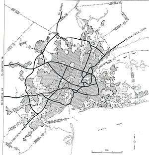
.svg.png)
What is now the easternmost part of I-280 was legislated as Route 25A in 1939. This route was a branch of Route 25 (US 1/9) that ran from Jersey City west through Kearny and Harrison across the Passaic River and into Newark, connecting with Route 21 and Clifton Avenue.[7] The William A. Stickel Memorial Bridge opened in 1949, with approaches stretching east to Harrison Avenue (now CR 508) in Harrison (crossing Cleveland Avenue and Hamilton Street at-grade) and west beyond Route 21 to Broad Street.[8] Route 25A was redesignated as Route 58 in the 1953 New Jersey state highway renumbering, and the next year an extension opened west beyond Clifton Avenue to Orange Street east of Duryea Street.[9][10]
Around the time the Stickel Bridge opened, the Essex Freeway was planned to connect US 46 in Morris County east to the New Jersey Turnpike in Hudson County, with the intention of alleviating traffic along Route 10.[11] During planning for the Interstate Highway System in the 1950s, the Bureau of Public Roads proposed an Interstate Highway along Route 3, to the north of Newark.[12] The New Jersey State Highway Department countered with the proposed Essex Freeway, which would run from I-80 to the New Jersey Turnpike (I-95) via the existing Route 58, saying that the Route 3 corridor "does not meet Interstate standards, and cannot be economically converted to such standards."[13] The Essex Freeway was selected as the interstate corridor, which was called FAI Corridor 105 before being designated I-280 in 1958.[13][14]
Construction progressed slowly, starting in 1960 near Orange. There were many obstacles that had to be overcome when constructing I-280. The first was whether to build the highway on an elevated or depressed alignment through urbanized areas of East Orange and Newark. Following opposition to the elevated option, it was decided to build I-280 on a depressed alignment through the area.[15][16] In addition, there was an issue of building the road across First Watchung Mountain in West Orange. A tunnel had initially been considered, although the expense of such a project caused this alternative to be rejected. Instead, a rock cut along a longer route was built through the mountain. Much of the material that was excavated from this section of I-280 and east was removed via a temporary rail line that was built in the center of the right-of-way west to I-80.[17][18]
The construction of I-280 destroyed a large part of the historic urban cores of Orange, East Orange, and Newark.[19] The Interstate passed through the historic downtown cores of East Orange and Orange, and many commercial buildings and historic Victorian homes were demolished in the process.[20][19]
I-280 fully opened west from Newark to I-80 in Parsippany-Troy Hills in 1973.[21] The portion of I-280 east of Newark was planned onto an alignment that would disrupt the fewest homes and would utilize existing railroad and utility right-of-way.[22] The section east from Newark to the New Jersey Turnpike was built in 1979-80.[23] In the 1966 plans, I-280 was to continue east to I-78 in Jersey City near the Holland Tunnel, following the CR 508 and Route 7 corridors; this was planned again in the 1970s but never built.[18][24]
In the 1990s, the Route 58 designation was officially removed from I-280 through Newark.[25][26] In 2001, the state determined the Stickel Bridge over the Passaic River and its approaches were structurally deficient and was going to need to be replaced after sections of it were falling apart.[4][27][28] Instead of replacing the bridge, in 2007 the NJDOT decided to rehabilitate it at a lower cost.[4] Reconstruction of the bridge was completed in April 2009 at a cost of $33 million.[29]
I-280, like many other highways in New Jersey, once had solar powered emergency call boxes every 1 mile (1.6 km), however with the advent of cell phones the usage of these call boxes became extremely limited. To save on maintenance costs, the NJDOT removed these call boxes in 2005.[30]
Exit list
| County | Location | mi[1] | km | Exit | Destinations | Notes |
|---|---|---|---|---|---|---|
| Morris | Parsippany-Troy Hills | 0.00 | 0.00 | – | Direct access to I-80 express lanes | |
| – | Westbound exit and eastbound entrance to I-80 local lanes | |||||
| 1.55 | 2.49 | 1 | No eastbound signage for US 46 | |||
| Essex | Roseland | 3.87 | 6.23 | 4 | Eisenhower Parkway (CR 609) | Split into exits 4A and 4B |
| 4.95 | 7.97 | 5 | Split into exits 5A and 5B | |||
| Livingston | 6.22 | 10.01 | 6 | Laurel Avenue (CR 634) | Split into exits 6A and 6B westbound | |
| West Orange | 7.49 | 12.05 | 7 | Pleasant Valley Way (CR 636) – Millburn, Verona | ||
| 8.23 | 13.24 | 8 | Split into exits 8A and 8B | |||
| 9.64 | 15.51 | 9 | Mount Pleasant Avenue (CR 660) – West Orange, Montclair | Eastbound exit and westbound entrance | ||
| 9.91 | 15.95 | 10 | Westbound exit and eastbound entrance | |||
| Orange | 10.61 | 17.08 | 11 | Center Street – Orange | Eastbound exit only | |
| 10.80 | 17.38 | 11B | Day Street / Essex Avenue – Orange | Westbound exit only | ||
| East Orange | 11.48 | 18.48 | 12A | Harrison Street, Clinton Street – East Orange | Exit 11A eastbound. No westbound signage for Harrison Street | |
| 12.32 | 19.83 | 12B | Toll plaza on ramp | |||
| Newark | 13.18 | 21.21 | 13 | 1st Street – Branch Brook Park | Eastbound exit and westbound entrance | |
| 13.40 | 21.57 | 13 | Orange Street / 6th Street | Westbound exit only | ||
| 13.74 | 22.11 | 14A | Clifton Avenue | No eastbound exit | ||
| 14.11 | 22.71 | 14B | Martin Luther King Boulevard – Broad Street Station, Rutgers University | Signed as exit 14 eastbound; no westbound entrance | ||
| 14.42 | 23.21 | 15A | Signed as exit 15 eastbound; no westbound entrance | |||
| 14.42 | 23.21 | 15B | Westbound exit and eastbound entrance | |||
| Passaic River | 14.53 | 23.38 | William A. Stickel Memorial Bridge | |||
| Hudson | Harrison | 14.92 | 24.01 | 16 | CR 508 – Harrison, Newark | |
| Kearny | 16.86 | 27.13 | 17 | Split into exits 17A and 17B | ||
| 17.05 | 27.44 | Exit 15W Toll Plaza | ||||
| 17.25 | 27.76 | 18 | Exit 15W on the Western Spur | |||
| 17.85 | 28.73 | Exit 15W on the Eastern Spur | ||||
1.000 mi = 1.609 km; 1.000 km = 0.621 mi
| ||||||
See also
 U.S. Roads portal
 New Jersey portal
- Route 25
- Route 25AD
References
- 1 2 3 4 5 6 7 8 9 10 11 12 13 14 15 16 17 18 19 New Jersey Department of Transportation. "Interstate 280 Straight Line Diagram" (PDF). New Jersey Department of Transportation. Retrieved January 6, 2010.
- 1 2 3 4 5 6 7 8 9 10 11 Google (January 6, 2010). "overview map of I-280" (Map). Google Maps. Google. Retrieved January 6, 2010.
- ↑ New Jersey Department of Transportation (2004). New Jersey Official Highway Map (Map). Trenton: New Jersey Department of Transportation.
- 1 2 3 Caldwell, Dave (May 27, 2007). "With Repairs and New Paint, a Bridge Is Getting Its Life Extended". The New York Times. Retrieved January 7, 2010.
- ↑ McNab, Matthew (July 24, 2012). "Designs for New Interstate 280 Exit Interchange in Harrison to Start Simulation Phase". Jersey Journal. Retrieved October 17, 2013.
- ↑ Harrison, NJ Interstate Route 280 Ramp Improvements Study (PDF) (Report). Jacobs Engineering Group. Retrieved November 22, 2013.
- ↑ ROUTE NO. 25A. Beginning at a point in State Highway Route No. 25 in Jersey City and extending via Jersey City, Kearny, Harrison, across the Passaic river at or near the present Bridge street bridge between the counties of Essex and Hudson to and connecting with State Highway Route No. 21 and Clifton avenue in Newark.
- ↑ "Newark Traffic Eased: Ramp From Stickel Bridge to Broad Street Is Opened". The New York Times. September 2, 1950. p. 12.
- ↑ New Jersey Department of Highways. "1953 renumbering". New Jersey Department of Highways. Retrieved July 31, 2009 – via Wikisource.
- ↑ "New Road Signs Ready in New Jersey". The New York Times. December 16, 1952. Retrieved July 20, 2009.
- ↑ Report on East–West and Route 10 Freeways and Connections (Report). New Jersey State Highway Department. 1948.
- ↑ Bureau of Public Roads (September 1955). "New York and Environs" (Map). General Location of National System of Interstate Highways Including All Additional Routes at Urban Areas Designated in September 1955. Scale not given. Washington, DC: Government Printing Office. p. 59. OCLC 4165975. Retrieved December 22, 2009.
- 1 2 New Jersey State Highway Department (1957). FAI 105 Interstate Highway Corridor: Recommendation Report (Report). New Jersey State Highway Department.
- ↑ Wright, George Cable (September 19, 1958). "New Roads with New Numbers Will Parallel Old U.S. Routes". The New York Times.
- ↑ Honig, Milton (April 1, 1959). "Depressed Road Backed in Essex". The New York Times.
- ↑ New Jersey State Assembly (March 2, 1961). Public Hearing on the Depression of Essex Freeway (Report). New Jersey State Assembly.
- ↑ Tri-State Transportation Commission (1962). Regional Highways: Status Report (Report). Tri-State Transportation Commission.
- 1 2 Tri-State Transportation Commission (1966). Transportation 1985: A Regional Plan (Report). Tri-State Transportation Commission.
- 1 2 Jacobs, Andrew (April 25, 1999). "Knocked Down, Yes. Knocked Out, Never. The Town of Orange, No Stranger to Bad News, Struggles to Make Sense of Police Shooting and Its Aftermath". The New York Times. Retrieved October 25, 2015.
- ↑ HANDS, Inc (April 2010). Heart of Orange Neighborhood Plan (PDF) (Report). HANDS, Inc. Retrieved October 25, 2015.
- ↑ "More Tieups for the Motorists: Impossible Task?". The New York Times. October 21, 1973. Retrieved January 7, 2010. (subscription required (help)).
- ↑ New Jersey Department of Transportation (1967). Interstate Route 280: Stickel Bridge to I-95 (Report). New Jersey Department of Transportation.
- ↑ State Farm Insurance; Rand McNally (1983). State Farm Road Atlas (Map). State Farm Insurance.
- ↑ Tri-State Regional Planning Commission (1975). Maintaining Mobility (Report). Tri-State Regional Planning Commission.
- ↑ New Jersey Department of Transportation (1990). "Route 58 Straight Line Diagram" (1990 ed.). New Jersey Department of Transportation.
- ↑ New Jersey Department of Transportation (1997). "Interstate 280 Straight Line Diagram" (1997 ed.). New Jersey Department of Transportation.
- ↑ Sterling, Guy (April 20, 2001). "State Looks To Fix the Stickel". The Star-Ledger.
- ↑ Sterling, Guy (May 2, 2001). "Elevated Route 280 Section Drops Chunks on Newark". The Star-Ledger.
- ↑ New Jersey Department of Transportation. "I-280 Stickel Bridge Rehabilitation & Reconstruction Overview, Construction Updates, Commuter Information". New Jersey Department of Transportation. Retrieved January 7, 2010.
- ↑ Barlas, Thomas (February 28, 2007). "Last Call for N.J.'s Roadside Call Boxes". The Press of Atlantic City.
External links
| Wikimedia Commons has media related to Interstate 280 (New Jersey). |
- An expanded view of road jurisdiction near the confluence of US 46, I-95 / NJTurnpike, I 280, NJ 7 and CR 508 in Kearny
- The Roads of Metro New York - Interstate 280 (New Jersey)
- New Jersey Roads: Interstate 280
- I-280 (Greater New York Roads)
| ||
