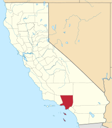
Politics of Los Angeles County
The Politics of Los Angeles County leans Democratic. Los Angeles County has voted Democratic in every Presidential election since 1988. Los Angeles County has voted for the Democratic candidate in most of the presidential elections in the past four decades, although it did vote twice for Dwight Eisenhower (1952, 1956), Richard Nixon (1968, 1972), and Ronald Reagan (1980, 1984) the latter two of whom were Californians. From 1920 to 1984 it could be considered as a reliable bellwether county which always voted for the eventual national winner. Los Angeles went against the overall national picture in 1988, 2000 and 2004. In 2008 and 2012 approximately 69% of the electorate voted for Democrat Barack Obama.
| Year | GOP | DEM | Others |
|---|---|---|---|
| 2012 | 27.8% 885,333 | 69.7% 2,216,903 | 2.5% 77,378 |
| 2008 | 28.8% 956,425 | 69.2% 2,295,853 | 2.0% 65,970 |
| 2004 | 35.6% 1,076,225 | 63.2% 1,907,736 | 1.3% 39,319 |
| 2000 | 32.4% 871,930 | 63.5% 1,710,505 | 4.2% 112,719 |
| 1996 | 31.0% 746,544 | 59.3% 1,430,629 | 9.7% 233,841 |
| 1992 | 29.0% 799,607 | 52.5% 1,446,529 | 18.4% 507,267 |
| 1988 | 46.9% 1,239,716 | 51.9% 1,372,352 | 1.2% 32,603 |
| 1984 | 54.5% 1,424,113 | 44.4% 1,158,912 | 1.1% 29,889 |
| 1980 | 50.2% 1,224,533 | 40.2% 979,830 | 9.7% 235,822 |
| 1976 | 47.8 1,174,926 | 49.7% 1,221,893 | 2.5% 62,258 |
| 1972 | 54.8% 1,549,717 | 42.0% 1,189,977 | 3.2% 90,676 |
| 1968 | 47.6% 1,266,480 | 46.0% 1,223,251 | 6.3% 168,251 |
| 1964 | 42.5% 1,161,067 | 57.4% 1,568,300 | 0.1% 1,551 |
| 1960 | 49.4% 1,302,661 | 50.2% 1,323,818 | 0.3% 8,020 |
| 1956 | 55.4% 1,260,206 | 44.3% 1,007,887 | 0.3% 7,331 |
| 1952 | 56.2% 1,278,407 | 42.7% 971,408 | 1.1% 24,725 |
| 1948 | 46.5% 804,232 | 47.0% 812,690 | 6.5% 112,160 |
| 1944 | 42.7% 666,441 | 56.8% 886,252 | 0.6% 8,871 |
| 1940 | 40.6% 574,266 | 58.1% 822,718 | 1.3% 18,285 |
| 1936 | 31.6% 357,401 | 67.0% 757,351 | 1.4% 15,663 |
| 1932 | 38.6% 373,738 | 57.2% 554,476 | 4.3% 41,380 |
| 1928 | 70.2% 513,526 | 28.7% 209,945 | 1.1% 7,830 |
| 1924 | 65.5% 299,675 | 7.3% 33,554 | 27.2% 124,228 |
| 1920 | 69.1% 178,117 | 21.6% 55,661 | 9.3% 23,992 |
Voter registration statistics
| Population and registered voters | ||
|---|---|---|
| Total population[1] | 9,787,747 | |
| Registered voters[2][note 1] | 4,865,403 | 49.7% |
| Democratic[2] | 2,486,479 | 51.1% |
| Republican[2] | 1,048,507 | 21.6% |
| Democratic–Republican spread[2] | +1,437,972 | +29.5% |
| Independent[2] | 109,055 | 2.2% |
| Green[2] | 24,534 | 0.5% |
| Libertarian[2] | 25,808 | 0.5% |
| Peace and Freedom[2] | 24,950 | 0.5% |
| Americans Elect[2] | 2,583 | 0.1% |
| Other[2] | 262,180 | 5.4% |
| No party preference[2] | 881,307 | 18.1% |
Congressional districts
In the United States House of Representatives, Los Angeles County is split between 18 congressional districts:[3]
- California's 23rd congressional district, represented by Republican Kevin McCarthy
- California's 25th congressional district, represented by Republican Steve Knight
- California's 26th congressional district, represented by Democrat Julia Brownley
- California's 27th congressional district, represented by Democrat Judy Chu
- California's 28th congressional district, represented by Democrat Adam Schiff
- California's 29th congressional district, represented by Democrat Tony Cárdenas
- California's 30th congressional district, represented by Democrat Brad Sherman
- California's 32nd congressional district, represented by Democrat Grace Napolitano
- California's 33rd congressional district, represented by Democrat Ted Lieu
- California's 34th congressional district, represented by Democrat Xavier Becerra
- California's 35th congressional district, represented by Democrat Norma Torres
- California's 37th congressional district, represented by Democrat Karen Bass
- California's 38th congressional district, represented by Democrat Linda Sánchez
- California's 39th congressional district, represented by Republican Ed Royce
- California's 40th congressional district, represented by Democrat Lucille Roybal-Allard
- California's 43rd congressional district, represented by Democrat Maxine Waters
- California's 44th congressional district, seat currently vacant and
- California's 47th congressional district, represented by Democrat Alan Lowenthal.
In the California State Senate, Los Angeles County is split between 15 legislative districts:[4]
- the 18th Senate District, represented by Democrat Robert Hertzberg,
- the 20th Senate District, represented by Democrat Connie Leyva,
- the 21st Senate District, represented by Republican Scott Wilk,
- the 22nd Senate District, represented by Democrat Ed Hernandez,
- the 23rd Senate District, represented by Republican Mike Morrell,
- the 24th Senate District, represented by Democrat Kevin de León,
- the 25th Senate District, represented by Democrat Anthony Portantino,
- the 26th Senate District, represented by Democrat Ben Allen,
- the 27th Senate District, represented by Democrat Henry Stern,
- the 29th Senate District, represented by Democrat Josh Newman,
- the 30th Senate District, represented by Democrat Holly Mitchell,
- the 32nd Senate District, represented by Democrat Tony Mendoza,
- the 33rd Senate District, represented by Democrat Ricardo Lara,
- the 34th Senate District, represented by Republican Janet Nguyen, and
- the 35th Senate District, represented by Democrat Steven Bradford.
In the California State Assembly, Los Angeles County is split between 24 legislative districts:[5]
- the 36th Assembly District, represented by Republican Tom Lackey,
- the 38th Assembly District, represented by Republican Dante Acosta,
- the 39th Assembly District, represented by Democrat Raul Bocanegra,
- the 41st Assembly District, represented by Democrat Chris Holden,
- the 43rd Assembly District, represented by Democrat Laura Friedman,
- the 44th Assembly District, represented by Democrat Jacqui Irwin,
- the 45th Assembly District, represented by Democrat Matt Dababneh,
- the 46th Assembly District, represented by Democrat Adrin Nazarian,
- the 48th Assembly District, represented by Democrat Blanca Rubio,
- the 49th Assembly District, represented by Democrat Ed Chau,
- the 50th Assembly District, represented by Democrat Richard Bloom,
- the 51st Assembly District, represented by Democrat Jimmy Gomez,
- the 52nd Assembly District, represented by Democrat Freddie Rodriguez,
- the 53rd Assembly District, represented by Democrat Miguel Santiago,
- the 54th Assembly District, represented by Democrat Sebastian Ridley-Thomas,
- the 55th Assembly District, represented by Republican Phillip Chen,
- the 57th Assembly District, represented by Democrat Ian Calderon,
- the 58th Assembly District, represented by Democrat Cristina Garcia,
- the 59th Assembly District, represented by Democrat Reggie Jones-Sawyer,
- the 62nd Assembly District, represented by Democrat Autumn Burke,
- the 63rd Assembly District, represented by Democrat Anthony Rendon,
- the 64th Assembly District, represented by Democrat Mike Gipson,
- the 66th Assembly District, represented by Democrat Al Muratsuchi, and
- the 70th Assembly District, represented by Democrat Patrick O'Donnell.
On November 4, 2008, Los Angeles County was almost evenly split over Proposition 8 which amended the California Constitution to ban same-sex marriages. The county voted for the amendment 50.1% with a margin of 2,385 votes.[6]
Cities by population and voter registration
| Cities by population and voter registration | |||||||
|---|---|---|---|---|---|---|---|
| City | Population[1] | Registered voters[2] [note 1] |
Democratic[2] | Republican[2] | D–R spread[2] | Other[2] | No party preference[2] |
| Agoura Hills | 20,353 | 70.3% | 40.1% | 33.8% | +6.3% | 11.5% | 17.4% |
| Alhambra | 83,301 | 45.4% | 47.4% | 19.1% | +28.3% | 10.9% | 24.4% |
| Arcadia | 55,993 | 53.7% | 28.4% | 34.2% | -5.8% | 10.1% | 28.9% |
| Artesia | 16,495 | 44.1% | 46.9% | 24.2% | +22.7% | 9.8% | 20.7% |
| Avalon | 3,690 | 46.6% | 38.7% | 34.9% | +3.8% | 12.0% | 17.1% |
| Azusa | 46,177 | 40.1% | 46.8% | 25.2% | +21.6% | 11.9% | 18.7% |
| Baldwin Park | 75,441 | 38.9% | 54.5% | 17.0% | +37.5% | 10.2% | 20.2% |
| Bell | 35,602 | 31.6% | 61.7% | 12.1% | +49.6% | 9.2% | 18.3% |
| Bell Gardens | 42,294 | 30.6% | 61.5% | 11.2% | +50.3% | 9.6% | 19.4% |
| Bellflower | 76,243 | 44.2% | 51.5% | 22.4% | +29.1% | 11.4% | 17.2% |
| Beverly Hills | 34,042 | 66.0% | 45.3% | 24.7% | +20.6% | 10.1% | 21.8% |
| Bradbury | 932 | 67.8% | 24.5% | 48.7% | -24.2% | 8.1% | 20.7% |
| Burbank | 103,037 | 59.4% | 44.2% | 26.7% | +17.5% | 12.5% | 19.0% |
| Calabasas | 22,839 | 67.8% | 43.2% | 31.0% | +12.2% | 10.9% | 17.2% |
| Carson | 91,508 | 58.3% | 60.7% | 14.8% | +45.9% | 8.5% | 17.8% |
| Cerritos | 49,281 | 64.8% | 39.6% | 28.5% | +11.1% | 8.5% | 25.0% |
| Claremont | 34,824 | 66.0% | 45.0% | 30.4% | +14.6% | 10.7% | 16.0% |
| Commerce | 12,791 | 49.0% | 67.0% | 11.0% | +56.0% | 8.5% | 15.0% |
| Compton | 96,102 | 47.2% | 73.0% | 6.8% | +66.2% | 9.2% | 12.8% |
| Covina | 47,662 | 53.6% | 42.5% | 32.5% | +10.0% | 11.4% | 16.4% |
| Cudahy | 23,846 | 28.1% | 61.9% | 11.6% | +50.3% | 9.7% | 18.1% |
| Culver City | 38,899 | 69.4% | 57.0% | 15.9% | +41.1% | 11.2% | 18.1% |
| Diamond Bar | 55,668 | 58.0% | 34.5% | 31.7% | +2.8% | 10.5% | 25.5% |
| Downey | 111,329 | 48.3% | 50.1% | 25.8% | +24.3% | 10.3% | 16.0% |
| Duarte | 21,363 | 55.9% | 47.6% | 26.5% | +21.1% | 9.9% | 18.3% |
| El Monte | 113,763 | 31.7% | 50.9% | 17.1% | +33.8% | 11.1% | 23.1% |
| El Segundo | 16,597 | 68.8% | 33.5% | 37.3% | -3.8% | 13.2% | 18.9% |
| Gardena | 58,743 | 51.8% | 62.8% | 15.5% | +47.3% | 8.5% | 15.0% |
| Glendale | 192,069 | 50.6% | 40.7% | 27.5% | +13.2% | 11.5% | 22.6% |
| Glendora | 50,000 | 63.6% | 30.1% | 46.0% | -15.9% | 10.7% | 16.1% |
| Hawaiian Gardens | 14,309 | 32.2% | 53.8% | 17.0% | +36.8% | 10.8% | 20.6% |
| Hawthorne | 84,293 | 42.8% | 61.7% | 13.3% | +48.4% | 10.6% | 16.4% |
| Hermosa Beach | 19,422 | 70.4% | 35.4% | 32.5% | +2.9% | 13.7% | 20.9% |
| Hidden Hills | 2,370 | 59.0% | 38.7% | 38.2% | +0.5% | 9.8% | 15.6% |
| Huntington Park | 58,465 | 28.5% | 64.1% | 11.0% | +53.1% | 9.4% | 17.1% |
| Industry | 518 | 19.7% | 25.5% | 53.9% | -28.4% | 16.7% | 9.8% |
| Inglewood | 109,967 | 49.8% | 74.1% | 6.1% | +68.0% | 8.6% | 12.8% |
| Irwindale | 1,525 | 61.0% | 62.4% | 15.5% | +46.9% | 10.1% | 15.0% |
| La Cañada Flintridge | 20,248 | 73.2% | 30.0% | 46.1% | -16.1% | 8.5% | 17.2% |
| La Habra Heights | 5,304 | 72.9% | 23.1% | 53.5% | -30.4% | 9.8% | 16.0% |
| La Mirada | 48,363 | 57.0% | 38.2% | 37.9% | +0.3% | 10.2% | 16.3% |
| La Puente | 39,957 | 39.5% | 58.6% | 15.9% | +42.7% | 9.9% | 17.5% |
| La Verne | 31,139 | 66.5% | 34.4% | 43.0% | -8.6% | 10.3% | 14.9% |
| Lakewood | 79,994 | 60.7% | 44.5% | 30.9% | +13.6% | 10.9% | 16.4% |
| Lancaster | 152,678 | 46.0% | 39.9% | 35.4% | +4.5% | 14.4% | 14.2% |
| Lawndale | 32,652 | 40.8% | 54.0% | 17.8% | +36.2% | 11.5% | 19.1% |
| Lomita | 20,246 | 56.4% | 41.8% | 32.1% | +9.7% | 11.6% | 17.2% |
| Long Beach | 462,197 | 54.2% | 51.5% | 21.1% | +30.4% | 13.2% | 16.6% |
| Los Angeles | 3,782,544 | 48.0% | 56.1% | 15.9% | +40.2% | 12.1% | 18.0% |
| Lynwood | 69,818 | 34.7% | 66.5% | 9.4% | +57.1% | 9.4% | 16.4% |
| Malibu | 12,746 | 72.3% | 42.2% | 29.4% | +12.8% | 11.9% | 19.1% |
| Manhattan Beach | 34,986 | 72.1% | 35.8% | 37.8% | -2.0% | 11.0% | 17.7% |
| Maywood | 27,454 | 30.4% | 62.3% | 10.1% | +52.2% | 9.1% | 19.8% |
| Monrovia | 36,622 | 56.9% | 41.4% | 32.2% | +9.2% | 11.2% | 17.7% |
| Montebello | 62,470 | 47.1% | 59.0% | 16.7% | +42.3% | 9.2% | 16.7% |
| Monterey Park | 60,251 | 46.3% | 44.7% | 19.0% | +25.7% | 9.3% | 28.5% |
| Norwalk | 105,348 | 45.1% | 54.3% | 19.9% | +34.4% | 10.1% | 17.8% |
| Palmdale | 149,001 | 45.2% | 44.5% | 30.6% | +13.9% | 13.1% | 15.2% |
| Palos Verdes Estates | 13,412 | 77.1% | 25.4% | 51.6% | -26.2% | 8.7% | 16.4% |
| Paramount | 54,196 | 36.4% | 61.3% | 13.5% | +47.8% | 10.3% | 16.8% |
| Pasadena | 136,807 | 58.2% | 49.7% | 23.2% | +26.5% | 11.5% | 17.7% |
| Pico Rivera | 63,004 | 51.5% | 61.9% | 15.8% | +46.1% | 8.5% | 15.4% |
| Pomona | 148,946 | 39.3% | 52.1% | 20.2% | +31.9% | 12.3% | 17.6% |
| Rancho Palos Verdes | 41,575 | 69.4% | 31.7% | 42.8% | -11.1% | 9.1% | 18.4% |
| Redondo Beach | 66,397 | 66.6% | 38.0% | 31.4% | +6.6% | 13.4% | 19.8% |
| Rolling Hills | 1,790 | 85.9% | 19.3% | 57.1% | -37.8% | 10.2% | 16.3% |
| Rolling Hills Estates | 8,040 | 74.6% | 28.1% | 49.9% | -21.8% | 8.2% | 15.5% |
| Rosemead | 53,725 | 38.5% | 45.2% | 17.4% | +27.8% | 11.5% | 28.2% |
| San Dimas | 33,523 | 64.4% | 34.2% | 41.7% | -7.5% | 11.0% | 16.0% |
| San Fernando | 23,638 | 38.6% | 60.9% | 12.5% | +48.4% | 11.1% | 17.2% |
| San Gabriel | 39,703 | 41.8% | 41.4% | 22.8% | +18.6% | 10.8% | 26.8% |
| San Marino | 13,131 | 67.9% | 22.7% | 42.1% | -19.4% | 7.8% | 28.9% |
| Santa Clarita | 173,993 | 60.4% | 33.7% | 40.8% | -7.1% | 12.1% | 16.5% |
| Santa Fe Springs | 16,333 | 58.5% | 57.5% | 20.5% | +37.0% | 8.7% | 15.3% |
| Santa Monica | 89,153 | 72.9% | 53.7% | 15.4% | +38.3% | 13.5% | 19.6% |
| Sierra Madre | 10,881 | 75.8% | 38.0% | 36.8% | +1.2% | 11.0% | 16.7% |
| Signal Hill | 10,842 | 56.5% | 50.7% | 21.6% | +29.1% | 12.9% | 17.6% |
| South El Monte | 20,197 | 35.7% | 57.9% | 13.4% | +44.5% | 9.2% | 21.4% |
| South Gate | 94,586 | 37.7% | 62.6% | 12.5% | +50.1% | 9.2% | 17.3% |
| South Pasadena | 25,465 | 65.4% | 45.6% | 24.1% | +21.5% | 11.6% | 20.8% |
| Temple City | 35,372 | 50.7% | 35.3% | 28.4% | +6.9% | 10.6% | 27.7% |
| Torrance | 144,622 | 58.2% | 37.1% | 35.5% | +1.6% | 10.3% | 19.3% |
| Vernon | 112[7] | 69.6% | 23.1% | 32.1% | -9.0% | 26.9% | 23.1% |
| Walnut | 29,269 | 62.2% | 33.2% | 28.0% | +5.2% | 10.3% | 30.3% |
| West Covina | 105,810 | 51.0% | 46.7% | 25.9% | +20.8% | 10.8% | 18.9% |
| West Hollywood | 34,564 | 76.3% | 60.5% | 9.9% | +50.6% | 12.9% | 18.8% |
| Westlake Village | 8,276 | 77.3% | 31.9% | 42.1% | -10.2% | 11.6% | 16.8% |
| Whittier | 85,161 | 54.2% | 44.1% | 33.2% | +10.9% | 10.4% | 14.8% |
See also
Notes
References
- 1 2 U.S. Census Bureau. American Community Survey, 2011 American Community Survey 5-Year Estimates, Table B02001. American FactFinder. Retrieved 2013-10-26.
- 1 2 3 4 5 6 7 8 9 10 11 12 13 14 15 16 17 "February 10, 2013 - Report of Registration" (PDF). California Secretary of State. Archived from the original (PDF) on 3 November 2013. Retrieved October 31, 2013.
- ↑ "Counties by County and by District". California Citizens Redistricting Commission. Retrieved September 24, 2014.
- ↑ "Communities of Interest — County". California Citizens Redistricting Commission. Retrieved September 28, 2014.
- ↑ "Communities of Interest — County". California Citizens Redistricting Commission. Retrieved September 28, 2014.
- ↑ Bowen, Debra. "Statement of Vote: 2008 General Election" (PDF). Archived from the original (PDF) on 2 November 2012.
- ↑ U.S. Census Bureau. 2010 Census Summary File 1, Table P1. American FactFinder. Retrieved October 31, 2013.
Population - 12,874,797 | ||
| Counties |  | |
| Major city 3.8 million | ||
| Cities over 250K | ||
| Cities and towns 100k-250k | ||
| Bodies of water | ||
| Regions |
| |