Kansas
| State of Kansas | |||||
|---|---|---|---|---|---|
| |||||
|
Nickname(s): The Sunflower State (official); The Wheat State; The Free State[1] | |||||
| Motto(s): Ad astra per aspera (Latin for To the stars through difficulties) | |||||
| State song(s): "Home on the Range" | |||||
 | |||||
| Official language | English[2] | ||||
| Demonym | Kansan | ||||
| Capital | Topeka | ||||
| Largest city | Wichita | ||||
| Largest metro | Kansas City metropolitan area | ||||
| Area | |||||
| • Total |
82,278[3] sq mi (213,100 km2) | ||||
| • Width | 410[4] miles (660 km) | ||||
| • Length | 213[4] miles (343 km) | ||||
| • % water | 0.6[5] | ||||
| • Latitude | 37° N to 40° N | ||||
| • Longitude | 94° 35′ W to 102° 3′ W | ||||
| Population | |||||
| • Total | 2,911,641 (2015 est)[6] | ||||
| • Density |
35.1/sq mi (13.5/km2) Ranked 40th | ||||
| • Median household income | $50,177 (25th) | ||||
| Elevation | |||||
| • Highest point |
Mount Sunflower[7][8] 4,041 ft (1232 m) | ||||
| • Mean | 2,000 ft (610 m) | ||||
| • Lowest point |
Verdigris River at Oklahoma border[7][8] 679 ft (207 m) | ||||
| Before statehood | Kansas Territory | ||||
| Admission to Union | January 29, 1861 (34th) | ||||
| Governor | Sam Brownback (R) | ||||
| Lieutenant Governor | Jeff Colyer (R) | ||||
| Legislature | |||||
| • Upper house | Senate | ||||
| • Lower house | House of Representatives | ||||
| U.S. Senators |
Pat Roberts (R) Jerry Moran (R) | ||||
| U.S. House delegation |
Tim Huelskamp (R) Lynn Jenkins (R) Kevin Yoder (R) Mike Pompeo (R) (list) | ||||
| Time zones |
| ||||
| • Majority of state | Central: UTC −6/−5 | ||||
| • 4 western counties (Hamilton, Greeley, Wallace, and Sherman) | Mountain: UTC −7/−6 | ||||
| ISO 3166 | US-KS | ||||
| Abbreviations | KS, Kan. | ||||
| Website |
www | ||||
| Kansas state symbols | |
|---|---|
|
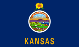
The Flag of Kansas | |
|
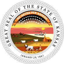
The Seal of Kansas | |
| Living insignia | |
| Amphibian | Barred tiger salamander |
| Bird | Western meadowlark |
| Flower | Wild sunflower |
| Grass | Little bluestem |
| Insect | Western honey bee |
| Mammal | American bison |
| Reptile | Ornate box turtle |
| Tree | Plains cottonwood |
| Inanimate insignia | |
| Motto | Ad astra per aspera (Latin for To the stars through difficulties) |
| Soil | Harney silt loam (unofficial) |
| Song | "Home on the Range" |
| State route marker | |
 | |
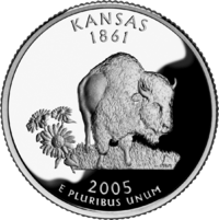
| State quarter | |
|
Released in 2005 | |
| Lists of United States state symbols | |
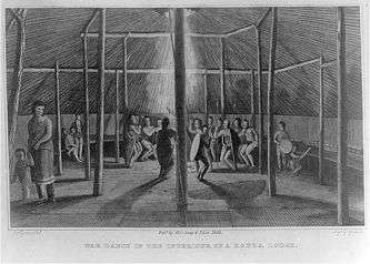
Kansas ![]() i/ˈkænzəs/ is a U.S. state located in the Midwestern United States.[9] Its capital is Topeka and its largest city is Wichita. Kansas is named after the Kansa Native American tribe, which inhabited the area.[10] The tribe's name (natively kką:ze) is often said to mean "people of the wind" or "people of the south wind", although this was probably not the term's original meaning.[11][12] For thousands of years, what is now Kansas was home to numerous and diverse Native American tribes. Tribes in the eastern part of the state generally lived in villages along the river valleys. Tribes in the western part of the state were semi-nomadic and hunted large herds of bison.
i/ˈkænzəs/ is a U.S. state located in the Midwestern United States.[9] Its capital is Topeka and its largest city is Wichita. Kansas is named after the Kansa Native American tribe, which inhabited the area.[10] The tribe's name (natively kką:ze) is often said to mean "people of the wind" or "people of the south wind", although this was probably not the term's original meaning.[11][12] For thousands of years, what is now Kansas was home to numerous and diverse Native American tribes. Tribes in the eastern part of the state generally lived in villages along the river valleys. Tribes in the western part of the state were semi-nomadic and hunted large herds of bison.
Kansas was first settled by European Americans in 1812, in what is the now Bonner Springs, Kansas,[13] but the pace of settlement accelerated in the 1850s, in the midst of political wars over the slavery issue. When it was officially opened to settlement by the U.S. government in 1854, abolitionist Free-Staters from New England and pro-slavery settlers from neighboring Missouri rushed to the territory to determine whether Kansas would become a free state or a slave state. Thus, the area was a hotbed of violence and chaos in its early days as these forces collided, and was known as Bleeding Kansas. The abolitionists eventually prevailed, and on January 29, 1861,[14][15] Kansas entered the Union as a free state. After the Civil War, the population of Kansas grew rapidly when waves of immigrants turned the prairie into farmland.
Today, Kansas is one of the most productive agricultural states, producing high yields of wheat, corn, sorghum, and soybeans.[16] Kansas with its 213,000 km2 is the 15th most extensive and with its about 2.9 million people the 34th most populous of the 50 United States. Residents of Kansas are called "Kansans", officially. Mount Sunflower is Kansas's highest point at 1232 m.
History
For millennia, the land that is currently Kansas was inhabited by Native Americans. The first European to set foot in present-day Kansas was Francisco Vázquez de Coronado, who explored the area in 1541. In 1803, most of modern Kansas was secured by the United States as part of the Louisiana Purchase. Southwest Kansas, however, was still a part of Spain, Mexico and the Republic of Texas until the conclusion of the Mexican–American War in 1848. From 1812 to 1821, Kansas was part of the Missouri Territory. The Santa Fe Trail traversed Kansas from 1821 to 1880, transporting manufactured goods from Missouri and silver and furs from Santa Fe, New Mexico. Wagon ruts from the trail are still visible in the prairie today.
In 1827, Fort Leavenworth became the first permanent settlement of white Americans in the future state. The Kansas–Nebraska Act became law on May 30, 1854, establishing the U.S. territories of Nebraska and Kansas, and opening the area to broader settlement by whites. Kansas Territory stretched all the way to the Continental Divide and included the sites of present-day Denver, Colorado Springs, and Pueblo.

Missouri and Arkansas sent settlers into Kansas all along its eastern border. These settlers attempted to sway votes in favor of slavery. The secondary settlement of Americans in Kansas Territory were abolitionists from Massachusetts and other Free-Staters, who attempted to stop the spread of slavery from neighboring Missouri. Directly presaging the American Civil War, these forces collided, entering into skirmishes that earned the territory the name of Bleeding Kansas.
Kansas was admitted to the United States as a free state on January 29, 1861, making it the 34th state to enter the Union. By that time the violence in Kansas had largely subsided, but during the Civil War, on August 21, 1863, William Quantrill led several hundred men on a raid into Lawrence, destroying much of the city and killing nearly 200 people. He was roundly condemned by both the conventional Confederate military and the partisan rangers commissioned by the Missouri legislature. His application to that body for a commission was flatly rejected due to his pre-war criminal record.[17]
After the Civil War, many veterans constructed homesteads in Kansas. Many African Americans also looked to Kansas as the land of "John Brown" and, led by freedmen like Benjamin "Pap" Singleton, began establishing black colonies in the state. Leaving southern states in the late 1870s because of increasing discrimination, they became known as Exodusters.
At the same time, the Chisholm Trail was opened and the Wild West-era commenced in Kansas. Wild Bill Hickok was a deputy marshal at Fort Riley and a marshal at Hays and Abilene. Dodge City was another wild cowboy town, and both Bat Masterson and Wyatt Earp worked as lawmen in the town. In one year alone, 8 million head of cattle from Texas boarded trains in Dodge City bound for the East, earning Dodge the nickname "Queen of the Cowtowns."
In response to demands of Methodists and other evangelical Protestants, in 1881 Kansas became the first U.S. state to adopt a constitutional amendment prohibiting all alcoholic beverages, which was only repealed in 1948.
Geography
.jpg)


Kansas is bordered by Nebraska on the north; Missouri on the east; Oklahoma on the south; and Colorado on the west. The state is divided into 105 counties with 628 cities, and is located equidistant from the Pacific and Atlantic oceans. The geographic center of the 48 contiguous states is located in Smith County near Lebanon. Until 1989, the Meades Ranch Triangulation Station in Osborne County was the geodetic center of North America: the central reference point for all maps of North America. The geographic center of Kansas is located in Barton County.
Geology
Kansas is underlain by a sequence of horizontal to gently westward dipping sedimentary rocks. A sequence of Mississippian, Pennsylvanian and Permian rocks outcrop in the eastern and southern part of the state. The western half of the state has exposures of Cretaceous through Tertiary sediments, the latter derived from the erosion of the uplifted Rocky Mountains to the west. These are underlain by older Paleozoic and Mesozoic sediments which correlate well with the outcrops to the east. The northeastern corner of the state was subjected to glaciation in the Pleistocene and is covered by glacial drift and loess.
Topography
The western two-thirds of the state, lying in the great central plain of the United States, has a generally flat or undulating surface, while the eastern third has many hills and forests. The land gradually rises from east to west; its altitude ranges from 684 ft (208 m) along the Verdigris River at Coffeyville in Montgomery County, to 4,039 ft (1,231 m) at Mount Sunflower, one half mile from the Colorado border, in Wallace County. It is a popular belief that Kansas is the flattest state in the nation, reinforced by a well known 2003 tongue-in-cheek study[18] stating that Kansas was indeed "flatter than a pancake".[19] This has since been called into question, with most scientists ranking Kansas somewhere between 20th and 30th flattest state, depending on measurement method. Its average elevation is 2,000 feet, higher than that of 36 states.[20]
Rivers

Nearly 75 mi (121 km) of the state's northeastern boundary is defined by the Missouri River. The Kansas River (locally known as the Kaw), formed by the junction of the Smoky Hill and Republican rivers at appropriately-named Junction City, joins the Missouri River at Kansas City, after a course of 170 mi (270 km) across the northeastern part of the state.
The Arkansas River (pronunciation varies), rising in Colorado, flows with a bending course for nearly 500 mi (800 km) across the western and southern parts of the state. With its tributaries, (the Little Arkansas, Ninnescah, Walnut, Cow Creek, Cimarron, Verdigris, and the Neosho), it forms the southern drainage system of the state.
Kansas' other rivers are the Saline and Solomon Rivers, tributaries of the Smoky Hill River; the Big Blue, Delaware, and Wakarusa, which flow into the Kansas River; and the Marais des Cygnes, a tributary of the Missouri River. Spring River is located between Riverton, Kansas, and Baxter Springs, Kansas.
National parks and historic sites
Areas under the protection of the National Park Service include:[21]
- Brown v. Board Of Education National Historic Site in Topeka
- California National Historic Trail
- Fort Larned National Historic Site in Larned
- Fort Scott National Historic Site
- Lewis and Clark National Historic Trail
- Nicodemus National Historic Site at Nicodemus
- Oregon National Historic Trail
- Pony Express National Historic Trail
- Santa Fe National Historic Trail
- Tallgrass Prairie National Preserve near Strong City
Climate


According to the Köppen climate classification the climate of Kansas can be characterized in terms of three types: it has humid continental, semi-arid steppe, and humid subtropical. The eastern two-thirds of the state (especially the northeastern portion) has a humid continental climate, with cool to cold winters and hot, often humid summers. Most of the precipitation falls in the summer and spring.
The western third of the state – from roughly the U.S. Route 83 corridor westward – has a semiarid steppe climate. Summers are hot, often very hot, and generally less humid. Winters are highly changeable between warm and very cold. The western region receives an average of about 16 inches (410 mm) of precipitation per year. Chinook winds in the winter can warm western Kansas all the way into the 80 °F (27 °C) range.
The far south-central and southeastern reaches of the state, including Wichita, have a humid subtropical climate with hot, humid summers, milder winters and more precipitation than elsewhere in Kansas. Some features of all three climates can be found in most of the state, with droughts and changeable weather between dry and humid not uncommon, and both warm and cold spells in the winter.
Temperatures in areas between US 83 and U.S. Route 81, as well as the southwestern portion of the state along and south of U.S. Route 50, reach 100 °F (38 °C) or above on most days of June, July and August. High humidity added to the high temperatures sends the heat index into life-threatening territory, especially in Wichita, Hutchinson, Salina, Russell, Hays and Great Bend. Temperatures are often higher in Dodge City, Garden City and Liberal, but the heat index in those locations is usually lower than the actual air temperature.
Although temperatures of 100 degrees or higher are not as common in areas east of US 81, higher humidity and the urban heat island effect lead most summer days to heat indices between 107 °F (42 °C) and 114 °F (46 °C) in Topeka, Lawrence and the Kansas City metropolitan area. During the summer, nightly low temperatures in the northeastern part of the state, especially in the aforementioned large cities, struggle to fall below 80 °F (27 °C), and combined with humidity between 85 and 95 percent, dangerous heat indices can be experienced at every hour of the day.
Precipitation ranges from about 47 inches (1,200 mm) annually in the southeast corner of the state, to about 16 inches (410 mm) in the southwest. Snowfall ranges from around 5 inches (130 mm) in the fringes of the south, to 35 inches (890 mm) in the far northwest. Frost-free days range from more than 200 days in the south, to 130 days in the northwest. Thus, Kansas is the ninth or tenth sunniest state in the country, depending on the source. Western Kansas is as sunny as California and Arizona.
Kansas is prone to severe weather, especially in the spring and early summer. Despite the frequent sunshine throughout much of the state, due to its location at a climatic boundary prone to intrusions of multiple air masses, the state is vulnerable to strong and severe thunderstorms. Some of these storms become supercell thunderstorms; these can spawn tornadoes, occasionally of EF3 strength or higher. Kansas averages over 50 tornadoes annually.[22] Severe thunderstorms sometimes drop very large hail over Kansas as well as bringing flash flooding and damaging straight line winds.
According to NOAA, the all-time highest temperature recorded in Kansas is (121 °F or 49.4 °C) on July 24, 1936, near Alton in Osborne County, and the all-time low is −40 °F (−40 °C) on February 13, 1905, near Lebanon in Smith County. Alton and Lebanon are approximately 50 miles (80 km) apart.
Kansas's record high of 121 °F (49.4 °C) ties with North Dakota for the fifth-highest record high in an American state, behind California (134 °F or 56.7 °C), Arizona (128 °F or 53.3 °C), Nevada (125 °F or 51.7 °C), and New Mexico (122 °F or 50 °C).
| Monthly Normal High and Low Temperatures For Various Kansas Cities | ||||||||||||
| City | Jan | Feb | Mar | Apr | May | Jun | Jul | Aug | Sep | Oct | Nov | Dec |
|---|---|---|---|---|---|---|---|---|---|---|---|---|
| Concordia | 36/17 | 43/22 | 54/31 | 64/41 | 74/52 | 85/62 | 91/67 | 88/66 | 80/56 | 68/44 | 51/30 | 40/21 |
| Dodge City | 41/19 | 48/24 | 57/31 | 67/41 | 76/52 | 87/62 | 93/67 | 91/66 | 82/56 | 70/44 | 55/30 | 44/22 |
| Goodland | 39/16 | 45/20 | 53/26 | 63/35 | 72/46 | 84/56 | 89/61 | 87/60 | 78/50 | 66/38 | 50/25 | 41/18 |
| Topeka | 37/17 | 44/23 | 55/33 | 66/43 | 75/53 | 84/63 | 89/68 | 88/65 | 80/56 | 69/44 | 53/32 | 41/22 |
| Wichita | 40/20 | 47/25 | 57/34 | 67/44 | 76/54 | 87/64 | 93/69 | 92/68 | 82/59 | 70/47 | 55/34 | 43/24 |
| Sources:[23][24][25][26][27] | ||||||||||||
Demographics

The United States Census Bureau estimates that the population of Kansas was 2,911,641 on July 1, 2015, a 2.05% increase since the 2010 United States Census[6] and an increase of 58,523, or 2.05%, since the year 2010.[6] This includes a natural increase since the last census of 93,899 people (that is 246,484 births minus 152,585 deaths) and a decrease due to net migration of 20,742 people out of the state. Immigration from outside the United States resulted in a net increase of 44,847 people, and migration within the country produced a net loss of 65,589 people.[28]
The population density of Kansas is 52.9 people per square mile.[29] The center of population of Kansas is located in Chase County, at 38°27′N 96°32′W / 38.450°N 96.533°W, approximately three miles north of the community of Strong City.[30]
| Historical population | |||
|---|---|---|---|
| Census | Pop. | %± | |
| 1860 | 107,206 | — | |
| 1870 | 364,399 | 239.9% | |
| 1880 | 996,096 | 173.4% | |
| 1890 | 1,428,108 | 43.4% | |
| 1900 | 1,470,495 | 3.0% | |
| 1910 | 1,690,949 | 15.0% | |
| 1920 | 1,769,257 | 4.6% | |
| 1930 | 1,880,999 | 6.3% | |
| 1940 | 1,801,028 | −4.3% | |
| 1950 | 1,905,299 | 5.8% | |
| 1960 | 2,178,611 | 14.3% | |
| 1970 | 2,246,578 | 3.1% | |
| 1980 | 2,363,679 | 5.2% | |
| 1990 | 2,477,574 | 4.8% | |
| 2000 | 2,688,418 | 8.5% | |
| 2010 | 2,853,118 | 6.1% | |
| Est. 2015 | 2,911,641 | 2.1% | |
| 1910–2010[31] 2015 Estimate[6] | |||
Race and ethnicity
According to the 2010 Census, the racial makeup of the population was:
- 83.8% of the population was White American (77.5% non-Hispanic white)
- 5.9% was Black or African American
- 1.0% American Indian and Alaska Native
- 2.4% Asian American
- 0.1% Native Hawaiian and other Pacific Islander
- 3.0% from two or more races.
Ethnically 10.5% of the total population was of Hispanic or Latino origin (they may be of any race).[32]
| Racial composition | 1990[33] | 2000[34] | 2010[35] |
|---|---|---|---|
| White | 90.1% | 86.1% | 83.8% |
| Black | 5.8% | 5.8% | 5.9% |
| Asian | 1.3% | 1.7% | 2.4% |
| Native | 0.9% | 0.9% | 1.0% |
| Native Hawaiian and other Pacific Islander | - | - | 0.1% |
| Other race | 2.0% | 3.4% | 3.9% |
| Two or more races | - | 2.1% | 3.0% |
As of 2004, the population included 149,800 foreign-born (5.5% of the state population). The ten largest reported ancestry groups, which account for over 85% of the population, in the state are: German (33.75%), Irish (14.4%), English (14.1%), American (7.5%), French (4.4%), Scottish (4.2%), Dutch (2.5%), Swedish (2.4%), Italian (1.8%), and Polish (1.5%).[36] German descendants are especially present in the northwest, while those of descendants of English and of white Americans from other states are especially present in the southeast.
Mexicans are present in the southwest and make up nearly half the population in certain counties. Many African Americans in Kansas are descended from the Exodusters, newly freed blacks who fled the South for land in Kansas following the Civil War.
As of 2011, 35.0% of Kansas' population younger than one year of age belonged to minority groups (i.e., did not have two parents of non-Hispanic white ancestry).[37]
Language
Spanish is the second-most-spoken language in Kansas, after English .
Religion
The 2014 Pew Religious Landscape Survey showed the religious makeup of Kansas was as follows:[38]
- Christian 76%,
- 31% Evangelical Protestant
- 24% Mainline Protestant
- 2% Black Protestant
- 18% Catholic
- 1% Mormon
- 1% Jehovah's Witness
- Non-Christian faiths 4%
- Unaffiliated 20%

As of 2010, the Association of Religion Data Archives (ARDA) reported that the Catholic Church has the highest number of adherents in Kansas (at 426,611), followed by the United Methodist Church with 202,989 members, and the Southern Baptist Convention, reporting 99,329 adherents.[39]
Kansas's capital Topeka is sometimes cited as the home of Pentecostalism as it was the site of Charles Fox Parham's Bethel Bible College, where glossolalia was first claimed as the evidence of a spiritual experience referred to as the baptism of the Holy Spirit in 1901. It is also the home of Reverend Charles Sheldon, author of In His Steps, and was the site where the famous question "What would Jesus do?" originated in a sermon of Sheldon's at Central Congregational Church.
Topeka is also home of the Westboro Baptist Church, a hate group according to the Southern Poverty Law Center.[40] The church has garnered worldwide media attention for picketing the funerals of U.S. servicemen and women for what church members claim as "necessary to combat the fight for equality for gays and lesbians." They have sometimes successfully raised lawsuits against the city of Topeka.
Rural flight
|

Known as rural flight, the last few decades have been marked by a migratory pattern out of the countryside into cities. Out of all the cities in these Midwestern states, 89% have fewer than 3,000 people, and hundreds of those have fewer than 1,000. In Kansas alone, there are more than 6,000 ghost towns and dwindling communities,[41] according to one Kansas historian, Daniel C. Fitzgerald. At the same time, some of the communities in Johnson County (metropolitan Kansas City) are among the fastest-growing in the country.
Important cities and towns
| City | Population* | Growth rate** | Metro area | |
|---|---|---|---|---|
| 1 | Wichita | 388,143 | 1.58% | Wichita |
| 2 | Overland Park | 184,525 | 6.43% | Kansas City, MO-KS |
| 3 | Kansas City | 149,636 | 2.64% | Kansas City |
| 4 | Olathe | 133,062 | 5.71% | Kansas City |
| 5 | Topeka | 127,215 | -0.20% | Topeka |
| 6 | Lawrence | 92,763 | 5.84% | Lawrence |
| 7 | Shawnee | 64,599 | 3.84% | Kansas City |
| 8 | Manhattan | 56,078 | 7.26% | Manhattan |
| 9 | Lenexa | 51,042 | 5.92% | Kansas City |
| 10 | Salina | 47,867 | 0.34% | ‡ |
| 11 | Hutchinson | 41,642 | −1.04% | ‡ |
| 12 | Leavenworth | 36,000 | 2.12% | Kansas City |
| 13 | Leawood | 34,395 | 7.93% | Kansas City |
| 14 | Dodge City | 28,117 | 2.84% | ‡ |
| 15 | Garden City | 27,004 | 1.30% | ‡ |
| 16 | Junction City | 24,665 | 5.62% | Manhattan |
| 17 | Emporia | 24,560 | -1.43% | ‡ |
| 18 | Derby | 23,234 | 4.86% | Wichita |
| 19 | Prairie Village | 21,877 | 2.00% | Kansas City |
| 20 | Hays | 21,044 | 2.60% | ‡ |
| 21 | Liberal | 21,012 | 2.37% | ‡ |
| 22 | Gardner | 20,667 | 8.07% | Kansas City |
| 23 | Pittsburg | 20,394 | 0.80% | ‡ |
| 24 | Newton | 19,120 | -0.06% | Wichita |
| 25 | Great Bend | 15,840 | −0.97% | ‡ |
| *2014 Estimate[42] **Growth rate 2010–2014 ‡Defined as a micropolitan area | ||||
Kansas has 627 incorporated cities. By state statute, cities are divided into three classes as determined by the population obtained "by any census of enumeration." A city of the third class has a population of less than 5,000, but cities reaching a population of more than 2,000 may be certified as a city of the second class. The second class is limited to cities with a population of less than 25,000, and upon reaching a population of more than 15,000, they may be certified as a city of the first class. First and second class cities are independent of any township and are not included within the township's territory.
Northeast Kansas
The northeastern portion of the state, extending from the eastern border to Junction City and from the Nebraska border to south of Johnson County is home to more than 1.5 million people in the Kansas City (Kansas portion), Manhattan, Lawrence, and Topeka metropolitan areas. Overland Park, a young city incorporated in 1960, has the largest population and the largest land area in the county. It is home to Johnson County Community College and the corporate campus of Sprint Nextel, the largest private employer in the metro area. In 2006, the city was ranked as the 6th best place to live in America; the neighboring city of Olathe was 13th.[43]
Olathe is the county seat and home to Johnson County Executive Airport. The cities of Olathe, Shawnee, and Gardner have some of the state's fastest growing populations. The cities of Overland Park, Lenexa, Olathe, and Gardner are also notable because they lie along the former route of the Santa Fe Trail. Among cities with at least one thousand residents, Mission Hills has the highest median income in the state.
Several institutions of higher education are located in Northeast Kansas including Baker University (the oldest university in the state, founded in 1858 and affiliated with the United Methodist Church) in Baldwin City, Benedictine College (sponsored by St. Benedict's Abbey and Mount St. Scholastica Monastery and formed from the merger of St. Benedict's College (1858) and Mount St. Scholastica College (1923)) in Atchison, MidAmerica Nazarene University in Olathe, Ottawa University in Ottawa and Overland Park, Kansas City Kansas Community College and KU Medical Center in Kansas City, and KU Edwards Campus in Overland Park. Less than an hour's drive to the west, Lawrence is home to the University of Kansas, the largest public university in the state, and Haskell Indian Nations University.
To the north, Kansas City, with the second largest land area in the state, contains a number of diverse ethnic neighborhoods. Its attractions include the Kansas Speedway, Sporting Kansas City, Kansas City T-Bones, Schlitterbahn, and The Legends at Village West retail and entertainment center. Nearby, Kansas's first settlement Bonner Springs, Kansas [13] is home to several national and regional attractions including the Providence Medical Center Amphitheather, the National Agricultural Center and Hall of Fame, and the annual Kansas City Renaissance Festival. Further up the Missouri River, the city of Lansing is the home of the state's first maximum-security prison. Historic Leavenworth, founded in 1854, was the first incorporated city in Kansas. North of the city, Fort Leavenworth is the oldest active Army post west of the Mississippi River. The city of Atchison was an early commercial center in the state and is well known as the birthplace of Amelia Earhart.
To the west, nearly a quarter million people reside in the Topeka metropolitan area. Topeka is the state capital and home to Washburn University and Washburn Institute of Technology. Built at a Kansas River crossing along the old Oregon Trail, this historic city has several nationally registered historic places. Further westward along Interstate 70 and the Kansas River is Junction City with its historic limestone and brick buildings and nearby Fort Riley, well known as the home to the U.S. Army's 1st Infantry Division, also known as the "Big Red One". A short distance away, the city of Manhattan is home to Kansas State University, the second largest public university in the state and the nation's oldest land-grant university, dating back to 1863. South of the campus, Aggieville dates back to 1889 and is the state's oldest shopping district of its kind.
Wichita

In south-central Kansas, the Wichita metropolitan area is home to over 600,000 people.[44] Wichita is the largest city in the state in terms of both land area and population. 'The Air Capital' is a major manufacturing center for the aircraft industry and the home of Wichita State University. Before Wichita was 'The Air Capital' it was a Cowtown.[45] With a number of nationally registered historic places, museums, and other entertainment destinations, it has a desire to become a cultural mecca in the Midwest. Wichita's population growth has grown by double digits and the surrounding suburbs are among the fastest growing cities in the state. The population of Goddard has grown by more than 11% per year since 2000.[46] Other fast-growing cities include Andover, Maize, Park City, Derby, and Haysville.
Wichita was one of the first cities to add the city commissioner and city manager in their form of government.[45] Wichita is also home of the nationally recognized Sedgwick County Zoo.[45]
Up river (the Arkansas River) from Wichita is the city of Hutchinson. The city was built on one of the world's largest salt deposits, and it has the world's largest and longest wheat elevator. It is also the home of Kansas Cosmosphere and Space Center, Prairie Dunes Country Club and the Kansas State Fair. North of Wichita along Interstate 135 is the city of Newton, the former western terminal of the Santa Fe Railroad and trailhead for the famed Chisholm Trail. To the southeast of Wichita are the cities of Winfield and Arkansas City with historic architecture and the Cherokee Strip Museum (in Ark City). The city of Udall was the site of the deadliest tornado in Kansas on May 25, 1955; it killed 80 people in and near the city.[47] To the southwest of Wichita is Freeport, the state's smallest incorporated city (population 5).
Around the state
Located midway between Kansas City, Topeka, and Wichita in the heart of the Bluestem Region of the Flint Hills, the city of Emporia has several nationally registered historic places and is the home of Emporia State University, well known for its Teachers College. It was also the home of newspaper man William Allen White.
Southeast Kansas
Southeast Kansas has a unique history with a number of nationally registered historic places in this coal-mining region. Located in Crawford County (dubbed the Fried Chicken Capital of Kansas), Pittsburg is the largest city in the region and the home of Pittsburg State University. The neighboring city of Frontenac in 1888 was the site of the worst mine disaster in the state in which an underground explosion killed 47 miners. "Big Brutus" is located a mile and a half outside the city of West Mineral. Along with the restored fort, historic Fort Scott has a national cemetery designated by President Lincoln in 1862.
Central and North-Central Kansas
Salina is the largest city in central and north-central Kansas. South of Salina is the small city of Lindsborg with its numerous Dala horses. Much of the architecture and decor of this town has a distinctly Swedish style. To the east along Interstate 70, the historic city of Abilene was formerly a trailhead for the Chisholm Trail and was the boyhood home of President Dwight D. Eisenhower, and is the site of his Presidential Library and the tombs of the former President, First Lady and son who died in infancy. To the west is Lucas, the Grassroots Art Capital of Kansas.
Northwest Kansas

Westward along the Interstate, the city of Russell, traditionally the beginning of sparsely-populated northwest Kansas, was the base of former U.S. Senator Bob Dole and the boyhood home of U.S. Senator Arlen Specter. The city of Hays is home to Fort Hays State University and the Sternberg Museum of Natural History, and is the largest city in the northwest with a population of around 20,001.
Two other landmarks are located in smaller towns in Ellis County: the "Cathedral of the Plains" is located 10 miles (16 km) east of Hays in Victoria, and the boyhood home of Walter Chrysler is 15 miles (24 km) west of Hays in Ellis. West of Hays, population drops dramatically, even in areas along I-70, and only two towns containing populations of more than 4,000: Colby and Goodland, which are located 35 miles apart along I-70.
Southwest Kansas
Dodge City, famously known for the cattle drive days of the late 19th century, was built along the old Santa Fe Trail route. The city of Liberal is located along the southern Santa Fe Trail route. The first wind farm in the state was built east of Montezuma. Garden City has the Lee Richardson Zoo. In 1992, a short-lived secessionist movement advocated the secession of several counties in southwest Kansas.
Economy
The Bureau of Economic Analysis estimates that the total GDP in 2008 was $122.7 billion, making it the United States's 32nd highest state by GDP.[48] Per capita personal income in 2008 was $35,013. As of April 2015, the state's unemployment rate is 4.3%.[49]
The agricultural outputs of the state are cattle, sheep, wheat, sorghum, soybeans, cotton, hogs, corn, and salt. Eastern Kansas is part of the Grain Belt, an area of major grain production in the central United States. The industrial outputs are transportation equipment, commercial and private aircraft, food processing, publishing, chemical products, machinery, apparel, petroleum and mining.
| ||||||||||||||||||||||||||||||||||||||||||||||||||||||||||||
Kansas ranks 8th in U.S. oil production. Production has experienced a steady, natural decline as it becomes increasingly difficult to extract oil over time. Since oil prices bottomed in 1999, oil production in Kansas has remained fairly constant, with an average monthly rate of about 2.8 million barrels (450,000 m3) in 2004. The recent higher prices have made carbon dioxide sequestration and other oil recovery techniques more economical.
Kansas ranks 8th in U.S. natural gas production. Production has steadily declined since the mid-1990s with the gradual depletion of the Hugoton Natural Gas Field—the state's largest field which extends into Oklahoma and Texas. In 2004, slower declines in the Hugoton gas fields and increased coalbed methane production contributed to a smaller overall decline. Average monthly production was over 32 billion cubic feet (0.9 km3).
The Kansas economy is also heavily influenced by the aerospace industry. Several large aircraft corporations have manufacturing facilities in Wichita and Kansas City, including Spirit AeroSystems, Cessna, Learjet, and Hawker Beechcraft (formerly Raytheon). Boeing ended a decades-long history of manufacturing in Kansas in 2012-13.
Major company headquarters in Kansas include the Sprint Corporation (with world headquarters in Overland Park), Embarq (with national headquarters in Overland Park), YRC Worldwide (Overland Park), Garmin (Olathe), Payless Shoes (national headquarters and major distribution facilities in Topeka), and Koch Industries (with national headquarters in Wichita).
Taxes
Kansas has three income brackets for income tax calculation, ranging from 3.5% to 6.45%. The state sales tax in Kansas is 6.15%. Various cities and counties in Kansas have an additional local sales tax. Except during the 2001 recession (March–November 2001) when monthly sales tax collections were flat, collections have trended higher as the economy has grown and two rate increases have been enacted. Total sales tax collections for 2003 amounted to $1.63 billion, compared to $805.3 million in 1990.
Revenue shortfalls resulting from lower than expected tax collections and slower growth in personal income following a 1998 permanent tax reduction has contributed to the substantial growth in the state's debt level as bonded debt increased from $1.16 billion in 1998 to $3.83 billion in 2006. Some increase in debt was expected as the state continues with its 10-year Comprehensive Transportation Program enacted in 1999.
As of June 2004, Moody's Investors Service ranked the state 14th for net tax-supported debt per capita. As a percentage of personal income, it was at 3.8%—above the median value of 2.5% for all rated states and having risen from a value of less than 1% in 1992. The state has a statutory requirement to maintain cash reserves of at least 7.5% of expenses at the end of each fiscal year, however, lawmakers can vote to override the rule, and did so during the most recent budget agreement.
Transportation

Kansas is served by two Interstate highways with one beltway, two spur routes, and three bypasses, with over a total of 874 miles (1,407 km) in all. The first section of Interstate in the nation was opened on Interstate 70 (I-70) just west of Topeka on November 14, 1956.[51]
I-70 is a major east–west route connecting to Denver, Colorado and Kansas City, Missouri. Cities along this route (from west to east) include Colby, Hays, Salina, Junction City, Topeka, Lawrence, Bonner Springs, and Kansas City.
I-35 is a major north–south route connecting to Oklahoma City, Oklahoma and Des Moines, Iowa. Cities along this route (from south to north) include Wichita, El Dorado, Emporia, Ottawa, and Kansas City (and suburbs).
Spur routes serve as connections between the two major routes. I-135, a north–south route, connects I-35 at Wichita to I-70 at Salina. I-335, a southwest–northeast route, connects I-35 at Emporia to I-70 at Topeka. I-335 and portions of I-35 and I-70 make up the Kansas Turnpike. Bypasses include I-470 around Topeka, I-235 around Wichita, and I-670 in downtown Kansas City. I-435 is a beltway around the Kansas City metropolitan area while I-635 bypasses through Kansas City.
U.S. Route 69 (US-69) travels south to north, from Oklahoma to Missouri. The highway passes through the eastern section of Kansas, traveling through Baxter Springs, Pittsburg, Frontenac, Fort Scott, Louisburg, and the Kansas City area.

Kansas also has the third largest state highway system in the country after Texas and California. This is because of the high number of counties and county seats (105) and the intertwining of them all.
In January 2004, the Kansas Department of Transportation (KDOT) announced the new Kansas 511 traveler information service.[52] By dialing 511, callers will get access to information about road conditions, construction, closures, detours and weather conditions for the state highway system. Weather and road condition information is updated every 15 minutes.
The state's only major commercial (Class C) airport is Wichita Dwight D. Eisenhower National Airport, located along US-54 on the western edge of the city. Manhattan Regional Airport in Manhattan offers daily flights to Dallas/Fort Worth International Airport and Chicago's O'Hare International Airport, making it the second-largest commercial airport in the state.[53] Most air travelers in northeastern Kansas fly out of Kansas City International Airport, located in Platte County, Missouri.
In the southeastern part of the state, people often use Tulsa International Airport in Tulsa, Oklahoma or Joplin Regional Airport in Joplin, Missouri. For those in the far western part of the state, Denver International Airport is a popular option. Connecting flights are also available from smaller Kansas airports in Dodge City, Garden City, Great Bend, Hays, Hutchinson, Salina or Topeka.
The Southwest Chief Amtrak route also runs through the state on its route from Chicago to Los Angeles. Stops in Kansas include Lawrence and Dodge City.
Interstate freeways
U.S. Routes through Kansas
-
 US-24
US-24 -
 US-36
US-36 -
 US-40
US-40 -
 US-50
US-50 -
 US-54
US-54 -
 US-56
US-56 -
 US-59
US-59
-
 US-160
 -
 US-166
 -
 US-69
US-69
-
 US-270
 -
 US-73
US-73 -
 US-75
US-75 -
 US-77
US-77
-
 US-81
US-81
-
 US-83
US-83
-
 US-400
Law and government
State and local politics
Executive branch: The executive branch consists of six elected officers. The Governor and Lt Governor are elected on the same slate, the Attorney General, Secretary of State, State Treasurer, and State Insurance Commissioner are elected separately. The six top executive offices of Kansas are all Republican. Governor Sam Brownback and Lieutenant Governor Jeff Colyer were elected in 2010 on the same ticket to a maximum of two consecutive four-year terms. Also elected in 2010 were the Attorney General Derek Schmidt of Independence; the Secretary of State Kris Kobach, of Kansas City; the State Treasurer Ron Estes, of Wichita; and the Insurance Commissioner Sandy Praeger, of Topeka.
Legislative branch: The bicameral Kansas Legislature consists of the Kansas House of Representatives, with 125 members serving two-year terms, and the Kansas Senate, with 40 members serving four-year terms. Currently, 32 of the 40 Senators are Republican and 92 of the 125 Representatives are Republican.
Judicial branch: The Judicial branch of the state government is headed by the Kansas Supreme Court. The court has seven judges. A vacancy is filled by the Governor picking one of three nominees selected by a 9-member judicial selection board. The board consists of five Kansas lawyers elected by other Kansas lawyers and four members selected by the Governor.
| State symbols |
|---|
|
Political culture
Over the past four decades, Kansas has remained one of the most socially conservative states in the nation. The 1990s brought the defeat of prominent Democrats, including Dan Glickman, and the Kansas State Board of Education's 1999 decision to eliminate evolution from the state teaching standards, a decision that was later reversed.[54] In 2005, voters accepted a constitutional amendment to ban same-sex marriage. The next year, the state passed a law setting a minimum age for marriage at 15 years.[55]
Kansas has a history of many firsts in legislative initiatives—it was the first state to institute a system of workers' compensation (1910) and to regulate the securities industry (1911). Kansas also permitted women's suffrage in 1912, almost a decade before the federal constitution was amended to require it. Suffrage in all states would not be guaranteed until ratification of the 19th Amendment to the U.S. Constitution in 1920.
The council–manager government model was adopted by many larger Kansas cities in the years following World War I while many American cities were being run by political machines or organized crime, notably the Pendergast Machine in neighboring Kansas City, Missouri. Kansas was also at the center of Brown v. Board of Education of Topeka, a 1954 Supreme Court decision that banned racially segregated schools throughout the U.S.
The state backed Republicans Wendell Willkie and Thomas E. Dewey in 1940 and 1944, respectively. Kansas also supported Dewey in 1948 despite the presence of incumbent president Harry S. Truman, who hailed from Independence, Missouri, approximately 15 miles east of the Kansas–Missouri state line. Since Roosevelt carried Kansas in 1932 and 1936, only one Democrat has won Kansas' electoral votes, Lyndon B. Johnson in 1964.
In 2008, Governor Kathleen Sebelius vetoed permits for the construction of new coal-fired energy plants in Kansas, saying: "We know that greenhouse gases contribute to climate change. As an agricultural state, Kansas is particularly vulnerable. Therefore, reducing pollutants benefits our state not only in the short term – but also for generations of Kansans to come."[56] However, shortly after Mark Parkinson became governor in 2009 upon Sebelius's resignation to become Secretary of U.S. Department of Health & Human Services, Parkinson announced a compromise plan to allow construction of a coal-fired plant.
In 2010, Sam Brownback was elected governor with 63 percent of the state vote. He was sworn in as governor in 2011, Kansas' first Republican governor in eight years. Brownback had established himself as a conservative member of the U.S. Senate in years prior, but since becoming governor has made several controversial decisions. In May 2011, much to the opposition of art leaders and enthusiasts in the state, Brownback eliminated the Kansas Arts Commission, making Kansas the first state without an arts agency.[57] In July 2011, Brownback announced plans to close the Lawrence branch of the Kansas Department of Social and Rehabilitation Services as a cost-saving measure. Hundreds rallied against the decision.[58] Lawrence City Commission later voted to provide the funding needed to keep the branch open.[59]
National politics
The state's current delegation to the Congress of the United States includes Republican Senators Pat Roberts of Dodge City and Jerry Moran of Manhattan; and Republican Representatives Tim Huelskamp of Fowler (District 1), Lynn Jenkins of Topeka (District 2), Kevin Yoder of Overland Park (District 3), and Mike Pompeo of Wichita (District 4).
Historically, Kansas has been strongly Republican, dating from the Antebellum age when the Republican Party was created out of the movement opposing the extension of slavery into Kansas Territory. Kansas has not elected a Democrat to the U.S. Senate since the 1932 election, when Franklin D. Roosevelt won his first term as President in the wake of the Great Depression. This is the longest Senate losing streak for either party in a single state. Senator Sam Brownback was a candidate for the Republican party nomination for President in 2008. Brownback was not a candidate for re-election to a third full term in 2010, but he was elected Governor in that year's general election. Moran defeated Tiahrt for the Republican nomination for Brownback's seat in the August 2010 primary, then won a landslide general election victory over Democrat Lisa Johnston.
The only non-Republican presidential candidates Kansas has given its electoral vote to are Populist James Weaver and Democrats Woodrow Wilson, Franklin Roosevelt (twice), and Lyndon Johnson. In 2004, George W. Bush won the state's six electoral votes by an overwhelming margin of 25 percentage points with 62% of the vote. The only two counties to support Democrat John Kerry in that election were Wyandotte, which contains Kansas City, and Douglas, home to the University of Kansas, located in Lawrence. The 2008 election brought similar results as John McCain won the state with 57% of the votes. Douglas, Wyandotte, and Crawford County were the only counties in support of President Barack Obama.[60]
Abilene was the boyhood home to Republican president Dwight D. Eisenhower, and he maintained lifelong ties to family and friends there. Kansas was the adult home of two losing Republican candidates (Governor Alf Landon in 1936 and Senator Bob Dole in 1996).
The New York Times reported in September 2014 that as the Democratic candidate for Senator has tried to drop out of the race, independent Greg Orman has attracted enough bipartisan support to seriously challenge the reelection bid of Republican Pat Roberts:
- Kansas politics have been roiled in recent years. The rise of the Tea Party and the election of President Obama have prompted Republicans to embrace a purer brand of conservatism and purge what had long been a robust moderate wing from its ranks. Mr. Roberts has sought to adapt to this new era, voting against spending bills that included projects for the state that he had sought.[61]
State laws
- See also: Alcohol laws of Kansas
The legal drinking age in Kansas is 21. In lieu of the state retail sales tax, a 10% Liquor Drink Tax is collected for liquor consumed on the licensed premises and an 8% Liquor Enforcement Tax is collected on retail purchases. Although the sale of cereal malt beverage (also known as 3.2 beer) was legalized in 1937, the first post-Prohibition legalization of alcoholic liquor did not occur until the state's constitution was amended in 1948. The following year the Legislature enacted the Liquor Control Act which created a system of regulating, licensing, and taxing, and the Division of Alcoholic Beverage Control (ABC) was created to enforce the act. The power to regulate cereal malt beverage remains with the cities and counties. Liquor-by-the-drink did not become legal until passage of an amendment to the state's constitution in 1986 and additional legislation the following year. As of November 2006, Kansas still has 29 dry counties and only 17 counties have passed liquor-by-the-drink with no food sales requirement.[62] Today there are more than 2600 liquor and 4000 cereal malt beverage licensees in the state.[63]
Education
Education in Kansas is governed at the primary and secondary school level by the Kansas State Board of Education. The state's public colleges and universities are supervised by the Kansas Board of Regents.
Twice since 1999 the Board of Education has approved changes in the state science curriculum standards that encouraged the teaching of intelligent design. Both times, the standards were reversed after changes in the composition of the board in the next election.
Culture
Music
The rock band Kansas was formed in the state capital of Topeka, the hometown of several of the band's members.
Joe Walsh, guitarist for the famous rock band, The Eagles, was born in Wichita.
Singers from Kansas include Leavenworth native Melissa Etheridge, Sharon native Martina McBride, Chanute native Jennifer Knapp (whose first album was titled Kansas), Kansas City native Janelle Monáe, and Liberal native Jerrod Niemann.
Literature
The state's most famous appearance in literature was as the home of Dorothy Gale, the main character in the novel The Wonderful Wizard of Oz (1900). Laura Ingalls Wilder's Little House on the Prairie, published in 1935, is another well-known tale about Kansas.
Kansas was also the setting of the 1965 best-seller In Cold Blood, described by its author Truman Capote as a "nonfiction novel." Mixing fact and fiction, the book chronicles the events and aftermath of the 1959 murder of a wealthy farmer and his family who lived in the small West Kansas town of Holcomb in Finney County.
The winner of the 2011 Newbery Medal for excellence in children's literature, Moon Over Manifest, tells the story of a young and adventurous girl named Abilene who is sent to the fictional town of Manifest, Kansas, by her father in the summer of 1936. It was written by Kansan Clare Vanderpool.
Lawrence, Kansas, is the setting for a number of science fiction writer James Gunn's novels.
Film
- As was the case with the novel, the main character in the 1939 fantasy film The Wizard of Oz was a young girl who lived in Kansas with her aunt and uncle. The line, "We're not in Kansas anymore", is now used even in the United Kingdom to describe finding oneself in a totally new situation.[64]
- The 1967 feature film In Cold Blood, like the book on which it was based, was set in various locations across Kansas. Many of the scenes in the film were filmed at the exact locations where the events profiled in the book took place. A 1996 TV miniseries was also based on the book.
- The 1988 film Kansas starred Andrew McCarthy as a traveler who met up with a dangerous wanted drifter played by Matt Dillon.
- The 2005 film Capote, for which Philip Seymour Hoffman was awarded the Academy Award for Best Actor for his portrayal of the title character, profiled the author as he traveled across Kansas while writing In Cold Blood (although most of the film itself was shot in the Canadian province of Manitoba).
- The setting of The Day After, a 1983 made-for-television movie about a fictional nuclear attack, was the city of Lawrence.
- The 2013 film Man of Steel is set primarily in Kansas (as Superman is from Smallville, Kansas – a fictitious town).
- The 2012 film Looper is set in Kansas.
- The 1973 film Paper Moon in which Tatum O'Neal won an Academy Award for Best Supporting Actress (The youngest to win an Academy Award) was based in and filmed in Kansas. The film was shot in the small towns of Hays, Kansas; McCracken, Kansas; Wilson, Kansas; and St. Joseph, Missouri. Various shooting locations include the Midland Hotel at Wilson, Kansas; the railway depot at Gorham, Kansas; storefronts and buildings on Main Street in White Cloud, Kansas; Hays, Kansas; sites on both sides of the Missouri River; Rulo Bridge; and Saint Joseph, Missouri.
- Scenes of the 1996 film Mars Attacks! took place in the fictional town of Perkinsville. Scenes taking place in Kansas were filmed in Burns, Lawrence, and Wichita.
- The 2007 film The Lookout is set mostly in Kansas (although filmed in Canada). Specifically two locations; Kansas City and the fictional town of Noel, Kansas.[65]
Television
- The protagonist brothers of the 2005 TV show Supernatural hail from Lawrence, with the city referenced numerous times on the show.
- 2006 TV series Jericho was based in the fictitious town of Jericho, Kansas, surviving post-nuclear America.
- Early seasons of Smallville, about Superman as a teenager, were based in a fictional town in Kansas.
- Gunsmoke, a radio series western, ran from 1952 to 1961, took place in Dodge City, Kansas.
- Gunsmoke, television series, the longest running prime time show of the 20th century, ran from September 10, 1955 to March 31, 1975 for a total of 635 episodes.
- The 2009 Showtime series United States of Tara is set in Overland Park, a suburb of Kansas City.
Sports
Professional
Sporting Kansas City, who have played their home games at Village West in Kansas City, Kansas, since 2008, are the first top-tier professional sports league and first Major League Soccer team to be located within Kansas. In 2011 the team moved to their new home, a $165m soccer specific stadium now known as Children's Mercy Park.
Historically, many Kansans have supported the major league sports teams of Kansas City, Missouri, including the Kansas City Royals (MLB), the Kansas City Chiefs (NFL) and the Kansas City Brigade (AFL) – in part because the home stadiums for these teams are just miles from the Kansas border. The Chiefs and the Royals play at the Truman Sports Complex, located about 10 miles (16 km) from the Kansas–Missouri state line. The Kansas City Brigade play in the newly opened Sprint Center, which is even closer to the state line. FC Kansas City, a charter member of the National Women's Soccer League, played the 2013 season, the first for both the team and the league, on the Kansas side of the metropolitan area, but has played on the Missouri side ever since. From 1973 to 1997 the flagship radio station for the Royals was WIBW in Topeka.[66]
Some Kansans, mostly from the westernmost parts of the state, support the professional sports teams of Denver, particularly the Denver Broncos of the NFL.
Two major auto racing facilities are located in Kansas. The Kansas Speedway located in Kansas City hosts races of the NASCAR, IRL, and ARCA circuits. Also, the National Hot Rod Association (NHRA) holds drag racing events at Heartland Park Topeka. The Sports Car Club of America has its national headquarters in Topeka.
History
The history of professional sports in Kansas probably dates from the establishment of the minor league baseball Topeka Capitals and Leavenworth Soldiers in 1886 in the Western League.[67][68] The African-American Bud Fowler played on the Topeka team that season, one year before the "color line" descended in professional baseball.[68]
In 1887, the Western League was dominated by a reorganized Topeka team called the Golden Giants – a high-priced collection of major leaguer players, including Bug Holliday, Jim Conway, Dan Stearns, Perry Werden and Jimmy Macullar, which won the league by 15½ games.[68] On April 10, 1887, the Golden Giants also won an exhibition game from the defending World Series champions, the St. Louis Browns (the present-day Cardinals), by a score of 12–9. However, Topeka was unable to support the team, and it disbanded after one year.
The first night game in the history of professional baseball was played in Independence on April 28, 1930 when the Muscogee (Oklahoma) Indians beat the Independence Producers 13 to 3 in a minor league game sanctioned by the Western League of the Western Baseball Association with 1,500 fans attending the game. The permanent lighting system was first used for an exhibition game on April 17, 1930 between the Independence Producers and House of David semi-professional baseball team of Benton Harbor, Michigan with the Independence team winning with a score of 9 to 1 before a crowd of 1,700 spectators.[69]
College
The governing body for intercollegiate sports in the United States, the National Collegiate Athletic Association (NCAA), was headquartered in Johnson County, Kansas, from 1973 until moving to Indianapolis in 1999.
NCAA Division I schools
While there are no franchises of the four major professional sports within the state, many Kansans are fans of the state's major college sports teams, especially the Jayhawks of the University of Kansas, commonly referred to as "KU", and the Wildcats of Kansas State University, known as "KSU" or "K-State". Both teams are rivals in the Big 12 Conference.
Both KU and K-State have tradition-rich programs in men's basketball. The Jayhawks are a perennial national power, ranking second in all-time victories among NCAA programs, behind Kentucky. The Jayhawks have won five national titles, including NCAA tournament championships in 1952, 1988, and 2008. They also were retroactively awarded national championships by the Helms Foundation for 1922 and 1923. K-State also had a long stretch of success on the hardwood, lasting from the 1940s to the 1980s, making four Final Fours during that stretch. In 1988, KU and K-State met in the Elite Eight, KU taking the game 71-58. After a 12-year absence, the Wildcats returned to the NCAA tournament in 2008 and made it into the Elite Eight in 2010. KU is fifth all-time with 14 Final Four appearances, while K-State's four appearances are tied for 17th.
However, success on the gridiron has been less frequent for both KSU and KU. However, there have been recent breakthroughs for both schools football teams. KU won the Orange Bowl for the first time in three tries in 2008, capping a 12–1 season, the best in school history. And when Bill Snyder arrived to coach at KSU in 1989, he turned the Wildcats from one of the worst college football programs in the nation into a national force for most of the 1990s and early 2000s. The team won the Fiesta Bowl in 1997, achieved an undefeated (11–0) regular season and No. 1 ranking in 1998, and took the Big 12 Conference championship in 2003. After three seasons in which K-State football languished, Snyder came out of retirement in 2009 and guided them to the top of the college football ranks again, finishing second in the Big XII in 2011 and earning a berth in the Cotton Bowl, and winning the Big XII again in 2012.
Wichita State University, which also fields teams (called the Shockers) in Division I of the NCAA, is best known for its baseball and basketball programs, winning the College World Series in 1989, and appearing at the Final Four in 1965 and 2013.
NCAA Division II schools
Notable success has also been achieved by the state's smaller schools in football. Pittsburg State University, a NCAA Division II participant, has claimed four national titles in football, two in the NAIA and most recently the 2011 NCAA Division II national title. Pittsburg State became the winningest NCAA Division II football program in 1995. PSU passed Hillsdale College at the top of the all-time victories list in the 1995 season on its march to the national runner-up finish. The Gorillas, in 96 seasons of intercollegiate competition, have accumulated 579 victories – posting a 579–301–48 overall mark.
Washburn University, in Topeka, won the NAIA Men's Basketball Championship in 1987. The Fort Hays State University men won the 1996 NCAA Division II title with a 34–0 record, and the Washburn women won the 2005 NCAA Division II crown. St. Benedict's College (now Benedictine College), in Atchison, won the 1954 and 1967 Men's NAIA Basketball Championships.
The Kansas Collegiate Athletic Conference has its roots as one of the oldest college sport conferences in existence and participates in the NAIA and all ten member schools are in the state of Kansas. Other smaller school conference that have some members in Kansas are the Heartland Conference, the Midlands Collegiate Athletic Conference, the Midwest Christian College Conference, and the Heart of America Athletic Conference. Many junior colleges also have active athletic programs.
High school
The Kansas State High School Activities Association (KSHSAA) is the organization which oversees interscholastic competition in the state of Kansas at the high school level. It oversees both athletic and non-athletic competition, and sponsors championships in several sports and activities.
Notable people
Landmarks
See also
- Outline of Kansas – organized list of topics about Kansas
- Index of Kansas-related articles
References
- ↑ "Free-Staters of Kansas". legendsofkansas.com.
- ↑ "Governor's Signature Makes English the Official Language of Kansas". US English. May 11, 2007. Retrieved August 6, 2008.
- ↑ Geography, US Census Bureau. "State Area Measurements and Internal Point Coordinates".
- 1 2 "Kansas Geography from NETSTATE".
- ↑ USGS, Howard Perlman,. "Area of each state that is water".
- 1 2 3 4 "Table 1. Annual Estimates of the Resident Population for the United States, Regions, States, and Puerto Rico: April 1, 2010 to July 1, 2015" (CSV). U.S. Census Bureau. December 26, 2015. Retrieved December 26, 2015.
- 1 2 "Elevations and Distances in the United States". United States Geological Survey. 2001. Archived from the original on October 15, 2011. Retrieved October 21, 2011.
- 1 2 Elevation adjusted to North American Vertical Datum of 1988.
- ↑ "Current Lists of Metropolitan and Micropolitan Statistical Areas and Delineations".
- ↑ John Koontz, p.c.
- ↑ Rankin, Robert. 2005. "Quapaw". In Native Languages of the Southeastern United States, eds. Heather K. Hardy and Janine Scancarelli. Lincoln: University of Nebraska Press, p. 492.
- ↑ Connelley, William E. 1918. "Indians". A Standard History of Kansas and Kansans, ch. 10, vol. 1.
- 1 2 Miller, Rober B. (2013). Bonner Springs (Images of America. USA: Arcadia Publishing Publishing. p. 7. ISBN 1467110434.
- ↑ "Today in History: January 29". Memory.loc.gov. Retrieved July 31, 2010.
- ↑ "Kansas Quick Facts". governor.ks.gov. Retrieved December 30, 2010.
- ↑ "Kansas Agriculture". Kansas Department of Agriculture. Retrieved September 14, 2015.
- ↑ Jones, Gray Ghosts and Rebel Riders Holt & Co. 1956, p. 76
- ↑ "Kansas Is Flatter Than a Pancake". Improbable.com. Retrieved July 31, 2010.
- ↑ Bert Nash Community Mental Health Center 785-843-9192 (July 27, 2003). "Study finds Kansas Flatter Than Pancake". ljworld.com. Retrieved July 31, 2010.
- ↑ "Fracas over Kansas pancake flap". Geotimes.org. Retrieved July 31, 2010.
- ↑ "Kansas". National Park Service. Retrieved July 15, 2008.
- ↑ "Annual Average Number of Tornadoes, 1953–2004". National Climatic Data Center. Retrieved October 25, 2006.
- ↑ "Goodland Weather - Kansas - Average Temperatures and Rainfall". countrystudies.us. Retrieved 2016-04-09.
- ↑ "Concordia Weather - Kansas - Average Temperatures and Rainfall". countrystudies.us. Retrieved 2016-04-09.
- ↑ "Dodge City Weather - Kansas - Average Temperatures and Rainfall". countrystudies.us. Retrieved 2016-04-09.
- ↑ "Topeka Weather - Kansas - Average Temperatures and Rainfall". countrystudies.us. Retrieved 2016-04-09.
- ↑ "Wichita Weather - Kansas - Average Temperatures and Rainfall". countrystudies.us. Retrieved 2016-04-09.
- ↑ "Cumulative Estimates of the Components of Population Change for the United States, Regions and States: April 1, 2000 to July 1, 2006", Population Estimates, US: Census Bureau, Population Division, December 22, 2006, NST-EST2006-04,
Kansas population has increased at a decreasing rate, reducing the number of congressmen from 5 to 4 in 1992 (Congressional Redistricting Act, eff. 1992).
- ↑ Wright, John W, ed. (2007). Almanac. The New York Times. p. 178.
- ↑ "Population and Population Centers by State". US: Census Bureau. 2000. Archived from the original on January 17, 2010. Retrieved December 5, 2008.
- ↑ "Resident Population Data". Census. US: Government. 2010. Retrieved October 12, 2011.
- ↑ "States", Quick facts, Census
- ↑ Historical Census Statistics on Population Totals By Race, 1790 to 1990, and By Hispanic Origin, 1970 to 1990, For The United States, Regions, Divisions, and States
- ↑ Population of Kansas: Census 2010 and 2000 Interactive Map, Demographics, Statistics, Quick Facts
- ↑ Center for New Media and Promotions(C2PO). "2010 Census Data".
- ↑ "Kansas – Social demographics". American Community Survey Office. 2006. Retrieved July 31, 2010.
- ↑ Exner, Rich (June 3, 2012). "Americans under age 1 now mostly minorities, but not in Ohio: Statistical Snapshot". The Plain Dealer.
- ↑ Pew Research Center, "Religious Landscape Study"Kansas" online
- ↑ "The Association of Religion Data Archives | State Membership Report". www.thearda.com. Retrieved November 12, 2013.
- ↑ "Westboro Baptist Church". Southern Poverty Law Center.
- ↑ Fitzgerald, Daniel C, KS extinct locations
- ↑ "Population Estimates". Fact finder. US: Census. 2014. Retrieved January 25, 2016.
- ↑ "Best places to live 2006". MONEY Magazine. Archived from the original on December 3, 2006. Retrieved December 9, 2006.
- ↑ N/A. "Wichita (city), Kansas". Census.gov.
- 1 2 3 "Go Wichita Convention and Visitors Bureau". Gowichita.com. Retrieved September 28, 2013.
- ↑ "Annual estimates of the population through July 1, 2006". Population Estimates. US: Census Bureau, Population Division. June 28, 2007. Archived from the original on December 6, 2006.
- ↑ "The Blackwell Tornado of 25 May 1955". NWS Norman, Oklahoma. June 13, 2006. Archived from the original on October 8, 2006. Retrieved January 28, 2007.
- ↑ "U.S. Bureau of Economic Analysis (BEA)". Bea.gov. December 23, 2010. Retrieved September 28, 2013.
- ↑ "Local Area Unemployment Statistics". Bls.gov. Retrieved September 28, 2013.
- ↑ "Kansas Department of Commerce – Official Website – Economic Overview Charts". Kansascommerce.com. Retrieved August 10, 2016.
- ↑ I-70 - the First Open Interstate, Kansas Department of Transportation, retrieved October 7, 2016
- ↑ "KDOT Launches New Traveler Information Service" (Press release). Kansas Department of Transportation. January 22, 2004. Retrieved July 14, 2006.
- ↑ "Manhattan Airport Official Site". Retrieved July 14, 2010.
- ↑ Los Angeles Times. Vote by Kansas School Board Favors Evolution's Doubters
- ↑ "Kansas Lawmakers Set Minimum Marriage Age to 15". Foxnews.com. May 5, 2006. Retrieved September 28, 2013.
- ↑ staff (March 21, 2008). "Kansas Governor Rejects Two Coal-Fired Power Plants". Ens-newswire.com. Retrieved July 31, 2010.
- ↑ "Kansas governor eliminates state's art funding". Los Angeles Times. May 31, 2011. p. m. Retrieved October 12, 2011.
- ↑ Hittle, Shaun (July 16, 2011). "Hundreds rally against closing SRS office". ljworld.com. Retrieved October 12, 2011.
- ↑ "Lawrence City Commission approves funding for SRS office". ljworld.com. August 9, 2011. Retrieved October 12, 2011.
- ↑ "2008 Election Results – Kansas". CNN. Retrieved July 31, 2010.
- ↑ Jonathan Martin, "National G.O.P. Moves to Take Over Campaign of Kansas Senator", New York Times September 4, 2014
- ↑ "Liquor Licensee and Supplier Information". Alcoholic Beverage Control, Kansas Department of Revenue. Archived from the original on December 8, 2006. Retrieved January 18, 2007.
- ↑ "History of Alcoholic Beverages in Kansas". Alcoholic Beverage Control, Kansas Department of Revenue. 2000. Archived from the original on January 17, 2007. Retrieved January 18, 2007.
- ↑ "PBR: Toto – we're not in Kansas anymore...". BBC Newsnight. December 9, 2009.
- ↑ "The Lookout" (PDF). dailyscript.com.
- ↑ "Making Airwaves Through History". Findarticles.com. December 2, 2002. Retrieved July 31, 2010.
- ↑ Evans, Harold (1940). "Baseball in Kansas, 1867–1940". Kansas Historical Quarterly. Retrieved February 18, 2008.
- 1 2 3 Madden, W.C.; Stewart, Patrick (2002). The Western League: A Baseball History, 1885 through 1999. ISBN 0-7864-1003-5.
- ↑ Bowman, Larry G. "I Think It Is Pretty Ritzy Myself: Kansas Minor League Teams and Night Baseball". Kansas History, Winter 1995/1996, pp 248–257. Kansas Historical Society. Retrieved 25 May 2013.
Bibliography
- Wishart, David J, ed. (2004), Encyclopedia of the Great Plains, University of Nebraska Press, ISBN 0-8032-4787-7; 900 pages of scholarly articles
External links
- State of Kansas
- Kansas at DMOZ
- Kansas Travel and Tourism Division
- Kansas State Historical Society
- Access documents, photographs, and other primary sources on Kansas Memory, the Kansas State Historical Society's digital portal
- Kansas State Databases – Annotated list of searchable databases produced by Kansas state agencies
- USGS real-time, geographic, and other scientific resources of Kansas
- Kansas Department of Transportation maps
- Cutler's History of Kansas
- Kansas State Facts from USDA
Maps
- Highway Map (PDF), KS: KSDOT, 2015.
- Railroad Map (PDF), KS: KSDOT, 2015.
- "Access state, county, city, railroad, and other maps", Kansas Memory (digital portal), the Kansas State Historical Society.
-
 Geographic data related to Kansas at OpenStreetMap
 - "Kansas Maps", Perry-Castañeda Library (map collection), The University of Texas.
 |
|
| ||
| |
|
| ||
| ||||
| | ||||
| |
| Preceded by Oregon |
List of U.S. states by date of statehood Admitted on January 29, 1861 (34th) |
Succeeded by West Virginia |
Coordinates: 38°30′N 98°00′W / 38.5°N 98°W