Udall, Kansas
| Udall, Kansas | |
|---|---|
| City | |
|
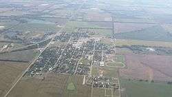
Aerial photograph of Udall (2015) | |
 Location within Cowley County and Kansas | |
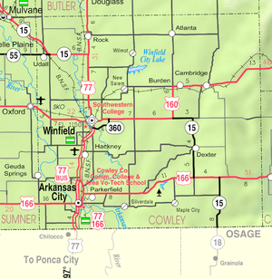 KDOT map of Cowley County (legend) | |
| Coordinates: 37°23′13″N 97°7′4″W / 37.38694°N 97.11778°WCoordinates: 37°23′13″N 97°7′4″W / 37.38694°N 97.11778°W | |
| Country | United States |
| State | Kansas |
| County | Cowley |
| Area[1] | |
| • Total | 0.57 sq mi (1.48 km2) |
| • Land | 0.57 sq mi (1.48 km2) |
| • Water | 0 sq mi (0 km2) |
| Elevation | 1,276 ft (389 m) |
| Population (2010)[2] | |
| • Total | 746 |
| • Estimate (2015)[3] | 732 |
| • Density | 1,300/sq mi (500/km2) |
| Time zone | Central (CST) (UTC-6) |
| • Summer (DST) | CDT (UTC-5) |
| ZIP code | 67146 |
| Area code | 620 |
| FIPS code | 20-71950 [4] |
| GNIS feature ID | 0470218 [5] |
| Website | CityOfUdall.com |
Udall is a city in Cowley County, Kansas, United States. As of the 2010 census, the city population was 746.[6]
History
The first post office at Udall was established in September, 1879.[7] J.M. Napier and P.W. Smith purchased ten acre tract from I.N Nelson in 1879.[8] Udall was laid out in 1881 by Napier and Smith. It was named after English author Cornelius Udall.[9][10] D.C. Green built the first house in Udall and opened a store.
1955 tornado
On May 25, 1955, the deadliest tornado to ever hit the state of Kansas struck Udall at 10:35 p.m.[11][12] The town was demolished by an 1,300 yd (0.74 mi) wide F5 tornado, no building within the city limits was untouched, including the grain elevator, water tower, old grade school, new high school, city hall, three churches. The water tower had been knocked over and the streets were flooded. Vehicles were thrown hundreds of yards and mangled beyond recognition, including a pickup truck that was wrapped around a tree and stripped of everything but its frame and tires. 77 people died and 270 were injured, 192 buildings (170 homes) were destroyed. Around 50% of families lost one or more members of their families.[13]
Before striking Udall, there were no warnings issued by the Weather Bureau. Unknown to them, the same tornado-producing thunderstorm had just laid waste to the city of Blackwell, Oklahoma, where 20 died and 250 were injured.[14][15]
Geography
Udall is located at 37°23′13″N 97°7′4″W / 37.38694°N 97.11778°W (37.386991, -97.117808).[16] According to the United States Census Bureau, the city has a total area of 0.57 square miles (1.48 km2), all of it land.[1]
Demographics

| Historical population | |||
|---|---|---|---|
| Census | Pop. | %± | |
| 1880 | 85 | — | |
| 1890 | 338 | 297.6% | |
| 1900 | 282 | −16.6% | |
| 1910 | 330 | 17.0% | |
| 1920 | 381 | 15.5% | |
| 1930 | 436 | 14.4% | |
| 1940 | 419 | −3.9% | |
| 1950 | 410 | −2.1% | |
| 1960 | 600 | 46.3% | |
| 1970 | 668 | 11.3% | |
| 1980 | 891 | 33.4% | |
| 1990 | 824 | −7.5% | |
| 2000 | 794 | −3.6% | |
| 2010 | 746 | −6.0% | |
| Est. 2015 | 732 | [3] | −1.9% |
| U.S. Decennial Census | |||
2010 census
As of the census[2] of 2010, there were 746 people, 289 households, and 203 families residing in the city. The population density was 1,308.8 inhabitants per square mile (505.3/km2). There were 319 housing units at an average density of 559.6 per square mile (216.1/km2). The racial makeup of the city was 94.8% White, 2.0% Native American, 0.1% Asian, 0.5% from other races, and 2.5% from two or more races. Hispanic or Latino of any race were 3.1% of the population.
There were 289 households of which 38.8% had children under the age of 18 living with them, 51.2% were married couples living together, 13.8% had a female householder with no husband present, 5.2% had a male householder with no wife present, and 29.8% were non-families. 26.3% of all households were made up of individuals and 11.5% had someone living alone who was 65 years of age or older. The average household size was 2.58 and the average family size was 3.07.
The median age in the city was 31.7 years. 30.4% of residents were under the age of 18; 9.2% were between the ages of 18 and 24; 25.3% were from 25 to 44; 22.5% were from 45 to 64; and 12.5% were 65 years of age or older. The gender makeup of the city was 46.4% male and 53.6% female.
2000 census
As of the census[4] of 2000, there were 794 people, 302 households, and 221 families residing in the city. The population density was 1,645.7 people per square mile (638.7/km²). There were 322 housing units at an average density of 667.4 per square mile (259.0/km²). The racial makeup of the city was 96.73% White, 1.64% Native American, 0.25% Asian, 0.63% from other races, and 0.76% from two or more races. Hispanic or Latino of any race were 3.27% of the population.
There were 302 households out of which 41.1% had children under the age of 18 living with them, 59.6% were married couples living together, 10.3% had a female householder with no husband present, and 26.8% were non-families. 24.2% of all households were made up of individuals and 9.9% had someone living alone who was 65 years of age or older. The average household size was 2.63 and the average family size was 3.16.
In the city the population was spread out with 32.2% under the age of 18, 10.5% from 18 to 24, 27.7% from 25 to 44, 18.6% from 45 to 64, and 11.0% who were 65 years of age or older. The median age was 28 years. For every 100 females there were 92.7 males. For every 100 females age 18 and over, there were 94.9 males.
The median income for a household in the city was $37,639, and the median income for a family was $42,981. Males had a median income of $34,750 versus $20,227 for females. The per capita income for the city was $16,202. About 4.8% of families and 5.8% of the population were below the poverty line, including 8.0% of those under age 18 and 8.0% of those age 65 or over.
See also
References
- 1 2 "US Gazetteer files 2010". United States Census Bureau. Retrieved 2012-07-06.
- 1 2 "American FactFinder". United States Census Bureau. Retrieved 2012-07-06.
- 1 2 "Annual Estimates of the Resident Population for Incorporated Places: April 1, 2010 to July 1, 2015". Retrieved July 2, 2016.
- 1 2 "American FactFinder". United States Census Bureau. Retrieved 2008-01-31.
- ↑ "US Board on Geographic Names". United States Geological Survey. 2007-10-25. Retrieved 2008-01-31.
- ↑ "2010 City Population and Housing Occupancy Status". U.S. Census Bureau. Retrieved March 6, 2011.
- ↑ "Kansas Post Offices, 1828-1961, page 2". Kansas Historical Society. Retrieved 6 June 2014.
- ↑ History of Udall Udall Community Historical Society
- ↑ "History of Udall". City of Udall. Retrieved 3 May 2014.
- ↑ Kansas State Historical Society (1916). Biennial Report of the Board of Directors of the Kansas State Historical Society. Kansas State Printing Plant. p. 168.
- ↑ The Udall tornado: Kansas town remembers the day it disappeared; The Wichita Eagle; May 25, 2015.
- ↑ 60 years after Kansas' deadliest tornado; KWCH 12 TV; May 15, 2015.
- ↑ Info on the 1955 Udall Kansas tornado; National Weather Service.
- ↑ 1955 Tornado, NOAA.gov
- ↑ 1955 Udall Tornado Photo Collection
- ↑ "US Gazetteer files: 2010, 2000, and 1990". United States Census Bureau. 2011-02-12. Retrieved 2011-04-23.
Further reading
- County
- History of Cowley County Kansas; D.A. Millington / E.P. Greer; Winfield Courier; 162 pages; 1901. (Download 16MB PDF eBook)
- Kansas
- History of the State of Kansas; William G. Cutler; A.T. Andreas Publisher; 1883. (Online HTML eBook)
- Kansas : A Cyclopedia of State History, Embracing Events, Institutions, Industries, Counties, Cities, Towns, Prominent Persons, Etc; 3 Volumes; Frank W. Blackmar; Standard Publishing Co; 944 / 955 / 824 pages; 1912. (Volume1 - Download 54MB PDF eBook), (Volume2 - Download 53MB PDF eBook), (Volume3 - Download 33MB PDF eBook)
External links
| Wikimedia Commons has media related to Udall, Kansas. |
- City
- Schools
- USD 463, local school district
- Historical
- Maps
- Udall City Map, KDOT
Municipalities and communities of Cowley County, Kansas, United States | ||
|---|---|---|
| Cities |  | |
| Unincorporated communities | ||
| Townships | ||
| Footnotes | ‡This populated place also has portions in an adjacent county or counties | |