Horace, North Dakota
| Horace, North Dakota | |
|---|---|
| City | |
|
Near the grain elevator in Horace | |
 Location of Horace, North Dakota | |
| Coordinates: 46°45′35″N 96°54′15″W / 46.75972°N 96.90417°WCoordinates: 46°45′35″N 96°54′15″W / 46.75972°N 96.90417°W | |
| Country | United States |
| State | North Dakota |
| County | Cass |
| Founded | 1882 |
| Government | |
| • Mayor | Kory Peterson |
| Area[1] | |
| • Total | 10.77 sq mi (27.89 km2) |
| • Land | 10.77 sq mi (27.89 km2) |
| • Water | 0 sq mi (0 km2) |
| Elevation | 915 ft (279 m) |
| Population (2010)[2] | |
| • Total | 2,430 |
| • Estimate (2015)[3] | 2,545 |
| • Density | 225.6/sq mi (87.1/km2) |
| Time zone | Central (CST) (UTC-6) |
| • Summer (DST) | CDT (UTC-5) |
| ZIP code | 58047 |
| Area code(s) | 701 |
| FIPS code | 38-38900 |
| GNIS feature ID | 1029530[4] |
| Website | http://www.cityofhorace.com/ |

Horace is a city in Cass County, North Dakota, United States. The population was 2,430 at the 2010 census.[5] From 2000 to 2010, Horace was the fastest-growing city in North Dakota in terms of percent increase, increasing 165.6% over that decade from a population of 915 in 2000.
The city is a suburb of the Fargo-Moorhead metropolitan area. It is the nineteenth-largest city in North Dakota. Horace was founded in 1882 at a time of widespread European-American settlement in the territory.
History
A post office has been in operation at Horace since 1875.[6] The city is named after Horace Greeley of Chappaqua, New York, editor of the New York Tribune.[7] Greeley encouraged western settlement with the motto "Go West, young man".[8]
The city is bordered on the west by the Sheyenne River, a tributary of the Red River of the North. To reduce damage from seasonal flooding, which sometimes was very severe, the state and federal government collaborated on the Sheyenne Diversion Project, constructing a canal and associated support in 1990-1992 to move Sheyenne flood waters to the west and south of Horace, and north past the western side of West Fargo. This has proved its worth, protecting the Sheyenne cities from damage that resulted from the large 1997 Red River Flood, which destroyed areas of Grand Forks and east Grand Forks to the north.[9]
Geography
Horace is located at 46°45′35″N 96°54′15″W / 46.75972°N 96.90417°W (46.759795, -96.904122).[10]
According to the United States Census Bureau, the city has a total area of 10.77 square miles (27.89 km2), all of it land.[1]
Demographics
| Historical population | |||
|---|---|---|---|
| Census | Pop. | %± | |
| 1950 | 190 | — | |
| 1960 | 178 | −6.3% | |
| 1970 | 276 | 55.1% | |
| 1980 | 494 | 79.0% | |
| 1990 | 662 | 34.0% | |
| 2000 | 915 | 38.2% | |
| 2010 | 2,430 | 165.6% | |
| Est. 2015 | 2,545 | [11] | 4.7% |
| U.S. Decennial Census[12] 2015 Estimate[3] | |||
2010 census
As of the census[2] of 2010, there were 2,430 people, 810 households, and 682 families residing in the city. The population density was 225.6 inhabitants per square mile (87.1/km2). There were 826 housing units at an average density of 76.7 per square mile (29.6/km2). The racial makeup of the city was 97.1% White, 0.5% African American, 1.4% Native American, 0.2% Asian, 0.2% from other races, and 0.7% from two or more races. Hispanic or Latino of any race were 0.9% of the population.
There were 810 households of which 50.1% had children under the age of 18 living with them, 74.4% were married couples living together, 4.4% had a female householder with no husband present, 5.3% had a male householder with no wife present, and 15.8% were non-families. 12.3% of all households were made up of individuals and 1.4% had someone living alone who was 65 years of age or older. The average household size was 3.00 and the average family size was 3.27.
The median age in the city was 35.6 years. 33.4% of residents were under the age of 18; 5.1% were between the ages of 18 and 24; 29.6% were from 25 to 44; 26.9% were from 45 to 64; and 4.9% were 65 years of age or older. The gender makeup of the city was 50.6% male and 49.4% female.
2000 census
As of the census of 2000, there were 915 people, 300 households, and 248 families residing in the city. The population density was 408.7 people per square mile (157.7/km²). There were 311 housing units at an average density of 138.9 per square mile (53.6/km²). The racial makeup of the city was 98.47% White, 0.11% African American, 0.55% Native American, 0.22% Asian, 0.33% from other races, and 0.33% from two or more races. Hispanic or Latino of any race were 0.33% of the population.
There were 300 households out of which 55.7% had children under the age of 18 living with them, 68.3% were married couples living together, 10.0% had a female householder with no husband present, and 17.3% were non-families. 11.3% of all households were made up of individuals and 2.7% had someone living alone who was 65 years of age or older. The average household size was 3.05 and the average family size was 3.29.
In the city the population was spread out with 35.7% under the age of 18, 7.0% from 18 to 24, 37.5% from 25 to 44, 15.6% from 45 to 64, and 4.2% who were 65 years of age or older. The median age was 30 years. For every 100 females there were 92.6 males. For every 100 females age 18 and over, there were 98.0 males.
The median income for a household in the city was $46,510, and the median income for a family was $47,639. Males had a median income of $31,875 versus $20,924 for females. The per capita income for the city was $15,761. About 3.2% of families and 3.9% of the population were below the poverty line, including 3.6% of those under age 18 and 9.5% of those age 65 or over.
References
- 1 2 "US Gazetteer files 2010". United States Census Bureau. Retrieved 2012-06-14.
- 1 2 "American FactFinder". United States Census Bureau. Retrieved 2012-06-14.
- 1 2 "Population Estimates". United States Census Bureau. Retrieved June 2, 2016.
- ↑ "US Board on Geographic Names". United States Geological Survey. 2007-10-25. Retrieved 2008-01-31.
- ↑ "2010 Census Redistricting Data (Public Law 94-171) Summary File". American FactFinder. United States Census Bureau. Retrieved 2 May 2011.
- ↑ "Cass County". Jim Forte Postal History. Retrieved 24 October 2015.
- ↑ Hoheisel, Tim; Nielsen, Andrew R. (2007). Cass County. Arcadia Publishing. p. 82. ISBN 978-0-7385-4145-7.
- ↑ Josiah Busnell Grinnell (1891). Men and Events of Forty Years. Boston: D. Lothrop. p. 87. Retrieved 2009-02-13.
- ↑ "Sheyenne Diversion", City of West Fargo Government website, 2016
- ↑ "US Gazetteer files: 2010, 2000, and 1990". United States Census Bureau. 2011-02-12. Retrieved 2011-04-23.
- ↑ "Annual Estimates of the Resident Population for Incorporated Places: April 1, 2010 to July 1, 2015". Retrieved July 2, 2016.
- ↑ United States Census Bureau. "Census of Population and Housing". Retrieved July 21, 2013.
Municipalities and communities of Cass County, North Dakota, United States | ||
|---|---|---|
| Cities | 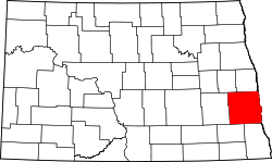 | |
| Townships |
| |
| CDPs | ||
| Unincorporated communities | ||
| Footnotes | ‡This populated place also has portions in an adjacent county or counties | |
| Counties | ||
|---|---|---|
| Main cities | ||
| Surrounding areas |
| |
‡ - county seat | ||
