Grandin, North Dakota
| Grandin, North Dakota | |
|---|---|
| City | |
 Location of Grandin, North Dakota | |
| Coordinates: 47°14′10″N 97°0′10″W / 47.23611°N 97.00278°WCoordinates: 47°14′10″N 97°0′10″W / 47.23611°N 97.00278°W | |
| Country | United States |
| State | North Dakota |
| Counties | Cass, Traill |
| Area[1] | |
| • Total | 0.17 sq mi (0.44 km2) |
| • Land | 0.17 sq mi (0.44 km2) |
| • Water | 0 sq mi (0 km2) |
| Elevation | 896 ft (273 m) |
| Population (2010)[2] | |
| • Total | 173 |
| • Estimate (2015)[3] | 174 |
| • Density | 1,017.6/sq mi (392.9/km2) |
| Time zone | Central (CST) (UTC-6) |
| • Summer (DST) | CDT (UTC-5) |
| ZIP code | 58038 |
| Area code(s) | 701 |
| FIPS code | 38-32300 |
| GNIS feature ID | 1029206[4] |
Grandin is a city in Cass and Traill counties in the State of North Dakota. The population was 173 at the 2010 census.[5] It is now a bedroom community for the nearby Fargo-Moorhead area. Grandin was founded in 1881.
Grandin was the birthplace of the abstract expressionist painter Clyfford Still.
History
Grandin was named for Bonanza farmer J.L. Grandin. Grandin, a native of Tidioute, Pennsylvania, along with his brother, purchased 99 sections of land in the Red River Valley, dividing them in 1,500 acre farms. The brothers had 14,000 acres under cultivation near Grandin, with another 600 acres near Mayville, North Dakota. Prior to the arrival of the railroad the brothers shipped wheat from their farm by barge on the Red River to Fargo, North Dakota, 90 miles upstream. The barges were towed by the steamers Alsop and Grandin. The Grandin brothers' bonanza farm was one of the earliest adopters of the telephone in the state.[6]
Geography
Grandin is located at 47°14′10″N 97°0′10″W / 47.23611°N 97.00278°W (47.236033, -97.002717).[7]
According to the United States Census Bureau, the city has a total area of 0.17 square miles (0.44 km2), all of it land.[1]
Demographics
| Historical population | |||
|---|---|---|---|
| Census | Pop. | %± | |
| 1930 | 172 | — | |
| 1940 | 158 | −8.1% | |
| 1950 | 156 | −1.3% | |
| 1960 | 147 | −5.8% | |
| 1970 | 187 | 27.2% | |
| 1980 | 210 | 12.3% | |
| 1990 | 213 | 1.4% | |
| 2000 | 181 | −15.0% | |
| 2010 | 173 | −4.4% | |
| Est. 2015 | 174 | [8] | 0.6% |
| U.S. Decennial Census[9] 2015 Estimate[3] | |||
2010 census
As of the census[2] of 2010, there were 173 people, 72 households, and 50 families residing in the city. The population density was 1,017.6 inhabitants per square mile (392.9/km2). There were 77 housing units at an average density of 452.9 per square mile (174.9/km2). The racial makeup of the city was 95.4% White, 1.7% Native American, 1.2% from other races, and 1.7% from two or more races. Hispanic or Latino of any race were 2.3% of the population.
There were 72 households of which 31.9% had children under the age of 18 living with them, 59.7% were married couples living together, 5.6% had a female householder with no husband present, 4.2% had a male householder with no wife present, and 30.6% were non-families. 27.8% of all households were made up of individuals and 8.4% had someone living alone who was 65 years of age or older. The average household size was 2.40 and the average family size was 2.96.
The median age in the city was 38.7 years. 23.1% of residents were under the age of 18; 8.7% were between the ages of 18 and 24; 28.3% were from 25 to 44; 31.3% were from 45 to 64; and 8.7% were 65 years of age or older. The gender makeup of the city was 54.9% male and 45.1% female.
2000 census
As of the census of 2000, there were 181 people, 72 households, and 56 families residing in the city. The population density was 1,086.2 people per square mile (411.1/km²). There were 80 housing units at an average density of 480.1 per square mile (181.7/km²). The racial makeup of the city was 98.90% White, 0.55% Native American, and 0.55% from two or more races. Hispanic or Latino of any race were 1.10% of the population.
There were 72 households out of which 31.9% had children under the age of 18 living with them, 66.7% were married couples living together, 6.9% had a female householder with no husband present, and 22.2% were non-families. 18.1% of all households were made up of individuals and 5.6% had someone living alone who was 65 years of age or older. The average household size was 2.51 and the average family size was 2.88.
In the city the population was spread out with 27.1% under the age of 18, 5.5% from 18 to 24, 30.4% from 25 to 44, 22.1% from 45 to 64, and 14.9% who were 65 years of age or older. The median age was 38 years. For every 100 females there were 98.9 males. For every 100 females age 18 and over, there were 109.5 males.
The median income for a household in the city was $40,625, and the median income for a family was $44,063. Males had a median income of $31,667 versus $21,023 for females. The per capita income for the city was $15,973. About 8.8% of families and 11.0% of the population were below the poverty line, including 13.0% of those under the age of eighteen and none of those sixty five or over.
References
- 1 2 "US Gazetteer files 2010". United States Census Bureau. Retrieved 2012-06-14.
- 1 2 "American FactFinder". United States Census Bureau. Retrieved 2012-06-14.
- 1 2 "Population Estimates". United States Census Bureau. Retrieved July 16, 2016.
- ↑ "US Board on Geographic Names". United States Geological Survey. 2007-10-25. Retrieved 2008-01-31.
- ↑ "2010 Census Redistricting Data (Public Law 94-171) Summary File". American FactFinder. United States Census Bureau. Retrieved 2 May 2011.
- ↑ Federal Writer's Project of the Works Progress Administration for the State of North Dakota (1977). The WPA Guide To 1930s North Dakota (2nd ed.). State Historical Society of North Dakota. pp. 193–194. ISBN 1891419145.
- ↑ "US Gazetteer files: 2010, 2000, and 1990". United States Census Bureau. 2011-02-12. Retrieved 2011-04-23.
- ↑ "Annual Estimates of the Resident Population for Incorporated Places: April 1, 2010 to July 1, 2015". Retrieved July 2, 2016.
- ↑ United States Census Bureau. "Census of Population and Housing". Retrieved July 21, 2013.
Municipalities and communities of Cass County, North Dakota, United States | ||
|---|---|---|
| Cities | 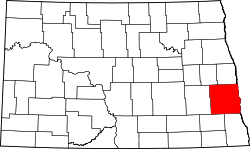 | |
| Townships |
| |
| CDPs | ||
| Unincorporated communities | ||
| Footnotes | ‡This populated place also has portions in an adjacent county or counties | |
Municipalities and communities of Traill County, North Dakota, United States | ||
|---|---|---|
| Cities |  | |
| Townships |
| |
| CDPs | ||
| Unincorporated communities |
| |
| Footnotes | ‡This populated place also has portions in an adjacent county or counties | |
| Counties | ||
|---|---|---|
| Main cities | ||
| Surrounding areas |
| |
‡ - county seat | ||