Ulen, Minnesota
| Ulen, Minnesota | |
|---|---|
| City | |
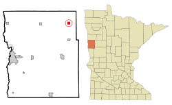 Location of Ulen, Minnesota | |
| Coordinates: 47°4′42″N 96°15′36″W / 47.07833°N 96.26000°W | |
| Country | United States |
| State | Minnesota |
| County | Clay |
| Area[1] | |
| • Total | 1.14 sq mi (2.95 km2) |
| • Land | 1.14 sq mi (2.95 km2) |
| • Water | 0 sq mi (0 km2) |
| Elevation | 1,152 ft (351 m) |
| Population (2010)[2] | |
| • Total | 547 |
| • Estimate (2013[3]) | 549 |
| • Density | 479.8/sq mi (185.3/km2) |
| Time zone | Central (CST) (UTC-6) |
| • Summer (DST) | CDT (UTC-5) |
| ZIP code | 56585 |
| Area code(s) | 218 |
| FIPS code | 27-66136 |
| GNIS feature ID | 0653486[4] |
Ulen (/ˈjuːlən/ EW-lən) is a city in Clay County, Minnesota, United States, along the South Branch of the Wild Rice River. The population was 547 at the 2010 census.[5]
Near this small community, what is believed to be an authentic Viking sword known as the Ulen sword was found in a field. The sword is currently on display in a museum.
Ulen is the southern terminus of the Agassiz Recreational Trail, a 53-mile multi-use trail built on an abandoned railroad grade which has its northern terminus at Crookston, Minnesota.[6]
Geography
According to the United States Census Bureau, the city has a total area of 1.14 square miles (2.95 km2), all land.[1]
Demographics
| Historical population | |||
|---|---|---|---|
| Census | Pop. | %± | |
| 1900 | 317 | — | |
| 1910 | 438 | 38.2% | |
| 1920 | 590 | 34.7% | |
| 1930 | 452 | −23.4% | |
| 1940 | 562 | 24.3% | |
| 1950 | 525 | −6.6% | |
| 1960 | 481 | −8.4% | |
| 1970 | 486 | 1.0% | |
| 1980 | 514 | 5.8% | |
| 1990 | 547 | 6.4% | |
| 2000 | 532 | −2.7% | |
| 2010 | 547 | 2.8% | |
| Est. 2015 | 551 | [7] | 0.7% |
| U.S. Decennial Census[8] 2013 Estimate[9] | |||
2010 census
As of the census[2] of 2010, there were 547 people, 234 households, and 130 families residing in the city. The population density was 479.8 inhabitants per square mile (185.3/km2). There were 268 housing units at an average density of 235.1 per square mile (90.8/km2). The racial makeup of the city was 93.1% White, 0.4% African American, 3.7% Native American, 0.2% Asian, 0.5% from other races, and 2.2% from two or more races. Hispanic or Latino of any race were 0.5% of the population.
There were 234 households of which 26.9% had children under the age of 18 living with them, 43.2% were married couples living together, 8.1% had a female householder with no husband present, 4.3% had a male householder with no wife present, and 44.4% were non-families. 39.7% of all households were made up of individuals and 21.8% had someone living alone who was 65 years of age or older. The average household size was 2.16 and the average family size was 2.89.
The median age in the city was 46.6 years. 21.2% of residents were under the age of 18; 5.3% were between the ages of 18 and 24; 21.5% were from 25 to 44; 23.9% were from 45 to 64; and 28% were 65 years of age or older. The gender makeup of the city was 49.4% male and 50.6% female.
2000 census
As of the census of 2000, there were 532 people, 203 households, and 120 families residing in the city. The population density was 488.9 people per square mile (188.4/km²). There were 228 housing units at an average density of 209.5 per square mile (80.8/km²). The racial makeup of the city was 99.25% White and 0.75% Native American. Hispanic or Latino of any race were 0.19% of the population.
There were 203 households out of which 28.6% had children under the age of 18 living with them, 44.3% were married couples living together, 9.9% had a female householder with no husband present, and 40.4% were non-families. 35.5% of all households were made up of individuals and 26.1% had someone living alone who was 65 years of age or older. The average household size was 2.24 and the average family size was 2.88.
In the city the population was spread out with 23.3% under the age of 18, 5.8% from 18 to 24, 19.9% from 25 to 44, 16.9% from 45 to 64, and 34.0% who were 65 years of age or older. The median age was 46 years. For every 100 females there were 88.7 males. For every 100 females age 18 and over, there were 78.2 males.
The median income for a household in the city was $27,813, and the median income for a family was $42,188. Males had a median income of $33,036 versus $20,000 for females. The per capita income for the city was $16,593. About 5.0% of families and 8.5% of the population were below the poverty line, including 8.3% of those under age 18 and 15.6% of those age 65 or over.
References
- 1 2 "US Gazetteer files 2010". United States Census Bureau. Retrieved 13 November 2012.
- 1 2 "American FactFinder". United States Census Bureau. Retrieved 13 November 2012.
- ↑ "Population Estimates". United States Census Bureau. Retrieved 2014-06-09.
- ↑ "US Board on Geographic Names". United States Geological Survey. 2007-10-25. Retrieved 2008-01-31.
- ↑ "2010 Census Redistricting Data (Public Law 94-171) Summary File". American FactFinder. U.S. Census Bureau, 2010 Census. Retrieved 23 April 2011.
- ↑ Dokken, Brad (24 December 2009), "Construction begins on Agassiz trail bridges", Northland Outdoors, retrieved 1 March 2011
- ↑ "Annual Estimates of the Resident Population for Incorporated Places: April 1, 2010 to July 1, 2015". Retrieved July 2, 2016.
- ↑ United States Census Bureau. "Census of Population and Housing". Retrieved September 11, 2013.
- ↑ "Annual Estimates of the Resident Population: April 1, 2010 to July 1, 2013". Retrieved June 9, 2014.
Municipalities and communities of Clay County, Minnesota, United States | ||
|---|---|---|
| Cities | 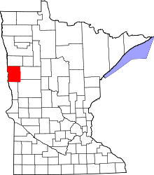 | |
| Townships | ||
| CDPs | ||
| Unincorporated communities | ||
| Ghost towns | ||
Coordinates: 47°04′44″N 96°15′32″W / 47.07889°N 96.25889°W