Wahpeton, North Dakota
| Wahpeton, North Dakota | |
|---|---|
| City | |
|
Dakota Avenue in downtown Wahpeton, 2007 | |
 Location of Wahpeton, North Dakota | |
| Coordinates: 46°16′12″N 96°36′38″W / 46.27000°N 96.61056°WCoordinates: 46°16′12″N 96°36′38″W / 46.27000°N 96.61056°W | |
| Country | United States |
| State | North Dakota |
| County | Richland |
| Government | |
| • Mayor | Meryl Hansey |
| • Finance Director | Darcie Huwe |
| Area[1] | |
| • Total | 5.29 sq mi (13.70 km2) |
| • Land | 5.29 sq mi (13.70 km2) |
| • Water | 0 sq mi (0 km2) |
| Elevation | 965 ft (294 m) |
| Population (2010)[2] | |
| • Total | 7,766 |
| • Estimate (2015)[3] | 7,899 |
| • Density | 1,468.1/sq mi (566.8/km2) |
| Time zone | Central (CST) (UTC-6) |
| • Summer (DST) | CDT (UTC-5) |
| ZIP codes | 58074-58076 |
| Area code(s) | 701 |
| FIPS code | 38-82660 |
| GNIS feature ID | 1033621[4] |
| Highways | ND 13, ND 210 |
| Website | wahpeton.com |

Wahpeton (/ˈwɑːpᵻtən/ WAH-pə-tən) is a city in Richland County, in southeastern North Dakota, United States. It is located along the Bois de Sioux River at its confluence with the Otter Tail River, forming the Red River of the North. Wahpeton is the county seat of Richland County.[5] The U.S. Census Bureau estimated the city's 2015 population was 7,899.
Wahpeton was founded in 1869 and is the principal city of the Wahpeton Micropolitan Statistical Area, which includes all of Richland County, North Dakota and Wilkin County, Minnesota. Wahpeton's twin city is Breckenridge, Minnesota, located to the east on the other side of the river. The Bois de Sioux River and the Otter Tail River join at Wahpeton and Breckenridge to form the Red River of the North.
The North Dakota State College of Science is located in Wahpeton. The local newspaper is the Wahpeton Daily News.
History

The first European explorer in the area was Jonathan Carver in 1767. He explored and mapped the Northwest at the request of Major Robert Rogers, commander of Fort Michilimackinac. This British fort at Mackinaw City, Michigan, protected the passage between Lake Michigan and Lake Huron of the Great Lakes. In 1763 the British had extended their reach in Canada after defeating the French in the Seven Years' War.
Carver's mission was to find the Northwest Passage, the imagined waterway to the Orient which Rogers (and many other explorers of the time) believed existed. Carver could not find what does not exist. His record of exploration helped attract fur traders and other explorers to this territory.
More than one hundred years after the Carver expedition, a United States Government surveying party passed through the Wahpeton area. With the Civil War over, the government wanted to encourage development in the West. J. W. Blanding, a member of the expedition, was so impressed by the fertile river valley that he returned to his Wisconsin home determined to move his family and belongings to the Dakota Territory. Blanding so influenced other Wisconsin settlers that many of them had arrived and homesteaded in the Wahpeton area before Blanding arranged his return.
The first settler was Morgan T. Rich. His plow turned the first furrow of rich black bottomland in 1869. When other settlers arrived, they formed a tiny community and named it Richville, commemorating both its founder and the fertile quality of the soil.
In 1871, a US post office was opened. At the same time, the town's name was changed to Chahinkapa, a Lakota Sioux word meaning "the end of the woods". Two years later, the county was organized and named Chahinkapa County.
Later that year the county was renamed as Richland County and the town of Chahinkapa renamed as Wahpeton, an adaptation of the Dakota name of the local band of Dakota Indians, the Wakhpetonwan. The name in Dakota means "leaf dwellers." They adopted this name at an earlier time when they lived in the vicinity of Lake Mille Lacs, before they were displaced by the Ojibwa and pushed to the west.[6]
Growth of the village of Wahpeton was quite slow during the first few years, but it increased rapidly in 1872 with the completion of a railroad line into Breckenridge, Minnesota, a tiny community just across the Bois de Sioux River. The St. Paul and Pacific Railway (now the Great Northern) had entered the region. The railroad generated a booming business in flatboat building in both communities. Flat boats could carry freight directly from the railroad downriver via the Red River of the North (which flowed North) to northern parts of the state and all the way to Winnipeg, Canada.
The railroad line attracted many more settlers to the area - both migrants from the Eastern United States and new immigrants. Germans, Bohemians, Scandinavians, and Native Americans moved to Richland County to file for homesteads. In 1874, Jacob Morvin and Joseph Sittarich opened the first retail store in the county in Wahpeton. By 1876 the traffic between Wahpeton and Breckenridge had grown past the capacity of the ferry. A bridge was built across the Bois de Sioux River connecting the two towns.
Another flurry of growth occurred in 1880 when the St. Paul, Minneapolis, and Manitoba Railroad crossed the river and pushed its tracks on toward the northwest. By 1883 the population of Wahpeton was estimated to be as high as 1,400 people.
In 1888, the Northern Light Electric Company (NLEC) was organized here. It made Wahpeton among the first cities in North Dakota to be electrified. In 1909, NLEC became the first customer of the newly founded Otter Tail Power Company. In 1913, the owner of NLEC, C. B. Kidder, sold his company to Otter Tail Power and became its first general manager. In 1927, Otter Tail Power built what was then its largest power plant at Wahpeton, naming it Kidder Station. The plant was removed in 1977; the site is now a park.
In 1889, the Red River Valley University was established in Wahpeton; it later was renamed as the North Dakota State College of Science.
In 1904, the United States Government established the Wahpeton Indian School (now called Circle of Nations School) for the education of Native American children from reservations and tribes in northern Minnesota, North Dakota, and northern South Dakota. It was an Indian boarding school established to assimilate the children to mainstream language, culture and religion. In most of such schools, children were required to use English rather than their native languages (which were many among these groups), dress in Euro-American style, and practice Christianity.
Geography
Wahpeton is located at 46°16′12″N 96°36′38″W / 46.27000°N 96.61056°W (46.269931, −96.610463).[7] According to the United States Census Bureau, the city has a total area of 5.29 square miles (13.70 km2), all of it land.[1]
The Red River of the North forms one of the most fertile river valleys in the world. As it flows north to Canada, it forms the state boundary between North Dakota and Minnesota. Wahpeton is located near the river's head-waters at the confluence of the Bois de Sioux and .
Climate
This climatic region is typified by large seasonal temperature differences, with warm to hot (and often humid) summers and cold (sometimes severely cold) winters. According to the Köppen Climate Classification system, Wahpeton has a humid continental climate, abbreviated "Dfb" on climate maps.[8]
Demographics
| Historical population | |||
|---|---|---|---|
| Census | Pop. | %± | |
| 1880 | 400 | — | |
| 1890 | 1,510 | 277.5% | |
| 1900 | 2,228 | 47.5% | |
| 1910 | 2,467 | 10.7% | |
| 1920 | 3,069 | 24.4% | |
| 1930 | 3,176 | 3.5% | |
| 1940 | 3,747 | 18.0% | |
| 1950 | 5,125 | 36.8% | |
| 1960 | 5,876 | 14.7% | |
| 1970 | 7,076 | 20.4% | |
| 1980 | 9,064 | 28.1% | |
| 1990 | 8,751 | −3.5% | |
| 2000 | 8,586 | −1.9% | |
| 2010 | 7,766 | −9.6% | |
| Est. 2015 | 7,899 | [9] | 1.7% |
| U.S. Decennial Census[10] 2015 Estimate[3] | |||

2010 census
As of the census[2] of 2010, there were 7,766 people, 3,151 households, and 1,717 families residing in the city. The population density was 1,468.1 inhabitants per square mile (566.8/km2). There were 3,482 housing units at an average density of 658.2 per square mile (254.1/km2). The racial makeup of the city was 92.6% White, 1.3% African American, 3.1% Native American, 0.8% Asian, 0.1% Pacific Islander, 0.3% from other races, and 1.8% from two or more races. Hispanic or Latino of any race were 2.0% of the population.
There were 3,151 households of which 26.8% had children under the age of 18 living with them, 40.7% were married couples living together, 9.2% had a female householder with no husband present, 4.6% had a male householder with no wife present, and 45.5% were non-families. 36.3% of all households were made up of individuals and 11.7% had someone living alone who was 65 years of age or older. The average household size was 2.17 and the average family size was 2.89.
The median age in the city was 31.1 years. 20.3% of residents were under the age of 18; 22.2% were between the ages of 18 and 24; 20.5% were from 25 to 44; 24.5% were from 45 to 64; and 12.6% were 65 years of age or older. The gender makeup of the city was 51.6% male and 48.4% female.
2000 census
As of the census of 2000, there were 8,586 people, 3,254 households, and 1,867 families residing in the city. The population density was 1,718.1 per square mile (663.0/km²). There were 3,492 housing units at an average density of 698.8 per square mile (269.7/km²). The racial makeup of the city was 95.47% White, 0.62% African American, 2.41% Native American, 0.43% Asian, 0.03% Pacific Islander, 0.12% from other races, and 0.92% from two or more races. Hispanic or Latino of any race were 0.76% of the population.
The top 6 ancestry groups in the city are German (47.4%), Norwegian (28.4%), Irish (7.1%), Swedish (5.8%), French (4.0%), English (4.0%).
There were 3,254 households out of which 30.4% had children under the age of 18 living with them, 45.3% were married couples living together, 8.5% had a female householder with no husband present, and 42.6% were non-families. 32.7% of all households were made up of individuals and 10.0% had someone living alone who was 65 years of age or older. The average household size was 2.28 and the average family size was 2.97.
In the city the population was spread out with 21.2% under the age of 18, 24.1% from 18 to 24, 24.2% from 25 to 44, 17.5% from 45 to 64, and 13.0% who were 65 years of age or older. The median age was 29 years. For every 100 females there were 109.8 males. For every 100 females age 18 and over, there were 112.3 males.
The median income for a household in the city was $33,471, and the median income for a family was $44,645. Males had a median income of $30,199 versus $20,089 for females. The per capita income for the city was $15,293. About 7.3% of families and 13.4% of the population were below the poverty line, including 8.9% of those under age 18 and 10.4% of those age 65 or over.
Economy
Wahpeton is the home of several large manufacturing plants, including Woodcraft Industries, Inc., WCCO Belting, Minn-Dak Farmers Cooperative, Cargill, and Wil-Rich.
Imation Corporation had operated a production facility in Wahpeton but it was closed in 2009.[11]
On May 14, 1991, Wahpeton voters approved a 1% city sales and use tax, the proceeds of which are to be dedicated solely to economic development of the City of Wahpeton and Richland County, North Dakota, by means of business and industrial expansion including job creation, job retention, business and industrial diversification, and the creation, fostering and maintenance of business and trade activities and facilities. The tax would become effective July 1, 1991, and sunset in five years. On June 14, 1994, voters approved to extend the sales tax 10 years to June 30, 2006. And again on October 14, 2003, voters approved broadening the use and extending the 1½% sales tax to June 30, 2026.[12]
Recreation and culture
The area attracts outdoorsmen and hunters, as it is located in the midst of the Central Flyway, thus providing excellent migratory waterfowl hunting.
The Bois de Sioux Golf Course is the only golf course in the United States with half the course in one state and half in another.
Near the golf course is Chahinkapa Park, which houses playgrounds, baseball, softball, and football fields, miniature golf, and tennis. During the summer the large swimming pool is also open. Chahinkapa Park is also home to Chahinkapa Zoo.
The Richland County Historical Society Museum features Native American artifacts and displays of pioneer life. Near Wahpeton is Fort Abercrombie and the Circus Monument, erected in memory of circus workers killed by lightning there in 1897. Circus performers hold a memorial service at the monument whenever they perform in the area.
The Carmelite Monastery, located in the bend of the Wild Rice River, is a few miles from Wahpeton.
On Thursday afternoons from June through October, the Twin Towns Gardeners' Market is held on the lawn of the Leach Public Library.[13]
Other Wahpeton area attractions include "Wahpper" the World's Largest Catfish, located at Kidder Dam, and the Bagg Bonanza Farm, a 15-acre (61,000 m2) historic bonanza farm with farm buildings and machinery.
Education
Colleges
K–12
The city of Wahpeton is served by an elementary school, Wahpeton Middle School, and Wahpeton Senior High School. A private school, St. John's Elementary School, is also located in Wahpeton.
- High school championships
- State Class 'A' football: 1930, 1971
- State Class 'A' boys basketball: 1941, 1944, 1954, 1979
- State Class 'A' girls basketball: 1986
- State Class 'A' volleyball: 1985, 1986
- State Class 'A' girls golf: 1991
- State Class 'A' wrestling: 2007
- State Class 'A' girls indoor track and field: 1999
Transportation
Wahpeton has two railroads, a bus line, five truck lines, and an airport with runways of approximately 3,000 and 5,000 feet (1,500 m) in length.
Notable people
- Sam Anderson, actor
- Louise Erdrich, Native American author
- Rose Thompson Hovick, inspired "Rose" character of musical Gypsy
- Woodrow W. Keeble, World War II and Korean War era Medal of Honor recipient
- Porter J. McCumber, former senator
- Jerome G. Miller, correctional institution reformer
- Steve Myhra, former placekicker for the Baltimore Colts
- William E. Purcell, former senator
- David Richman, North Dakota State men's basketball head coach
- Mary Shaw Shorb, research scientist
- John Wall, North Dakota educator and politician
References
- 1 2 "US Gazetteer files 2010". United States Census Bureau. Retrieved 2012-06-14.
- 1 2 "American FactFinder". United States Census Bureau. Retrieved 2012-06-14.
- 1 2 "Population Estimates". United States Census Bureau. Retrieved June 1, 2016.
- ↑ "US Board on Geographic Names". United States Geological Survey. 2007-10-25. Retrieved 2008-01-31.
- ↑ "Find a County". National Association of Counties. Retrieved 2011-06-07.
- ↑ Upham, Warren (2001). Minnesota Place Names, A Geographical Encyclopedia, 3rd Edition. Saint Paul, Minnesota: Minnesota Historical Society. p. 75. ISBN 0-87351-396-7.
- ↑ "US Gazetteer files: 2010, 2000, and 1990". United States Census Bureau. 2011-02-12. Retrieved 2011-04-23.
- ↑ Climate Summary for Wahpeton, North Dakota
- ↑ "Annual Estimates of the Resident Population for Incorporated Places: April 1, 2010 to July 1, 2015". Retrieved July 2, 2016.
- ↑ United States Census Bureau. "Census of Population and Housing". Retrieved July 13, 2013.
- ↑ Nulph, Scott (May 8, 2007). "Imation closing its doors". Wahperton, ND. Wahpeton, ND. Retrieved October 15, 2010
ComDel Innovations, a contract manufacturer, now utilizing two buildings on the old Imation campus,and Bobcat utilizing the other for valves and cylinders.. line feed character in
|accessdate=at position 17 (help); Check date values in:|access-date=(help) - ↑ "Economic Development in Wahpeton". City of Wahpeton.
- ↑ Summers, Brandon L. (August 30, 2010). "Gardeners' Market celebrates success". Wahpeton Daily News. Wahpeton, ND. Retrieved October 15, 2010.
External links
![]() Media related to Wahpeton, North Dakota at Wikimedia Commons
Media related to Wahpeton, North Dakota at Wikimedia Commons
- City of Wahpeton
- Wahpeton Public Schools
- Wahpeton Events Calendar
- A history of Richland County and the city of Wahpeton, North Dakota (1938?) from the Digital Horizons website
Municipalities and communities of Richland County, North Dakota, United States | ||
|---|---|---|
| Cities | 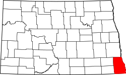 | |
| Townships |
| |
| Unincorporated communities |
| |
| Indian reservations | ||
| Footnotes | ‡This populated place also has portions in an adjacent county or counties | |