Langdon, North Dakota
| Langdon, North Dakota | |
|---|---|
| City | |
|
Business district of Langdon | |
 Location of Langdon, North Dakota | |
| Coordinates: 48°45′42″N 98°22′18″W / 48.76167°N 98.37167°WCoordinates: 48°45′42″N 98°22′18″W / 48.76167°N 98.37167°W | |
| Country | United States |
| State | North Dakota |
| County | Cavalier |
| Area[1] | |
| • Total | 1.68 sq mi (4.35 km2) |
| • Land | 1.65 sq mi (4.27 km2) |
| • Water | 0.03 sq mi (0.08 km2) |
| Elevation | 1,611 ft (491 m) |
| Population (2010)[2] | |
| • Total | 1,878 |
| • Estimate (2015)[3] | 1,787 |
| • Density | 1,138.2/sq mi (439.5/km2) |
| Time zone | Central (CST) (UTC-6) |
| • Summer (DST) | CDT (UTC-5) |
| ZIP code | 58249 |
| Area code(s) | 701 |
| FIPS code | 38-44780 |
| GNIS feature ID | 1029827[4] |
| Highways | ND 1, ND 5 |
| Website | http://www.cityoflangdon.com/ |

Langdon is a city in Cavalier County, North Dakota, United States. It is the county seat of Cavalier County.[5] The population was 1,878 at the 2010 census.[6] Langdon was designated as the county seat in 1884 and was incorporated in 1885.
History
A post office has been in operation in Langdon since 1886.[7] The city was named for Robert Bruce Langdon, a politician and railroad official.[8]
Geography
Langdon is located at 48°45′42″N 98°22′18″W / 48.76167°N 98.37167°W (48.761696, -98.371780).[9]
According to the United States Census Bureau, the city has a total area of 1.68 square miles (4.35 km2), of which, 1.65 square miles (4.27 km2) is land and 0.03 square miles (0.08 km2) is water.[1]
Demographics
| Historical population | |||
|---|---|---|---|
| Census | Pop. | %± | |
| 1890 | 291 | — | |
| 1900 | 1,188 | 308.2% | |
| 1910 | 1,214 | 2.2% | |
| 1920 | 1,228 | 1.2% | |
| 1930 | 1,221 | −0.6% | |
| 1940 | 1,546 | 26.6% | |
| 1950 | 1,838 | 18.9% | |
| 1960 | 2,151 | 17.0% | |
| 1970 | 2,182 | 1.4% | |
| 1980 | 2,335 | 7.0% | |
| 1990 | 2,241 | −4.0% | |
| 2000 | 2,101 | −6.2% | |
| 2010 | 1,878 | −10.6% | |
| Est. 2015 | 1,787 | [10] | −4.8% |
| U.S. Decennial Census[11] 2015 Estimate[3] | |||
2010 census
As of the census[2] of 2010, there were 1,878 people, 894 households, and 506 families residing in the city. The population density was 1,138.2 inhabitants per square mile (439.5/km2). There were 1,057 housing units at an average density of 640.6 per square mile (247.3/km2). The racial makeup of the city was 97.2% White, 0.2% African American, 0.7% Native American, 0.2% Asian, 0.1% Pacific Islander, 0.4% from other races, and 1.2% from two or more races. Hispanic or Latino of any race were 0.8% of the population.
There were 894 households of which 21.4% had children under the age of 18 living with them, 49.0% were married couples living together, 5.5% had a female householder with no husband present, 2.1% had a male householder with no wife present, and 43.4% were non-families. 40.0% of all households were made up of individuals and 23.8% had someone living alone who was 65 years of age or older. The average household size was 2.04 and the average family size was 2.73.
The median age in the city was 50.1 years. 19.1% of residents were under the age of 18; 5.9% were between the ages of 18 and 24; 17.9% were from 25 to 44; 28.5% were from 45 to 64; and 28.5% were 65 years of age or older. The gender makeup of the city was 47.9% male and 52.1% female.
2000 census
As of the census of 2000, there were 2,101 people, 917 households, and 565 families residing in the city. The population density was 1,233.1 people per square mile (477.2/km²). There were 1,178 housing units at an average density of 691.4 per square mile (267.5/km²). The racial makeup of the city was 98.57% White, 0.14% African American, 0.29% Native American, 0.10% Asian, 0.14% from other races, and 0.76% from two or more races. Hispanic or Latino of any race were 0.76% of the population.
There were 917 households out of which 26.3% had children under the age of 18 living with them, 54.4% were married couples living together, 5.1% had a female householder with no husband present, and 38.3% were non-families. 36.6% of all households were made up of individuals and 22.6% had someone living alone who was 65 years of age or older. The average household size was 2.20 and the average family size was 2.89.
In the city the population was spread out with 23.2% under the age of 18, 4.1% from 18 to 24, 20.9% from 25 to 44, 23.3% from 45 to 64, and 28.4% who were 65 years of age or older. The median age was 46 years. For every 100 females there were 87.6 males. For every 100 females age 18 and over, there were 84.1 males.
The median income for a household in the city was $28,839, and the median income for a family was $37,121. Males had a median income of $31,010 versus $19,342 for females. The per capita income for the city was $15,670. About 4.9% of families and 8.8% of the population were below the poverty line, including 10.3% of those under age 18 and 11.9% of those age 65 or over.
Education
Langdon's high school underwent a name change because of surrounding schools closing. The school was renamed "Langdon Area High School" (instead of "Langdon High School") in the fall of 2001. The mascot of Langdon Area High School is the Cardinal.
Students from Langdon Area Schools perform better than state averages in several areas. Graduation rates, for example, typically exceed state averages by several points. Since 2005, in all areas where comparable statistics were available, Langdon outperformed state averages from 4.5% to 15.4%.[12]
Langdon's students also tend to outperform their District's Adequate Yearly Progress goals in both the proficiency and participation categories. In some cases, these differences are quite significant. For example, the District's 2007-2008 proficiency goal in mathematics was 65.5%, whereas the district's actual proficiency was measured at 97.7%, a difference of 32.2%.[12] A similarly large difference can be seen in reading proficiency scores. Despite this high achievement, however, the District is not considered by the state to have achieved Annual Yearly Progress in the 2007-2008 school year. However, this may be a statistical anomaly given the District's consistently high performance in previous years. For example, in the 2006-2007 school year, reading participation was 100% and mathematics participation was 99.5%. Even though the 2007-2008 rates in these areas were very high (97.7% in both cases) such a score still represents a decline from previous years. Similar patterns of small declines from already high figures can be seen in the areas of graduation rates (0.4% decline, from 95% to 94.6%) and attendance (0.1% decline, from 97.3% to 97.2%). These small changes may keep the District from being listed as having made adequate yearly progress, despite their high overall proficiency. Additionally, in some areas the 2007-2008 figures represent significant improvement over those from the 2006-2007 school year, where Landgon underperformed state averages in the key areas of reading (-10.2%) and mathematics (-7.4%) proficiency. This indicates a positive trend for the District, although one which will need to reevaluated when the 2008-2009 data become available to determine whether it is part of a larger pattern or not.
In addition to student academic performance, average daily attendance at Langdon Area Schools is slightly higher than the state average (97.2% versus 96.7%), a general pattern which has held true since at least 2005.[12]
Local media
Four radio stations are based in Langdon. Simmons Broadcasting owns and operates; KNDK (AM), KNDK-FM, KAOC, and KYTZ.
Climate
This climatic region is typified by large seasonal temperature differences, with warm to hot (and often humid) summers and cold (sometimes severely cold) winters. According to the Köppen Climate Classification system, Langdon has a humid continental climate, abbreviated "Dfb" on climate maps.[13]
The town was devastated by a tornado in May 1909.
References
- 1 2 "US Gazetteer files 2010". United States Census Bureau. Retrieved 2012-06-14.
- 1 2 "American FactFinder". United States Census Bureau. Retrieved 2012-06-14.
- 1 2 "Population Estimates". United States Census Bureau. Retrieved June 3, 2016.
- ↑ "US Board on Geographic Names". United States Geological Survey. 2007-10-25. Retrieved 2008-01-31.
- ↑ "Find a County". National Association of Counties. Retrieved 2011-06-07.
- ↑ "2010 Census Redistricting Data (Public Law 94-171) Summary File". American FactFinder. United States Census Bureau. Retrieved 2 May 2011.
- ↑ "Cavalier County". Jim Forte Postal History. Retrieved 6 January 2015.
- ↑ Olstad, Geneva Roth (2000). Main Street, North Dakota in Vintage Postcards. Arcadia Publishing. p. 58. ISBN 978-0-7385-0726-2.
- ↑ "US Gazetteer files: 2010, 2000, and 1990". United States Census Bureau. 2011-02-12. Retrieved 2011-04-23.
- ↑ "Annual Estimates of the Resident Population for Incorporated Places: April 1, 2010 to July 1, 2015". Retrieved July 2, 2016.
- ↑ United States Census Bureau. "Census of Population and Housing". Retrieved August 3, 2013.
- 1 2 3 http://www.dpi.state.nd.us/dpi/reports/profile/0708/ProfileDistrict/10023A.pdf
- ↑ Climate Summary for Langdon, North Dakota
External links
- City of Langdon official website
- Langdon, North Dakota :community fact survey (1965) from the Digital Horizons website
- Langdon, North Dakota, diamond jubilee,June 13, 14, and 15, 1888-1963 from the Digital Horizons website
Municipalities and communities of Cavalier County, North Dakota, United States | ||
|---|---|---|
| Cities | 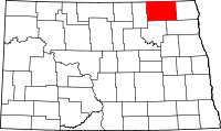 | |
| Townships |
| |
| Unincorporated communities |
| |
| Footnotes | ‡This populated place also has portions in an adjacent county or counties | |