Burnside, Arizona
| Burnside, Arizona | |
|---|---|
| Census-designated place | |
 Location in Apache County and the state of Arizona | |
 Burnside, Arizona Location in the United States | |
| Coordinates: 35°45′18″N 109°37′49″W / 35.75500°N 109.63028°WCoordinates: 35°45′18″N 109°37′49″W / 35.75500°N 109.63028°W | |
| Country | United States |
| State | Arizona |
| County | Apache |
| Area | |
| • Total | 9.3 sq mi (24.1 km2) |
| • Land | 9.3 sq mi (24.1 km2) |
| • Water | 0.0 sq mi (0.0 km2) |
| Elevation | 6,410 ft (1,954 m) |
| Population (2010) | |
| • Total | 537 |
| • Density | 58/sq mi (22.4/km2) |
| Time zone | MST (UTC-7) |
| • Summer (DST) | MDT (UTC-6) |
| FIPS code | 04-08535 |
| GNIS feature ID | 1853156 |
Burnside is a census-designated place (CDP) in Apache County, Arizona, United States. The population was 537 at the 2010 census.[1]
Geography
Burnside is located at 35°45′18″N 109°37′49″W / 35.75500°N 109.63028°W (35.755138, -109.630277).[2]
According to the United States Census Bureau, the CDP has a total area of 9.3 square miles (24 km2), all land.
Demographics
As of the census[3] of 2000, there were 632 people, 173 households, and 134 families residing in the CDP. The population density was 67.9 people per square mile (26.2/km²). There were 216 housing units at an average density of 23.2/sq mi (9.0/km²). The racial makeup of the CDP was 91.77% Native American, 7.12% White, 0.63% from other races, and 0.47% from two or more races. 0.63% of the population were Hispanic or Latino of any race.
There were 173 households out of which 48.6% had children under the age of 18 living with them, 38.2% were married couples living together, 33.5% had a female householder with no husband present, and 22.0% were non-families. 21.4% of all households were made up of individuals and 3.5% had someone living alone who was 65 years of age or older. The average household size was 3.65 and the average family size was 4.35.
In the CDP the age distribution of the population shows 44.8% under the age of 18, 10.0% from 18 to 24, 27.5% from 25 to 44, 13.6% from 45 to 64, and 4.1% who were 65 years of age or older. The median age was 21 years. For every 100 females there were 92.7 males. For every 100 females age 18 and over, there were 85.6 males.
The median income for a household in the CDP was $24,063, and the median income for a family was $25,441. Males had a median income of $18,661 versus $21,389 for females. The per capita income for the CDP was $8,236. About 30.6% of families and 38.9% of the population were below the poverty line, including 48.4% of those under age 18 and 13.2% of those age 65 or over.
Education
Burnside is served by the Ganado Unified School District.
The area is served by Ganado Primary School, Ganado Intermediate School, Ganado Middle School, and Ganado High School.
References
- ↑ "Geographic Identifiers: 2010 Demographic Profile Data (G001): Burnside CDP, Arizona". U.S. Census Bureau, American Factfinder. Retrieved April 17, 2013.
- ↑ "US Gazetteer files: 2010, 2000, and 1990". United States Census Bureau. 2011-02-12. Retrieved 2011-04-23.
- ↑ "American FactFinder". United States Census Bureau. Archived from the original on 2013-09-11. Retrieved 2008-01-31.
Municipalities and communities of Apache County, Arizona, United States | ||
|---|---|---|
| City | 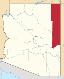 | |
| Towns | ||
| CDPs |
| |
| Unincorporated communities |
| |
| Indian reservations | ||
| Footnotes | ‡This populated place also has portions in an adjacent county or counties | |