Blue Gap, Arizona
| Blue Gap, Arizona | |
|---|---|
| Unincorporated community | |
 Blue Gap, Arizona  Blue Gap, Arizona | |
| Coordinates: 36°10′15″N 109°56′47″W / 36.17083°N 109.94639°WCoordinates: 36°10′15″N 109°56′47″W / 36.17083°N 109.94639°W | |
| Country | United States |
| State | Arizona |
| County | Apache |
| Elevation | 6,496 ft (1,980 m) |
| Time zone | Mountain (MST) (UTC-7) |
| ZIP code | 86520 |
| Area code(s) | 928 |
| GNIS feature ID | 25260[1] |
Blue Gap (Navajo: Tachíí/Bis Dootłʼizh Ndeeshgiizh) is an unincorporated community in Apache County, Arizona, United States. Blue Gap is on the Navajo Nation 22 miles (35 km) west of Chinle. Blue Gap has a post office with ZIP code 86520.[2]
References
Municipalities and communities of Apache County, Arizona, United States | ||
|---|---|---|
| City | 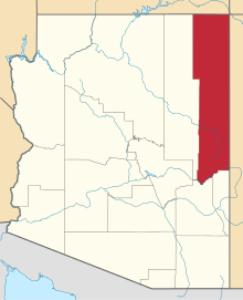 | |
| Towns | ||
| CDPs |
| |
| Unincorporated communities |
| |
| Indian reservations | ||
| Footnotes | ‡This populated place also has portions in an adjacent county or counties | |
This article is issued from Wikipedia - version of the 11/19/2016. The text is available under the Creative Commons Attribution/Share Alike but additional terms may apply for the media files.