Nutrioso, Arizona
| Nutrioso, Arizona | |
|---|---|
| Census-designated place | |
 Nutrioso  Nutrioso | |
| Coordinates: 33°57′11″N 109°12′33″W / 33.95306°N 109.20917°WCoordinates: 33°57′11″N 109°12′33″W / 33.95306°N 109.20917°W | |
| Country | United States |
| State | Arizona |
| County | Apache |
| Area | |
| • Total | 0.3 sq mi (0.8 km2) |
| • Land | 0.3 sq mi (0.8 km2) |
| • Water | 0 sq mi (0 km2) |
| Elevation | 7,671 ft (2,338 m) |
| Population (2010) | |
| • Total | 26 |
| • Density | 85/sq mi (32.7/km2) |
| Time zone | Mountain (MST) (UTC-7) |
| ZIP code | 85932 |
| Area code(s) | 928 |
| GNIS feature ID | 32412[1] |
Nutrioso is an unincorporated community and census-designated place (CDP) in Apache County, Arizona, United States. Nutrioso is located on U.S. Route 180 and U.S. Route 191 12 miles (19 km) south-southeast of Eagar. Nutrioso has a post office with ZIP code 85932.[2] As of the 2010 census, the population was 26.[3]
History
Nutrioso's name is derived from the Spanish word Nutria ("Otter"). The early Spanish colonists referred to beaver as "nutria", perhaps because the Eurasian beaver had been extinct in Spain since the 17th century.[4][5][6] On August 2, 1776 Francisco Silvestre Vélez de Escalante wrote in his diary, "...we halted in a small plain on the bank of another arroyo which is called Rio de las Nutrias, because, although it is of permanent and running water, apparently during all or most of the year it stands in pools where they say beavers breed."[7] The first settlers in the area either killed an otter and a bear (Oso in Spanish) and took the name from that incident,[8] killed a beaver and a bear and misused the term "Nutria"[9] or killed just a beaver and used the term "Nutrioso" to mean "Of Beavers".[10]
Nutrioso rose in importance as Mormon refugees relocated here after other nearby settlements were attacked by Native American groups. By 1880, a fort had been constructed, and by 1883 a post office was established. [9]
References
- ↑ U.S. Geological Survey Geographic Names Information System: Nutrioso, Arizona
- ↑ "Free ZIP Code Lookup with area code, county, geocode, MSA/PMSA, population.". Retrieved 17 September 2016.
- ↑ "Geographic Identifiers: 2010 Demographic Profile Data (G001): Nutrioso CDP, Arizona". U.S. Census Bureau, American Factfinder. Retrieved April 29, 2013.
- ↑ J. J. Warner (1907–1908). "Reminiscences of Early California from 1831 to 1846 Warner Annual Publications of the Historical Society of Southern California 1907-1908". Annual Publication of the Historical Society of Southern California. 7 (2/3): 176–193.
- ↑ Francisco Tomás Hermenegildo Garcés, Elliott Coues (1900). On the trail of a Spanish pioneer: the diary and itinerary of Francisco Garcés (missionary priest) in his travels throughout Sonora, Arizona, and California, 1775-1776 Vol. I and II. F. P. Harper.
- ↑ Robert Hixson Julyan (1996). The Place Names of New Mexico. University of New Mexico Press. p. 297. ISBN 9780826316899. Retrieved 2012-06-04.
- ↑ "The Diary and Itinerary of Fathers Dominguez and Escalante". Retrieved 2012-06-04.
- ↑ Charles S. Peterson (1973). Take up your mission; Mormon colonizing along the Little Colorado River, 1870-1900. University of Arizona Press. p. 36. Retrieved 7 December 2011.
- 1 2 Byrd H. Granger (1960). Arizona Place Names. University of Arizona Press. p. 18. Retrieved 2013-09-01.
- ↑ George Rippey Stewart (1970). American place-names: A concise and selective dictionary for the continental United States of America. Oxford University Press. p. 335. Retrieved 7 December 2011.
Municipalities and communities of Apache County, Arizona, United States | ||
|---|---|---|
| City | 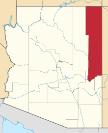 | |
| Towns | ||
| CDPs |
| |
| Unincorporated communities |
| |
| Indian reservations | ||
| Footnotes | ‡This populated place also has portions in an adjacent county or counties | |