Wolcott, Connecticut
| Wolcott, Connecticut | ||
|---|---|---|
| Town | ||
| ||
 Location in New Haven County, Connecticut | ||
| Coordinates: 41°36′04″N 72°58′30″W / 41.60111°N 72.97500°WCoordinates: 41°36′04″N 72°58′30″W / 41.60111°N 72.97500°W | ||
| Country | United States | |
| State | Connecticut | |
| NECTA | Waterbury | |
| Region | Central Naugatuck Valley | |
| Incorporated | 1796 | |
| Government | ||
| • Type | Mayor-council | |
| • Mayor | Thomas G. Dunn (R) | |
| • Town Council |
David Valletta (R), Chairman Rachel Wisler (R), Majority Leader Gale L. Mastrofrancesco (R), Vice Chairman Donald Charette, Sr. (R) Roger Picard (R) Jeffrey Slavin (R) Chuck Marsella (D) Joseph D. Bueno (D) Fran Masi (D) | |
| Area | ||
| • Total | 21.1 sq mi (54.6 km2) | |
| • Land | 20.4 sq mi (52.9 km2) | |
| • Water | 0.7 sq mi (1.8 km2) | |
| Elevation | 853 ft (260 m) | |
| Population (2010) | ||
| • Total | 16,680 | |
| • Density | 790/sq mi (310/km2) | |
| Time zone | Eastern (UTC-5) | |
| • Summer (DST) | Eastern (UTC-4) | |
| ZIP code | 06716 | |
| Area code(s) | 203 | |
| FIPS code | 09-87560 | |
| GNIS feature ID | 0213538 | |
| Website |
www | |

Wolcott (local /ˈwʊlkət/)[1] is a town in New Haven County, Connecticut, United States. It is primarily residential with a population of 16,680 at the 2010 census.[2] Known as Farmingbury when it was settled in the 1730s by the Connecticut Colony, the town was renamed Wolcott after being incorporated in 1796.[3]
History
As the end of the 17th-century grew near, the early towns of Waterbury and Farmington had come to occupy a great deal of west-central Connecticut in the Naugatuck River Valley and Farmington River Valley, respectively. At that time, the borderlands between these two towns were known as Farmingbury, a term derived by simply combining parts of the two town names.
Although individuals were living within the Farmingbury territory as early as the 1730s, they possessed no official identity apart from the parent towns of either Waterbury or Farmington. By 1770, the residents of Farmingbury successfully petitioned the Connecticut General Assembly to create the First Ecclesiastical Society of Farmingbury. Having established an independent parish, Farmingbury gained a good deal of religious, legal and financial independence from Waterbury and Farmington.
However, the political boundaries of the region remained unchanged for more than two decades afterwards. During that time the Farmingbury parish was largely self-sufficient, owing to its fairly remote location, but still officially considered to be part and parcel to Waterbury in the west and Farmington in the east. Thus, the parish society found itself handling several matters that would ordinarily have been municipal duties, such as managing taxes and local education.
Farmingbury petitioned the Connecticut General Assembly in 1796, requesting that it be incorporated as an independent town distinct from Waterbury and Farmington. Assembly votes tallied up to a tie, half in favor and half against the proposal. The tie-breaking vote in favor of Farmingbury was cast by Lieutenant Governor Oliver Wolcott and the lands of Farmingbury previously owned by Waterbury and Farmington were officially ceded to the new town. In honor of the Lieutenant Governor's deciding vote, the residents of Farmingbury renamed their newly incorporated town "Wolcott".[3] The 1800 United States Census was the first census conducted after Wolcott's incorporation and counted 948 individuals living within the town.[4]
Geography
According to the United States Census Bureau, the town has a total area of 21.1 square miles (55 km2), of which 20.4 square miles (53 km2) is land and 0.7 square miles (1.8 km2), or 3.22%, is water.
Although there aren't any natural lakes of significant size in Wolcott, there are several man-made reservoirs created from the damming of small rivers and brooks. Scovill Reservoir, also known as Woodtick Reservoir, covers 121 acres (49 ha) and was built by damming the Mad River in central Wolcott. Although it was originally constructed in 1917 to supply water for a brass manufacturer, it is now a town-owned recreational lake.[5] Other reservoirs that are at least partially contained within Wolcott include Chestnut Hill Reservoir, Hitchcock Lake, Southington Reservoir #2, New Britain Reservoir (which extends east into neighboring Southington, Connecticut) and Cedar Lake and Dunham Mill Pond (both of which extend north into neighboring Bristol, Connecticut).
The highest point in New Haven County is found in Wolcott atop Lindsley Hill, which has an elevation of approximately 1,046 feet above sea level.[6]
Land use
Wolcott is primarily a residential, suburban town[7] with a population density of 816 people per square mile,[8] though approximately 56% of the town's land remains undeveloped. Residential developments occupy roughly 33% of the town and encompass 6,148 housing units (of which 89.5% are single family homes).[9] Cumulatively, about 11% of the town is currently used for agriculture, commerce/industry, recreation and municipal facilities.[7]
Demographics
| Historical population | |||
|---|---|---|---|
| Census | Pop. | %± | |
| 1800 | 948 | — | |
| 1820 | 943 | — | |
| 1850 | 603 | — | |
| 1860 | 574 | −4.8% | |
| 1870 | 493 | −14.1% | |
| 1880 | 522 | 5.9% | |
| 1890 | 522 | 0.0% | |
| 1900 | 581 | 11.3% | |
| 1910 | 563 | −3.1% | |
| 1920 | 719 | 27.7% | |
| 1930 | 972 | 35.2% | |
| 1940 | 1,765 | 81.6% | |
| 1950 | 3,553 | 101.3% | |
| 1960 | 8,889 | 150.2% | |
| 1970 | 12,495 | 40.6% | |
| 1980 | 13,008 | 4.1% | |
| 1990 | 13,700 | 5.3% | |
| 2000 | 15,215 | 11.1% | |
| 2010 | 16,680 | 9.6% | |
| Est. 2014 | 16,716 | [10] | 0.2% |
As of the census[12] of 2000, there were 15,215 people, 5,414 households, and 4,249 families residing in the town. The population density was 744.7 people per square mile (287.5/km²). There were 5,544 housing units at an average density of 271.4 per square mile (104.8/km²). The racial makeup of the town was 96.23% White, 1.24% Black, 0.14% Native American, 0.75% Asian, 0.04% Pacific Islander, 0.59% from other races, and 1.01% from two or more races. Hispanic or Latino of any race were 1.79% of the population.
There were 5,414 households out of which 37.3% had children under the age of 18 living with them, 66.0% were married couples living together, 8.7% had a female householder with no husband present, and 21.5% were non-families. 18.0% of all households were made up of individuals and 8.6% had someone living alone who was 65 years of age or older. The average household size was 2.79 and the average family size was 3.17.
In the town the population was spread out with 26.0% under the age of 18, 5.6% from 18 to 24, 31.3% from 25 to 44, 24.0% from 45 to 64, and 13.1% who were 65 years of age or older. The median age was 38 years. For every 100 females there were 95.0 males. For every 100 females age 18 and over, there were 92.5 males.
The median income for a household in the town was $61,376, and the median income for a family was $67,582. Males had a median income of $45,682 versus $31,964 for females. The per capita income for the town was $25,018. About 1.0% of families and 2.6% of the population were below the poverty line, including 2.6% of those under age 18 and 5.0% of those age 65 or over.
Notable people
- Amos Bronson Alcott (1799–1888), father of Louisa May Alcott, born in Wolcott, teacher, writer, and founder of the utopian community "Fruitlands"[13]
- William Andrus Alcott (1798–1859), born in Wolcott, teacher and noted author of over 100 books[13]
- Andrew B. Jackson (1814-1878), Wisconsin pioneer and territorial legislator, was born in Wolcott.[14]
- Seth Thomas (1785–1859), famous clock maker born in Wolcott
- Colleen Ward, Miss Connecticut 2015 is a 2010 graduate of Wolcott High School
- Governor Oliver Wolcott,Sr. (1726-1797), born in Windsor, Connecticut. Signed the Declaration of Independence August 2, 1776. He helped melt the statue of King George III into bullets making 42,088 cartridges to be used by the Continental Soldiers. Colonial Governor from 1751-1754, Lt. Governor of Connecticut in 1796 and appointed Brigadier-General, the town of Farmingbury was changed to "Wolcott", Conn. in gratitude for his lifelong commitment.From the "Wolcot Family History Book" (1578-1985)[15]
- Anthony Fantano (1985-), music critic and creator of The Needle Drop.
Wolcott public schools

There are five public schools within the Wolcott Public Schools system:
- Elementary schools (Grades Pre-K - 5)
- Alcott Elementary School - Mascot is "All Star"
- Frisbie Elementary School - Mascot is "Bee"
- Wakelee Elementary School - Mascot is "Wildcat"
- Middle schools (Grades 6-8)
- Tyrrell Middle School (TMS) - Mascot is "Tornado"
High schools (Grades 9-12)
- Wolcott High School (WHS) - Mascot is "Eagle"
All of the elementary schools offer a latchkey program, though the latchkey program is traditionally run at Wakelee Elementary School.
References
- ↑ Kyff, Rob (2008). "Pronunciation For Novice Nutmeggers." Hartford Courant. Hartford, CT.
- ↑ "Profile of General Population and Housing Characteristics: 2010 Demographic Profile Data (DP-1): Wolcott town, New Haven County, Connecticut". U.S. Census Bureau, American Factfinder. Retrieved October 1, 2012.
- 1 2 Orcutt, Samuel. History of the Town of Wolcott (Connecticut) from 1731 to 1874, with an account of the Centenary Meeting, September 10th and 11th 1873; and with the Genealogies of the Families of the Town. Waterbury: Press of the American Printing Company, 1874. Print.
- ↑ United States of America. Return of the Whole Number of Persons Within the Several Districts of the United States. Printed by order of the House of Representatives, 1801. Print. <http://www2.census.gov/prod2/decennial/documents/1800-return-whole-number-of-persons.pdf>.
- ↑ "Recreation - Woodtick Reservoir Information." Wolcott, Connecticut. Town of Wolcott. Web. 12 Aug 2013. <http://www.wolcottct.org/pages/page_content/secondary_services_recreation_woodtick-reservoir_woodtick-reservoir-info.aspx>.
- ↑ Goodman, Florence. "Wolcott Historical Society History for July 2013." Wolcott Historical Society. N.p., n.d. Web. 31 Oct 2013. <http://www.tapr.org/~wa1lou/whs/news201307.html>.
- 1 2 "Town of Wolcott, Connecticut Plan of Conservation and Development" (PDF). Town of Wolcott. Wolcott Planning and Zoning Commission. Retrieved 24 January 2016.
- ↑ 2010 US Census, United States Census, 2010; Wolcott, Connecticut;. Retrieved on January 23, 2016.
- ↑ "Wolcott, Connecticut: CERC Town Profile 2014". Connecticut Economic Resource Center. Connecticut Economic Resource Center. Retrieved 24 January 2016.
- ↑ "Annual Estimates of the Resident Population for Incorporated Places: April 1, 2010 to July 1, 2014". Retrieved June 4, 2015.
- ↑ "Census of Population and Housing". Census.gov. Retrieved June 4, 2015.
- ↑ "American FactFinder". United States Census Bureau. Retrieved 2008-01-31.
- 1 2 Who Was Who in America, Historical Volume, 1607-1896. Marquis Who's Who. 1967.
- ↑ Atwood, David; Tenney, Horace Addison (1880). Memorial Record of the Fathers of Wisconsin: Containing Sketches of the Lives and Careers of the Members of the Constitutional Conventions of 1846 and 1847-8. With a History of Early Settlement in Wisconsin. Madison, Wisconsin: David Atwood. pp. 227–228. Retrieved 22 February 2016.
- ↑ Ancestry.com (Wolcott-Pierce)
Further reading
- History of the town of Wolcott (Connecticut) from 1731 to 1874 by Samuel Orcutt, 1874 (copy) (copy)
External links
- Town of Wolcott official website
- Wolcott Historical Society
- Wolcott Public Schools
- WOLCOTT, CT LIVESTREAM

Municipalities and communities of New Haven County, Connecticut, United States | ||
|---|---|---|
| Cities | 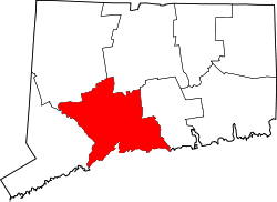 | |
| Towns |
*Consolidated borough and town | |
| Borough | ||
| Other communities | ||
