Southbury, Connecticut
| Southbury, Connecticut | ||
|---|---|---|
| Town | ||
| ||
 Location in New Haven County, Connecticut | ||
| Coordinates: 41°28′25″N 73°14′03″W / 41.47361°N 73.23417°WCoordinates: 41°28′25″N 73°14′03″W / 41.47361°N 73.23417°W | ||
| Country | United States | |
| State | Connecticut | |
| NECTA | Bridgeport-Stamford | |
| Region | Central Naugatuck Valley | |
| Incorporated | 1787 | |
| Government | ||
| • Type | Selectman-town meeting | |
| • First selectman | Jeff Manville (R) | |
| • Selectmen |
Chad A. Landmon (R) Kenneth Korsu (R) Jennifer B. O'Neill (R) John Monteleone (R) Donna Pereira (D) | |
| Area | ||
| • Total | 40.1 sq mi (103.8 km2) | |
| • Land | 39.0 sq mi (101.0 km2) | |
| • Water | 1.1 sq mi (2.8 km2) | |
| Elevation | 335 ft (102 m) | |
| Population (2010) | ||
| • Total | 19,904 | |
| • Density | 500/sq mi (190/km2) | |
| Time zone | Eastern (UTC-5) | |
| • Summer (DST) | Eastern (UTC-4) | |
| ZIP code | 06488 | |
| Area code(s) | 203 | |
| FIPS code | 09-69640 | |
| GNIS feature ID | 0213507 | |
| Website |
www | |

Southbury is a town in western New Haven County, Connecticut, USA. Southbury is north of Oxford and Newtown, and east of Brookfield. Its population was 19,904 at the 2010 census.[1]
Southbury comprises rural country areas, suburban neighborhoods, and historic districts. It is a short distance from major business and commercial centers, and is within 80 miles (130 km) of New York City and 40 miles (64 km) of Hartford; the latter the capital of Connecticut.
Southbury is the only community in the country with the name "Southbury", which is why the town seal reads Unica Unaque, meaning "The One and Only."
History

The town of Southbury was one of several towns formed out of a parcel of land purchased from the Paugussett Indians in 1659. Southbury was originally part of Woodbury, which was settled in 1673. A meetinghouse for the Southbury Ecclesiastical Society was built in 1733, and in 1845 the town of Southbury was incorporated.[2] Although incorporated as part of Litchfield County, Southbury has been in New Haven County for most of its existence.[3]
In the 1800s, water power became essential to the growth of Southbury's industries, which included mills, tanneries, and distilleries.[4] The power for these industries came primarily from the Pomperaug River[5] and the Housatonic River. As the industrial revolution progressed, many of these businesses left for Waterbury.
In the 1920s, Russian expatriates Count Ilya Tolstoy (son of author Leo Tolstoy) and George Grebentschikoff founded an artists' colony at one end of Main Street, known as Churaevka (or "Russian Village"). At its peak, Churaevka had a printing press used by Russian and Ukrainian scholars and novelists. Visitors to the colony included the composer Sergei Rachmaninoff. Most of its immigrant population is now gone; however, St. Sergius Chapel, designed by Nicholas Roerich and built in 1932-1933, remains. Churaevka is listed on the National Register of Historic Places.
In November 1937 residents of the farming outpost got word that a man by the name of Wolfgang Jung had purchased 178 acres (0.72 km2) in the town. Residents looking into his plans discovered that he was a member of the German American Bund, an organization of ethnic Germans living in the United States who supported Adolf Hitler and Nazi Germany. Its leader, Fritz Kuhn, was considered the leading anti-Semite in the country. Word soon got out that they were in fact planning to build their largest training facility in the country. Residents objected by calling a town meeting and set up a zoning department with one simple rule, no military activity excluding the United States Army. The law was adopted December 14 and the Bund stopped work and eventually sold the land.[6] In 2012 a documentary was created entitled 'Home of the Brave: When Southbury Said No to the Nazi s'
Southbury was a rural farming town for most of its history. However, with the development of the Interstate Highway System, that changed. With the opening of Interstate 84 through Southbury by 1963,[7] the town gained easy access to New York and Hartford, also improving its access to Danbury and Waterbury. Heritage Village opened in 1967, on a 1,000-acre (4.0 km2) site.[8] In 1987, IBM built an extensive office and research building in Southbury, employing over 2,500 workers. Southbury was no longer a small, rural town. Today, Southbury has approximately 17% open space, with a goal of 20%.[9]
In the early 1990s, Southbury was the subject of a lawsuit by the Golden Hill Paugussett Indian Nation. The 100-member tribe sought to take the land of roughly 1,200 property holders in the town. The lawsuit was thrown out in 1993 based on the fact that the man who brought the suit was not a chieftain, contrary to his claims, and had no standing to bring the suit.[10]
Geography
According to the US Census Bureau, Southbury has a total area of 40.1 square miles (103.8 km2), of which 39.0 square miles (101.0 km2) is land and 1.1 square miles (2.8 km2), or 2.69%, is water.[11]
Towns that border Southbury are Middlebury to the northeast, Oxford to the east and southeast, Newtown to the southwest, Bridgewater to the west, and Roxbury and Woodbury to the north.
South Britain and Southford are included in the incorporated township of Southbury.
Demographics
| Historical population | ||
|---|---|---|
| Year | Pop. | ±% |
| 1800 | 1,757 | — |
| 1850 | 1,484 | −15.5% |
| 1900 | 1,238 | −16.6% |
| 1950 | 3,828 | +209.2% |
| 1960 | 5,186 | +35.5% |
| 1970 | 7,852 | +51.4% |
| 1980 | 14,156 | +80.3% |
| 1990 | 15,818 | +11.7% |
| 2000 | 18,567 | +17.4% |
| 2010 | 19,904 | +7.2% |
| Source: [12] | ||
As of the 2000 census,[13] there were 18,567 people comprising 7,225 households, including 4,833 families residing in Southbury. The population density was 475.4 people per square mile (183.5/km²). There were 7,799 housing units at an average density of 199.7 per square mile (77.1/km²). The racial makeup of the town was 97.34% White, 0.45% African American, 0.08% Native American, 1.15% Asian, 0.01% Pacific Islander, 0.35% from other races, and 0.62% from multiple races. Hispanic or Latino of any race were 1.59% of the population.
Of Southbury's 7,225 households, 29.0% had children under the age of 18 living with them, 59.8% were married couples living together, 5.4% had a female householder with no husband present, and 33.1% were non-families. About 29.8% of all households were made up of individuals, and 21.4% had someone living alone who was 65 or older. The average household size was 2.41, and the average family size was 3.02.
Southbury's population consisted of 22.8% under the age of 18, 3.3% from 18 to 24, 22.7% from 25 to 44, 25.1% from 45 to 64, and 26.1% who were 65 or older. The median age was 46 years. For every 100 females there were 86.9 males. For every 100 females age 18 and over, there were 82.3 males.
The median income for a household in Southbury is $75,970 in 2007, compared to $61,919 in 1999; the median income for a family in 1999 was $81,109. In 1999, males had a median income of $87,365 versus $68,657 for females. The per capita income for the town was $62,731. About 1.9% of families and 4.9% of the population were below the poverty line, including 2.3% of those under age 18 and 5.0% of those 65 or over. The median home value was $532,650.
In July 2008, it was estimated that there were 19,702 (+6.1% from 2000) people in Southbury. The estimated median household income was $75,970 (+22.7% from 2000). The estimated median home (or condominium) value was to $374,178 (+92.6% from 2000).[14]
Heritage Village
Southbury is home to a variety of retirement facilities, including Heritage Village, New England's largest retirement community. Heritage Village sits on 1,000 acres (4.0 km2) and includes approximately 2,580 homes with 4,000 people.[15] It is billed as being an "active retirement" community, offering many activities.[16] Heritage Village was planned in the 1960s, as I-84 was completed in the area.[17] Potential Heritage Village residents must be 55 years of age or older.[18]
By 2013, about 30% of the population of Southbury is expected to be 60 years of age or older. By 2020, about 40% will be 60 or older.[19] Southbury has developed a three-phase plan to increase services for the services. The former Southbury Library was converted into a senior center; it also houses the new home of the area Parks & Recreations Department.
In addition to the "active living" area of Heritage Village, Southbury contains several "assisted living facilities", including:
- Kensington Green
- Lutheran Home of Southbury
- River Glen Health Care Center
Other "active senior living" options that provide independent living, assisted living, and memory care in Southbury include:
- Pomperaug Woods
- Watermark at East Hill
Government and voting
Southbury has a six-member Board of Selectmen, including First Selectman, Edward Edelson.[20]
Method of voting
Southbury used mechanical voting machines until 2007, when it switched to optical scanning machines. The new system has been criticized for several reasons, including lack of privacy.
Southbury utilizes up to five polling stations.[21] for most elections, only the firehouse is used.
Consistent with Connecticut law, citizens have the option of choosing a party when they register to vote. A citizen may join, or change, their affiliation later. Primary voting is limited to members of that party. (For the 2008 primaries, the day before the February 5 primary was the final day to select that party.[21]
Voting results for Connecticut and federal elected officials
In 2006, veteran U.S. House Representative Nancy Johnson was ousted in favor of Democrat Christopher Murphy, who carried Southbury, 51-49%. Junior U.S. Senator Joseph Lieberman dropped his Democratic party affiliation, but was re-elected as an independent, carrying Southbury with 57% of the vote; his closest opponent, Democrat Ned Lamont, had only 32% of Southbury's support.[22]
In 2008, Southbury supported Republican John McCain for President over Democrat Barack Obama by a vote of 53-46%. For the U.S. House, the town narrowly supported Republican David Cappiello over Murphy, the Democratic incumbent who ultimately won in a landslide.
In 2010, Southbury voted in favor of Republican candidates Tom Foley for Governor and Linda McMahon for U.S. Senate. Though neither of the Republicans won statewide, they carried Southbury with 61% and 56% of the vote, respectively. Southbury again supported the Republican for U.S. House, voting for Sam Caligiuri over the Democrat Murphy by a 56-44% margin.
U.S. Senators: Joseph Lieberman, Richard Blumenthal
U.S. Congressman: Christopher Murphy
State Senator: Robert Kane
State Representatives: Arthur J. O'Neill, David Labriola
Political parties
- Southbury Democratic Town Committee, 2,967 members (+283 from previous totals)[23]
- Southbury Republican Town Committee, 4,583 members (+57 from previous totals)[23] - Members are elected to serve two-year terms on the RTC.[24]
Education

Southbury is part of the Pomperaug Regional School District, a 15-school system that includes Southbury and Middlebury. The system contains four elementary, two middle and one high school. Both middle schools are national blue ribbon schools.
There has been a debate between the two towns over the amount each pays towards the system.[25] Southbury is considerably larger than Middlebury, with a considerably larger tax base. This has resulted in Southbury contributing greater funds to the school system, yet each Southbury resident pays less per student. In recent times these data have been challenged, especially during the struggle to pass the school system's 2008-2009 budget.
Schools located in Southbury include:
- Gainfield Elementary School
- Pomperaug Elementary School
- Rochambeau Middle School
- Pomperaug High School
Students from Region 15 also have the option to attend:
- W.F. Kaynor Technical High School (Waterbury)
- Henry Abbot Technical High School (Danbury)
- Nonnewaug High School (Region 14, Woodbury, accessible as an agricultural school for Region 15 students)
Recreation
The Southbury Parks & Recreations Department moved into the old Southbury Library in 2007. Southbury town sports include:
- Babe Ruth/Cal Ripken baseball
- Basketball
- Pop Warner football
- Soccer
- Lacrosse
Controversy has arisen over town sports since the Parks and Recreation department began enforcing a policy banning out-of-town players from participating in town-sanctioned sports in 2006.[26] This policy stems from the fact of overcrowding at town fields, a problem which is plaguing Southbury.[27]
Local media
- Waterbury Republican-American - A Waterbury-based independent daily newspaper
- The Danbury News-Times - A Danbury-based daily newspaper
- Voices - A local newspaper serving Southbury, Middlebury, Oxford, Seymour, Naugatuck, Woodbury, Bethelhem, New Preston, Washington, Washington Depot, Roxbury, Bridgewater, Monroe, Sandy Hook and Newtown
- Macaroni Kid - An events calendar for families in Bridgewater, Roxbury, Bethlehem, Woodbury, Southbury, Oxford, Watertown, Oakville, Middlebury, Waterbury, and western Naugatuck
- WTCH - A local student & staff run television station broadcast by Pomperaug High School in Southbury. Channel 17 in Southbury, Channel 16 in Middlebury.
Infrastructure
Only a small area of Southbury is covered by water or sewer systems, with the vast majority left to wells and septic. Southbury is generally concerned with its water table, to the point where the only car wash in town is required to recycle all of their water used, an expensive process.
The town water provider is Aquarion. The gas provider is Yankee Gas Company. The cable (TV, internet, and soon, phone) provider is Charter Communications. The electric provider is Connecticut Light & Power (a Northeast Utilities Company). The phone provider (POTS & DSL) is AT&T Inc.
Notable features
National Historic Registry
- Aaron Bronson House – 846 Southford Rd.
- Adin Wheeler House and Theodore F. Wheeler Wheelwright Shop – 125 Quaker Farms Rd.
- Bullet Hill School – Main St. and Seymour Rd.
- Hurley Road Historic District – 6 and 17 Hurley Rd.
- Little Pootatuck Brook Archeological Site
- Plaster House – 117 Plaster House Rd.
- Reuben Curtiss House – 1770 Bucks Hill Rd.
- Russian Village Historic District – Roughly Kiev Dr. and Russian Village Rd. between US 6 and the Pomperaug River
- Sanford Road Historic District – 480 and 487 Sanford Rd.
- South Britain Historic District – E. Flat Hill, Hawkins, Library, and Middle Rds., and 497-864 S. Britain Rd.
- Southbury Historic District No. 1 – Main St. from Woodbury Town Line to Old Waterbury Rd.
- Southbury Training School – 1484 S. Britain Rd., a 1,600-acre (6.5 km2) section of Southbury developed as a facility for mentally handicapped adults.
- William Hurd House – 327 Hulls Hill Rd.


Southbury Public Library
The Southbury Public Library is a department of the town, with its own 9-member Board of Directors.[28] On May 1, 2006 Southbury officially opened its new library (its 3rd, though no two have ever been in use concurrently) at 100 Poverty Road. This $6 million project was the first public building constructed in Southbury in 30 years. It is a 32,000-square-foot (3,000 m2), 2 floor, state-of-the-art facility. It contains around 90,000 books. It has computers, audiobooks, DVDs, recording rooms for recording books for the blind, meeting rooms, internet, a fireplace and a coffee bar.[29] Selections recorded for the blind at the Southbury Public Library become part of the National Library Service catalog.[30]
Planning for the library began in 1998, with an original projected bond issue of $7.35m. The planning committee solicited donations from the public, which resulted in two single donations of $100,000 or more, and five more of between $25,000 and $99,000, in addition to smaller donations.[31]
The old library building, at 561 Main Street South, has been converted to hold offices for the Parks and Recreation department, as well as a new senior center. The old library was built in 1969, and expanded in 1979.[28]
The oldest library building was located in South Britain (a section and Historic District of Southbury) and was replaced in 1969.[28] It was built in 1904 and contained approximately 1,000 volumes.[32]
Shepaug Dam and eagle observation area
The Shepaug Dam on the Housatonic River is part of a hydroelectric power plant, operated by FirstLight Power Resources, capable of a peak power output of 42,600 kW.[33] This dam is a popular nesting and feeding ground for wintering eagles and hawks, including bald eagles. Near the power station, FirstLight also operates an eagle observation area first opened by the utility's predecessor, Northeast Utilities, in the mid-1980s.[34] Access is free, and some telescopes are provided. Utility company employees and volunteers from the Connecticut Audubon Society and other groups are at the observation area to assist visitors.[34][35] Advanced reservations are required.[36] Eagles are attracted to the spot because the water churning through the dam's hydroelectric turbine keeps the surface from icing over, allowing the birds to fish. Red-tailed hawks, goshawks, great blue herons and other waterfowl are also attracted to the spot.[34] The dam flooded an area now known as Lake Lillinonah.
FirstLight Power Resources has submitted a plan to the Connecticut Department of Public Utility Control to build a new peak-power plant next to the existing hydroelectric facility.[37]
Parks

- Kettletown State Park, a state park on the Housatonic River that includes campgrounds located off I-84 Exit 15
- Southford Falls State Park, a state park off I-84 Exit 15 and I-84 Exit 16
- George Waldo State Park, a state park located on the Housatonic River, off Purchase Brook Road
- Ballentine Park, a town park with fields, basketball courts and a public pool (town residents only)
- George Ewald Park, a town park consisting of little league baseball fields
- Audubon Center at Bent of the River, a 700-acre (2.8 km2) nature sanctuary with about 15 miles (24 km) of hiking trails, an extensive nature library, and a bird-watching balcony
- Community House, a park consisting of newly renovated basketball courts, soccer field, football field, baseball field and multiple tennis courts
Businesses
IBM Southbury
The largest corporate complex in Southbury is that of IBM. IBM located its facilities between Kettletown Road and Bullet Hill Road, up a hill from Main Street on a 230-acre (0.93 km2) site. Access to the site is restricted to authorized personnel only. Its original design and construction allowed for 1,100,000 square feet (100,000 m2) of office space, intended for 2,500 people (later increased as around-the-clock operations began).[38] It also had 250,000 square feet (23,000 m2) of "raised floor" data center space, originally designed for large-scale water-cooled mainframe operations. It is an "off the grid" facility, with its power plant taking advantage of jet turbine technology to generate power for the entire site. In 2006, this power plant was replaced with a larger one as power demands increased. IBM Southbury was originally designed to be one of IBM's new corporate headquarters buildings, as IBM's "North Castle" facility in Armonk became outdated. It was never used for this purpose, and has been primarily used as an IBM Global Services facility. There are four buildings, labeled A, B, C, and Central Services. Due to decreasing demand for office space, buildings A and C are currently shut down.
Southbury Corporate Park
Southbury Corporate Park is a largely theoretical 125-acre (0.51 km2) site between I-84 exits 13 and 14. It is approved for roughly 900,000 square feet (84,000 m2) of zone R60-C compliant corporate offices.[39] The town purchased the site for a total of $5 million. It is designed to attract large corporate partners, or at worst, non-"big box" retailers. An arts center has also been proposed for the site, though this proposal was later revoked in favor of a possible location inside the Southbury Training School.[40]
Community organizations
Southbury Volunteer Firemen's Association
The Southbury Volunteer Firemen's Association, Inc. is a private, member governed corporation, operating as a non-profit organization and is chartered for the purpose of providing emergency service to the community. Serving a rural territory which includes several miles of Interstate 84, single family homes, industrial, heavy commercial, institutional, and some multi-family occupancies. Founded in 1932, they operate out of 4 facilities, with 16 specialty fire vehicles, and 107 department members. They provide services including Fire Suppression, Motor Vehicle Extrication, Operations level HAZMAT, Confined Space and Water Rescue to the community.[41]
Southbury Ambulance Association
The Southbury Ambulance Association was started as a volunteer organization in 1953 by the Southbury Lions Club, handling both Southbury and Woodbury. The SAA had some of the first EMT's in the state in the 1970s. Until 1978, only SLC members were allowed to join the SAA, which caused difficulties in finding sufficient crew for the ambulance service. As of 1997, the SAA was responding to more than 1,500 service calls a year. Today, the SAA still operates as a volunteer organization which receives zero funding from the town. It currently operates three ambulances.[42]
Southbury Land Trust
The Southbury Land Trust is a "private nonprofit conservation organization dedicated to the protection and preservation of Southbury Connecticut's natural resources for the enjoyment and benefit of all present and future generations." Basically, the SLT purchases or is gifted with land which it places development restrictions on. They currently control more than 800 acres (3.2 km2) of land in Southbury. Much of this land is open to the public.[43]
Notable people

- Howard Malcolm Baldrige (1894-1985), politician and lawyer; father of Howard M. Baldrige, Jr. and Letitia Baldrige
- Polly Bergen (1930-2014), actress, recording artist and entrepreneur. Bergen called a vintage house on several wooded acres in the South Britain area her home.
- Victor Borge (1909–2000), comedian, owned the Colonial House in Southbury, which now serves as a community center.[44] His estate and Cornish hen game farm is now Heritage Village.
- Linda Cohn (1959-), sportscaster on the ESPN network
- Philip Evergood (1901–1973), painter, etcher, lithographer, sculptor, illustrator and writer
- Joel Hinman (1802–1870), Chief Justice, Connecticut Supreme Court of Errors[45]
- James Ledbetter, author and editor based in New York City
- Dave Longstreth, singer and guitarist for Brooklyn-based band, Dirty Projectors
- Jan Miner (1917–2004), actress, most likely to be remembered as "Madge the Manicurist" in dozens of TV commercials for Palmolive dishwashing soap
- Wallace Nutting (1861–1941), famed photographer (and also a minister, author, lecturer, furniture maker), moved his photography studio to a farm in town from New York City in 1899. In 1912, he moved again to Framingham, Massachusetts.
- Katie Stevens (born 1992), actress and singer, known for her role in the MTV series Faking it
- Leland Stowe (1899–1994), Pulitzer Prize-winning journalist and one of the first to recognize the expansionist character of the German Nazi regime
- Ed Sullivan (1901–1974), iconic television personality and columnist; had a country home in town
- Gladys Taber (1899–1980), author of 59 books and columnist in the Lady's Home Journal, lived in "Stillmeadow", a 1690 farmhouse off Jeremy Swamp Road, starting in 1933 (summers only) and 1935 (full-time).[46]
- Sada Thompson (1927-2011), actress of stage, screen, and television, perhaps best known for her role on the long-running ABC drama Family
References
- ↑ "Profile of General Population and Housing Characteristics: 2010 Demographic Profile Data (DP-1): Southbury town, New Haven County, Connecticut". U.S. Census Bureau, American Factfinder. Retrieved September 28, 2012.
- ↑ "Official Website of the Town of Southbury".
- ↑ Palmer-Skok, Virginia. "Southbury": 11.
- ↑ Palmer-Skok, Virginia. "Southbury": 7.
- ↑ "Pomperaug River offers history lesson to region". Newsday.
- ↑ "Southbury whipped pro-Nazi group 70 years ago this month". Republican-American.
- ↑ "Connecticut Interstate 84". Kurami.
- ↑ Charles, Eleanor (June 2, 1985). "If You're Thinking of Living in Southbury". The New York Times. Retrieved May 23, 2010.
- ↑ "At Southbury Town Meeting Open Space Land Purchase Approved". Voices.
- ↑ "Judge Dismisses Suit By Indian for Land". The New York Times. October 29, 1993. Retrieved May 23, 2010.
- ↑ "Geographic Identifiers: 2010 Demographic Profile Data (G001): Southbury town, New Haven County, Connecticut". U.S. Census Bureau, American Factfinder. Retrieved September 28, 2012.
- ↑ "Connecticut State Register and Manual". Connecticut Secretary of the State.
- ↑ "American FactFinder". United States Census Bureau. Retrieved 2008-01-31.
- ↑ "Southbury, CT Detailed Profile". CityData.com.
- ↑ "The Village Today". HeritageVillageCT.org.
- ↑ "Villagers Activities Page". Villagers.com.
- ↑ "Heritage Village The Dream That Came True". HeritageVillageCT.org.
- ↑ "Heritage Village, Southbury". Active Adult Living.
- ↑ "Southbury to look at needs of town's senior set". Republican-American.
- ↑ "Town Officials Take Oath in Southbury Ceremony". Voices.
- 1 2 "Southbury Makes Plans for Presidential Primary". Voices.
- ↑ "Senate Election 2006 Connecticut County Results". CNN. Retrieved May 23, 2010.
- 1 2 "Clinton, McCain Win in Southbury". Voices.
- ↑ "Southbury GOP Picks New Members of RTC". Voices.
- ↑ "Middlebury to hire consultant to review Region 15 battle". Republican-American.
- ↑ "Town Playing Policy Opposed by Sports Leagues' Officials". Voices.
- ↑ "At Schools in Southbury Fire Marshal Tells Board of Traffic Issues". Voices.
- 1 2 3 "Southbury, CT: Southbury Public Library". AmericanTowns.com.
- ↑ "$6M Public Library to Open" (PDF). Republican-American.
- ↑ "Rep. O'Neill Secures Grant For Southbury Library" (PDF). House Republican Press Release's.
- ↑ "The House That Volunteers Built". ActForLibraries.org.
- ↑ Palmer-Skok, Virginia. "Southbury": 15.
- ↑ "Hydroelectric Power Generation". FirstLight Power Resources.
- 1 2 3 Associated Press, "Popular eagle-watching spot set to welcome visitors today", The Advocate of Stamford, Connecticut, December 26, 2007, page A13
- ↑ "Eagles are main attraction at Southbury observation area". Waterbury Republican-American.
- ↑ "Shepaug Bald Eagle Observation Area". Voices.
- ↑ "State Targets Power Peaks". The Hartford Courant.
- ↑ "LDP Portfolio - IBM Southbury Headquarters". LDP Architects.
- ↑ "Southbury Economic Development Council". The Official Site of the Town of Southbury.
- ↑ "STS Suggested Site: EDC Directs Arts Center Proposal to State". Zwire.
- ↑ title = SVFA
- ↑ "Southbury Ambulance Association".
- ↑ "Southbury Land Trust".
- ↑ "RealtyQuest for Southbury, CT". RealtyQuest.
- ↑ "Memorials to Connecticut Judges and Attorneys, Chief Justice Hinman". Connecticut State Library.
- ↑ "Circle of Writers, Gladys Taber". The Mystical Gardens.
External links
- Town of Southbury official website
- Southbury Public Library
- Pomperaug Regional School District 15
- Greater Tribury Chamber of Commerce
- Pomperaug District Department of Health, serving Southbury, Woodbury and Oxford
- Heritage Village Retirement Community
- Southbury Land Trust

Municipalities and communities of New Haven County, Connecticut, United States | ||
|---|---|---|
| Cities | 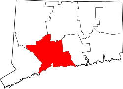 | |
| Towns |
*Consolidated borough and town | |
| Borough | ||
| Other communities | ||