Tara Hill, County Wexford
Location
| Tara Hill | |
|---|---|
| Torrchoill | |
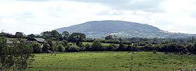 Tara Hill, from the northwest | |
| Highest point | |
| Elevation | 253 m (830 ft) [1] |
| Prominence | 198 m (650 ft) [1] |
| Listing | Marilyn |
| Coordinates | 52°41′56″N 6°13′04″W / 52.699°N 6.2177°WCoordinates: 52°41′56″N 6°13′04″W / 52.699°N 6.2177°W |
| Geography | |
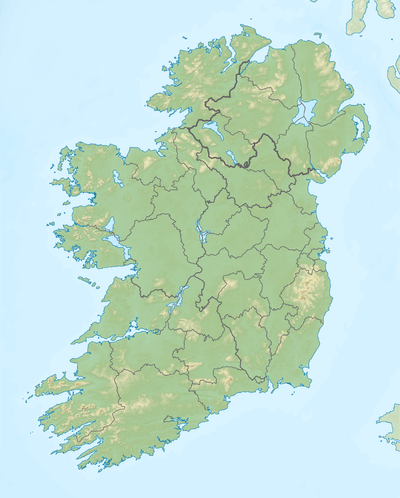 Tara Hill Location in Ireland | |
| Location | County Wexford, Ireland |
| OSI/OSNI grid | T205623 |
| Topo map | OSi Discovery 62 |
Tara Hill (Torrchoill in Irish) is an isolated hill near the Irish Sea coast in north County Wexford, Ireland. Though only 253 metres (830 feet) high, it dominates the landscape of northeast Wexford. It provides extensive views of the Wexford coast line, from Courtown harbour to Castletown. It is located in the heart of Tara Hill village. Tara Hill has many facilities including a church, a primary school (St Kevins) and a local shop (Siopa linn). The local GAA club (Castletown Liam Mellows) is located just meters down the road on the Castletown, Tara Hill border.
Geography
Due to its height relative to the surrounding landscape this hill qualifies as a Marilyn. It should not be confused with the much better known but much less prominent Royal Hill of Tara in County Meath, which is only 159m high.
The summit is marked by a cairn from where one can see nearby Gorey, Courtown and other villages and town-lands and views of the North Wexford coast.
History
Saint Caemhan or Kevin or Cavan, as the name is variously spelt is the Patron Saint of Tara Hill and the site of the old church founded by him is situated at Kilcavan at the north side of the hill under a cliff by the road.[2]
References
- 1 2 "North Wexford Area - Tara Hill". MountainViews. Ordnance Survey Ireland. Retrieved July 2, 2015.
- ↑ http://www.northwexford.com/tarahill.htm
Lists of Marilyns | |
|---|---|