Mullacor
| Mullacor | |
|---|---|
| Mullaigh Mhór | |
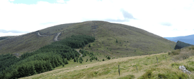 View from NW | |
| Highest point | |
| Elevation | 657[1] m (2,156 ft) |
| Prominence | 102[1] |
| Coordinates | 52°59′6″N 6°22′26″W / 52.98500°N 6.37389°WCoordinates: 52°59′6″N 6°22′26″W / 52.98500°N 6.37389°W |
| Geography | |
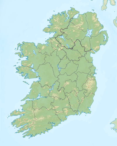 Mullacor Location in Ireland | |
| Location | Wicklow, Ireland |
| Parent range | Wicklow Mountains |
| Geology | |
| Mountain type | Granite |
Mullacor (Irish: Mullaigh Mhór, meaning "Big hilltop"[2]) is a mountain in Wicklow Mountains in County Wicklow, Ireland.
Geography

Summit cairna, with Turlough Hill in the background
Mullacor stands at 657 metres (2,156 ft) making it the 22nd highest mountain in the Wicklow Mountains and the 177th highest in Ireland.[1] Its summit is located on the border of the Wicklow Mountains National Park.
Access to the summit
The wicklow Way leds to a saddle close to the rounded summit of the mountain,[3] which is easily accessible from there.
See also
References
- 1 2 3 "Mullacor". MountainViews. Ordnance Survey Ireland. Retrieved November 8, 2016.
- ↑ "Mullaigh Mhór". Placenames Database of Ireland. Dublin City University. Retrieved November 8, 2016.
- ↑ Dillon, Paddy (2013). The Irish Coast to Coast Walk: Dublin to Bray Head. Cicerone Press Limited. p. 56.
![]() Media related to Mullacor at Wikimedia Commons
Media related to Mullacor at Wikimedia Commons
This article is issued from Wikipedia - version of the 11/9/2016. The text is available under the Creative Commons Attribution/Share Alike but additional terms may apply for the media files.
