Slieve Foy
| Slieve Foy | |
|---|---|
| Sliabh Feá | |
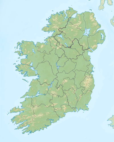
 Slieve Foy viewed outside Carlingford 12-2010 | |
| Highest point | |
| Elevation | 589 m (1,932 ft) [1] |
| Prominence | 494 [1] |
| Listing | Marilyn |
| Coordinates | 54°02′40″N 6°13′05″W / 54.04444°N 6.21806°WCoordinates: 54°02′40″N 6°13′05″W / 54.04444°N 6.21806°W |
| Geography | |
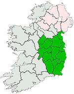
 Slieve Foy Location in Ireland | |
| Location | County Louth, Ireland |
| Parent range | Cooley Mountains |
| OSI/OSNI grid | J168119 |
| Topo map | OSi Discovery 36 |
Slieve Foy or Slieve Foye (Irish: Sliabh Feá) is the highest peak of a ridge of mountains collectively referred to as Carlingford Mountain, which rises near the town of Carlingford, County Louth, Ireland.
Geography

Slieve Foy rises to an elevation of 589 metres and is the highest peak in County Louth. The chain of mountains of which it is a part rises at The Foxes Rock (404m) and runs for roughly 6 km in a south-easterly direction, culminating in Slieve Foy itself.
Carlingford Mountain ridge is one of two ridges on the Cooley Peninsula which together make up the Cooley Mountains. Slieve Foy looks directly across Carlingford Lough to the Mourne Mountains in Ulster.
History
The area is steeped in legend, one of which is the Battle for the Brown bull of Cooley when Cú Chulainn invoked the right for single combat and fought all of Queen Medbh's forces in the narrow gully formed by a geological fault, now christened Medbh's Gap and the profile of the mountain is said to resemble a sleeping giant, thought by some to be Finn MacCumhaill (Finn McCool).
References
- 1 2 "Cooley/Gullion Area / Slieve Foye Mountain". MountainViews. Ordnance Survey Ireland. Retrieved May 27, 2015.
See also
![]() Media related to Slieve Foye at Wikimedia Commons
Media related to Slieve Foye at Wikimedia Commons
Lists of Marilyns | |
|---|---|