Strasburg, Virginia
| Strasburg, Virginia | |||
|---|---|---|---|
| Town | |||
|
Strasburg Theater | |||
| |||
| Nickname(s): Pot Town[1] | |||
 Strasburg, Virginia Location of Strasburg in Virginia | |||
| Coordinates: 38°59′26″N 78°21′31″W / 38.99056°N 78.35861°WCoordinates: 38°59′26″N 78°21′31″W / 38.99056°N 78.35861°W | |||
| Country | United States | ||
| State | Virginia | ||
| County | Shenandoah | ||
| Founded | 1761 | ||
| Incorporated | 1871 | ||
| Founded by | Peter Stover | ||
| Government | |||
| • Type | Mayor-Council | ||
| • Mayor | Rich Orndorff, Jr. | ||
| • Town Manager | Ryan Spitzer | ||
| • Council |
Members' List
| ||
| Area | |||
| • Total | 3.2 sq mi (8.2 km2) | ||
| • Land | 3.2 sq mi (8.2 km2) | ||
| • Water | 0.04 sq mi (0.1 km2) | ||
| Elevation | 578 ft (176 m) | ||
| Population (2010) | |||
| • Total | 6,398 | ||
| Time zone | EST (UTC-5) | ||
| • Summer (DST) | EDT (UTC-4) | ||
| ZIP Code | 22657 | ||
| Area code(s) | 540 | ||
| FIPS code | 51-76000[2] | ||
| GNIS feature ID | 1487663[3] | ||
| Website |
www | ||


Strasburg /ˈstrɑːzbərɡ/ is a town in Shenandoah County, Virginia, United States, which was founded in 1761 by Peter Stover. It is the largest town by population in the county and is known for its pottery, antiques, and Civil War history.[4] The population was 6,398 at the 2010 census.
History
Early settlers
German-speaking Pennsylvanians were among the first non-native settlers to arrive in the northern Shenandoah Valley and Strasburg area. The luscious greenery and fertile land were prime targets for immigrant farmers. On August 21, 1734 speculator Henry Willis was granted 2,030 acres (8.2 km2) total of this land by William Gooch, Virginia's Lieutenant Governor and Commander in Chief.[5] Gooch wished to settle the valley to create a buffer between Native American tribes and the rest of the Virginia colony. During the summer of 1735, Willis sold his entire property to Jacob Funk. Jacob in return, partitioned his new purchase, reselling a part of it to his brother John.[6][7]
In contrast to the English culture found east of the Blue Ridge, Strasburg was settled with family farms and towns rather than plantations; few slaves; and Germanic language, religions, architecture and decorative arts. The thriving agricultural community that developed in the fertile bottomland along the banks of the Shenandoah River boasted scenic views of the Massanutten and Allegheny Mountains. Later nicknamed “Pot Town,” Strasburg also became a center for the production of both utilitarian and fancy earthenware and stoneware pottery. During the 19th and 20th centuries, many residents worked for the railroad industry and at limestone quarries; after WW II, other industries came to Strasburg, including paper and auto parts manufacture. Today Strasburg boasts a growing service economy, museums, charming eateries, numerous antique stores and other shops. Despite its location only 80 miles from Metro D.C. Strasburg has maintained its hospitable small town charm.[8]
Founder
Peter Stover (Petrus Stauffer) is considered the founder of the town of Strasburg. Stover was born in 1715 to a German-Swiss father, Christian Stauffer I., in Mannheim, Baden-Württemberg, Germany.[9] Stauffer took his family to America in 1718, to gain religious freedom, and settled in Montgomery County, Pennsylvania where he would live out his entire life.
His son Peter migrated south to Virginia by 1730 and to the Shenandoah Valley as early as 1739. On May 2, 1749 Stover purchased 483 acres (1.95 km2) of land from Jacob Funk, his future father-in-law.[10] The purchase was divided into smaller plots for sale to other settlers[11] and a village was informally established.
Stover applied for a town charter in November 1761 giving the town the official name of Strasburg.[12] The name was taken from Strasbourg, the capital of Alsace, France. Some called the area Staufferstadt, the German name for Stoverstown. Ten trustees were named; William Miller, Matthew Harrison, Jacob Bowman, Valentine Smith, Charles Buck, Peter Stover, Isaac Hite, Leonard Batice, John Funk, and Philip Huffman (Hoffman).[13]
Peter eventually married Frainey Funk, before he died August 13, 1799 at the age of 84.[14] He was survived by eight children.[10] Being a philanthropist for most of his life, Stover's will left land and $10,000 to the community to establish schools.[15] A monument resides in Strasburg's Riverview Cemetery honoring Peter Stover, but the whereabouts of his grave is unknown.
Recent growth
Strasburg has experienced rapid growth along its northern corridor due to the fact that Washington D.C. is approximately 80 miles away.
Geography
Strasburg is located at 38°59′26″N 78°21′31″W / 38.990550°N 78.358615°W (38.990550, −78.358615)[16] in the northern end of the Shenandoah Valley. The area is surrounded by the natural boundaries of the Massanutten and Allegheny mountains, as well as the Shenandoah River. Cedar Creek and Belle Grove National Historical Park is located in and around Strasburg.
According to the United States Census Bureau, the town has a total area of 3.2 square miles (8.2 km2), of which, 3.2 square miles (8.2 km2) of it is land and 0.04 square miles (0.1 km2) of it (0.63%) is water. The elevation of the area is 578 ft (176 m).
Culture
Museums
The most heralded museum in Strasburg is the Strasburg Museum. The building was once home to the Strasburg Stone and Earthenware Manufacturing Company and later was converted to a Southern Railway depot. It operated in this manner until the early 1960s. In 1970 it opened as a museum.[17]
The now closed Stonewall Jackson Museum at Hupp's Hill was redeveloped by the Cedar Creek Battlefield Foundation and reopened on May 7, 2011 as the Hupp’s Hill Cedar Creek Museum at Hupp's Hill Civil War Park.[18][19] A nearby cave called Crystal Caverns at Hupp's Hill was open for tourism from 1922 to 2010.[20]
Former attractions include the Jeane Dixon Museum and Library and the Museum of American Presidents.
Post Office
The historic post office in Strasburg contains a New Deal WPA mural titled Apple Orchard. Muralist Sarah Jane Blakeslee completed the work in 1938, having won a commission by the United States Treasury Section of Fine Arts. [21]
Sports teams
In June 2011, Strasburg welcomed their first Valley Baseball League team called "The Strasburg Express."[22] Strasburg's basketball,baseball, and football team is called the "Rams".
Tourism
Strasburg holds two festivals each year: Mayfest and Oktoberfest. The town's Mayfest is traditionally held the third weekend in May and includes arts and craft vendors, a variety of food vendors, business and civic organizations, a parade, and an old-fashioned carnival complete with rides. To celebrate the area's German roots, an Oktoberfest takes place each autumn, the first Saturday in October. This event offers food concessions, beer and wine gardens, activities for children and adults, music, and street dancing. Although the festival still offers German food and beer, the festival has been modernized and no longer emphasizes Bavarian culture.
Popular destinations include Christina's Café, an American/Tex-Mex restaurant. The café offers music on weekends. Past performances have included Americana, folk, blues, and bluegrass. Other popular destinations include the Strasburg Antique Emporium and Flea Market and the Iron Rose bohemian clothing and accessories shop. Iron Rose is run by Danni Leigh, a Nashville country and western star and native of Strasburg. Danni's husband Mike runs the nearby guitar and music shop Frets and Friends.
Strasburg offers overnight accommodations at Hotel Strasburg, housed in a Victorian building dating to 1902. The building was once used as a private hospital. Local legend says the hotel is haunted. The hotel includes an English pub, The Depot Lounge.
The Cedar Creek Battlefield and Belle Grove, Hupp House, Strasburg Historic District, Strasburg Museum, Mount Pleasant, and Stoner-Keller House and Mill are listed on the National Register of Historic Places.[23][24]
Demographics
| Historical population | |||
|---|---|---|---|
| Census | Pop. | %± | |
| 1860 | 624 | — | |
| 1870 | 580 | −7.1% | |
| 1880 | 647 | 11.6% | |
| 1890 | 646 | −0.2% | |
| 1900 | 690 | 6.8% | |
| 1910 | 762 | 10.4% | |
| 1920 | 650 | −14.7% | |
| 1930 | 1,901 | 192.5% | |
| 1940 | 1,968 | 3.5% | |
| 1950 | 2,022 | 2.7% | |
| 1960 | 2,428 | 20.1% | |
| 1970 | 2,431 | 0.1% | |
| 1980 | 2,311 | −4.9% | |
| 1990 | 3,762 | 62.8% | |
| 2000 | 4,017 | 6.8% | |
| 2010 | 6,398 | 59.3% | |
| Est. 2015 | 6,586 | [25] | 2.9% |
As of the census[2] of 2000, there were 4,017 people, 1,773 households, and 1,086 families residing in the town, making it the largest population center in Shenandoah County. The population density was 1,275.5 people per square mile (492.4/km2). There were 1,877 housing units at an average density of 596.0 per square mile (230.1/km2). The racial makeup of the town was 93.63% White, 4.48% African American, 0.05% Native American, 0.40% Asian, 0.05% Pacific Islander, 0.45% from other races, and 0.95% from two or more races. Hispanic or Latino of any race were 1.42% of the population.
There were 1,773 households out of which 30.4% had children under the age of 18 living with them, 43.9% were married couples living together, 12.9% had a female householder with no husband present, and 38.7% were non-families. 33.1% of all households were made up of individuals and 14.3% had someone living alone who was 65 years of age or older. The average household size was 2.27 and the average family size was 2.87.
In the town the population was spread out with 24.7% under the age of 18, 7.0% from 18 to 24, 32.0% from 25 to 44, 21.0% from 45 to 64, and 15.3% who were 65 years of age or older. The median age was 37 years. For every 100 females there were 87.4 males. For every 100 females age 18 and over, there were 85.8 males.
The median income for a household in the town was $32,724, and the median income for a family was $40,978. Males had a median income of $29,750 versus $21,755 for females. The per capita income for the town was $17,697. About 5.3% of families and 9.7% of the population were below the poverty line, including 11.7% of those under age 18 and 13.6% of those age 65 or over.
Education
Students living in the northern third of Shenandoah County attend one of three public schools located near Strasburg. Kindergarten through fifth grade students attend Sandy Hook Elementary School, while sixth through eighth graders attend Signal Knob Middle School. Located within the town limits, Strasburg High School serves ninth through twelfth graders.
The schools are administrated by the Shenandoah County Public School system, which is located in Woodstock, and the Virginia Department of Education, which is located in Richmond.
Notable people
- Joe Bauserman (athlete)
- Danni Leigh (musician)
References
- ↑ "Preserve America Community". PreserveAmerica.gov. Retrieved July 19, 2011.
- 1 2 "American FactFinder". United States Census Bureau. Archived from the original on September 11, 2013. Retrieved 2008-01-31.
- ↑ "US Board on Geographic Names". United States Geological Survey. 2007-10-25. Retrieved 2008-01-31.
- ↑ "About the Town/History – Town of Strasburg". Town of Strasburg. Retrieved July 19, 2011.
- ↑ "Isaac and John Vanmetre Land Grant assignees, 1730/1734". RootsWeb.com. Retrieved April 20, 2007.
- ↑ "Shenandoah Valley, VA – Early Strasburg Families". Ann Brown. Retrieved April 20, 2007.
- ↑ "BARD/BEARD in Shenandoah County, Virginia". Robert W. Baird. Retrieved April 20, 2007.
- ↑ Melton, Babs. "A Brief History of Strasburg". Downtown Strasburg. Town of Strasburg, VA. Retrieved 29 April 2015.
- ↑ "Shenandoah Ancestors Online". Alley Blackford. Archived from the original on November 14, 2007. Retrieved April 20, 2007.
- 1 2 "Christian Stover". Trekking Stover Counsins Webpage. Archived from the original on October 26, 2009. Retrieved April 20, 2007.
- ↑ "IM206: Jacob STOVER (ABOUT 1685 – March 1741)". The Cockrill Family of Sonoma County. Archived from the original on January 27, 2007. Retrieved April 20, 2007.
- ↑ "Frontier Fort – The Old Hupp Homestead Marker". HMdb.org. Retrieved April 20, 2007.
- ↑ "RootsWeb: WVPIONEERS-L WVPioneers German Element – Chapter 6 – Part 1". RootsWeb.com. Retrieved April 20, 2007.
- ↑ "The Ancestors/Family Tree of Kim Denny". Kim Denny. Archived from the original on April 21, 2006. Retrieved April 20, 2007.
- ↑ "Tour 5 from A Guide to the Old Dominion". University of Virginia American Studies Program. Retrieved April 20, 2007.
- ↑ "US Gazetteer files: 2010, 2000, and 1990". United States Census Bureau. 2011-02-12. Retrieved 2011-04-23.
- ↑ "Strasburg Museum, Strasburg, Virginia". Calvin Sonner. Retrieved October 5, 2007.
- ↑ "Hupp's Hill Civil War Park". Cedar Creek Battlefield Foundation. Retrieved 8 October 2015.
- ↑ "Civil War park, museum to open Saturday". The Northern Virginia Daily. Retrieved November 29, 2012.
- ↑ http://www.virginiaplaces.org/cave/cavelist.html
- ↑ "Post Office Mural:Strasburg, VA.". livingnewdeal.org. The Living New Deal. Retrieved 28 April 2016.
- ↑ "Strasburg Express: About us". Strasburg Express. Retrieved November 29, 2012.
- ↑ National Park Service (2010-07-09). "National Register Information System". National Register of Historic Places. National Park Service.
- ↑ "National Register of Historic Places Listings". Weekly List of Actions Taken on Properties: 8/15/11 through 8/19/11. National Park Service. 2011-08-26.
- ↑ "Annual Estimates of the Resident Population for Incorporated Places: April 1, 2010 to July 1, 2015". Retrieved July 2, 2016.
- ↑ "Census of Population and Housing". Census.gov. Archived from the original on May 11, 2015. Retrieved June 4, 2015.
External links
- Shenandoah County, VA
- Shenandoah County Public Schools
- Sandy Hook Elementary School
- Signal Knob Middle School
- Strasburg High School
- Strasburg Chamber of Commerce
- Hometown Strasburg
Municipalities and communities of Shenandoah County, Virginia, United States | ||
|---|---|---|
| Towns | 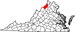 | |
| CDPs | ||
| Unincorporated communities | ||