Northumberland County, Virginia
| Northumberland County, Virginia | ||
|---|---|---|
|
Northumberland County Courthouse in Heathsville | ||
| ||
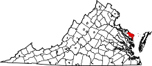 Location in the U.S. state of Virginia | ||
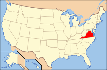 Virginia's location in the U.S. | ||
| Founded | 1648 | |
| Seat | Heathsville | |
| Largest community | Heathsville | |
| Area | ||
| • Total | 286 sq mi (741 km2) | |
| • Land | 191 sq mi (495 km2) | |
| • Water | 94 sq mi (243 km2), 33.0% | |
| Population (est.) | ||
| • (2015) | 12,232 | |
| • Density | 65/sq mi (25/km²) | |
| Congressional district | 1st | |
| Time zone | Eastern: UTC-5/-4 | |
| Website |
www | |


Northumberland County is a county located in the Commonwealth of Virginia. As of the 2010 census, the population was 12,330.[1] Its county seat is Heathsville.[2] The county is located on the Northern Neck and is part of the Northern Neck George Washington Birthplace AVA winemaking appellation.
History
The area was occupied at the time of English settlement by the Algonquian-speaking historic tribes of the Wicocomico and Chickacoan. The county was created by the Virginia General Assembly in 1648 during a period of rapid population growth and geographic expansion. Settlement began in this area of the Northern Neck around 1635. Originally known as the Indian district Chickacoan, the area was first referred to as Northumberland in the colonial records in 1644. The following year, John Mottrom served as the first burgess for the territory in the House of Burgesses, which met at the capital of the Virginia Colony at Jamestown.
The colonial court ordered the two tribes to merge and by 1655, assigned them a reservation of 4,400 acres (18 km2) near Dividing Creek, south of the Great Wicomico River.[3] By the early 1700s, the Wicocomico tribe was greatly reduced, and English colonists took control of their lands. They were believed to be extinct as a tribe as, landless, they disappeared from the historical record. Descendants of the last weroance are working to regain recognition as a tribe, the Wicocomico Indian Nation.[4]
The size of the county was drastically reduced in 1651 and 1653 when the colonial government organized Lancaster and Westmoreland counties from it.
Of the 172 counties that have ever existed in Virginia's history, Northumberland ended up being an "ancestor" to 116 of these –– more than the current 95 counties (several were lost to other states, such as West Virginia).[5]
Geography
According to the U.S. Census Bureau, the county has a total area of 286 square miles (740 km2), of which 191 square miles (490 km2) is land and 94 square miles (240 km2) (33.0%) is water.[6] The county is located between the Rappahannock River and Potomac River.
Adjacent counties
- Lancaster County - south
- Richmond County - west
- Westmoreland County - northwest
Demographics
| Historical population | |||
|---|---|---|---|
| Census | Pop. | %± | |
| 1790 | 9,163 | — | |
| 1800 | 7,803 | −14.8% | |
| 1810 | 8,308 | 6.5% | |
| 1820 | 8,016 | −3.5% | |
| 1830 | 7,953 | −0.8% | |
| 1840 | 7,924 | −0.4% | |
| 1850 | 7,346 | −7.3% | |
| 1860 | 7,531 | 2.5% | |
| 1870 | 6,863 | −8.9% | |
| 1880 | 7,929 | 15.5% | |
| 1890 | 7,885 | −0.6% | |
| 1900 | 9,486 | 20.3% | |
| 1910 | 10,777 | 13.6% | |
| 1920 | 11,518 | 6.9% | |
| 1930 | 11,081 | −3.8% | |
| 1940 | 10,463 | −5.6% | |
| 1950 | 10,012 | −4.3% | |
| 1960 | 10,185 | 1.7% | |
| 1970 | 9,239 | −9.3% | |
| 1980 | 9,828 | 6.4% | |
| 1990 | 10,524 | 7.1% | |
| 2000 | 12,259 | 16.5% | |
| 2010 | 12,330 | 0.6% | |
| Est. 2015 | 12,232 | [7] | −0.8% |
| U.S. Decennial Census[8] 1790-1960[9] 1900-1990[10] 1990-2000[11] 2010-2013[1] | |||
As of the census[12] of 2000, there were 12,259 people, 5,470 households, and 3,785 families residing in the county. The population density was 64 people per square mile (25/km²). There were 8,057 housing units at an average density of 42 per square mile (16/km²). The racial makeup of the county was 72.18% White, 26.58% Black or African American, 0.15% Native American, 0.20% Asian, 0.33% from other races, and 0.56% from two or more races. 0.93% of the population were Hispanic or Latino of any race.
There were 5,470 households out of which 20.11% had children under the age of 18 living with them, 57.30% were married couples living together, 8.70% had a female householder with no husband present, and 30.80% were non-families. 27.70% of all households were made up of individuals and 15.20% had someone living alone who was 65 years of age or older. The average household size was 2.24 and the average family size was 2.70.
In the county, the population was spread out with 18.60% under the age of 18, 4.80% from 18 to 24, 20.20% from 25 to 44, 30.10% from 45 to 64, and 26.20% who were 65 years of age or older. The median age was 50 years. For every 100 females there were 91.20 males. For every 100 females age 18 and over, there were 88.40 males.
The median income for a household in the county was $38,129, and the median income for a family was $49,047. Males had a median income of $30,151 versus $24,116 for females. The per capita income for the county was $22,917. 12.30% of the population and 8.10% of families were below the poverty line. Out of the total people living in poverty, 17.00% are under the age of 18 and 10.70% are 65 or older.
Government, education, law enforcement, and emergency services
The county is governed by a Board of Supervisors, elected every four years, one from each of five districts. Similarly, the county has an elected school board, elected every four years, one from each of the five supervisor districts. The school board, formerly appointed by the Board of Supervisors, manages local education policy; but it remains subordinate to the Board of Supervisors and must submit budgetary matters for supervisors' approval. The county has three public schools (high, middle, and elementary), all located on one campus near Heathsville; the high and middle schools comprise a large consolidated facility that opened in 2009.
There is no police department in the county. Instead, law enforcement is the responsibility of the county Sheriff, a commonwealth constitutional officer elected every four years, with support from the Virginia State Police. The Northumberland County Sheriff's Office is located in Heathsville.
Northumberland County has two courthouses: an antebellum building constructed before the Civil War and a new building constructed in the late 1990s behind the older structure. The county courts (Circuit Court, General District Court, and Juvenile and Domestic Relations District Court), along with the Clerk of the Circuit Court and the Commonwealth's Attorney, both commonwealth constitutional officers, are located in the new building. The Commissioner of Revenue and the County Treasurer, both commonwealth constitutional officers, have offices in the older building.
Northumberland County is one of the few counties left in Virginia that has all-volunteer emergency services. The county is served by two fire departments, Callao Volunteer Fire Department in Callao and Fairfield Volunteer Fire Department with buildings in Reedville and Burgess. There are three rescue squads that serve the county: Callao Volunteer Rescue Squad in Callao, Mid-County Volunteer Rescue Squad in Heathsville, and Northumberland County Rescue Squad in Reedville and Burgess. The county also has a water rescue service, Smith Point Sea Rescue.
Reedville, menhaden fishing industry
Reedville is a small village in eastern Northumberland County on the western shore of the Chesapeake Bay. Reedville is home to the Atlantic menhaden fishing industry. It is named for Captain Elijah W. Reed (1827-1888), who is credited with bringing the menhaden fishing industry, and the tremendous wealth that resulted from it, to Reedville –– and to Northumberland County in general.
Dozens of fish-processing factories, most recently Omega Protein Corporation (successor to Zapata Haynie, Reedville Oil and Guano Company and Haynie Products Company) and Standard Products Company, have dotted the Northumberland coastline near Reedville and adjacent fishing communities.
Today, Omega Protein remains the largest industrial organization in the area. Omega, with a fleet of large oceangoing fish-harvesting vessels, supported by a number of spotter aircraft, is a major industry in the area and on the Eastern seaboard. Menhaden, once caught, are cooked in large mass and processed for further use in various applications, including as a protein additive for poultry feed.
Located at the eastern terminus of U.S. Route 360, Reedville is a popular place to begin fishing charters and trips to Tangier Island in the Bay. Reedville is also a tourist destination itself, steeped in the history of the menhaden fishing industry. The Millionaire's Row of Victorian Era mansions and several watercraft of the Fishermen's Museum are listed on the National Register of Historic Places.
Communities
Town
- Kilmarnock in Lancaster County extends into southeastern Northumberland County.
Unincorporated communities
See also
References
- 1 2 "State & County QuickFacts". United States Census Bureau. Retrieved January 4, 2014.
- ↑ "Find a County". National Association of Counties. Retrieved 2011-06-07.
- ↑ Rountree, Helen (1996). Pocahontas's People: The Powhatan Indians of Virginia through Four Centuries. Univ. of Oklahoma Press.
- ↑ Wicocomico History, Wicocomico Indian Nation
- ↑ A Hornbook of Virginia History, p. 9.
- ↑ "US Gazetteer files: 2010, 2000, and 1990". United States Census Bureau. 2011-02-12. Retrieved 2011-04-23.
- ↑ "County Totals Dataset: Population, Population Change and Estimated Components of Population Change: April 1, 2010 to July 1, 2015". Retrieved July 2, 2016.
- ↑ "U.S. Decennial Census". United States Census Bureau. Retrieved January 4, 2014.
- ↑ "Historical Census Browser". University of Virginia Library. Retrieved January 4, 2014.
- ↑ "Population of Counties by Decennial Census: 1900 to 1990". United States Census Bureau. Retrieved January 4, 2014.
- ↑ "Census 2000 PHC-T-4. Ranking Tables for Counties: 1990 and 2000" (PDF). United States Census Bureau. Retrieved January 4, 2014.
- ↑ "American FactFinder". United States Census Bureau. Retrieved 2011-05-14.
External links
 |
Westmoreland County | Potomac River | | |
| |
Chesapeake Bay | |||
| ||||
| | ||||
| Richmond County | Lancaster County |
Coordinates: 37°52′N 76°23′W / 37.86°N 76.38°W