Brodnax, Virginia
| Brodnax, Virginia | |
|---|---|
| Town | |
 Location of Brodnax, Virginia | |
| Coordinates: 36°42′12″N 78°1′54″W / 36.70333°N 78.03167°WCoordinates: 36°42′12″N 78°1′54″W / 36.70333°N 78.03167°W | |
| Country | United States |
| State | Virginia |
| Counties | Brunswick, Mecklenburg |
| Area | |
| • Total | 0.71 sq mi (1.84 km2) |
| • Land | 0.71 sq mi (1.83 km2) |
| • Water | 0.008 sq mi (0.02 km2) |
| Elevation | 410 ft (125 m) |
| Population (2010) | |
| • Total | 298 |
| • Density | 423/sq mi (163.3/km2) |
| Time zone | Eastern (EST) (UTC-5) |
| • Summer (DST) | EDT (UTC-4) |
| ZIP code | 23920 |
| Area code(s) | 434 |
| FIPS code | 51-10072[1] |
| GNIS feature ID | 1463870[2] |
Brodnax is a town in Brunswick and Mecklenburg counties in the U.S. state of Virginia. The population was 298 at the 2010 census.[3]
History
The Church Home for Aged, Infirm and Disabled Colored People was listed on the National Register of Historic Places in 2004.[4]
Geography
Brodnax is located on the border of Brunswick and Mecklenburg counties at 36°42′12″N 78°1′54″W / 36.70333°N 78.03167°W (36.703422, -78.031570).[5] U.S. Route 58 passes through the town, leading west 6 miles (10 km) to South Hill and Interstate 85 and east 30 miles (48 km) to Emporia and Interstate 95.
According to the United States Census Bureau, the town has a total area of 0.71 square miles (1.84 km2), of which 0.71 square miles (1.83 km2) is land and 0.008 square miles (0.02 km2), or 0.94%, is water.[3]
Demographics
| Historical population | |||
|---|---|---|---|
| Census | Pop. | %± | |
| 1920 | 235 | — | |
| 1930 | 365 | 55.3% | |
| 1940 | 536 | 46.8% | |
| 1950 | 499 | −6.9% | |
| 1960 | 561 | 12.4% | |
| 1970 | 569 | 1.4% | |
| 1980 | 492 | −13.5% | |
| 1990 | 388 | −21.1% | |
| 2000 | 317 | −18.3% | |
| 2010 | 298 | −6.0% | |
| Est. 2015 | 281 | [6] | −5.7% |
As of the census[1] of 2000, there were 317 people, 122 households, and 80 families residing in the town. The population density was 450.1 people per square mile (174.8/km²). There were 139 housing units at an average density of 197.4 per square mile (76.7/km²). The racial makeup of the town was 51.42% White and 48.58% African American. Hispanic or Latino of any race were 1.89% of the population.
There were 122 households out of which 27.9% had children under the age of 18 living with them, 47.5% were married couples living together, 16.4% had a female householder with no husband present, and 34.4% were non-families. 30.3% of all households were made up of individuals and 18.0% had someone living alone who was 65 years of age or older. The average household size was 2.60 and the average family size was 3.29.
In the town the population was spread out with 26.2% under the age of 18, 6.3% from 18 to 24, 27.8% from 25 to 44, 21.1% from 45 to 64, and 18.6% who were 65 years of age or older. The median age was 39 years. For every 100 females there were 86.5 males. For every 100 females age 18 and over, there were 82.8 males.
The median income for a household in the town was $24,706, and the median income for a family was $38,750. Males had a median income of $22,045 versus $19,250 for females. The per capita income for the town was $14,785. About 10.8% of families and 18.3% of the population were below the poverty line, including 30.5% of those under age 18 and 20.3% of those age 65 or over.
References
- 1 2 "American FactFinder". United States Census Bureau. Archived from the original on 2013-09-11. Retrieved 2008-01-31.
- ↑ "US Board on Geographic Names". United States Geological Survey. 2007-10-25. Retrieved 2008-01-31.
- 1 2 "Geographic Identifiers: 2010 Demographic Profile Data (G001): Brodnax town, Virginia". U.S. Census Bureau, American Factfinder. Retrieved May 1, 2014.
- ↑ National Park Service (2010-07-09). "National Register Information System". National Register of Historic Places. National Park Service.
- ↑ "US Gazetteer files: 2010, 2000, and 1990". United States Census Bureau. 2011-02-12. Retrieved 2011-04-23.
- ↑ "Annual Estimates of the Resident Population for Incorporated Places: April 1, 2010 to July 1, 2015". Retrieved July 2, 2016.
- ↑ "Census of Population and Housing". Census.gov. Archived from the original on May 11, 2015. Retrieved June 4, 2015.
Municipalities and communities of Brunswick County, Virginia, United States | ||
|---|---|---|
| Towns | 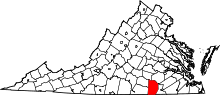 | |
| CDPs | ||
| Unincorporated communities |
| |
| Footnotes | ‡This populated place also has portions in an adjacent county or counties | |
Municipalities and communities of Mecklenburg County, Virginia, United States | ||
|---|---|---|
| Towns |  | |
| CDPs | ||
| Unincorporated communities | ||
| Footnotes | ‡This populated place also has portions in an adjacent county or counties | |