Pembroke, Virginia
| Pembroke, Virginia | |
|---|---|
| Town | |
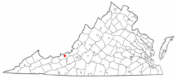 Location of Pembroke, Virginia | |
| Coordinates: 37°19′19″N 80°38′11″W / 37.32194°N 80.63639°WCoordinates: 37°19′19″N 80°38′11″W / 37.32194°N 80.63639°W | |
| Country | United States |
| State | Virginia |
| County | Giles |
| Area | |
| • Total | 1.1 sq mi (2.9 km2) |
| • Land | 1.1 sq mi (2.9 km2) |
| • Water | 0.0 sq mi (0.0 km2) |
| Elevation | 1,654 ft (504 m) |
| Population (2010) | |
| • Total | 1,128 |
| • Density | 1,022/sq mi (389/km2) |
| Time zone | Eastern (EST) (UTC-5) |
| • Summer (DST) | EDT (UTC-4) |
| ZIP code | 24136 |
| Area code(s) | 540 |
| FIPS code | 51-61336[1] |
| GNIS feature ID | 1497081[2] |
Pembroke is a town in Giles County, Virginia, United States. The population was 1,128 at the 2010 census. It is part of the Blacksburg–Christiansburg–Radford Metropolitan Statistical Area.
Geography
Pembroke is located at 37°19′19″N 80°38′11″W / 37.32194°N 80.63639°W (37.321902, -80.636403).[3]
According to the United States Census Bureau, the town has a total area of 1.1 square miles (2.9 km²), all land.
Demographics
| Historical population | |||
|---|---|---|---|
| Census | Pop. | %± | |
| 1950 | 1,010 | — | |
| 1960 | 1,038 | 2.8% | |
| 1970 | 1,095 | 5.5% | |
| 1980 | 1,302 | 18.9% | |
| 1990 | 1,064 | −18.3% | |
| 2000 | 1,134 | 6.6% | |
| 2010 | 1,128 | −0.5% | |
| Est. 2015 | 1,081 | [4] | −4.2% |
As of the census[1] of 2010, there were 1,128 people, 491 households, and 317 families residing in the town. The population density was 1,022 people per square mile (389.0/km²). There were 520 housing units at an average density of 471.2 per square mile (182.5/km²). The racial makeup of the town was 90.5% White, 6.2% African American, 0.2% Native American, 0.2% Asian, 0.0% from other races, and 2.0% from two or more races. Hispanic or Latino of any race were 0.9% of the population.
There were 491 households out of which 27.1% had children under the age of 18 living with them, 49.1% were married couples living together, 11.4% had a female householder with no husband present, and 37.3% were non-families. 31.6% of all households were made up of individuals and 15.9% had someone living alone who was 65 years of age or older. The average household size was 2.2 and the average family size was 2.89.
In the town the population was spread out with 22.2% under the age of 18, 6.0% from 18 to 24, 31.2% from 25 to 44, 23.6% from 45 to 64, and 16.9% who were 65 years of age or older. The median age was 42.6 years. For every 100 females there were 98.2 males. For every 100 females age 18 and over, there were 88.5 males.
The median income for a household in the town was $29,437, and the median income for a family was $54,297. Males had a median income of $27,419 versus $22,240 for females. The per capita income for the town was $17,922. About 5.3% of families and 11.7% of the population were below the poverty line, including 3.1% of those under age 18 and 11.1% of those age 65 or over.
Climate
The climate in this area has mild differences between highs and lows, and there is adequate rainfall year round. According to the Köppen Climate Classification system, Pembroke has a marine west coast climate, abbreviated "Cfb" on climate maps.[6]
References
- 1 2 "American FactFinder". United States Census Bureau. Retrieved 2008-01-31.
- ↑ "US Board on Geographic Names". United States Geological Survey. 2007-10-25. Retrieved 2008-01-31.
- ↑ "US Gazetteer files: 2010, 2000, and 1990". United States Census Bureau. 2011-02-12. Retrieved 2011-04-23.
- ↑ "Annual Estimates of the Resident Population for Incorporated Places: April 1, 2010 to July 1, 2015". Retrieved July 2, 2016.
- ↑ "Census of Population and Housing". Census.gov. Retrieved June 4, 2015.
- ↑ Climate Summary for Pembroke, Virginia
External links
Municipalities and communities of Giles County, Virginia, United States | ||
|---|---|---|
| Towns | 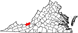 | |
| Unincorporated communities | ||