Alberta, Virginia
| Alberta, Virginia | |
|---|---|
| Town | |
 Location of Alberta, Virginia | |
| Coordinates: 36°51′49″N 77°52′53″W / 36.86361°N 77.88139°WCoordinates: 36°51′49″N 77°52′53″W / 36.86361°N 77.88139°W | |
| Country | United States |
| State | Virginia |
| County | Brunswick |
| Area | |
| • Total | 2.15 sq mi (5.56 km2) |
| • Land | 2.14 sq mi (5.53 km2) |
| • Water | 0.01 sq mi (0.03 km2) |
| Elevation | 397 ft (121 m) |
| Population (2010) | |
| • Total | 298 |
| • Density | 140/sq mi (53.9/km2) |
| Time zone | Eastern (EST) (UTC-5) |
| • Summer (DST) | EDT (UTC-4) |
| ZIP code | 23821 |
| Area code(s) | 434 |
| FIPS code | 51-00724[1] |
| GNIS feature ID | 1498398[2] |
| Website |
www |
Alberta is a town in Brunswick County, Virginia, United States. The population was 298 at the 2010 census.[3] It is home to the Christanna Campus of Southside Virginia Community College.
History
Hobson's Choice and Rocky Run Methodist Church are listed on the National Register of Historic Places.[4]
Geography
Alberta is located in north-central Brunswick County along U.S. Route 1. Interstate 85 passes south of the original portion of the town, with access from Exit 28. The town limits extend southwest along Route 1 and I-85 to Virginia State Route 46 and Southside Virginia Community College, with access from I-85 to VA 46 from Exit 27. Via I-85 it is 40 miles (64 km) northeast to Petersburg and 16 miles (26 km) southwest to South Hill.
According to the United States Census Bureau, Alberta has a total area of 2.15 square miles (5.56 km2), of which 2.14 square miles (5.53 km2) is land and 0.01 square miles (0.03 km2), or 0.61%, is water.[3]
Demographics
| Historical population | |||
|---|---|---|---|
| Census | Pop. | %± | |
| 1930 | 328 | — | |
| 1940 | 416 | 26.8% | |
| 1950 | 430 | 3.4% | |
| 1960 | 430 | 0.0% | |
| 1970 | 466 | 8.4% | |
| 1980 | 394 | −15.5% | |
| 1990 | 337 | −14.5% | |
| 2000 | 306 | −9.2% | |
| 2010 | 298 | −2.6% | |
| Est. 2015 | 285 | [5] | −4.4% |
As of the census[1] of 2000, there were 306 people, 128 households, and 86 families residing in the town. The population density was 278.3 people per square mile (107.4/km²). There were 158 housing units at an average density of 143.7 per square mile (55.5/km²). The racial makeup of the town was 59.80% White, 39.54% African American, 0.33% Asian, 0.33% from other races. Hispanic or Latino of any race were 0.33% of the population.
There were 128 households out of which 26.6% had children under the age of 18 living with them, 44.5% were married couples living together, 20.3% had a female householder with no husband present, and 32.8% were non-families. 29.7% of all households were made up of individuals and 14.1% had someone living alone who was 65 years of age or older. The average household size was 2.39 and the average family size was 2.93.
In the town the population was spread out with 26.8% under the age of 18, 5.2% from 18 to 24, 27.1% from 25 to 44, 24.2% from 45 to 64, and 16.7% who were 65 years of age or older. The median age was 39 years. For every 100 females there were 86.6 males. For every 100 females age 18 and over, there were 75.0 males.
The median income for a household in the town was $27,361, and the median income for a family was $31,875. Males had a median income of $27,250 versus $20,833 for females. The per capita income for the town was $14,607. About 10.8% of families and 16.3% of the population were below the poverty line, including 21.1% of those under the age of eighteen and 14.5% of those sixty five or over.
References
- 1 2 "American FactFinder". United States Census Bureau. Archived from the original on 2013-09-11. Retrieved 2008-01-31.
- ↑ "US Board on Geographic Names". United States Geological Survey. 2007-10-25. Retrieved 2008-01-31.
- 1 2 "Geographic Identifiers: 2010 Demographic Profile Data (G001): Alberta town, Virginia". U.S. Census Bureau, American Factfinder. Retrieved May 1, 2014.
- ↑ National Park Service (2010-07-09). "National Register Information System". National Register of Historic Places. National Park Service.
- ↑ "Annual Estimates of the Resident Population for Incorporated Places: April 1, 2010 to July 1, 2015". Retrieved July 2, 2016.
- ↑ "Census of Population and Housing". Census.gov. Archived from the original on May 11, 2015. Retrieved June 4, 2015.
External links
Municipalities and communities of Brunswick County, Virginia, United States | ||
|---|---|---|
| Towns | 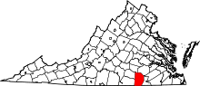 | |
| CDPs | ||
| Unincorporated communities |
| |
| Footnotes | ‡This populated place also has portions in an adjacent county or counties | |