Stonewall County, Texas
| Stonewall County, Texas | |
|---|---|
|
Stonewall County Courthouse in Aspermont | |
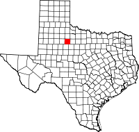 Location in the U.S. state of Texas | |
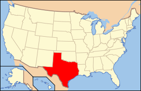 Texas's location in the U.S. | |
| Founded | 1888 |
| Named for | Stonewall Jackson |
| Seat | Aspermont |
| Largest town | Aspermont |
| Area | |
| • Total | 920 sq mi (2,383 km2) |
| • Land | 916 sq mi (2,372 km2) |
| • Water | 3.9 sq mi (10 km2), 0.4% |
| Population | |
| • (2010) | 1,490 |
| • Density | 1.6/sq mi (1/km²) |
| Congressional district | 19th |
| Time zone | Central: UTC-6/-5 |

Stonewall County is a county located in the U.S. state of Texas. As of the 2010 census, its population was 1,490.[1] Its county seat is Aspermont.[2] The county was created in 1876 and organized in 1888.[3] It is named for Stonewall Jackson, a general of the Confederate States Army.
Republican Drew Springer, Jr., a businessman from Muenster in Cooke County, has since January 2013 represented Stonewall County in the Texas House of Representatives.[4]
History
Stonewall County was formed in 1876 from portions of Bexar County and Young County. It was named after Thomas Jonathan "Stonewall" Jackson, a general of the Confederate Army.
Geography
According to the U.S. Census Bureau, the county has a total area of 920 square miles (2,400 km2), of which 916 square miles (2,370 km2) is land and 3.9 square miles (10 km2) (0.4%) is water.[5]
Geographic features
- Double Mountain (county high point[6] and most topographically prominent point for almost 160 miles (260 km)[7]
- The Brazos River (proper) begins in Stonewall County at the confluence of the Double Mountain Fork and Salt Fork Brazos River, about 3 miles (4.8 km) west of Jud, Texas, now a ghost town.[8]
Major highways
Adjacent counties
- King County (north)
- Haskell County (east)
- Jones County (southeast)
- Fisher County (south)
- Kent County (west)
Demographics
| Historical population | |||
|---|---|---|---|
| Census | Pop. | %± | |
| 1880 | 104 | — | |
| 1890 | 1,024 | 884.6% | |
| 1900 | 2,183 | 113.2% | |
| 1910 | 5,320 | 143.7% | |
| 1920 | 4,086 | −23.2% | |
| 1930 | 5,667 | 38.7% | |
| 1940 | 5,589 | −1.4% | |
| 1950 | 3,679 | −34.2% | |
| 1960 | 3,017 | −18.0% | |
| 1970 | 2,397 | −20.6% | |
| 1980 | 2,406 | 0.4% | |
| 1990 | 2,013 | −16.3% | |
| 2000 | 1,693 | −15.9% | |
| 2010 | 1,490 | −12.0% | |
| Est. 2015 | 1,410 | [9] | −5.4% |
| U.S. Decennial Census[10] 1850–2010[11] 2010–2014[1] | |||
As of the census[12] of 2010, there were 1,490 people, 642 households, and 426 families residing in the county. The population density was 2 people per square mile (1/km²). There were 928 housing units at an average density of 1 per square mile (0/km²). The racial makeup of the county was 87.7% White, 2.6% Black or African American, 0.5% Native American, 0.9% Asian, 6.3% from other races, and 1.9% from two or more races. 14.0% of the population were Hispanic or Latino of any race.
There were 642 households out of which 24% had children under the age of 18 living with them, 53% were married couples living together, 10.1% had a female householder with no husband present, and 33.6% were non-families. 15.7% had someone living alone who was 65 years of age or older. The average household size was 2.28 and the average family size was 2.83.
In the county, the population was spread out with 22.80% under the age of 18, 6.20% from 18 to 24, 22.60% from 25 to 44, 24.50% from 45 to 64, and 24.00% who were 65 years of age or older. The median age was 44 years. For every 100 females there were 90.00 males. For every 100 females age 18 and over, there were 91.10 males.
The median income for a household in the county was $27,935, and the median income for a family was $35,571. Males had a median income of $27,083 versus $15,000 for females. The per capita income for the county was $16,094. About 14.80% of families and 19.30% of the population were below the poverty line, including 31.50% of those under age 18 and 14.50% of those age 65 or over.
Communities
References
- 1 2 "State & County QuickFacts". United States Census Bureau. Retrieved December 24, 2013.
- ↑ "Find a County". National Association of Counties. Retrieved 2011-06-07.
- ↑ "Texas: Individual County Chronologies". Texas Atlas of Historical County Boundaries. The Newberry Library. 2008. Retrieved May 26, 2015.
- ↑ "State Rep. Springer announces district tour July 30". Lubbock Avalanche-Journal, July 16, 2013. Retrieved July 18, 2013.
- ↑ "2010 Census Gazetteer Files". United States Census Bureau. August 22, 2012. Retrieved May 10, 2015.
- ↑ "Stonewall County High Point Trip Report". Retrieved 2008-08-14.
- ↑ "Prominence Ladder from Double Mountains". Retrieved 2008-08-14.
- ↑ U.S. Geological Survey Geographic Names Information System: Brazos River
- ↑ "County Totals Dataset: Population, Population Change and Estimated Components of Population Change: April 1, 2010 to July 1, 2015". Retrieved July 2, 2016.
- ↑ "U.S. Decennial Census". United States Census Bureau. Retrieved May 10, 2015.
- ↑ "Texas Almanac: Population History of Counties from 1850–2010" (PDF). Texas Almanac. Retrieved May 10, 2015.
- ↑ "American FactFinder". United States Census Bureau. Retrieved 2011-05-14.
External links
- Stonewall County from the Handbook of Texas Online
- Stonewall County extension profile at Texas A&M University
- Stonewall County Profile from the Texas Association of Counties
 |
King County | | ||
| Kent County | |
Haskell County | ||
| ||||
| | ||||
| Fisher County | Jones County |
Municipalities and communities of Stonewall County, Texas, United States | ||
|---|---|---|
| Town | | |
| Unincorporated communities | ||
| Ghost town | ||

Coordinates: 33°11′N 100°15′W / 33.18°N 100.25°W