Upton County, Texas
| Upton County, Texas | |
|---|---|
|
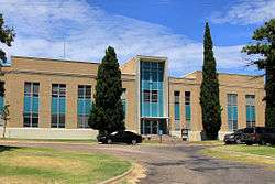
The Upton County Courthouse in Rankin | |
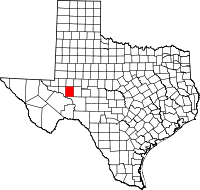 Location in the U.S. state of Texas | |
 Texas's location in the U.S. | |
| Founded | 1910 |
| Seat | Rankin |
| Largest city | McCamey |
| Area | |
| • Total | 1,242 sq mi (3,217 km2) |
| • Land | 1,241 sq mi (3,214 km2) |
| • Water | 0.2 sq mi (1 km2), 0.01% |
| Population | |
| • (2010) | 3,355 |
| • Density | 2.7/sq mi (1/km²) |
| Congressional district | 23rd |
| Time zone | Central: UTC-6/-5 |
| Website |
www |
Upton County is a county located on the Edwards Plateau in the U.S. state of Texas. As of the 2010 census, its population was 3,355.[1] Its county seat is Rankin.[2] The county was created in 1887 and later organized in 1910.[3] It is named for two brothers: John C. and William F. Upton, both colonels in the Confederate Army.
History
Native Americans
Indigenous peoples were the first inhabitants of the area. Later Indian tribes included Comanches, Apache.[4]
Trails
One of the first routes bringing people through the area was the Chihuahua Trail [5][6] connecting Mexico's state of Chihuahua with Santa Fe, New Mexico. The trail served as a trade route for nomadic tribes of Indians and Spaniards, as well as traders from both Mexico and Texas.
The Butterfield Overland Mail crossed the area 1858–1861.[7]
Cattle drive Goodnight-Loving Trail. served cowboys 1866-1888. The trail began at Young County, Texas and passed along the Pecos River, Fort Sumner, New Mexico, and Colorado before ending in Cheyenne, Wyoming.[8]
Establishment of the county
Upton was formed in 1887 from Tom Green County, Texas. The county was named after John C. Upton and his brother William F. Upton. of Tennessee.[9] Cattleman George Elliott became the first to establish a homestead in Upton County in 1880.[10] Beginning as open range, the land was shared with sheepmen by the 1890s. The United States Census counted fifty-two people living in the county in 1890, and only forty-eight in 1900; most of these were either members of three families, or were in their employ. The agricultural sector of the county has been out-paced by cattle and sheep ranching. In 1982, about 92 percent of the land in Upton County was in farms and ranches, but less than 1 percent of the county was considered prime farmland, and only 2 percent of the county was cultivated.[4] In the fall of 1911, the Kansas City, Mexico and Orient Railway reached the townsite of Rankin, and by January 1912, most of the people living in Upland had moved to Rankin.[11]
Oil
Wildcatter George McCamey's Baker No. 1 in September 1925 opened up the McCamey Oil Field, established the town of McCamey and brought the subsequent oil boom to Upton County.[12] The Yates Oil Field in Crockett and Pecos counties resulted in a financial boon for the town of Rankin, which served as a supply and service center. The resulting financial windfall benefitted infrastructure in Rankin.[13][14] In 1946, Mike Benedum began wildcatting in Upton County and opened up what would become known as the Benedum Oil Field.[15] The Weir No. 1 gushed in 1961 and enabled Upton County to continue as an outstanding Texas production area.[16]
Geography
According to the U.S. Census Bureau, the county has a total area of 1,242 square miles (3,220 km2), of which 1,241 square miles (3,210 km2) is land and 0.2 square miles (0.52 km2) (0.01%) is water.[17] The Spraberry Trend, the third-largest oil field in the United States by remaining reserves, underlies much of the county.[18]
Major highways
Adjacent counties
- Midland County (north)
- Reagan County (east)
- Crockett County (south)
- Crane County (west)
- Ector County (northwest)
Demographics
| Historical population | |||
|---|---|---|---|
| Census | Pop. | %± | |
| 1890 | 52 | — | |
| 1900 | 48 | −7.7% | |
| 1910 | 501 | 943.8% | |
| 1920 | 253 | −49.5% | |
| 1930 | 5,968 | 2,258.9% | |
| 1940 | 4,297 | −28.0% | |
| 1950 | 5,307 | 23.5% | |
| 1960 | 6,239 | 17.6% | |
| 1970 | 4,697 | −24.7% | |
| 1980 | 4,619 | −1.7% | |
| 1990 | 4,447 | −3.7% | |
| 2000 | 3,404 | −23.5% | |
| 2010 | 3,355 | −1.4% | |
| Est. 2015 | 3,651 | [19] | 8.8% |
| U.S. Decennial Census[20] 1850–2010[21] 2010–2014[1] | |||
As of the census[22] of 2000, there were 3,404 people, 1,256 households, and 934 families residing in the county. The population density was 3 people per square mile (1/km²). There were 1,609 housing units at an average density of 1 per square mile (0/km²). The racial makeup of the county was 77.79% White, 1.62% Black or African American, 1.20% Native American, 0.03% Asian, 0.06% Pacific Islander, 17.95% from other races, and 1.35% from two or more races. 42.57% of the population were Hispanic or Latino of any race.
There were 1,256 households out of which 36.30% had children under the age of 18 living with them, 61.10% were married couples living together, 9.10% had a female householder with no husband present, and 25.60% were non-families. 23.50% of all households were made up of individuals and 12.20% had someone living alone who was 65 years of age or older. The average household size was 2.68 and the average family size was 3.19.
In the county, the population was spread out with 29.30% under the age of 18, 7.90% from 18 to 24, 24.90% from 25 to 44, 23.80% from 45 to 64, and 14.20% who were 65 years of age or older. The median age was 38 years. For every 100 females there were 95.90 males. For every 100 females age 18 and over, there were 93.30 males.
The median income for a household in the county was $28,977, and the median income for a family was $37,083. Males had a median income of $30,729 versus $18,750 for females. The per capita income for the county was $14,274. About 18.10% of families and 19.90% of the population were below the poverty line, including 26.60% of those under age 18 and 13.50% of those age 65 or over.
Communities
Notable people
- Paul Patterson, western author reared in Upton County
References
- 1 2 "State & County QuickFacts". United States Census Bureau. Retrieved December 29, 2013.
- ↑ "Find a County". National Association of Counties. Retrieved 2011-06-07.
- ↑ "Texas: Individual County Chronologies". Texas Atlas of Historical County Boundaries. The Newberry Library. 2008. Retrieved May 27, 2015.
- 1 2 Leffler, John; Hunt, William R. "Upton County, Texas". Handbook of Texas Online. Texas State Historical Association. Retrieved 15 December 2010.
- ↑ Perry, Ann; Smith, Deborah; Simons, Helen; Hoyt, Catherine A (1996). A Guide to Hispanic Texas. University of Texas Press. p. 6. ISBN 978-0-292-77709-5.
- ↑ Sharp, Jay W. "Desert Trails: The Chihuahua Trail". Desert USA. Retrieved 15 December 2010.
- ↑ Allen, Jon L (1996). Texas on Stamps. Texas Christian University Press. p. 16. ISBN 978-0-87565-164-4.
- ↑ Janin, Hunt; Carlson, Ursula B (2009). Trails of Historic New Mexico: Routes Used by Indian, Spanish and American Travelers through 1886. McFarland. pp. 141–149. ISBN 978-0-7864-4010-8.
- ↑ "John C. Upton and His Brother, W. F. Upton - Rankin, Upton County, Texas". Texas Historical Markers. William Nienke, Sam Morrow. Retrieved 15 December 2010.
- ↑ "Elliott Ranch - Rankin, Upton County, Texas". Texas Historical Markers. William Nienke, Sam Morrow. Retrieved 15 December 2010.
- ↑ "Rankin, Texas". Texas Escapes. Texas Escapes - Blueprints For Travel, LLC. Retrieved 15 December 2010.
- ↑ Warner, C A; Thompson, Ernest O (2007). Texas Oil & Gas Since 1543. Copano Bay Press. p. 292. ISBN 978-0-9767799-5-7.
- ↑ Hyne, Norman J. Nontechnical Guide to Petroleum Geology, Exploration, Drilling, and Production, 2nd edition. PennWell Books, 2001. ISBN 0-87814-823-X, ISBN 0-87814-823-X p. 105.
- ↑ "University of Texas Oil Connections". UT Watch. Retrieved 15 December 2010.
- ↑ Murphy, Charles J W (16 February 1948). "Old Mike's Big Strike". Life: 51, 52, 54, 56, 58.
- ↑ "Weir No. 1 Oil Well - Rankin, Upton County, Texas". Texas Historical Markers. William Nienke, Sam Morrow. Retrieved 15 December 2010.
- ↑ "2010 Census Gazetteer Files". United States Census Bureau. August 22, 2012. Retrieved May 11, 2015.
- ↑ Top 100 Oil and Gas Fields
- ↑ "County Totals Dataset: Population, Population Change and Estimated Components of Population Change: April 1, 2010 to July 1, 2015". Retrieved July 2, 2016.
- ↑ "U.S. Decennial Census". United States Census Bureau. Retrieved May 11, 2015.
- ↑ "Texas Almanac: Population History of Counties from 1850–2010" (PDF). Texas Almanac. Retrieved May 11, 2015.
- ↑ "American FactFinder". United States Census Bureau. Retrieved 2011-05-14.
External links
- http://genealogytrails.com/tex/bigbend/upton/
- Upton County government’s website
- Upton County from the Handbook of Texas Online
- Inventory of county records, Upton County courthouse, Rankin, Texas, hosted by the Portal to Texas History
 |
Ector County | Midland County | | |
| Crane County | |
Reagan County | ||
| ||||
| | ||||
| Crockett County |
Municipalities and communities of Upton County, Texas, United States | ||
|---|---|---|
| Cities | | |
| Unincorporated community | ||
Coordinates: 31°22′N 102°02′W / 31.36°N 102.04°W