Bowie County, Texas
| Bowie County, Texas | |
|---|---|
|
The Bowie County Courthouse | |
 Location in the U.S. state of Texas | |
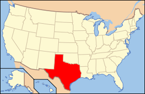 Texas's location in the U.S. | |
| Founded | 1840 |
| Named for | James Bowie |
| Seat |
Boston (legal); New Boston (courthouse) |
| Largest city | Texarkana |
| Area | |
| • Total | 923 sq mi (2,391 km2) |
| • Land | 885 sq mi (2,292 km2) |
| • Water | 38 sq mi (98 km2), 4.1% |
| Population | |
| • (2010) | 92,565 |
| • Density | 105/sq mi (41/km²) |
| Congressional district | 4th |
| Time zone | Central: UTC-6/-5 |
| Website |
www |

Bowie County (/ˈbuː.i/ BOO-ee[1]) is a county located in the U.S. state of Texas. As of the 2010 census, the population was 92,565.[2] Its legal county seat is Boston, though its courthouse is located in New Boston.[3] The county is named for James Bowie, the legendary knife fighter who died at the Battle of the Alamo.
Bowie County is part of the Texarkana, TX-AR Metropolitan Statistical Area.
Bowie County is not one of the 7 prohibition or entirely dry counties in the state of Texas any longer. Both the city of Nash[4] and the city of Texarkana[5] (on November 6, 2013 and November 5, 2014, respectively) have since passed to sell beer and wine.
History
Native Americans
The farming Caddoan Mississippian culture dates as early as the Late Archaic Period 1500 BCE in Bowie County.[6] The Hernando de Soto expedition of 1541 resulted in violent encounters. Spanish and French missionaries brought a smallpox, measles malaria and influenza epidemics against which the Caddo had no immunity.[7] Eventually, these issues and problems with the Osage, forced the Caddo to abandon their reservations. Settlers had peaceful relations with the 19th Century Shawnee, Delaware, and Kickapoo in the area.
Explorations and county established
French explorer Jean Baptiste Bénard de La Harpe founded the military fort Le Poste des Cadodaquious[8] in 1719 . The fort remained in continuous use until 1770. The Red River Expedition[9] of 1806 which passed through Bowie County, headed by Thomas Freeman and Dr. Peter Custis, was of great diplomatic and economic importance to President Thomas Jefferson. Bowie County was established in December 1840 and named for James Bowie, reduced to its present size in 1846. DeKalb[10] was the temporary county seat, with Boston[11] becoming the permanent county seat in 1841.
Bowie County in the years leading up to the American Civil War was settled mostly by Southerners who brought their slave labor system to work the cotton fields. By 1860, slaves outnumbered whites 2,651 to 2,401. The county voted 208-15 in favor of secession[3] from the Union. While Bowie was never a battlefield in that war, it was nevertheless occupied during Reconstruction. Between 1860 and 1870 the population declined. The occupation, and the new legal equality of blacks, became a hostile situation that fostered Cullen Baker.
Cullen Montgomery Baker[12] (b. circa 1835 - d. 1869) was a twice-widowed mean-spirited drunk who killed his first man before he was 20. When Thomas Orr married Baker's late wife's sister, thereby denying Baker that opportunity, Baker attempted to hang Orr. Legends abound as to his activities in both Bowie and Cass counties, including a rumored tie to the Ku Klux Klan. His exploits turned him into a folk hero dubbed "The Swamp Fox of the Sulphur River".[13][14] He was a Confederate States Army veteran who joined two units, designated as a deserter from the first, and receiving a disability discharge from the second.[15] Reconstruction enabled him to focus his anger towards what many at the time believed was a Union intrusion into their lives. Baker and his gang conducted a vicious rampage against citizens he perceived as being on the wrong side of the black labor issue, at William G. Kirkman and the Freedman's Bureau in Bowie County, and at the soldiers of the Union occupation.[16] Kirkman unsuccessfully pursued Baker, killing one of Baker's men in the second attempt. Like Swamp Fox Francis Marion, Baker always managed to elude capture, often with the help of local citizens. Kirkland was murdered by "person or persons unknown",[3] but Baker boasted of having done the deed. In December 1869, Thomas Orr and a group of neighbors killed Baker.[15] A local legend has it that the deed was accomplished with strychnine-laced whiskey.
When the Texas and Pacific Railway[17] was constructed through the county, a new town named Texarkana[18] was founded.
Bowie was hit hard by the Great Depression like everywhere else. Measurable relief came late when the Lone Star Army Ammunition Plant was established in 1942. The base was active until[19] 2009. The Red River Army Depot,[20] opened in 1941, remains active. The two installations occupied almost 40,000 acres (160 km2) and provided job opportunities for thousands.
Geography
According to the U.S. Census Bureau, the county has a total area of 923 square miles (2,390 km2), of which 885 square miles (2,290 km2) is land and 38 square miles (98 km2) (4.1%) is water.[21]
Major highways
 I-30
I-30 I-49
I-49 I-369
I-369 US 59
US 59 US 67
US 67 US 71
US 71 US 82
US 82 US 259
 SH 14
SH 14 FM 44
FM 44 SH 93
SH 93 SH 151
 FM 558
 FM 559
 FM 989
 FM 1397
 FM 2148
Adjacent counties
- McCurtain County, Oklahoma (northwest)
- Little River County, Arkansas (north)
- Miller County, Arkansas (east)
- Cass County (south)
- Morris County (southwest)
- Red River County (west)
Demographics
| Historical population | |||
|---|---|---|---|
| Census | Pop. | %± | |
| 1850 | 2,912 | — | |
| 1860 | 5,052 | 73.5% | |
| 1870 | 4,684 | −7.3% | |
| 1880 | 10,965 | 134.1% | |
| 1890 | 20,267 | 84.8% | |
| 1900 | 26,676 | 31.6% | |
| 1910 | 34,827 | 30.6% | |
| 1920 | 39,472 | 13.3% | |
| 1930 | 48,563 | 23.0% | |
| 1940 | 50,208 | 3.4% | |
| 1950 | 61,966 | 23.4% | |
| 1960 | 59,971 | −3.2% | |
| 1970 | 67,813 | 13.1% | |
| 1980 | 75,301 | 11.0% | |
| 1990 | 81,665 | 8.5% | |
| 2000 | 89,306 | 9.4% | |
| 2010 | 92,565 | 3.6% | |
| Est. 2015 | 93,389 | [22] | 0.9% |
| U.S. Decennial Census[23] 1850–2010[24] 2010–2014[2] | |||
As of the census[25] of 2000, there were 89,306 people, 33,058 households, and 23,438 families residing in the county. The population density was 101 inhabitants per square mile (39/km2). There were 36,463 housing units at an average density of 41 per square mile (16/km²). The racial makeup of the county was 73.26% White, 23.42% Black or African American, 0.58% Native American, 0.43% Asian, 0.04% Pacific Islander, 1.12% from other races, and 1.15% from two or more races. 4.47% of the population were Hispanic or Latino of any race.
There were 33,058 households out of which 33.00% had children under the age of 18 living with them, 52.00% were married couples living together, 15.00% had a female householder with no husband present, and 29.10% were non-families. 26.00% of all households were made up of individuals and 11.10% had someone living alone who was 65 years of age or older. The average household size was 2.50 and the average family size was 3.00.
In the county, the population was spread out with 24.80% under the age of 18, 9.40% from 18 to 24, 29.60% from 25 to 44, 22.40% from 45 to 64, and 13.80% who were 65 years of age or older. The median age was 36 years. For every 100 females there were 101.80 males. For every 100 females age 18 and over, there were 101.00 males.
The median income for a household in the county was $33,001, and the median income for a family was $41,108. Males had a median income of $31,883 versus $21,439 for females. The per capita income for the county was $17,357. About 13.80% of families and 17.70% of the population were below the poverty line, including 25.00% of those under age 18 and 12.40% of those age 65 or over.
Government and infrastructure
Barry Telford Unit, a Texas Department of Criminal Justice prison for men, is in an unincorporated area of the county, near New Boston.[26] Federal Correctional Institution, Texarkana is a Federal Bureau of Prisons facility in unincorporated Bowie County, near Texarkana, Texas.[27][28]
Education
The following school districts serve Bowie County:
Communities
Cities
|
Unincorporated communities
Ghost town
See also
- Dry counties
- Le Poste des Cadodaquious, a French fort established in Bowie County in 1719
- National Register of Historic Places listings in Bowie County, Texas
References
- ↑ http://www.texastripper.com/pronounce/locations-b.html
- 1 2 "State & County QuickFacts". United States Census Bureau. Retrieved December 8, 2013.
- 1 2 3 Harper Jr., Cecil: Bowie County from the Handbook of Texas Online. Retrieved 14 May 2010. Texas State Historical Association
- ↑ "Archived copy". Archived from the original on 2015-01-19. Retrieved 2015-01-19.
- ↑ http://txktoday.com/news/texarkana-texas-voters-approve-beer-wine-sales/
- ↑ "Caddo Timeline". Texas Beyond History. Retrieved 14 May 2010. UT Texas at Austin
- ↑ "Caddo". Oklahoma Historical Society. Retrieved 14 May 2010. Oklahoma Historical Society
- ↑ Britton, Morris L: Le Poste des Cadodaquious from the Handbook of Texas Online. Retrieved 14 May 2010. Texas State Historical Association
- ↑ Flores, Dan L.: Red River Expedition from the Handbook of Texas Online. Retrieved 14 May 2010. Texas State Historical Association
- ↑ "DeKalb, Texas". Texas Escapes - Blueprints For Travel, LLC. Retrieved 14 May 2010. Texas Escapes - Blueprints For Travel, LLC.
- ↑ "Boston, Texas". Texas Escapes - Blueprints For Travel, LLC. Retrieved 14 May 2010. Texas Escapes - Blueprints For Travel, LLC.
- ↑ Anderson, Dale; Yadon, Laurence (2009). Ten Deadly Texans. Pelican Publishing. pp. 29–51. ISBN 978-1-58980-599-6.
- ↑ Sulphur River, Texas from the Handbook of Texas Online. Retrieved 14 May 2010. Texas State Historical Association
- ↑ Crouch, Barry A; Brice, Donaly E (1997). Cullen Montgomery Baker, Reconstruction Desperado. Louisiana State University Press. ISBN 978-0-8071-2140-5.
- 1 2 Crouch, Barry A: Cullen Montgomery Baker from the Handbook of Texas Online. Retrieved 14 May 2010. Texas State Historical Association
- ↑ "Oakwood Cemetery, Grave of Cullen Montgomery Baker". Find A Grave. Retrieved 14 May 2010.
- ↑ "Texas and Pacific Railway". Texas and Pacific Railway. Retrieved 14 May 2010.
- ↑ "Texarkana, Texas". Texas Escapes - Blueprints For Travel, LLC. Retrieved 14 May 2010. Texas Escapes - Blueprints For Travel, LLC.
- ↑ Montgomery, Rebecca J. "Lone Star Army Ammunition Plant Deactivates". United States Army. Retrieved 14 May 2010. =United States Army
- ↑ "Defense Distribution Depot Red RiverRed River Army Depot (RRAD)". GlobalSecurity.org. Retrieved 14 May 2010. GlobalSecurity.org
- ↑ "2010 Census Gazetteer Files". United States Census Bureau. August 22, 2012. Retrieved April 19, 2015.
- ↑ "County Totals Dataset: Population, Population Change and Estimated Components of Population Change: April 1, 2010 to July 1, 2015". Retrieved July 2, 2016.
- ↑ "U.S. Decennial Census". United States Census Bureau. Archived from the original on May 11, 2015. Retrieved April 19, 2015.
- ↑ "Texas Almanac: Population History of Counties from 1850–2010" (PDF). Texas Almanac. Retrieved April 19, 2015.
- ↑ "American FactFinder". United States Census Bureau. Archived from the original on 2013-09-11. Retrieved 2011-05-14.
- ↑ "Telford TO", Texas Department of Criminal Justice, Accessed 2014-01-08
- ↑ "FCI Texarkana Contact Information". Federal Bureau of Prisons. Retrieved June 2, 2010.
- ↑ "Ward Map". City of Texarkana, Texas. Retrieved July 2, 2010.
External links
- Bowie County government
- Bowie County from the Handbook of Texas Online
- Bowie County from the Texas Almanac
- Bowie County from the TXGenWeb Project
 |
McCurtain County, Oklahoma | Little River County, Arkansas | | |
| Red River County | |
|||
| ||||
| | ||||
| Morris County | Cass County | Miller County, Arkansas |
Municipalities and communities of Bowie County, Texas, United States | ||
|---|---|---|
| Cities | | |
| Unincorporated communities |
| |
| Footnotes | ‡This populated place also has portions in an adjacent county or counties | |
Coordinates: 33°27′N 94°25′W / 33.45°N 94.42°W