Sutton County, Texas
| Sutton County, Texas | |
|---|---|
|
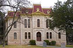
The Sutton County Courthouse in Sonora | |
 Location in the U.S. state of Texas | |
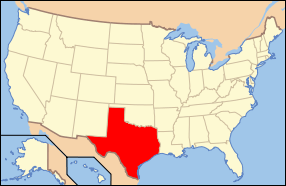 Texas's location in the U.S. | |
| Founded | 1890 |
| Seat | Sonora |
| Largest city | Sonora |
| Area | |
| • Total | 1,454 sq mi (3,766 km2) |
| • Land | 1,454 sq mi (3,766 km2) |
| • Water | 0.5 sq mi (1 km2), 0.03% |
| Population | |
| • (2010) | 4,128 |
| • Density | 2.8/sq mi (1/km²) |
| Congressional district | 23rd |
| Time zone | Central: UTC-6/-5 |
| Website |
www |


Sutton County is a county located on the Edwards Plateau in the U.S. state of Texas. As of the 2010 census, the population was 4,128.[1] Its county seat is Sonora.[2] The county was created in 1887 and organized in 1890.[3] Sutton County is named for John S. Sutton, an officer in the Confederate Army.
History
- 9500 BC – c. 1860s AD Paleo-Indians in the county leave behind archaeological remains of a burned-rock midden with mortar and pestle, as well as other tools. Later native inhabitants include Tonkawa, Comanche and Lipan Apache.[4]
- 1736 Lt. Miguel de la Garza Falcón leads 100 soldiers along the Devils River[5][6]
- 1852, February 2 - Camp Terrett, later known as Fort Terrett, established to protect settlers from Comanches. Founded by Lt. Col. Henry Bainbridge and named for Lt. John Terrett, who was killed in the Battle of Monterrey in 1846.[7]
- 1881 Wall’s Well discovered by Tim Birtrong and Ed Wall. Town of Wentworth discovered. Birtrong Ranch is the area’s only ranch.[8]
- 1885 Charles G. Adams, a merchant and sometime rancher from Fort McKavett, founds Sonora, Texas, named after a family servant from Sonora, Mexico.[9]
- 1887 The Texas legislature establishes Sutton County, carved out of eastern Crockett County named for Confederate officer John Schuyler Sutton.[4]
- 1890 Sonora becomes the county seat.[4]
- 1915 Texas Sheep & Goat Raisers’ Association organized.[10]
- 1928 The Atchison, Topeka and Santa Fe Railway acquires Kansas City, Mexico and Orient Railway to connect Sonora with San Angelo, Del Rio, and the outside world by rail.[4]
- 1930 Sonora Wool and Mohair Company established.[4]
- 1936 WPA projects help local economy.[4]
- 1958, August 1 – Sonora Municipal Airport activated.[11]
- 1960, July 16 – Caverns of Sonora open to the public.[12]
- 1965 Caverns of Sonora designated National Natural Landmark.[13]
- 1975 Fort Terrett Ranch is purchased by the Texas oil industrrialist Bill Noël and used in part for the growing of pecans.[14]
Geography
According to the U.S. Census Bureau, the county has a total area of 1,454 square miles (3,770 km2), of which 1,454 square miles (3,770 km2) is land and 0.5 square miles (1.3 km2) (0.03%) is water.[15]
Major highways
Adjacent counties
- Schleicher County (north)
- Kimble County (east)
- Edwards County (south)
- Val Verde County (southwest)
- Crockett County (west)
- Menard County (northeast)
Demographics
| Historical population | |||
|---|---|---|---|
| Census | Pop. | %± | |
| 1890 | 658 | — | |
| 1900 | 1,727 | 162.5% | |
| 1910 | 1,569 | −9.1% | |
| 1920 | 1,598 | 1.8% | |
| 1930 | 2,807 | 75.7% | |
| 1940 | 3,977 | 41.7% | |
| 1950 | 3,746 | −5.8% | |
| 1960 | 3,738 | −0.2% | |
| 1970 | 3,175 | −15.1% | |
| 1980 | 5,130 | 61.6% | |
| 1990 | 4,135 | −19.4% | |
| 2000 | 4,077 | −1.4% | |
| 2010 | 4,128 | 1.3% | |
| Est. 2015 | 3,913 | [16] | −5.2% |
| U.S. Decennial Census[17] 1850–2010[18] 2010–2014[1] | |||
As of the census[19] of 2000, there were 4,077 people, 1,515 households, and 1,145 families residing in the county. The population density was 3 people per square mile (1/km²). There were 1,998 housing units at an average density of 1 per square mile (1/km²). The racial makeup of the county was 45.28% White, 0.25% Black or African American, 0.42% Native American, 0.17% Asian, 2.27% from other races, and 1.62% from two or more races. 49.99% of the population were Hispanic or Latino of any race.
There were 1,515 households out of which 38.20% had children under the age of 18 living with them, 63.60% were married couples living together, 7.70% had a female householder with no husband present, and 24.40% were non-families. 22.60% of all households were made up of individuals and 9.60% had someone living alone who was 65 years of age or older. The average household size was 2.67 and the average family size was 3.15.
In the county, the population was spread out with 28.80% under the age of 18, 6.70% from 18 to 24, 27.70% from 25 to 44, 24.40% from 45 to 64, and 12.50% who were 65 years of age or older. The median age was 36 years. For every 100 females there were 99.50 males. For every 100 females age 18 and over, there were 96.00 males.
The median income for a household in the county was $34,385, and the median income for a family was $38,143. Males had a median income of $31,193 versus $18,587 for females. The per capita income for the county was $17,105. About 14.10% of families and 18.00% of the population were below the poverty line, including 25.20% of those under age 18 and 16.10% of those age 65 or over.
Education
Sutton County is served by the Sonora Independent School District based in Sonora.
Communities
- Fort Terrett
- Owenville
- Sonora (county seat)
- Wentworth
See also
- List of museums in Central Texas
- National Register of Historic Places listings in Sutton County, Texas
References
- 1 2 "State & County QuickFacts". United States Census Bureau. Retrieved December 24, 2013.
- ↑ "Find a County". National Association of Counties. Retrieved 2011-06-07.
- ↑ "Texas: Individual County Chronologies". Texas Atlas of Historical County Boundaries. The Newberry Library. 2008. Retrieved May 26, 2015.
- 1 2 3 4 5 6 Hosmer, Brian C. "Sutton County, Texas". Handbook of Texas Online. Texas State Historical Association. Retrieved 30 November 2010.
- ↑ Smith, Julia Cauble. "Devils River". Handbook of Texas Online. Texas State Historical Association. Retrieved 30 November 2010.
- ↑ Skiles, Jack; Kelton, Elmer (1996). Judge Roy Bean Country. Texas Tech University Press. p. 45. ISBN 978-0-89672-369-6.
- ↑ Uglow, Loyd and Loyd M (2001). Standing in the Gap: Army Outposts, Picket Stations, and the Pacification of the Texas Frontier, 1866-1886. Texas Christian University. p. 62. ISBN 978-0-87565-246-7.
- ↑ "Wentworth - Sonora, Sutton County, Texas". Texas Historical Markers. William Nienke, Sam Morrow. Retrieved 30 November 2010.
- ↑ "Sonora, Texas". Texas Escapes. Texas Escapes - Blueprints For Travel, LLC. Retrieved 30 November 2010.
- ↑ Lackey, Jerry (21 December 2009). "HOMESTEAD: 'Stockman's Paradise' true to the past". San Angelo Standard Times.
- ↑ "Sonora Municipal Airport". AirNav. Retrieved 30 November 2010.
- ↑ "History Caverns of Sonora". Caverns of Sonora. Retrieved 30 November 2010.
- ↑ "NPS Caverns of Sonora". National Park Service. Retrieved 30 November 2010.
- ↑ "William Douglas Noël". The Handbook of Texas. Retrieved June 27, 2011.
- ↑ "2010 Census Gazetteer Files". United States Census Bureau. August 22, 2012. Retrieved May 10, 2015.
- ↑ "County Totals Dataset: Population, Population Change and Estimated Components of Population Change: April 1, 2010 to July 1, 2015". Retrieved July 2, 2016.
- ↑ "U.S. Decennial Census". United States Census Bureau. Retrieved May 10, 2015.
- ↑ "Texas Almanac: Population History of Counties from 1850–2010" (PDF). Texas Almanac. Retrieved May 10, 2015.
- ↑ "American FactFinder". United States Census Bureau. Retrieved 2011-05-14.
External links
- Sutton County government's website
- Sutton County from the Handbook of Texas Online
- Sutton County Profile from the Texas Association of Counties
 |
Schleicher County | | ||
| Crockett County | |
Kimble County | ||
| ||||
| | ||||
| Val Verde County | Edwards County |
Municipalities and communities of Sutton County, Texas, United States | ||
|---|---|---|
| City | | |
| Ghost towns | ||
Coordinates: 30°30′N 100°32′W / 30.50°N 100.54°W