Jasper County, Texas
| Jasper County, Texas | |
|---|---|
|
Jasper County Courthouse | |
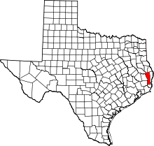 Location in the U.S. state of Texas | |
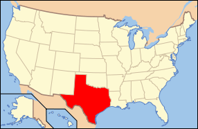 Texas's location in the U.S. | |
| Founded | 1837 |
| Named for | William Jasper |
| Seat | Jasper |
| Largest city | Jasper |
| Area | |
| • Total | 970 sq mi (2,512 km2) |
| • Land | 939 sq mi (2,432 km2) |
| • Water | 31 sq mi (80 km2), 3.2% |
| Population | |
| • (2010) | 35,710 |
| • Density | 38/sq mi (15/km²) |
| Congressional district | 36th |
| Time zone | Central: UTC-6/-5 |
| Website |
www |

Jasper County is a county located in the U.S. state of Texas. As of the 2010 census, its population was 35,710.[1] Its county seat is Jasper.[2] The county was created as a municipality in Mexico in 1834, and in 1837 was organized as a county in the Republic of Texas.[3][4][5] It is named for William Jasper, an American Revolutionary War hero.[6]
Geography
According to the U.S. Census Bureau, the county has a total area of 970 square miles (2,500 km2), of which 939 square miles (2,430 km2) is land and 31 square miles (80 km2) (3.2%) is covered by water.[7]
Major highways
 U.S. Highway 69
 U.S. Highway 96
 U.S. Highway 190
 State Highway 62
 State Highway 63
 Recreational Road 255
Adjacent counties
- San Augustine County (north)
- Sabine County (northeast)
- Newton County (east)
- Orange County (south)
- Hardin County (southwest)
- Tyler County (west)
- Angelina County (northwest)
National protected areas
- Angelina National Forest (part)
- Big Thicket National Preserve (part)
- Sabine National Forest (part)
Demographics
| Historical population | |||
|---|---|---|---|
| Census | Pop. | %± | |
| 1850 | 1,767 | — | |
| 1860 | 4,037 | 128.5% | |
| 1870 | 4,218 | 4.5% | |
| 1880 | 5,779 | 37.0% | |
| 1890 | 5,592 | −3.2% | |
| 1900 | 7,138 | 27.6% | |
| 1910 | 14,000 | 96.1% | |
| 1920 | 15,569 | 11.2% | |
| 1930 | 17,064 | 9.6% | |
| 1940 | 17,491 | 2.5% | |
| 1950 | 20,049 | 14.6% | |
| 1960 | 22,100 | 10.2% | |
| 1970 | 24,692 | 11.7% | |
| 1980 | 30,781 | 24.7% | |
| 1990 | 31,102 | 1.0% | |
| 2000 | 35,604 | 14.5% | |
| 2010 | 35,710 | 0.3% | |
| Est. 2015 | 35,506 | [8] | −0.6% |
| U.S. Decennial Census[9] 1850–2010[10] 2010–2014[1] | |||
As of the census[11] of 2000, 35,604 people, 13,450 households, and 9,966 families resided in the county. The population density was 38 people per square mile (15/km²). The 16,576 housing units averaged 18 per square mile (7/km²). The racial makeup of the county was 78.24% White, 17.81% Black or African American, 0.42% Native American, 0.32% Asian, 0.03% Pacific Islander, 2.04% from other races, and 1.15% from two or more races. About 3.89% of the population was Hispanic or Latino of any race.
Of the 13,450 households, 33.40% had children under the age of 18 living with them, 58.20% were married couples living together, 12.50% had a female householder with no husband present, and 25.90% were not families. About 23% of all households were made up of individuals and 11.2% had someone living alone who was 65 years of age or older. The average household size was 2.58 and the average family size was 3.03.
In the county, the population was distributed as 26.50% under the age of 18, 8.00% from 18 to 24, 26.80% from 25 to 44, 23.40% from 45 to 64, and 15.30% who were 65 years of age or older. The median age was 37 years. For every 100 females, there were 94.60 males. For every 100 females age 18 and over, there were 92.10 males.
The median income for a household in the county was $30,902, and for a family was $35,709. Males had a median income of $31,739 versus $19,119 for females. The per capita income for the county was $15,636. About 15.00% of families and 18.10% of the population were below the poverty line, including 23.40% of those under age 18 and 17.80% of those age 65 or over.
Government
County officials
- County Judge - Judge Mark W. Allen
- Commissioner, Pct. #1 - Charles Shofner, Jr.
- Commissioner, Pct. #2 - Roy Parker
- Commissioner, Pct. #3 - Willie Stark
- Commissioner, Pct. #4 - Vance Moss
- County Sheriff - Mitchel Newman
- Tax Assessor/Collector - Bobby Biscamp
- County Clerk - Debbie Newman
- County Treasurer - René Kelley
- County Auditor - Renee Weaver
- Tax Appraiser - David Luther
- Emergency Management Coordinator - Billy Ted Smith
District officials
- District Judge - Judicial District 1 - Judge Craig M. Mixson (appointed by Texas Governor Rick Perry to complete term of Judge Gary Gatlin, who resigned effective December 31, 2011)
- District Judge - Judicial District 1A - Judge Jerome Owens
- District Clerk - Kathy Kent
- District Attorney - Steven M. Hollis
Courts
- Justice of the Peace, Pct. #1 - Ronny Billingsley
- Justice of the Peace, Pct. #2 - Freddie Miller
- Justice of the Peace, Pct. #3 - Mike Smith
- Justice of the Peace, Pct. #4 - Becky Cleveland
- Justice of the Peace, Pct. #5 - Brett Holloway
- Justice of the Peace, Pct. #6 - Steve Conner
- Constable, Pct. #1 - Kit Stephenson
- Constable, Pct. #2 - Ralph Nichols
- Constable, Pct. #3 - Ronnie Hutchison
- Constable, Pct. #4 - Gene Hawthorne
- Constable, Pct. #5 - Michael Poindexter
- Constable, Pct. #6 - Tommy R. Robinson
Communities
Cities
- Browndell
- Jasper (county seat)
- Kirbyville
Census-designated places
Unincorporated communities
- Beans
- Beech Grove
- Bessmay
- Brookeland (partly in Sabine County)
- Cairo Springs
- Curtis
- Erin
- Gist
- Gumslough
- Harrisburg
- Holly Springs
- Magnolia Springs
- Mount Union
- Roganville
Ghost towns
See also
References
- 1 2 "State & County QuickFacts". United States Census Bureau. Retrieved December 18, 2013.
- ↑ "Find a County". National Association of Counties. Retrieved 2011-06-07.
- ↑ "Texas: Individual County Chronologies". Texas Atlas of Historical County Boundaries. The Newberry Library. 2008. Retrieved June 20, 2015.
- ↑ "Jasper County". Texas Almanac. Texas State Historical Association. Retrieved June 20, 2015.
- ↑ Glenn Justice (June 15, 2010). "Jasper County". Handbook of Texas Online. Texas State Historical Association. Retrieved June 20, 2015.
- ↑ Gannett, Henry (1905). The Origin of Certain Place Names in the United States. Govt. Print. Off. p. 168.
- ↑ "2010 Census Gazetteer Files". United States Census Bureau. August 22, 2012. Retrieved May 2, 2015.
- ↑ "County Totals Dataset: Population, Population Change and Estimated Components of Population Change: April 1, 2010 to July 1, 2015". Retrieved July 2, 2016.
- ↑ "U.S. Decennial Census". United States Census Bureau. Retrieved May 2, 2015.
- ↑ "Texas Almanac: Population History of Counties from 1850–2010" (PDF). Texas Almanac. Retrieved May 2, 2015.
- ↑ "American FactFinder". United States Census Bureau. Retrieved 2011-05-14.
External links
- Jasper-Newton-Sabine Counties - Office of Emergency Management & Homeland Security
- Jasper County Government Website
- Jasper Newton County Public Health District Public Health Website for Jasper County
- The Deep East Texas Council of Governments (DETCOG)
- Jasper County from the Handbook of Texas Online
- Jasper County, TXGenWeb Focuses on genealogical research in Jasper County.
 |
Angelina County | San Augustine County | Sabine County | |
| Tyler County | |
Newton County | ||
| ||||
| | ||||
| Hardin County | Orange County |
Municipalities and communities of Jasper County, Texas, United States | ||
|---|---|---|
| Cities | | |
| CDPs | ||
| Unincorporated communities | ||
| Ghost towns | ||
| Footnotes | ‡This populated place also has portions in an adjacent county or counties | |
Coordinates: 30°44′N 94°02′W / 30.74°N 94.03°W