Cooley Peninsula
Coordinates: 54°2′4″N 6°13′36″W / 54.03444°N 6.22667°W
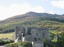
The Cooley Peninsula (from Irish: Cuaille,[1] older Cúalṅge)[2] is a hilly peninsula in County Louth, Ireland, which includes towns such as Omeath, Carlingford and Greenore.
Geography
The peninsula contains the Cooley Mountains, the highest of which, Slieve Foy, is also the highest peak in County Louth at 588m. To the north is Carlingford Lough and the border with Northern Ireland; to the south is Dundalk Bay. The peninsula is ringed by the R173 regional road.
The peninsula is geologically diverse, with 440-million-year-old Silurian greywacke sandstones in the north west and south west, 340-million-year-old limestones in the east, and 60-million-year-old volcanic rocks forming the Cooley Mountains.
Antiquity
In Irish mythology Cooley (Old Irish Cúalnge) was the home of the bull Donn Cúailnge, and the site of the Táin Bó Cúailnge or Cattle Raid of Cooley. Ancient monuments in Cooley include the Proleek Dolmen,[3] whose capstone weighs an estimated 35 tons (31.75 tonnes), and a Bronze Age gallery grave, both near Ballymascanlon.
People
The Cooley Peninsula is the home of current Leinster and Irish rugby players, Rob Kearney and David Kearney.